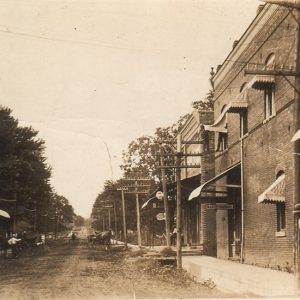
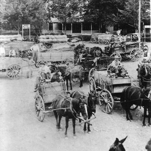
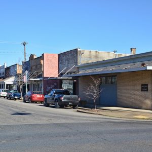
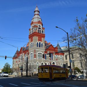
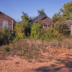
 Prairie Grove Street Scene
Entry Category: Cities and Towns - Starting with P
Prairie Grove Street Scene
 Prairie Grove Street Scene
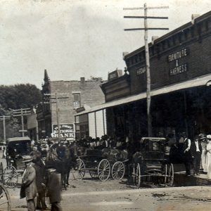 Prairie Grove Street Scene
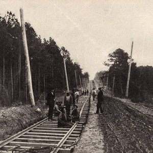
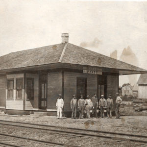
 Prairie Grove Train Station
 Prairie Oil and Gas
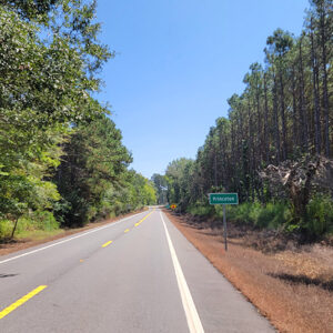
 Entering Prairie View
 Prattsville
 Prattsville
Prattsville (Grant County)
Prattsville is a city located on State Highway 270 in Grant County, a few miles west of Sheridan (Grant County). Although it did not incorporate as a town until 1962, Prattsville had already been continuously inhabited for more than 100 years, and the area shows evidence of human presence for many previous centuries. Prattsville reincorporated as a second-class city early in the twenty-first century. An archaeological survey conducted in 1973 found evidence of a prehistoric settlement in the vicinity of Prattsville. Native Americans had, however, already left the area before European explorers or American settlers arrived in the area. Early settlers in Arkansas created a number of roads, one of which ran through what was then Saline County, linking such …
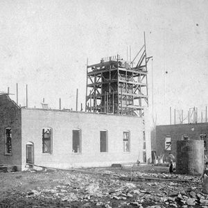
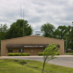 Prattsville City Hall and Water Tower
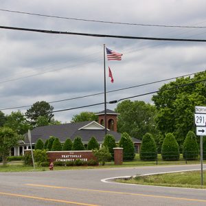 Prattsville Community Center
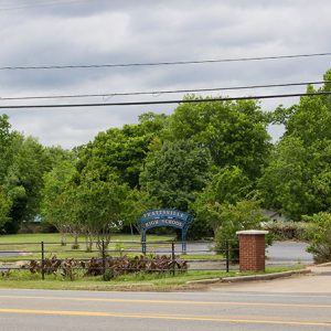 Prattsville High School
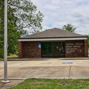 Prattsville Post Office
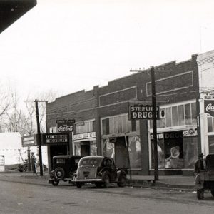
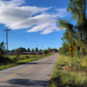
 Prattsville Street Scene
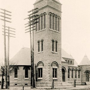 Presbyterian Church
Prescott (Nevada County)
Prescott, the county seat of Nevada County in southwest Arkansas, is also the largest city in the county. Originating as a railroad town, it remains a vital link on the land route between Little Rock (Pulaski County) and Texarkana (Miller County), as well as a local center of business and agriculture. As part of the West Gulf Coastal Plain, the land that now is Nevada County was sparsely populated both before and after the Louisiana Purchase added Arkansas to the United States. Caddo Indians moved through the area and inhabited some villages, and some European settlers made their homes along the rivers, but the land that is now Prescott remained wilderness, with a few cotton plantations introduced to the area …
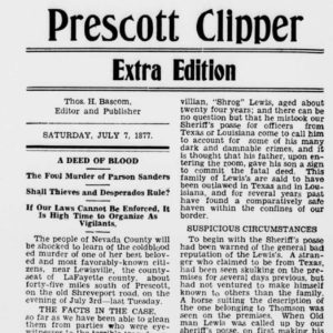 Prescott Clipper
 Prescott Commercial Historic District
 Prescott Commercial Historic District
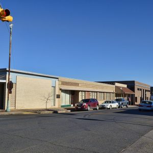 Prescott Commercial Historic District
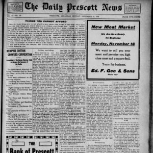 Prescott Daily News
 Prescott Depot
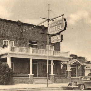 Prescott Hotel
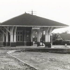
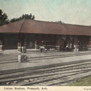 Prescott Union Station
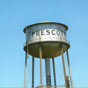 Prescott Water Tower
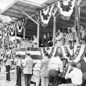 President Truman at Bull Shoals
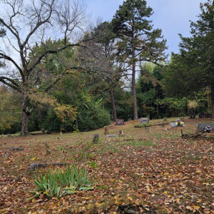 Price Cemetery
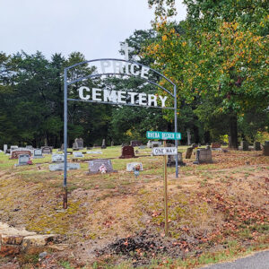 Price Cemetery
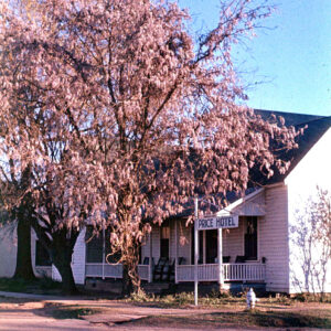 Price Hotel
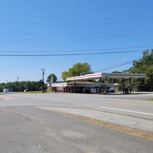
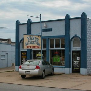 Price Produce and Filling Station
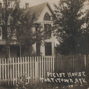 Priest House
Prim (Cleburne County)
Prim is an unincorporated community located at the junction of Arkansas Highway 225 (Sunny Slope Road) and Highway 263 (Prim Road), nine miles north-northeast of the resort area of Greers Ferry (Cleburne County) and ten miles north-northwest of Heber Springs (Cleburne County), the county seat. Devil’s Fork, a tributary of the Little Red River, is at Prim, and Turkey Creek is to the north. The Osage once lived in the area. In 1812, the year the Missouri Territory was carved from the Louisiana Territory, John Benedict and his wife, Rebecca Standlee Benedict, came from Kentucky—along with Rebecca’s three brothers—to settle in Arkansas. They cleared thirty acres of land and built two cabins on Little Red River below Devil’s Fork. The …
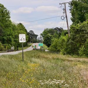
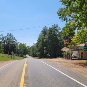
 Entering Princeton
Princeton (Dallas County)
A once thriving town, Princeton had become a small community with a population of only thirteen by the 2020 federal census. Although it was the first seat of Dallas County, the town was supplanted by Fordyce (Dallas County) as the leading community in the county in the early twentieth century. Founded in 1845, Dallas County was formed from Clark and Bradley counties. The site for the town was selected later that year, and work began on a courthouse. An early name for the community was Dallastown. Winthrop Colbath received a federal land patent for the area that would become Princeton on July 10, 1848. The eighty-acre plot was divided into smaller lots and sold. Several public structures were built in …
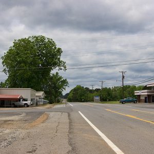
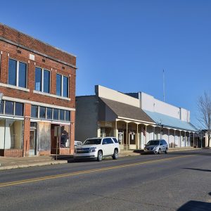
 Princeton Street Scene
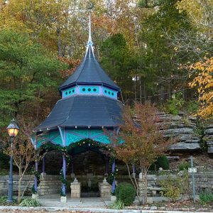 Protective Gazebo
 Pulaski County Courthouse
Pulaski Heights (Pulaski County)
Pulaski Heights, an affluent neighborhood in Little Rock (Pulaski County), was originally a suburban development located on the outskirts of the state’s capital city. Work began on the Pulaski Heights development in the late nineteenth century, and it incorporated as its own town in 1905. The Pulaski Heights development marked the beginning of Little Rock’s westward expansion, a trend that greatly accelerated in the late twentieth and early twenty-first centuries. Like many suburban developments of the late nineteenth and early twentieth centuries, it was racially exclusive, enforcing an all-white residence primarily by means of restrictive covenants. Pulaski Heights was the project of Michigan industrialist Henry Franklin (H. F.) Auten, who settled in Little Rock by 1890 and later organized the …
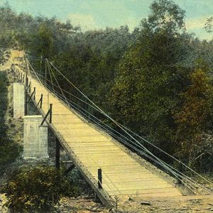 Pulaski Heights Bridge
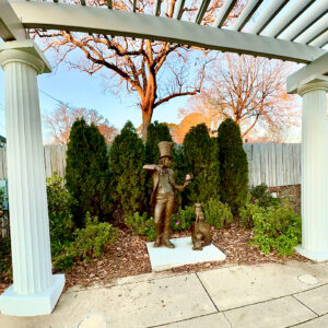 Pulaski Heights Display
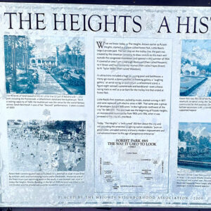 Pulaski Heights History
 Pulaski Heights Line
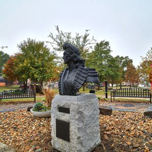 Casimir Pulaski Bust
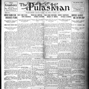 Pulaskian
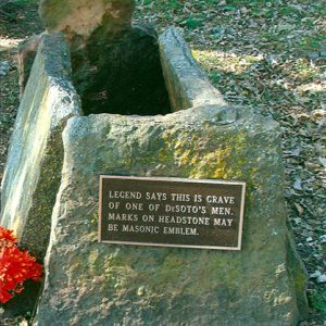 Purported de Soto Soldier Grave
Puryear (Scott County)
Puryear is an unincorporated community in western Scott County. Puryear was established in 1915 along Haw Creek. The agriculture and timber industries have contributed the economy and way of life in Puryear. Prior to European exploration, the area surrounding Puryear was a wilderness. Several species of wildlife that no longer inhabit the area, such as elk and buffalo, were present throughout the region. Numerous archaeological sites and burial mounds can be found along the banks of prominent waterways such as the Fourche La Fave River and Black Fork Creek. Archaeological findings have provided evidence of early inhabitants dating to the Archaic, Woodland, and Mississippian periods. Further archaeological evidence has indicated that the people of the Caddo tribe later inhabited the …
Pyatt (Marion County)
Pyatt is a town located on Crooked Creek in Marion County. It is connected by U.S. Business Highway 62 to U.S. Highway 62, which crosses the creek a few miles south of Pyatt. Native Americans were frequent visitors to the Crooked Creek valley before white settlers began arriving in the area. The first land survey conducted in Marion County found that the land along the creek had been cleared and planted with cotton by 1832. Settlers referred to the early settlement as Stringtown because of the way homesteads were strung along the creek. When a post office was established at the settlement in 1855, it was given the name Clear Creek. The community had a cotton gin and a steam …
 Pyatt Cabins
 Pyatt Depot


