calsfoundation@cals.org
Wabbaseka (Jefferson County)
| Latitude and Longitude: | 34°21’39″N 091°47’45″W |
| Elevation: | 200 feet |
| Area: | 0.34 square miles (2020 Census) |
| Population: | 180 (2020 Census) |
| Incorporation Date: | April 12, 1920 |
Historical Population as per the U.S. Census:
|
1810 |
1820 |
1830 |
1840 |
1850 |
1860 |
1870 |
1880 |
1890 |
1900 |
|
– |
– |
– |
– |
– |
– |
– |
– |
– |
– |
|
1910 |
1920 |
1930 |
1940 |
1950 |
1960 |
1970 |
1980 |
1990 |
2000 |
|
– |
– |
333 |
258 |
375 |
432 |
644 |
428 |
332 |
323 |
|
2010 |
2020 |
|
|
|
|
|
|
|
|
|
255 |
180 |
|
|
|
|
|
|
|
|
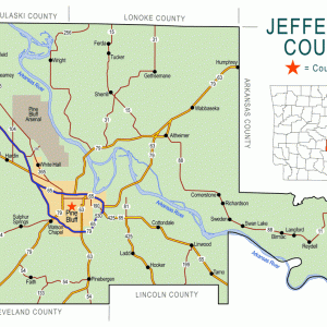
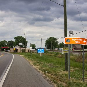
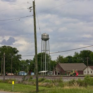
Wabbaseka is a town in northern Jefferson County. It is on the conjoined highways U.S. 63 and U.S. 79 between Humphrey (Arkansas and Jefferson counties) and Altheimer (Jefferson County).
When Arkansas became part of the United States, the land where Wabbaseka would later be founded was a forested swamp that attracted few settlers. Antoine Barraque visited Quapaw chief Heckaton at what was referred to as Wadittesha Wattiska, or Black Clay Bayou, in January 1826. Surveyor William Pelham noted “Bayou Wabbaseekee” in 1836, calling it “a stream with a gentle current.” High land next to the bayou was noted during a flood in 1844, leading Jordan Embree to purchase the “island” in 1853. On his map of Jefferson County in 1872, W. H. W. Wilson spelled the name of the bayou “Water Seca.”
During the Civil War, skirmishes associated with the Pine Bluff Expedition took place near the bayou in January and February 1865. In 1882, the Texas and St. Louis Railway Company (later part of the Cotton Belt) acquired a 100-foot right-of-way from brothers Nathaniel Roberts and John Charles Roberts, who had acquired the land originally purchased by Embree in 1853. The next year, the Southwestern Improvement Company bought a tract of land from the brothers to establish a train depot and to plat a town. The railroad at this time standardized the name of the community as Wabbaseka. Eight to ten lots had been purchased by the end of 1883, including lots for several homes. A post office was also established in 1883. A steam gin and mill were soon added, as well as a boarding house for railroad employees and a factory manufacturing wagon parts and other wooden items. A school was also organized, with Justice of the Peace Robert James Watkins serving as the first teacher. The town did not incorporate until 1920.
A Methodist church was established in Wabbaseka in 1891. African American railroad workers began to make their home in the community, and they worshiped in several small churches built around the town. Like many of the towns in Jefferson County north of the Arkansas River, Wabbaseka is protected by the Plum Bayou Levee, which was built beginning in 1905. Although the levee did not succeed in restraining the historic Flood of 1927, it has generally protected the communities and farmland from catastrophic flooding.
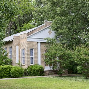
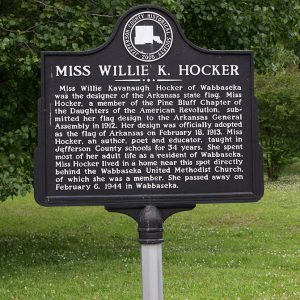
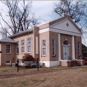
In 1925, the Methodist congregation built a new church building, which was later added to the National Register of Historic Places. Willie K. Hocker was teaching school in Wabbaseka (after growing up on a farm near the town) when her design for the Arkansas state flag was selected to represent the state. By 1935, the town had a twelve-grade, two-story schoolhouse for white students and a separate school for African Americans that was funded by the Rosenwald Foundation. In 1935, the town had several stores, including a grocery store, a drugstore, and a service station, as well as a café.
A new high school was dedicated in 1938, and it was named for Willie Hocker. The schools in Wabbaseka were integrated in the late 1960s. Although the population of Wabbaseka was over 600 in 1970, the town began to dwindle, and it was described in 1984 as “a sleepy little village of about 400 with several active businesses, but with a number of vacant stores that saw better times when the surrounding farms had many workers and tenants.” An effort was made in 1984 to begin a Julyfest fundraiser as a homecoming for former residents and a fundraiser for community projects. The festival did not succeed in becoming an annual event.
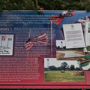
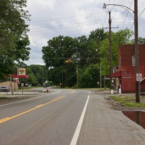
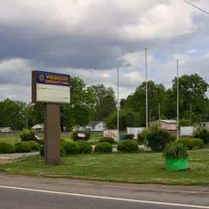
Wabbaseka remains a town on the highway to Pine Bluff (Jefferson County). The surrounding area is frequented by hunters during duck season. Several businesses operate along the highway, and the Methodist church (now United Methodist) and a Baptist church still gather for worship. In 2013, the centennial of the Arkansas flag was celebrated in Wabbaseka’s city park, and citizens gathered again the next year to dedicate a plaque honoring Hocker and the state flag.
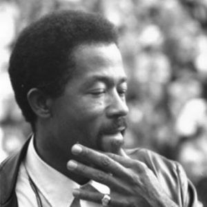
Elridge Cleaver, a leader in the Black Panther Party, was born in Wabbaseka in 1935, and his family lived there until 1943.
For additional information:
Leslie Family Collection. Butler Center for Arkansas Studies. Central Arkansas Library System, Little Rock, Arkansas.
Leslie, James W. “Wabbaseka History Written on the Rails through Town.” Pine Bluff Commercial, June 24, 1984, p. 11.
Leslie, James W., ed. “Willie K. Hocker’s History of the Wabbaseka Methodist Church’s Sunday School.” Jefferson County Historical Quarterly 13 (1985): 24–29.
Steven Teske
Butler Center for Arkansas Studies


My family was on both sides of the tracks. My great-grandmother was a native and my mother had lower-back-length hair and cut it short because they called her a little Chinese girl. Her hair is short to this day. My great-grandparents were listed as farmers. We owned what would have been eight lots leaving town going toward Stuttgart on the left where pecan orchard was. They took our land and left my family one lot! We were native to Wabbaseka before it was incorporated.
My great-great-grandfather, a Mr. Elliot, purchased several hundred acres just to the south of the Wabbaseka Bayou in 1876. It was inherited by his daughter, Mrs. Frank Ragland Sr. It remained in the Ragland family until 2013. There are many undisturbed Indian mounds on the property, and we found numerous arrowheads along the bayou banks. I am the granddaughter of Mrs. Ragland and daughter of Frank Ragland Jr., who farmed the land until his death. I managed the farm until it was sold in 2013. My husband and my father farmed the land until his retirement. My father’s picture with his best friend Mr. Son Carty is hanging in the Butler Center/Roberts Library in the stairway. They had just completed a successful duck hunting trip.