calsfoundation@cals.org
Scenic Byways
Scenic byway designation recognizes noteworthy travel routes that provide unique travel experiences. Arkansas has several national and state scenic byways, in addition to others that are located within the boundaries of U.S. national forests.
The U.S. Congress established the National Scenic Byways program as part of 1991’s Intermodal Surface Transportation Efficiency Act to help communities “balance economic development and resource conservation.” The program was strengthened by subsequent federal legislation in 1997 and 2005. It is administered by the U.S. Department of Transportation, Federal Highway Administration.
To qualify as a National Scenic Byway, a route must exhibit one or more “intrinsic qualities”: it must be scenic, historic, natural, recreational, cultural, or archeological. Applications for National Scenic Byway status require “strong community support” and must include detailed plans for marketing, preservation, and improvement of the route. National Scenic Byway status originally included funding that could pay up to eighty percent of byway projects. That funding dried up in 2012 but was renewed in March 2022.
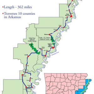
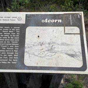
Arkansas has three National Scenic Byways. The first to be designated was the Crowley’s Ridge National Scenic Byway, which covers 198 miles on highways, county roads, and city streets. First designated an Arkansas scenic byway in 1997, it received the federal designation the following year. The second designee, the Great River Road National Scenic Byway, was initially established as the Great River Road, the Mississippi River national parkway, in 1938. The road’s 362 miles in Arkansas were made a state scenic byway in 2001 and became a National Scenic Byway in 2002. The third designee was the Talimena Scenic Drive National Scenic Byway, which follows Highway 88 from Mena (Polk County) to the Oklahoma state line. It became an Arkansas scenic byway in 1998 and was named a National Scenic Byway in 2005.
Shortly after the creation of the National Scenic Byways Program in 1991, the Arkansas Highway Commission created a statewide system following similar guidelines “to facilitate Arkansans’ recognition of special routes within the state.” Since 1993, there have been seven routes designated as Arkansas scenic byways in addition to the three that were elevated to national status:
- Arkansas Scenic 7 became the state’s first scenic byway in 1993, following Arkansas Highway 7 from Arkadelphia (Clark County) to Harrison (Boone County); it was extended in 1999 to include the highway from the Louisiana state line to Arkadelphia, ultimately covering around 290 miles.
- Mount Magazine Scenic Byway/Highway 309 became a state scenic byway in 1994, following Highway 309 for forty-five miles from Havana (Yell County) to Webb City (Franklin County).
- Boston Mountain Scenic Loop contains two routes—a forty-two-mile stretch of Highway 71 from Dean’s Market (Crawford County) to Fayetteville (Washington County) was made an Arkansas scenic byway in 1998, while thirty-eight miles of Interstate 540 from Dean’s Market to Fayetteville received the state designation in 1999.
- Interstate 530 Scenic Byway, running fifteen miles from White Hall (Jefferson County) to southeast of Pine Bluff (Jefferson County), became a state scenic byway in 2001.
- Highway 21/Ozark Highlands Scenic Byway, covering thirty-five miles of Highway 21 from Highway 64 to the Buffalo National River, received the state scenic byway designation in 2005.
- West/Northwest Scenic Byway became a state scenic byway in 2005 and contains 261 miles of various highway routes from Mena to I-540 and from Ola (Yell County) to the Oklahoma state line.
- Camden Expedition Scenic Byway is a loop that begins and ends in Little Rock (Pulaski County) and follows the route of Civil War Union general Frederick Steele’s 1864 sortie into southwestern Arkansas through Pulaski, Saline, Hot Spring, Clark, Nevada, Ouachita, Hempstead, Dallas, Cleveland, and Grant counties; it became Arkansas’s newest scenic byway in 2021.
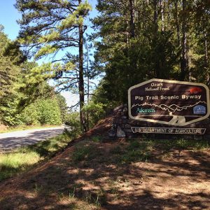
Since 1989, the head of the U.S. Forest Service of the U.S. Department of Agriculture has been able to designate routes within national forests as national forest scenic byways. In Arkansas, there are nine such byways in the Ozark-St. Francis National Forest, including the Pig Trail Scenic Byway and the Sylamore Scenic Byway, and at least one in the Ouachita National Forest. In addition, several of the state’s national and state scenic byways traverse land owned by the U.S. Forest Service.
For additional information:
“About Scenic Byways.” Scenic America. https://www.scenic.org/visual-pollution-issues/scenic-byways/about-scenic-byways/ (accessed March 3, 2023).
“America’s Byways.” U.S. Transportation Department, Federal Highway Administration. https://www.fhwa.dot.gov/byways/ (accessed March 3, 2023).
“FWHA Announces First Availability of National Scenic Byways Program Funding Since 2012.” U.S. Transportation Department, Federal Highway Administration. https://highways.dot.gov/newsroom/fhwa-announces-first-availability-national-scenic-byways-program-funding-2012?msclkid=59613252a6e511eca47898a8f73b646e (accessed March 3, 2023).
Lloyd, Peggy. “The Camden Expedition State Scenic Byway in Clark County, Arkansas.” Clark County Historical Journal (2024): 49–60.
“Ouachita National Forest Scenic Driving.” U.S. Forest Service. https://www.fs.usda.gov/activity/ouachita/recreation/scenicdrivinginfo/?recid=10712&actid=105&msclkid=10dd4e71a6c911ecbeccc7783aecdb10 (accessed March 3, 2023).
“Ozark National Forest Service Scenic Byway (Line).” Arkansas GIS Office. https://gis.arkansas.gov/Metadata/HTML/asdi.Transportation.OZARKNFS_SCENIC_BYWAY_NFS_export.html?msclkid=f80f0722a6cb11ecaab4aa2f1b3be17e (accessed March 3, 2023).
“Scenic Byways.” Arkansas Department of Transportation. https://www.ardot.gov/divisions/right-of-way/row_sections/beautification-section/scenic-byways/ (accessed March 3, 2023).
Mark K. Christ
Central Arkansas Library System


Comments
No comments on this entry yet.