calsfoundation@cals.org
Harrisburg (Poinsett County)
County Seat
| Latitude and Longitude: | 35º33’51″N 090º43’00″W |
| Elevation: | 276 feet |
| Area: | 2.43 square miles (2020 Census) |
| Population: | 2,212 (2020 Census) |
| Incorporation Date: | February 24, 1883 |
Historical Population as per the U.S. Census:
|
1810 |
1820 |
1830 |
1840 |
1850 |
1860 |
1870 |
1880 |
1890 |
1900 |
|
– |
– |
– |
– |
– |
– |
– |
– |
482 |
462 |
|
1910 |
1920 |
1930 |
1940 |
1950 |
1960 |
1970 |
1980 |
1990 |
2000 |
|
942 |
1,315 |
1,111 |
1,193 |
1,498 |
1,481 |
1,931 |
1,921 |
1,943 |
2,192 |
|
2010 |
2020 |
|
|
|
|
|
|
|
|
|
2,288 |
2,212 |
Situated upon Crowley’s Ridge, Harrisburg (Poinsett County) became the seat of Poinsett County in September 1856. Harrisburg is home to the Modern News, the oldest established weekly newspaper in Arkansas. It is situated on the Helena (Phillips County) branch of the St. Louis, Iron Mountain and Southern Railroad line.
The town is named in honor of the Benjamin Harris family. The Harris family came to the Harrisburg area from Alabama before 1830. Benjamin Harris married Martha Thrower, a Kentucky native, and they had eleven children. This pioneer settler of the county was prominent in both local and state affairs, serving as magistrate, representative, and senator. Harrisburg was also the home of Benjamin Harris’s son, County Judge William Harris, who held court in his private home, in the early 1850s. William Harris was a successful farmer who owned a sawmill, cotton gin, and gristmill. The Harris family home still exists on Jackson Street.
The area was conducive to agriculture and timber industries. Orchards flourished, as did livestock. Unfortunately, access to the remote area was hindered by swamps and heavily wooded areas.
During the Civil War, Harrisburg remained loyal to the South. In 1862, Federal soldiers galloped into town and burned most of the stores. Local residents who enlisted at Harrisburg included J. E. Sparks, J. W. Killough, W. C. Harris Jr., J. W. Newsom, and W. I. Renshaw. There is little known about the area previous to this time primarily because it was inaccessible due to ridges, streams, and timberland.
The St. Louis and Iron Mountain Railroad arrived in 1882, causing a great upswing in the town’s economy. Before the arrival of the railroad, citizens faced tremendous difficulty getting their products to market. Swamps and heavily wooded countryside began to disappear.
Harrisburg was legally incorporated on February 24, 1883. There is little left of the original Harrisburg. The Poinsett County Courthouse burned in 1887 along with nearly all public records. A bitter struggle ensued over the location of the new courthouse, as residents from Marked Tree (Poinsett County) and Weiner (Poinsett County) sought to move the location of the courthouse away from Harrisburg, which was remote and difficult to get to. The existing courthouse was built in 1918 and continues to be a gathering place for all county politicians.
In the early 1900s, farming flourished in the Harrisburg area. Cotton plantations and rice farms were prevalent, and gins and rice mills appeared. Forest product industries helped small farmers survive, and improvements in transportation marked Harrisburg as a thriving area.
A steady decline in agricultural prices, along with natural disasters like floods, devastated the town in the late 1920s and 1930s. Like many businessmen across the country, planters were on the verge of bankruptcy. Merchants, tenants, and sharecroppers feared starvation. Banks and businesses depended on the farm economy, and by 1932, both of Harrisburg’s banks had closed. Little is known of the racial composition of the area at this time, but the black population was small and remains so today.
An agricultural crisis developed in the area after World War I, and many farmers again found themselves poverty stricken. Many residents left the area but returned when the war ended. In the ensuing years, although Harrisburg experienced economic growth, it could not compete with forest industries in the surrounding areas, and the region remained a less-than-desirable region in which to locate.
The Poinsett County Fair Association, organized in the early 1900s in Harrisburg, discontinued the county fair in 1942 because of World War II. The fairgrounds were used as a prisoner-of-war camp to house German soldiers. Many of the prisoners helped rebuild the local economy by working in the cotton and rice fields.
Today, Harrisburg is primarily a farming community, producing rice, cotton, wheat, and soybeans. There is one grocery store, a number of dollar-item stores, several restaurants, a doctor’s office, an optometrist’s office, and a dentist’s office. There are numerous banks, insurance agencies, and agriculture cooperatives in the area.
Harrisburg is twenty miles south of Jonesboro (Craighead County), a growing metropolitan area. The proximity of Harrisburg to industries and shopping opportunities in Jonesboro has made Harrisburg a desirable location for residents. It is quickly becoming a bedroom community of employees who work outside the town but come home to Harrisburg.
Harrisburg, like many areas of Arkansas, has its share of storms. On occasion, torrential rains have flooded the town. As a result, many homes along Highway 1 have been demolished, and a new drainage ditch and park became part of the landscape. In May of 2003, tornado-like straight-line winds damaged many homes in the area. Authorities clocked the sustained winds in excess of 100 mph for a period of more than thirty minutes. No injuries or fatalities were reported. On April 8, 2020, a tornado struck Harrisburg, damaging about thirty homes.
The Harrisburg school system originated in 1868. The school, which has a separate campus for the elementary and high school, moved to its present location on Highway 1 in 1948. The Crowley’s Ridge Educational Cooperative is located on the northern edge of town. This organization serves the community and surrounding area by providing training and educational resources for area instructors.
The Poinsett County jail is located adjacent to Harrisburg’s Industrial Park, as is the area juvenile detention center. This developing area houses two construction companies and a bail bondsman.
An abundance of churches serve the Harrisburg area, including Calvary Church, First Baptist, First United Methodist, Assembly of God, Pentecostal, New Testament Missionary Baptist, and the Church of Christ. Harrisburg has various civic organizations including Rotary, Lions Club, Progressive Century Club, Mother’s Club, and Garden Club.
Parker Pioneer Homestead, a collection of buildings and artifacts from pioneer days, is located five miles south of Harrisburg. Thousands of area residents and school children visit the homestead yearly. Owned by Phil and Teressa Parker, the homestead sprung from the desire to preserve pioneer crafts for the enjoyment of others.
Lake Poinsett State Park is located three miles south of the city limits. The park offers camping and fishing opportunities year round. The Lawrence Reddmann Memorial Park, inside the Harrisburg city limits, includes a swimming pool, walking track, playground, baseball field, and tennis courts. The area is also known for deer, duck, goose, turkey, and small game hunting.
For additional information:
Poinsett County Historical Society. Poinsett County, Arkansas History and Families. Paducah, KY: Turner Publishing Company, 1998.
Whayne, Jeannie M. A New Plantation South: Land, Labor, and Federal Favor in Twentieth-Century Arkansas. Charlottesville: University of Virginia Press, 1996.
Nechia Whittingham
Harrisburg, Arkansas
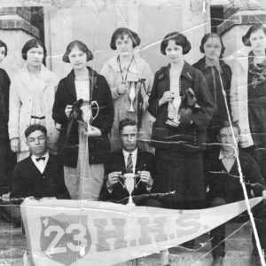 Harrisburg High School
 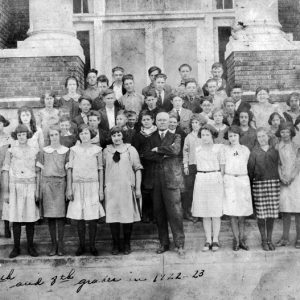 Harrisburg School Children
 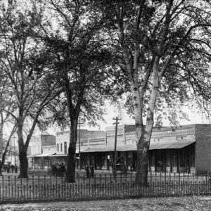 Harrisburg Street Scene
 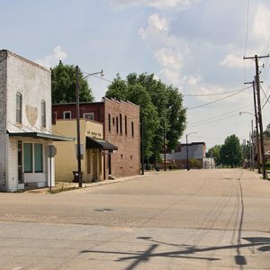 Harrisburg Street Scene
 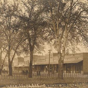 Harrisburg Street Scene
 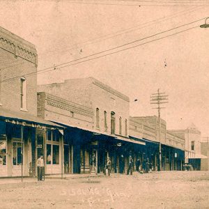 Harrisburg Street Scene
 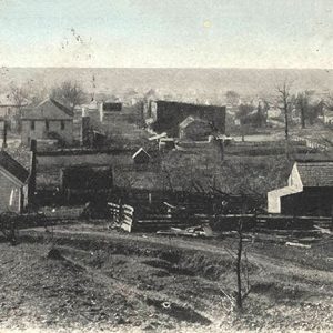 Harrisburg View
 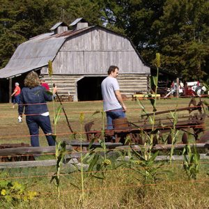 Parker Pioneer Homestead
 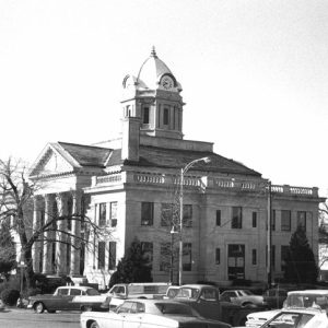 Poinsett County Courthouse
 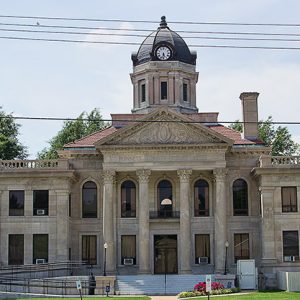 Poinsett County Courthouse
 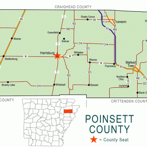 Poinsett County Map
  Stump Saw Ad


Comments
No comments on this entry yet.