calsfoundation@cals.org
Morrison Bluff (Logan County)
| Latitude and Longitude: | 35°23’16″N 093°31’43″W |
| Elevation: | 384 feet |
| Area: | 1.34 square miles (2020 Census) |
| Population: | 78 (2020 Census) |
| Incorporation Date: | January 16, 1912 |
Historical Population as per the U.S. Census:
| 1810 | 1820 | 1830 | 1840 | 1850 | 1860 | 1870 | 1880 | 1890 | 1900 |
| – | – | – | – | – | – | – | – | – | – |
| 1910 | 1920 | 1930 | 1940 | 1950 | 1960 | 1970 | 1980 | 1990 | 2000 |
| – | – | – | – | – | – | 49 | 69 | 84 | 74 |
| 2010 | 2020 | ||||||||
| 64 | 78 |
Morrison Bluff is a town in northern Logan County. It is on the south bank of the Arkansas River and was once a significant stopping point for keel boats and steamboats.
According to local lore, a settler whose last name was Morrison traveled by keel boat around 1800 to the bluff that now bears his name and settled there. In its earlier years, it was often called Morrison’s Bluff. However, no evidence of a white settlement from that time exists.
In 1820, Matthew Lyon, U.S. factor to the Cherokee Nation in Arkansas Territory, settled at the trading post in Spadra (Johnson County), on the north shore of the river. By the end of the decade, about a dozen families had formed settlements near the post, including Lorenzo Clark and Clayton Clark. Both men acquired land patents for the bluff and surrounding land, and steamboats began to land at their property on the bluff in 1835. After Johnson County was created in 1833, Lorenzo Clark tried to have the county seat established at Morrison Bluff. Because of his concession to Abraham Laster, the county seat (which was established elsewhere) was named Clarksville (Johnson County).
Clark was a state senator who signed the Arkansas Constitution in 1836. Meanwhile, he had built a large brick house near the bluff and owned a lavish store near the boat landing. A Masonic lodge was started in Morrison Bluff in 1844, but it relocated to Clarksville four years later.
By the time of the Civil War, the main stream of the Arkansas River had shifted, and Morrison Bluff was no longer useful as a boat landing. It continued to be visited, however, because it was on the Military Road that connected Little Rock (Pulaski County) to Fort Smith (Sebastian County). No significant military actions happened near Morrison Bluff during the war, although, like other settlements along the Arkansas River, it was visited by Federal troops, Confederate troops, and unaligned guerrilla troops, all of whom were gathering food and other supplies at the expense of the local residents.
In 1873, the Little Rock and Fort Smith Railroad was being built along the route of the Military Road. Railroad workers who were recruited from Germany built homes in the settlements along the railroad, including Morrison Bluff. A post office was established in the settlement in 1872. Logan County was created in 1871, and Morrison Bluff was part of the new county. When the Subiaco Abbey was founded by Benedictine monks in 1877, they began to build Roman Catholic churches in the nearby communities. The Church of Saints Peter and Paul was completed in Morrison Bluff in 1881 and began to hold services. The church also supported a private school.
Harmon Remmel created the Arkansas Anthracite Coal Company in 1907 to mine for coal in Logan and Johnson counties. In 1909, the company surveyed land for a new town a few miles south of Morrison Bluff. Scranton (Logan County) was incorporated in 1910, and businesses from Morrison Bluff and other nearby communities relocated to Scranton. The Morrison Bluff post office closed in 1916, in spite of the fact that the town had incorporated in 1912 in an effort to preserve its identity. The Catholic church in Morrison Bluff built a new building, which opened in 1918.
Before 1920, the citizens of Morrison Bluff allowed the town’s incorporation to lapse. It appeared that Morrison Bluff would be abandoned until the McClellan-Kerr Arkansas River Navigation System began making the river less flood-prone and more navigable in the 1960s. This allowed for the construction of a bridge spanning the river on State Highway 109, from Morrison Bluff north to the Spadra Bluff vicinity in Johnson County. The bridge, completed and dedicated in 1980, is 1.6 miles long and provides a roadway thirty feet wide. The forty-nine citizens of Morrison Bluff had renewed the town’s incorporation by 1970.
In 1986, Tyson Foods, Inc., built a $22 million poultry processing plant near Morrison Bluff. The population of the town remained under 100 residents, but jobs were provided for many people in the surrounding area. The population of Morrison Bluff was sixty-four in 2010. Twenty-first-century Morrison Bluff has the Catholic church and a few businesses.
For additional information:
Logan County Historical Society. Logan County, Arkansas, Its History and People. Dallas, TX: Taylor Publishing Company, 1987.
Saints Peter and Paul Church. https://www.dolr.org/parishes/sts-peter-and-paul-church-morrison-bluff (accessed July 21, 2022).
Seibenmorgen, Annene, et al. “Morrison Bluff.” Wagon Wheels 1 (October 1980): 34–36.
Steven Teske
Butler Center for Arkansas Studies
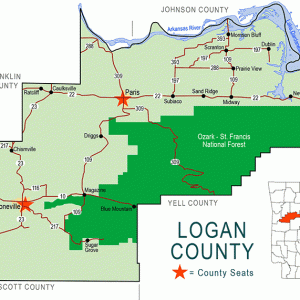 Logan County Map
  Entering Morrison Bluff
 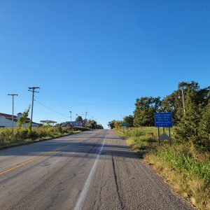 Morrison Bluff Street Scene
 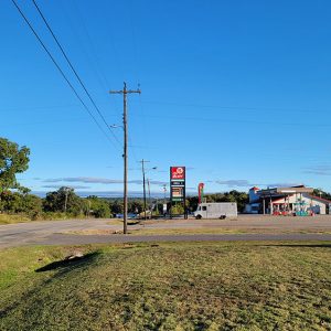 Morrison Bluff Street Scene
 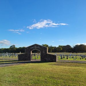 Sts. Peter & Paul Catholic Cemetery
 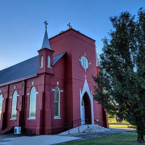 Sts. Peter & Paul Catholic Church
 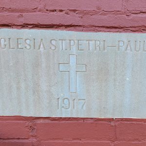 Sts. Peter & Paul Church Datestone


My maternal grandparents lived in a house right down the road from Saints Peter and Paul Church in Morrison Bluff. I have many fond memories of that farm! The street that their house was located on went from basically a cul-de-sac to a main thoroughfare! Can’t say Grandpa liked it, but life goes on. Reading this was a trip down memory lane.