501-918-3025
calsfoundation@cals.org
calsfoundation@cals.org
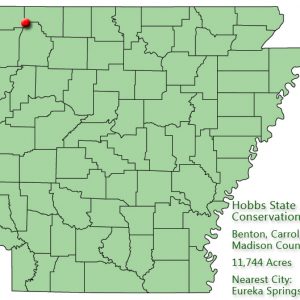
| Location: | Benton, Carroll and Madison counties |
| Size: | 12,054 acres |
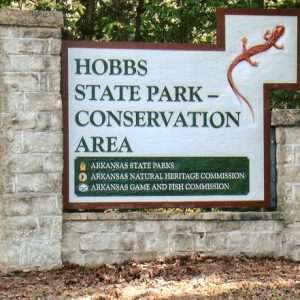
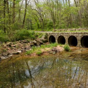
Hobbs State Park-Conservation Area in northwest Arkansas offers outdoor recreational activities such as hiking, boating, and fishing, as well as sites of historical interest. In addition, it is the only Arkansas state park where hunting is allowed. The property was once the home of the first lumber magnate of northwest Arkansas and contained the largest sawmill in the state. The three state agencies that technically manage the property are Arkansas State Parks, Arkansas Natural Heritage Commission, and Arkansas Game and Fish. The addition of “Conservation Area” to the name of the park was added to represent the work of Arkansas Natural Heritage and Arkansas Game and Fish.
Starting in the 1840s and continuing throughout his life, Peter Van Winkle, who had established himself as a wagon maker in Fayetteville (Washington County), acquired vast amounts of land in northwest Arkansas. The current property that makes up Hobbs State Park-Conservation Area was part of Van Winkle’s holdings and is rich with archaeological artifacts relating to Van Winkle’s home and sawmill, which was the first steam-driven sawmill in Arkansas. Drawn to southeast Benton County’s large supply of pine trees, Van Winkle soon became the leading lumber producer in the area. He built and operated the state’s largest sawmill and supplied the lumber for most of the Victorian houses still seen today from Fayetteville to Bentonville (Benton County) to Eureka Springs (Carroll County). Van Winkle also supplied the lumber for the Old Main building (over 700,000 board feet) at the University of Arkansas (UA) in Fayetteville.
With Van Winkle’s land development came roads that intersected in front of his home. (His crew was responsible for many of the main roads in northwest Arkansas that are still used today, given his need to get his lumber to market.) During the Civil War, those roads were used extensively. Confederate and Union forces marched through Van Winkle Hollow—located on the north fork of Little Clifty Creek, about thirteen miles east of Rogers (Benton County) on Highway 12—as they fought their way from Arkansas to Missouri in battles such as the Battle of Pea Ridge and Joseph Shelby’s Raid on Missouri.
Van Winkle’s mill and first home were burned on December 3, 1863, during a time when northwest Arkansas saw a lot of lawlessness but not much official Civil War action. Speculation has it that the mill was burned by “bushwhackers” so it could not be utilized by Northern troops. Van Winkle himself sat out the war in Texas with his family and eighteen slaves. (According to the Arkansas Archeological Survey, the Van Winkle mill is the state’s only example of slavery in an industrial setting.) He returned to Arkansas in 1865 and rebuilt his mill the next year. In 1872, he rebuilt his home on the same site, within a few hundred feet of his mill.
Ironically, Van Winkle’s heirs lost much of the property in the same manner it was originally acquired, through foreclosure. In 1928, Roscoe Hobbs of Bentonville (Benton County) purchased some of the Van Winkle land and used its woodlands to supply his tie and timber company, the Hobbs-Western Tie Company. He bought the Van Winkle estate in the 1940s.
When Hobbs died in 1965, he gave the state, through his will, the first option of buying his estate. Lack of money originally kept state officials from acting on the land offer, so other prospective buyers began looking at the property. In 1978, after a full-price negotiation with a California developer failed due to a disagreement on terms of payment, county and state officials began a serious campaign to buy the land.
Availability of the estate aroused interest from three state agencies: the Arkansas Department of Parks and Tourism, the Department of Arkansas Heritage, and the Arkansas Game and Fish Commission. The 11,744-acre Hobbs Estate was purchased in January 1979 by the Arkansas chapter of The Nature Conservancy for $3,250,000 and held until the state of Arkansas could secure funds for acquisition of the property. Governor Bill Clinton signed Act 128 on February 14, 1979, authorizing the Arkansas Department of Parks and Tourism to acquire the property.
The parks agency entered into a joint-management agreement with the heritage and game and fish agencies, identifying primary elements of the property to be supervised by the appropriate agency. In May 1980, the area was named the Hobbs State Management Area. Later, the state park’s management sector was given the name Beaver Lake State Park. Twenty-two miles of Beaver Lake shoreline border the property on the north and west. The Arkansas Forestry Commission was added in 1984 to the list of agencies cooperating to manage the area, but the commission withdrew from the agreement in 1988 because of strong public criticism of its resource management plan, which entailed cutting down native hardwoods and planting a test stand of non-native loblolly pine. In November 2002, the Parks, Recreation and Travel Commission voted to change the name of Beaver Lake State Park and Hobbs State Management Area to Hobbs State Park-Conservation Area, the name that now covers the entire property.
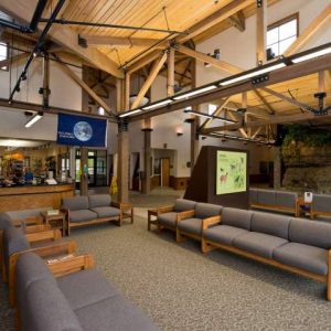
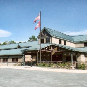
The park is a natural area with little development. It currently offers hiking trails, an all-weather public firing range, regulated seasonal hunting, undeveloped access to the lake, and interpretive programs. The twenty-four miles of multi-use trail have four loops of different lengths. The single-track trail is for horses, non-motorized bikes, and hikers. The area features remnants of a sawmill and an antebellum garden. Arkansas Archeological Survey digs have unearthed evidence of Van Winkle’s estate—slave quarters, a blacksmith shop, a slave graveyard, a mill site, the Van Winkle house site, and nineteenth-century dump sites.
Beaver Lake offers numerous water-related activities such as boating, swimming, and fishing. The War Eagle Creek, which brushes the park’s southern boundary, also offers water activities.
The park is located almost entirely within the Springfield Plateau subdivision of the Ozark Plateau. With beds of limestone underlying it, the park contains numerous karst features: caves, springs, and sinkholes caused by water erosion of the limestone. Because of the extensive erosion of the Springfield Plateau, the park’s topography comprises a series of narrow ridges divided by steep sided ravines.
Dominant vegetation on ridge tops and south-facing slopes includes blackjack oak, black hickory, northern and southern red oak, chinquapin oak, shortleaf pine, and low-bush blueberry. Clearings generally contain eastern red cedar, blackjack oak, post oak, and winged elm interspersed with big bluestem, little bluestem, and other grasses. North-facing slopes and bottoms of ravines support white oak, black gum, mockernut hickory, hophornbeam, red and sugar maples, spicebush, roughleaf dogwood, redbud, witch hazel, and ferns. Hobbs is a habitat for wild turkey, white-tailed deer, fox, gray squirrel, eastern chipmunk, rabbits, and other mammals. Hobbs is the only state park that allows hunting. By 2022, the park covered 12,054 acres.
For additional information:
Arkansas State Parks–Hobbs State Park-Conservation Area. http://www.arkansasstateparks.com/HobbsStateParkConservationArea/default.aspx (accessed July 11, 2022).
Duggan, Tom. “A Man and His Legacy.” Benton County Pioneer 46, no. 4 (2001): 7–13.
Freyder, Doris K. “A Legacy Dedicated to Nature.” Ozarks Mountaineer 25 (September 1977): 20–21.
Valentino, Alicia Beth. “The Dynamics of Industry as Seen from Van Winkle’s Mill, Arkansas.” PhD diss., University of Arkansas, 2006.
Staff of the Arkansas Department of Parks and Tourism


Comments
No comments on this entry yet.