State Parks

Subcategories:
  • No categories
Clear

Entry Category: State Parks
Devil’s Den State Park

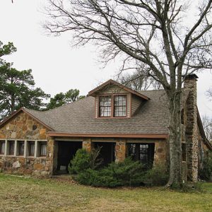
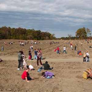
Devil’s Den State Park in the Boston Mountains of northwest Arkansas is one of the best-preserved Civilian Conservation Corps (CCC) park developments in the United States and contains the largest sandstone crevice cave area in the country. The park is popular for a variety of recreational opportunities and was designated a Natural Area by the Arkansas Natural Heritage Commission. The Arkansas Archeological Survey in 1979 recorded eleven archaeological sites at the park. Six sites are prehistoric and indicate the presence of Native Americans as far back as 8,000 years. Archaeological evidence of European-American settlement indicates that whites probably settled in the area before 1836, the year Arkansas became the twenty-fifth state. Settlement of upper Lee Creek Valley steadily increased during …

Hampson Archeological Museum State Park
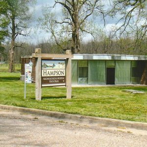
Hampson Archeological Museum State Park houses and exhibits the archaeological collection from a Mississippian era ceremonial complex and village known as the Nodena Site, located in Wilson (Mississippi County) and originally uncovered by Dr. James K. Hampson. This remarkable collection is accompanied by graphics and written material describing the lifestyles of the artistic people who lived here from AD 1400 to 1650. As a boy, Hampson (1877–1956) was fascinated by arrowheads. His interest in archaeology was rekindled in the early 1920s, when he returned to the family plantation, Nodena, to set up a successful medical practice. In 1927, he began a painstaking study of the physical remains of the people who inhabited the Nodena Site. Hampson, his wife, and his …
Herman Davis State Park

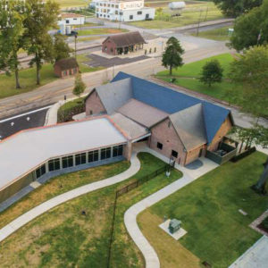
Herman Davis State Park at Manila (Mississippi County) in northeast Arkansas honors Private Herman Davis, a native of Manila who is considered one of the top heroes of World War I. The one-acre park surrounds a monument to Davis. Davis distinguished himself with unusual feats of bravery on more than one occasion during the time he served in World War I. He was listed fourth on U.S. General John J. Pershing’s list of the100 greatest heroes of World War I and was awarded the Distinguished Service Cross, the Croix de Guerre, and the Medaille Militaire by the American and French governments. Soon after Davis died in a Memphis hospital on January 5, 1923, two campaigns were launched to raise funds …

Historic Washington State Park

Historic Washington State Park, originally called Old Washington Historic State Park, is one of fifty-two state parks operated by the Arkansas Department of Parks and Tourism. This park primarily exists to preserve and interpret the history of the town of Washington (Hempstead County), emphasizing its political, cultural, and architectural history in the nineteenth century. Washington was a major stopping point on the Southwest Trail that connected St. Louis, Missouri, to Fulton (Hempstead County) on the Red River. Many pioneers and settlers traveled this route on their way to Texas and the Southwest. Sam Houston, Davy Crockett, and Jim Bowie each traveled separately through Washington before they fought for Texas’s independence. While in Washington, Bowie commissioned local blacksmith James Black to …

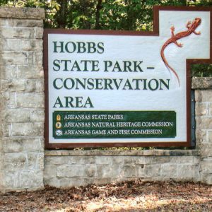
Hobbs State Park-Conservation Area

Hobbs State Park-Conservation Area in northwest Arkansas offers outdoor recreational activities such as hiking, boating, and fishing, as well as sites of historical interest. In addition, it is the only Arkansas state park where hunting is allowed. The property was once the home of the first lumber magnate of northwest Arkansas and contained the largest sawmill in the state. The three state agencies that technically manage the property are Arkansas State Parks, Arkansas Natural Heritage Commission, and Arkansas Game and Fish. The addition of “Conservation Area” to the name of the park was added to represent the work of Arkansas Natural Heritage and Arkansas Game and Fish. Starting in the 1840s and continuing throughout his life, Peter Van Winkle, who …

Jacksonport State Park

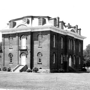
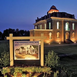
Jacksonport State Park lets visitors relive nineteenth-century Arkansas history—including the days of the pioneers, steamboats, the Civil War, Reconstruction, the Victorian Age, and the Industrial Revolution—through its various exhibits and interpretive programs. The 1872 courthouse serves as a museum, and the last sternwheeler riverboat to ply the White River is permanently moored nearby. Due to its location near the confluence of the Black and White rivers, Jacksonport became a trading center during the 1820s and thus was significant for the early settlement and economic development of Arkansas. The first steamboats arrived in 1833, and the town grew around the landing site. Jackson County, established in 1829, moved its seat of justice from Augusta (now in Woodruff County) to Jacksonport in …
Jenkins Ferry Battleground State Park

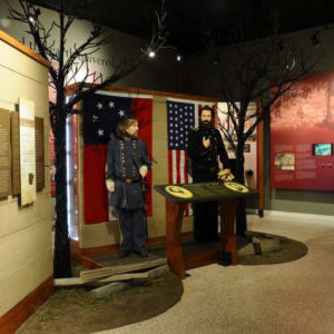
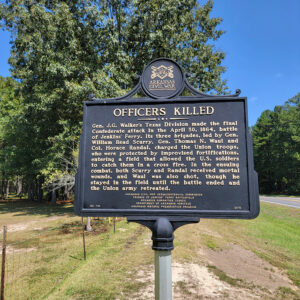
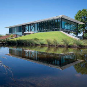
Location: Grant County Size: 40 acres Jenkins Ferry Battleground State Park, in Grant County on the Saline River, commemorates a Civil War engagement that was part of the Camden Expedition of General Frederick Steele. The park contains interpretive exhibits, as well as a picnic area and a boat ramp for access to the river. The name of the park comes from Thomas Jenkins, who established a ferry on the Saline River in 1815. By 1861, at the beginning of the Civil War, the ferry was being operated by Jenkins’s sons, William and John DeKalb. In March 1864, General Steele led approximately 14,000 troops out of Little Rock (Pulaski County) to join in the Union army’s Red River Campaign. The goal …

Lake Catherine State Park

Lake Catherine State Park in southwest Arkansas provides access to fishing, water sports, and lakeside recreation while conserving natural features representative of the Ouachita Mountains, such as waterfalls, mountain streams, and rock outcroppings. Three stone-and-wood cabins, a former concessions building, and a bridge located within the park are listed on the National Register of Historic Places as examples of the rustic architecture style used by the Depression-era Civilian Conservation Corps (CCC), which built the park. In August 1935, Harvey Couch, founder of the Arkansas Power and Light Company, donated to the state 2,048 acres of his land along the shore of Lake Catherine. The 1,940-acre lake had been created by Remmel Dam, the state’s first major hydroelectric project, in 1924. …

Lake Charles State Park

When Lake Charles State Park was constructed in the 1960s, it was the first of its kind and size in the nation. It is located in the foothills of the Ozarks near the Black River in Lawrence County and is a very popular family recreation area in northeastern Arkansas. Lake Charles was originally planned as a watershed/flood protection project near the Black River in Lawrence County. In 1956, the Lawrence County Soil and Water Conservation District Board of Supervisors sponsored an application under the U.S. Department of Agriculture’s Watershed Protection and Flood Prevention Program. When the application was submitted, the sponsors were thinking only of watershed protection on the uplands and flood prevention on the bottomlands. However, before an intensive …

Lake Chicot State Park

Lake Chicot State Park, located near Arkansas’s southeastern corner, provides recreational access to Arkansas’s largest natural lake, Lake Chicot, a twenty-mile-long oxbow created by the Mississippi River hundreds of years ago. Activities at the lake and its environs include fishing and bird watching. Early in the twentieth century, the pure waters of the lake were used untreated by the city of Lake Village (Chicot County). The area became popular for its fishing, boating, and other recreational activities. The forests surrounding the lake served as a rich habitat for wildlife. The lake was polluted by a flood in 1916 and, beginning in 1920, work on the Mississippi River levee polluted it even more. Dredging, increased cultivation around the lake, and the …

Lake Dardanelle State Park

Lake Dardanelle State Park is a popular camping and fishing destination located on the shores of a 34,300-acre man-made reservoir on the Arkansas River near the cities of Russellville (Pope County) and Dardanelle (Yell County). The park combines outdoor recreational opportunities with state-of-the-art facilities, exhibits, and technology. In 1964, construction was completed on the Dardanelle Dam, located near the river crossing between Dardanelle and Russellville. Lake Dardanelle was created in 1965. Construction on the lock and powerhouse was completed in 1969. The dam, built by the U.S. Army Corps of Engineers, was part of the McClellan-Kerr navigation project that made the Arkansas River navigable to commercial vessels. At the urging of Russellville civic leaders, the Arkansas Publicity and Parks Commission …

Lake Fort Smith State Park

Although it first became a state park in 1967, making it Arkansas’s twenty-third state park, the opening of Lake Fort Smith State Park in the spring of 2008 in a new location with entirely new facilities made it the newest of Arkansas’s state parks. At the park’s official dedication on June 19, 2008, park officials and local leaders celebrated the site that overlooks Lake Fort Smith and that in many ways reproduces the environment of the earlier park. The park was originally developed in the late 1930s as a city recreational park when Crawford County, along with the City of Fort Smith (Sebastian County) decided to utilize Lake Fort Smith as a tourism destination, called the Mountainburg Recreational Facility, as well …

Lake Frierson State Park

Lake Frierson State Park provides a variety of recreational activities on the shores of 335-acre Lake Frierson, which fronts the western slopes of picturesque Crowley’s Ridge in northeast Arkansas. Constructed in the 1970s by the U.S. Soil Conservation Service, Lake Frierson is one of ten reservoirs—not all of them state parks—along Crowley’s Ridge managed by the Arkansas Game and Fish Commission. The Arkansas Department of Parks and Tourism has a lease agreement with the Game and Fish Commission for the park’s 114 acres. The lake was named for Charles Frierson, a Jonesboro (Craighead County) attorney who played a major role in securing the property. Funding for Lake Frierson State Park came from legislative appropriations in 1975, and construction started in …

Lake Ouachita State Park

Lake Ouachita State Park lies within the Ouachita Mountains in west central Arkansas. Bordering Arkansas’s largest man-made lake and the Ouachita National Forest, the park offers camping, swimming, fishing, and many other outdoor opportunities, and it preserves the historic site of Three Sisters Springs. In 1875, homesteader John McFadden claimed that three springs on his property about twelve miles north of Hot Springs (Garland County) possessed healing properties. The springs’ collective name, “Three Sisters,” was reputedly derived from the fact McFadden had three daughters. In 1907, W. M. Cecil and his partners bought the property. Cecil later bought out his partners and began developing McFadden’s Three Sisters Springs Resort. By the mid-1930s, its facilities included cottages, a springhouse, and a …

Lake Poinsett State Park

Arkansas’s twentieth state park, Lake Poinsett, is a fishing haven located off Arkansas Highway 163 in Harrisburg (Poinsett County) in northeastern Arkansas. It is one of four state parks located along Crowley’s Ridge in eastern Arkansas. In the 1950s, several residents in the Harrisburg area started volunteer efforts to have a recreational lake built in the county. Spearheaded by a local Rotary Club committee chaired by Richard D. Woods, the planners envisioned a place to fish, picnic, and camp, but it became clear they did not have the funds to construct the type of multi-purpose facility they wanted. The Arkansas Game and Fish Commission expressed interest in damming Distress Creek to create a lake, but only when funds became available. …

Logoly State Park

Logoly State Park in southwestern Arkansas was the state’s first environmental education park. At Logoly, interpreters present workshops on ecological and environmental topics, and the park’s natural resources provide a living laboratory for students and nature lovers alike. The area surrounding Logoly State Park has been the scene of human activity since it was inhabited by Native Americans, whose artifacts have been found in the park. Because mature timber stands cover most of the park, the few artifacts found have been along the trails or water-washed areas. No detailed archaeological surveys have been done to locate any possible village sites. During the late 1800s, a collection of springs in an area called Magnesia Springs was used by the early settlers …