State Parks

Subcategories:
  • No categories
Clear

Entry Category: State Parks

Arkansas Museum of Natural Resources

The Arkansas Museum of Natural Resources houses exhibits that tell the story of oil and bromine production in southern Arkansas, with particular attention given to the historic oil boom that began in the 1920s. The center also interprets the history of these resources from the beginning of the oil’s creation eons ago through modern times. In the 1920s, nationwide attention focused on this area when the Smackover oil field was ranked first among the nation’s oil fields with a yearly production of sixty-nine million barrels in 1925. In 1925, during south Arkansas’s oil boom, the forty-square-mile Smackover oil field was the focal point of one of the fastest mineral booms in North America, with 1,000 wells drilled in the first six …

Arkansas Post Museum

The Arkansas Post Museum (previously Arkansas Post Museum State Park) in southeastern Arkansas displays exhibits and artifacts and presents programs about Arkansas Post—the first permanent European settlement in the state—and life in the state’s Delta region, including the Grand Prairie. It succeeded Arkansas Post State Park, which was transferred to the National Park Service in 1964 for creation of the Arkansas Post National Memorial. The museum complex is located at the junction of Highways 165 and 169. The Arkansas Post State Park Commission, established by Legislative Act 57 of 1929, acquired sixty-two acres that had been occupied by Arkansas Post when it became the capital of Arkansas Territory in 1819, when the territory was established. At the time of the …

Bull Shoals-White River State Park

Arkansas’s seventh state park, Bull Shoals-White River State Park, is near Mountain Home (Baxter County) in northeast Arkansas on the White River, one of the nation’s premier trout-fishing streams, and Bull Shoals Lake, one of the region’s major man-made lakes. The site was adopted into the state park system in 1955 after the U.S. Army Corps of Engineers created the lake by constructing Bull Shoals Dam on the White River. Bull Shoals was named by early French hunters and trappers who used the word “Boill,” meaning a large spring, to describe the area. Edmund Jennings, the first English-speaking person to visit the “Six Bulls” country, lived among the Indians for fifteen years before returning to his home state of Tennessee. …

Cane Creek State Park

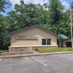
Cane Creek State Park in southeast Arkansas occupies an environmentally significant setting on the border of two of the state’s geographic regions, the flat Mississippi Alluvial Plain (the Delta) and the rolling West Gulf Coastal Plain. Located on the shore of Cane Creek Lake, the park provides for recreational activities that include camping, picnicking, fishing, kayaking, hiking, and wildlife watching. The park, a joint project of state and federal agencies, grew out of a 1973 proposal by the Arkansas Game and Fish Commission (AGFC) to develop a lake and park near Star City (Lincoln County) to enhance recreational opportunities in southeast Arkansas, although legislation authorizing the creation of the park had passed two years earlier. The state parks department entered …
Conway Cemetery State Park

Conway Cemetery State Park, near Walnut Hill (Lafayette County) in southwest Arkansas, preserves a half-acre cemetery containing the grave of the state’s first governor, James Sevier Conway. It is the second-smallest Arkansas state park. Conway was governor of Arkansas from 1836 to 1840 and a member of “The Family,” a powerful dynasty that dominated early Arkansas politics. During his tenure in office, he was responsible for a budget surplus and many of the state’s initial institutions, including roads, a prison system, and a state bank. An advocate of education, he unsuccessfully requested that the Arkansas General Assembly use the budget surplus to create a public school system and state university. The economic depression of 1837 collapsed the banking system and …

Cossatot River State Park-Natural Area

The Cossatot River State Park–Natural Area conserves a twelve-and-one-half-mile stretch of the Cossatot River, a southwest Arkansas stream included by the legislature in the state’s Natural and Scenic Rivers System. The National Park Service has designated the Cossatot’s upper reaches as a National Wild and Scenic River. The upper Cossatot is free of impoundments, and its shoreline is largely primitive and undeveloped. Within the park, there are over thirty rare plant and animal species, many of which are endemic to the Ouachita Mountains. The idea of establishing a natural area along the upper Cossatot surfaced in 1974, shortly after the Arkansas Environmental Preservation Commission was created. The panel was subsequently renamed the Arkansas Natural Heritage Commission. In October 1975, its …

Crater of Diamonds State Park

Located on State Highway 301 in Pike County, the Crater of Diamonds State Park contains the world’s only diamond mine that is open to the public. John Wesley Huddleston, a farmer and sometime prospector, first found diamonds on the site in 1906. Huddleston’s discovery sparked a diamond rush in Pike County. Diamond-bearing soil was also found on Millard M. Mauney’s property that was adjacent to Huddleston’s. Prospectors and fortune hunters rushed to the area, and soon the town of Kimberly developed to accommodate the influx of people. Within a few years of the discovery, all the land on top of Prairie Creek Pipe was in the hands of two rival companies, Arkansas Diamond Company and Ozark Diamond Mines Corporation. The …

Crowley’s Ridge State Park

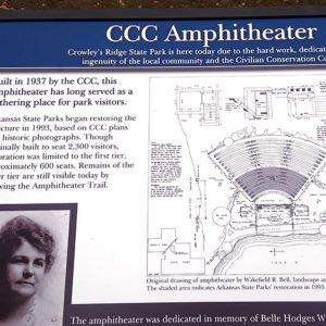
Crowley’s Ridge State Park in northeast Arkansas is a recreationally oriented park with a rich social and geological history. The park, situated on land that was homesteaded by nineteenth-century pioneer Benjamin F. Crowley, also preserves the structures built by young men in the Civilian Conservation Corps (CCC) during the 1930s. Arriving on the scene in 1820, Crowley was the first prominent white settler in the region. He selected the site for his plantation home because of the upland terrain and a spring, which continues to flow today. Crowley, a veteran of the War of 1812, became an acknowledged leader in northeast Arkansas and strongly supported the creation of Greene County on November 5, 1833. He died in 1842 at age …

Daisy State Park

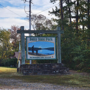
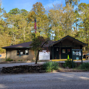
Daisy State Park is situated on the northern shoreline of 7,000-acre Lake Greeson in southwest Arkansas. The clear water and Ouachita Mountains scenery make the park a favorite of campers seeking water sports and fishing. Daisy is the eighth state park established in Arkansas. Lake Greeson was created in 1950 when the U.S. Army Corps of Engineers placed a dam on the Little Missouri River some six miles north of Murfreesboro (Pike County). The lake was created for flood control and hydroelectric power generation. The land for Daisy State Park, consisting of 272 acres, was acquired by the state and the U.S. Army Corps of Engineers on March 22, 1955. Former state representative Pete Austin, a lifetime resident of Pike …

Davidsonville Historic State Park

Davidsonville Historic State Park is a 163-acre park located on the Black River in southern Randolph County. The park preserves the site of the town of Davidsonville, which housed the first postal stop, the first courthouse building and county seat of Lawrence County, and the first federal land office in what is now the state of Arkansas. The town was created from a few log cabins in 1815, when the Act of Lawrence County was written; it was briefly known as the town of Lawrence. Strangely, this town of “firsts” was also the first county seat to be bypassed by a major road connecting Missouri to the Great Southwest. By 1829, Davidsonville had lost the courthouse to Jackson and the …

DeGray Lake Resort State Park

DeGray Lake Resort State Park, located in southwest Arkansas, features a ninety-four-room lodge, an eighteen-hole championship golf course, a full service marina, a convention center, tennis courts, and a pool. It is the state’s only resort state park. While the U.S. Army Corps of Engineers was constructing DeGray Lake (1963–1972) by damming the Caddo River, support grew within the State Parks Division and surrounding communities for developing along the 13,400-acre lake a state park to rival resort state parks in neighboring Oklahoma and Texas. The Corps and the Arkansas Department of Parks and Tourism reached an agreement in November 1971 for the construction and management of a resort and recreation area on the lake’s north shore. Effective May 1, 1972, …

Delta Heritage Trail State Park

The Delta Heritage Trail State Park is being developed in phases along seventy-three miles of abandoned Union Pacific Railroad right of way through Phillips, Arkansas, and Desha counties in eastern Arkansas. The trail project starts one mile south of Lexa (Phillips County) and goes to Arkansas City (Desha County). In early 1991, as part of the “rails-to-trails” provision of the National Trails System Act, which preserves rail corridors by reclaiming land along abandoned railroads for recreational use, the Union Pacific Railroad notified the Arkansas Department of Parks and Tourism of the potential track abandonment. Under the act, which is funded by the Department of the Interior, railroad companies can transfer all rights and liabilities connected to a rail corridor to …