Protected Areas

Subcategories:
  • No categories
Clear

Entry Category: Protected Areas

Holla Bend National Wildlife Refuge

Holla Bend National Wildlife Refuge (Holla Bend NWR), located six miles south of Dardanelle (Yell County), is a strategic stopover for migratory birds. The 7,000 acres (owned plus managed) offers a place for wintering ducks and geese to rest, and for spring and summer birds to nest while traveling the Central and Mississippi flyways. Extensive wildlife also makes this protected area its year-round home. In 1954, the United States Army Corps of Engineers’ navigation and flood control project along the Arkansas River straightened a section of the river by cutting a channel across Holla Bend Bottoms—on the water route of the Trail of Tears—to improve navigation and prevent flood damage, resulting in an island between the old and new river …

Lost 40

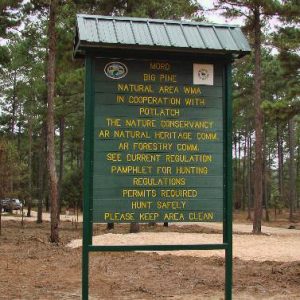
The Lost 40 is a forty-acre tract of mature forest along Wolf Branch (a tributary of Moro Creek) in southeastern Calhoun County. Owned by PotlatchDeltic Corporation, the tract is known for its large trees, some more than 200 years old, and has variously been described as “primary,” “virgin,” and “old-growth.” It has been the site of several scientific studies conducted by the faculty and students of the University of Arkansas at Monticello (UAM) School of Forestry and Natural Resources, and is protected by a forty-year cooperative management agreement between PotlatchDeltic and the Arkansas Natural Heritage Commission (ANHC) signed in 1996. Lost Forty Brewing, a brewery based in Little Rock (Pulaski County), takes its name from the tract. Several natural communities …

Mammoth Spring

Mammoth Spring is the largest spring in the state of Arkansas, the second largest in the Ozark Mountains region, and the seventh largest in the United States. This National Natural Landmark is located within the boundaries of Mammoth Spring State Park. Approximately 497 feet from the Missouri state line in north-central Arkansas, it is within sight of U.S. Highway 63 and the city of Mammoth Spring (Fulton County). Though the spring has always been known as “big” or “mammoth,” the first known settlers in the 1820s created a small village called “Head of the River,” which would later be renamed Mammoth Spring. Water flows from the spring at an average rate of 9.78 million gallons per hour, with a constant …

Mississippi Flyway

The Mississippi Flyway is one of four loosely defined routes used by some species of migratory birds as they travel each autumn from breeding areas in northern North America to wintering sites in the southern United States, Mexico, and Central and South America, and back again in spring. Other North American flyways are the Atlantic, to the east of the Mississippi Flyway; the Central, through the Plains states; and the Pacific, west of the Rocky Mountains. In northern latitudes, summer brings long days and abundant insects and other invertebrates for food, conducive to nesting success for birds. Winter, however, means harsh weather conditions, the disappearance of invertebrates, and frozen lakes and rivers. As a result, most birds nesting in the …

Ouachita National Forest

The Ouachita National Forest, originally called the Arkansas National Forest, was created through an executive order issued by President Theodore Roosevelt on December 18, 1907. Forest Service Chief Gifford Pinchot remarked at the time that this national forest was the only major shortleaf pine forest under the federal government’s protection. In January 1908, the Arkansas Sentinel newspaper reprinted an article from Forestry and Irrigation Magazine that praised the hearty spirit of cooperation manifested by Arkansas’s people and spoke of benefits to be gained by the conservation of timber supplies. At first, the Arkansas National Forest consisted solely of reserved public domain lands (part of the Louisiana Purchase) south of the Arkansas River. The 1911 Weeks Law, which authorized federal purchase …

Overflow National Wildlife Refuge

Overflow National Wildlife Refuge was established on November 6, 1980, to protect one of the remaining bottomland hardwood forest tracts in the Lower Mississippi River Valley (LMRV). Located in Ashley County, it is part of the National Wildlife Refuge System administered by the United States Fish and Wildlife Service under the Department of the Interior. These bottomland forests are used by a huge contingent of migratory birds including waterfowl, wading birds, raptors, and songbirds. Original refuge land acquisitions were limited to forested bottomlands only, as they were in eminent danger of being drained and cleared for agriculture. The refuge has been officially designated a globally Important Bird Area (IBA) by the American Bird Conservancy. Most of the land within the …

Ozark-St. Francis National Forests

The Ozark-St. Francis National Forests are replete with distinct topographical, geological, and biological features. The forests are overseen by the U.S. Department of Agriculture (USDA) Forest Service, which employs a multiple-use management concept to serve the best interests of the landowners and visitors. The forests serve as a source of renewable hardwood for industry and as prime recreation areas in the state. On December 18, 1907, President Theodore Roosevelt signed a proclamation creating the Arkansas National Forest (now the Ouachita National Forest) from the land south of the Arkansas River. On March 6, 1908, he signed the proclamation creating the Ozark National Forest from the land north of the river. The Ozark National Forest was the only major hardwood timberland …

Pond Creek National Wildlife Refuge

Pond Creek National Wildlife Refuge, the 501st refuge in the National Wildlife Refuge System, protects and preserves one of the last remaining bottomland hardwood tracts in the Red River Basin. Established in 1994 under the Emergency Wetlands Resources Act, the refuge encompasses approximately 28,000 acres and is located in southwest Arkansas along the Texas/Oklahoma border. Originally established as Cossatot National Wildlife Refuge, the name was changed in 1997 at the request of citizens to retain the local name, Pond Creek Bottoms. Pond Creek National Wildlife Refuge is one of four refuges managed as part of the South Arkansas National Wildlife Refuge Complex with headquarters at Crossett (Ashley County). Geographically positioned in an area where the Central and Mississippi flyways overlap, …