Entry Category: Land and Resources

Plum Bayou Project

The Plum Bayou Project was part of a New Deal plan designed to help rural residents receive federal relief and assistance during the economic crisis of the 1930s. Located approximately seventeen miles north of Pine Bluff (Jefferson County), Plum Bayou was one of several similar communities built in the Arkansas Delta. During the Great Depression, the federal Resettlement Administration—later the Farm Security Administration (FSA)—experimented with programs designed to give assistance to rural farm families. Rexford G. Tugwell, head of the Resettlement Administration, believed that sending farmers into the cities with no job prospects was an untenable situation and certainly no answer to the farmers’ desperate plight. Instead, he focused on developing resettlement projects designed to move farmers barely surviving on …

Plum Point Energy Station

The Plum Point Energy Station (PPES) is a 665-megawatt (MW) energy facility located approximately five miles east of Osceola (Mississippi County). Owned by NRG Energy of Houston, Texas, the station began commercial production of electricity on September 1, 2010, serving members of the Missouri Joint Municipal Electric Utility Commission (MJMEUC) in the Arkansas communities of North Little Rock (Pulaski County), Osceola, and Piggott (Clay County), along with the Missouri communities of Carthage, Kennett, Malden, and Poplar Bluff, plus all thirty-five members of the Missouri Public Energy Pool No. 1 (MoPEP). The Empire District Electric Company, East Texas Electric Cooperative, and Municipal Energy Agency of Mississippi own smaller shares of the company. Development and Construction Spurred by recent economic setbacks in …

Pomeroy, Leslie Klett (Les)

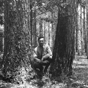
Although Sierra Club founder John Muir championed forest conservation by setting aside large acreages, it was Leslie Klett Pomeroy who devised a conservation plan for growing and harvesting timber that both conserved it and turned it into a renewable resource. His science-based management plans regenerated timberlands across the South after cut-out-and-get-out practices had decimated its forests. Pomeroy’s groundbreaking work carried out in Arkansas ultimately affected forestry in the South and across America. Leslie Pomeroy was born on December 12, 1896, in Hub City, Wisconsin. He was the only child of William Justis Pomeroy and Anna Barbara Klett Pomeroy. His mother was a housewife, and his father began his employment with Madison Bus Company in 1922 as a motorman on streetcars, …

Ponca Elk Education Center

The Ponca Elk Education Center was established in 2002 to serve wildlife enthusiasts coming to Newton County to view elk, which were introduced to the state in 1981. The center is in a handsome log building on Arkansas Highway 43 in the village of Ponca in western Newton County. The building was for a short time used as a charter school by a religious organization and was later leased by the Arkansas Game and Fish Commission (AGFC). The Ponca facility has displays of elk and many other Arkansas wildlife. It features eye-catching photographs and a gift shop selling nature-related items, as well as hunting and fishing licenses. There is also a small meeting room. Porches offer visitors a chance to …

Pond Creek National Wildlife Refuge

Pond Creek National Wildlife Refuge, the 501st refuge in the National Wildlife Refuge System, protects and preserves one of the last remaining bottomland hardwood tracts in the Red River Basin. Established in 1994 under the Emergency Wetlands Resources Act, the refuge encompasses approximately 28,000 acres and is located in southwest Arkansas along the Texas/Oklahoma border. Originally established as Cossatot National Wildlife Refuge, the name was changed in 1997 at the request of citizens to retain the local name, Pond Creek Bottoms. Pond Creek National Wildlife Refuge is one of four refuges managed as part of the South Arkansas National Wildlife Refuge Complex with headquarters at Crossett (Ashley County). Geographically positioned in an area where the Central and Mississippi flyways overlap, …

Poteau River

The Poteau River rises in Arkansas from springs east of Waldron (Scott County) and flows westward for approximately thirty-nine miles before entering Le Flore County, Oklahoma. From there, the river continues to flow west until entering Wister Lake. Exiting the north side of the lake, the river flows northeast until finally emptying into the Arkansas River in Fort Smith (Sebastian County). The river flows for a total length of 141 miles. Early inhabitants were located along the Poteau River during the Archaic, Woodland, and Mississippian eras. There are numerous archaeological sites located along the river, giving evidence indicating that the Caddo Indians once inhabited the area. The Poteau River and its banks served as hunting and fishing grounds for early …

Potlatch Cook’s Lake Nature Center

Potlatch Cook’s Lake Nature Center (originally the Potlatch Conservation Education Center at Cook’s Lake) is located near the small community of Casscoe (Arkansas County) approximately twenty miles southeast of Stuttgart (Arkansas County). The general purpose of the facility is conservation education, focusing on the bottomland hardwood forests and upland community of forests that surround the center. This is accomplished by introducing various audiences to hands-on outdoor learning activities. The property is recognized as an important wildlife sanctuary, especially for migrating waterfowl. In 1990, the forty-nine nations of the Ramsar Convention (an international treaty for conserving and sustainably utilizing wetlands) recognized the 200-acre Cook’s Lake and its surrounding property as a “wetland of international importance,” representing the diverse natural features of …

Poultry Industry

A staple of the state’s economy, the Arkansas poultry industry first emerged in the 1890s. A century later, Tyson Foods, based in Springdale (Washington and Benton Counties), had become one of the largest agribusiness firms in the United States. Northwestern Arkansas, particularly Washington and Benton counties, produces the majority of poultry in Arkansas. The topography of the Ozark highlands—in contrast to the relatively flat eastern half of the state—is well suited to raising chickens. The hilly terrain has historically prevented the widespread cultivation of rice and cotton, which led northwestern Arkansas farmers to pursue interests in timber, fruit orchards, and especially poultry. By the early twenty-first century, poultry production had become an essential component of Arkansas’s economy, and Tyson Foods—with …

Proud Spirit Horse Sanctuary

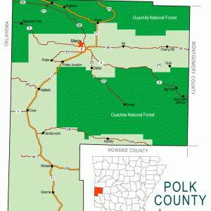
Proud Spirit Horse Sanctuary began with just one horse on five acres of rural land outside Sarasota, Florida, and eventually evolved into an award-winning, 320-acre facility located in Mena (Polk County). Melanie and Jim Bowles, the founders of Proud Spirit, originally earned their livings as professional firefighters for Sarasota County, Florida. In 1990, they purchased a small home on five acres out in the country. A few months later, they decided they had room for a horse and began looking for one to purchase. In their search, they discovered a thoroughbred mare that was being neglected and purchased the horse to get her out of the abusive situation. In 1992, they opened their five acres to more horses in need, …

Public Land Surveys

The survey and division of the public lands that would make up the state of Arkansas was vitally important to the orderly settlement and development of the future territory and state. The modern survey system devised by the United States in the late 1700s provided the basis for subdividing the vast new lands acquired by the expanding nation into more identifiable, transferable tracts. Soon after the Louisiana Purchase in 1803, the U.S. government began the process of dividing the vast addition into smaller tracts, including the eventual survey and charting of nearly all of the newly acquired public land in the territory that would become Arkansas. That process in Arkansas would last nearly half a century. Prior to 1815, the …

Quartz Mining

Arkansas is one of a small number of places in the world with enough quartz crystals to justify commercial mining. Though the amount of unmined quartz in the state is not yet known, Arkansas does have, in terms of both size and quality, some world-class deposits of quartz. Quartz is a common mineral that becomes crystallized under extreme geologic pressure. These crystals have been used to make oscillators for radios, computer chips, and clocks. Quartz crystals are also valued for their beauty as mineral specimens and gemstones. In 1967, the General Assembly adopted the quartz crystal as the Arkansas State Mineral. History of Quartz in Arkansas A quartz arrowhead that is estimated to be over 11,000 years old was discovered …

Ray, Mary Lee McCrary

Mary L. Ray spent thirty-seven years educating African Americans. She applied the self-help approach she learned at the Tuskegee Institute to formal education in private and public schools, and then in informal education as the first African-American female employee of the “Negro” division of the Arkansas Agricultural Extension Service—that is, the first black home demonstration agent in the state. Mary Lee McCrary’s birth year and early life remain a mystery. During the late nineteenth century,  as African Americans faced increased assaults to their civil liberties, many turned to capitalism, another American ideal, as visible evidence of citizenship. McCrary apparently embraced this approach. She learned the self-help philosophy from one of the most celebrated advocates of the approach, Booker T. Washington, …

Red River

The Red River emerges from two forks in the Texas panhandle and flows east approximately 1,290 miles, forming the border between Oklahoma and Texas as well as part of the border between Texas and Arkansas. In southwestern Arkansas near Fulton (Hempstead County), the Red River takes a decidedly southern turn before entering Louisiana, where it flows southeasterly before emptying into the Mississippi River northeast of the town of Simmesport. Although only approximately 180 miles of the Red River touches upon or passes through the state of Arkansas, it has had a major impact upon the people of southwestern Arkansas from prehistoric times to the present day. Important prehistoric Caddo artifacts have been unearthed in the Red River valley, particularly the …

Red-cockaded Woodpeckers

aka: Picoides borealis
With the exception of the recently rediscovered ivory-billed woodpecker, red-cockaded woodpeckers (Picoides borealis) are the rarest of Arkansas’s nesting woodpeckers. A century ago, the bird was common in mature, open pine stands. Its natural range included millions of acres of pine habitat throughout the southeast United States. An estimated ninety-nine percent of suitable habitat was lost because of logging, wildfire suppression, conversion to agricultural lands, and urbanization. Best estimates range-wide indicate an original population numbering over four million. By the time the bird was declared endangered, it had declined to an estimated 10,000. The Arkansas population dwindled to under 400 birds. The red-cockaded woodpecker was designated as endangered on October 13, 1970. It received formal legal protection with the passage …

Reed, Pearlie Sylvester

Pearlie Sylvester Reed spent more than a quarter century of his career working in agriculture, serving four major regions of the United States and initiating sweeping progressive and anti-discrimination policies in the 1990s. He was inducted into the Arkansas Black Hall of Fame in 2012. Pearlie S. Reed was born in Heth (St. Francis County) on June 14, 1948. He was one of eighteen children of Floyd L. Reed and Gennora Reed. Reed attended school in the nearby town of Hughes (St. Francis County) and graduated from the segregated Mildred Jackson High School. As a student at what is now the University of Arkansas at Pine Bluff (UAPB), Reed began his career in agriculture in 1968 as an intern in …

Rice Industry

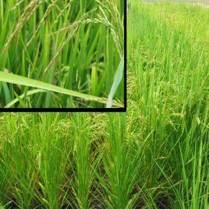
Rice, the most popular grain in the world, is Arkansas’s leading agricultural product. Although it was only rarely grown in Arkansas before the twentieth century, rice came to dominate eastern Arkansas farms, beginning in the Grand Prairie but rapidly expanding into the Mississippi Delta and the Arkansas Valley. Domesticated rice (Oryza sativa) is not native to North America. It has been cultivated in central Asia for up to 6,500 years, and its use gradually spread to eastern and western Asia, the Mediterranean basin, and Africa. Roughly 40,000 official varieties of rice are recognized, but they usually are sorted into three categories: short-grain, medium-grain, and long-grain. While most rice is consumed as a grain, rice is also an ingredient in many …

Riceland Foods

Riceland Foods, Inc., headquartered in Stuttgart (Arkansas County), is the world’s largest rice miller and rice marketer. It also operates one of the world’s largest rice mills, which is located in Jonesboro (Craighead County). Founded in 1921 as a farmers’ cooperative to market crops, Riceland is one of the top companies in Arkansas. It is the largest supplier of rice for the food industry in the United States, a major rice exporter to foreign countries, one of the nation’s largest grain storage companies, and is also one of the Mid-South’s largest soybean processors. In the late nineteenth century, most of America’s rice was grown in Louisiana. Around 1900, William H. Fuller from Carlisle (Lonoke County) went to Louisiana on a …