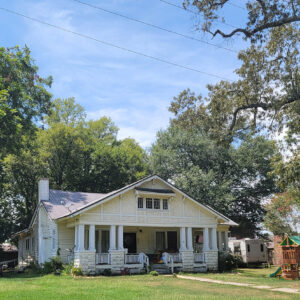
 Bethel House
Entry Category: Cities and Towns - Starting with B
Bethel House
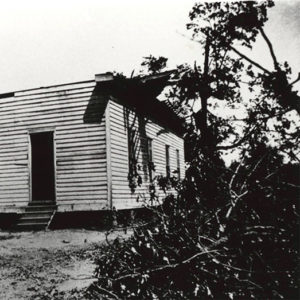
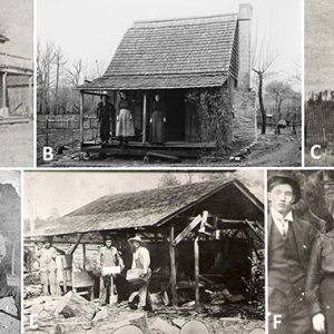
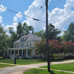 Bedford Brown Bethell House
Bethesda (Independence County)
Although there were settlers in what became Bethesda (it was originally called Washington) in the early days of statehood, the community was officially established with the opening of a post office in 1888. The name of the community is believed to have been derived from the biblical Bethesda healing pool in Jerusalem, the word meaning “house of grace” or “house of mercy.” Bethesda is located along Highway 106, about three miles south-southeast of Cushman (Independence County) and about eight miles west-northwest of the county seat of Batesville (Independence County). The White River is about four miles to the south, where Lock and Dam No. 2 is located. The Union Pacific Railroad follows the White River bank south of Bethesda. The …
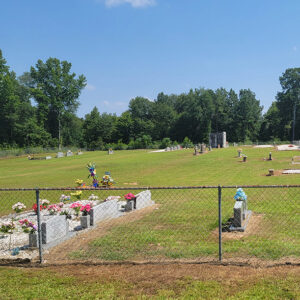
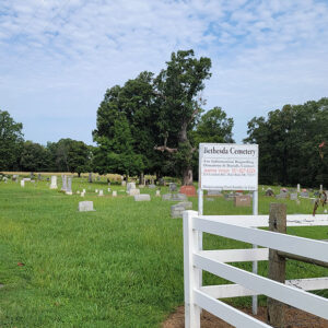 Bethesda Cemetery
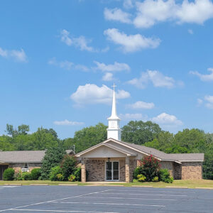
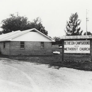 Bethesda Church
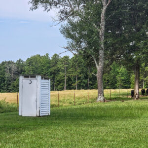 Bethesda Outhouse
 Bethesda Tornado
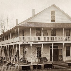 Bevill Hotel
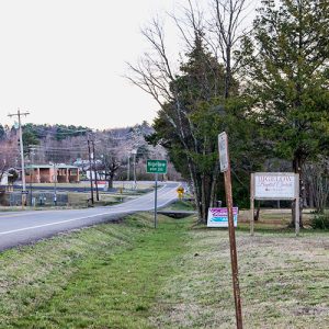
Big Flat (Baxter and Searcy Counties)
Big Flat is a town on State Highway 14, mostly in southern Baxter County but straddling the Searcy County line. It is just outside the Ozark National Forest. One of the earliest settlements of northern Arkansas, Big Flat long flourished because it was isolated from other settlements by the hills and forests of the region. The town did not incorporate, though, until 1939. Big Flat was named for a plateau in the Leatherwood Mountains of the Ozark Mountain range. For thousands of years, the area was visited by hunters, fishers, and gatherers of food; the Osage came down from what now is Missouri to collect food to bring back to their homes in the north. White settlers began to …
Big Fork (Polk County)
aka: Bigfork
Big Fork is an unincorporated community in the Ouachita Mountains of Polk County at an elevation of 308 m (1,020 ft.). It is located on Arkansas Highway 8, about 29 km (18 mi.) east of Mena (Polk County). After 1820, a large westward expansion brought settlers to Arkansas, and the Ouachita Mountains attracted many people from northern Georgia to Big Fork. Land in western Arkansas was fairly inexpensive and easy to obtain, and an early settler did not have to pay taxes for five years on land purchased. There were many pioneer families who migrated from Georgia to Big Fork, including the Abernathy, Bates, Beck, Dilbeck, Edwards, Goss, Smith, Turner, and Vandivier families. Some early families of Big Fork also …
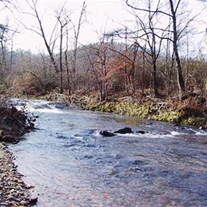 Big Fork Creek
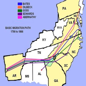 Big Fork Families
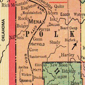 Big Fork Map
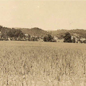
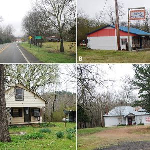 Big Fork Scenes
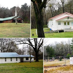 Big Fork Scenes
 Big Fork Scenes
Big Springs (Stone County)
Big Springs is located in Sylamore Township on Big Springs Road just off Highway 66 (West Main Street) about a mile and a half northwest of Newnata (Stone County) and four miles northeast of Timbo (Stone County). The county seat, Mountain View, is about seven and a half miles east via West Main Street. The community received its name from a large spring where the early settlers built their cabins. The spring, a church, a store, the nearby Avey family home place and barn, and Big Springs Cemetery on the hill made up the main part of the Big Springs community. The Avey family had a home atop the hill above the spring. They got their water by attaching a …
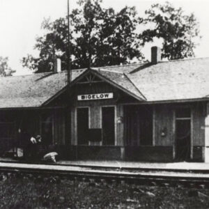
 Bigelow
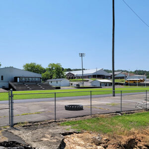
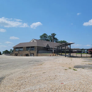
Bigelow (Perry County)
Bigelow is located in the eastern part of Perry County, near the confluence of the Fourche La Fave and Arkansas rivers. The town’s past is tied to the lumber industry, and it has seen its population surge and fall with the state of the local lumber economy. An early settler in the area was Gustave Klingelhoeffer, a German immigrant who came to Arkansas in the early 1830s and eventually settled in Perry County, first near the county seat of Perryville and then later near the mouth of the Fourche La Fave River. Klingelhoeffer featured prominently in the stories of Friedrich Gerstäcker, a German writer who traveled through Perry County and visited the Klingelhoeffer home. In 1880, an application to establish …
 Bigelow Access
 Bigelow Depot
 Bigelow High School
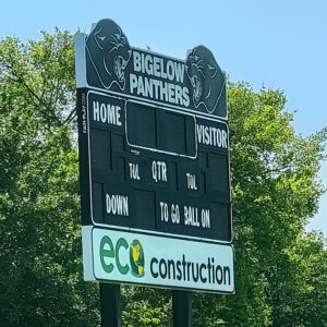 Bigelow High School Scoreboard
Biggers (Randolph County)
Located on the Current River near the Cherokee Bay in the southeastern Randolph County lowlands, the town of Biggers developed around 1900. While scattered settlements may have been present in the region from 1815 to 1830, the first major development near the modern site of Biggers was the plantation of Thomas Drew, who later served as the governor of Arkansas. Drew received the land from Dr. Ransom Bettis upon Drew’s marriage to Bettis’s daughter Cinderella; he developed the land and had amassed around twenty slaves by 1832. Bettis also continued to own land near the future Biggers site. In 1889, B. F. Bigger, the namesake for the town, bought land, established a ferry crossing over the Current River, and built a …
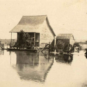 Biggers Flood
 Biggs Onion Farm
 Entering Billstown
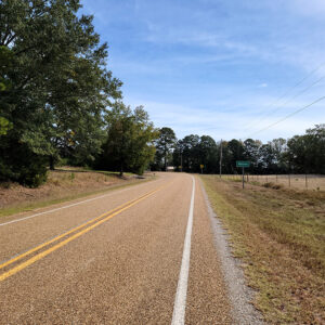
Billstown (Pike County)
Billstown is a small community about six miles southwest of Delight (Pike County) and ten miles southeast of Murfreesboro (Pike County). It is also known as Bills. The first settlers in the area were William Canatser and Thomas Titus, who obtained forty acres in federal land patents in 1858. As more settlers moved into the area, a school named Pleasant Hill was established by 1895. Later schools included Chigger Hill and Baulding Branch. Pleasant Hill school was also used for church services, and Methodist and Church of Christ congregations were organized, both later constructing buildings. John Hipp, who obtained eighty acres in 1885, donated the land for the Pleasant Hill school and a cemetery. The town reached its peak in …
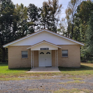 Billstown Church
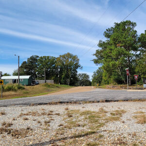 Billstown Street Scene
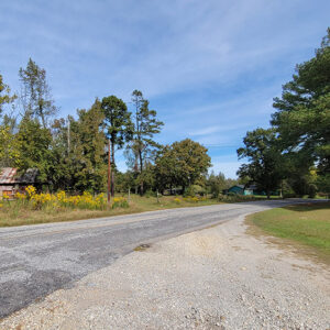 Billstown Street Scene
Bingen (Hempstead County)
An unincorporated community in Mine Creek Township, Bingen (Hempstead County) is located about four miles northeast of Nashville (Howard County) and about twenty-seven miles northwest of Hope (Hempstead County). The growth and early history of the community are closely tied to Dr. J. R. Wolff. The original name of the community was Ozan, not to be confused with the town of the same name located about nine miles to the southeast. A post office opened in the community in 1852. A name change was suggested by South Carolina native Wolff, who moved to the area around 1859. Wolff’s grandfather was a native of Germany, inspiring the community to be named around 1881 for Bingen am Rhein, located in Rhineland-Palatinate, Germany. Trained as a physician, Wolff established a medical practice in Bingen but quickly branched out into other businesses. In 1889, the community included a number of businesses, all owned by Wolff, such as a general …
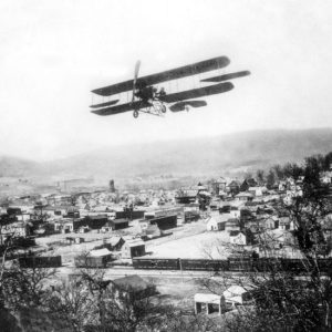 Biplane Over Leslie
Birdsong (Mississippi County)
Located in the extreme southwestern corner of Mississippi County, Birdsong is an African American community that gained national recognition in 1935 due to the plight of sharecroppers in northeastern Arkansas and southeastern Missouri. There, local planters and sheriff deputies threatened the life of Norman Thomas, leader of the Socialist Party, forcing him out of town after dispersing a crowd of some 500 men, women, and children. Birdsong is located in the Mississippi River Delta; at 220 feet above sea level, Birdsong at its founding was in a swamp. The community is about eleven miles from the Mississippi River on the east. To the west, about four miles away, is the Tyronza River, with Right Hand Slough (Little River) and the St. Francis …
 Birta Street Scene
Biscoe (Prairie County)
aka: Fredonia (Prairie County)
Biscoe, also known as Fredonia, is located on Surrounded Hill between the White River and the Cache River in eastern Prairie County. It is on U.S. Highway 70 a few miles east of DeValls Bluff (Prairie County). Surrounded Hill was surveyed by the federal government in 1849. Edwin Burr was the first settler to claim title to the land, registering his deed in Batesville (Independence County) in 1853. The area remained relatively unpopulated through the Civil War but gained significance with construction of the Memphis and Little Rock Railroad, which was completed through the Surrounded Hill area in 1871. A depot was built on flat land near the hill, and a post office was established in 1872 with the name …
Bismarck (Hot Spring County)
Bismarck is an unincorporated community located in western Hot Spring County at the intersection of Arkansas Highways 7 and 84. Near DeGray Lake, the community serves visitors to the lake as well as serving as a bedroom community for Hot Springs (Garland County) and Arkadelphia (Clark County). DeGray Lake Resort State Park is located in the community. The first settlers in the area began to obtain land patents just before the Civil War. Neal McDonald obtained 240 acres on July 1, 1859, including the area where Bismarck is now centered. At this time, the area was part of Clark County. Several other settlers obtained patents on April 2, 1860, including Jonathan Fulton, Edward Howerton, Caleb Killian, and Elisha Williams. These …
 Bismarck Cemetery
 Bismarck Church
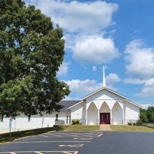 Bismarck Church
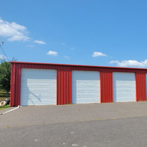 Bismarck Fire Department
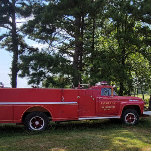 Bismarck Fire Engine
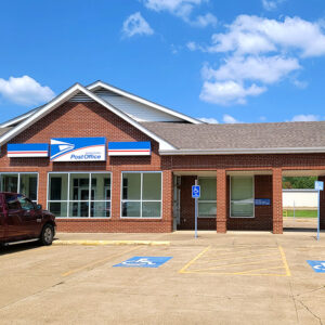 Bismarck Post Office
 Bismarck School
 Bismarck Street Scene
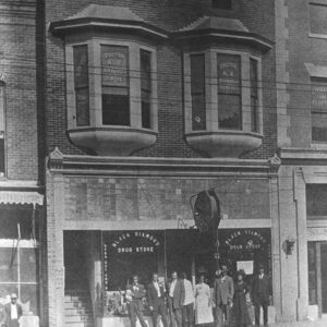 Black Diamond Drug Store
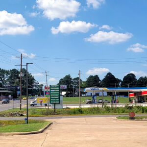
Black Fork (Scott County)
Black Fork is an unincorporated community located in southwestern Scott County, just north of Black Fork Mountain. Black Fork was named after a creek—supposedly with dark, murky water—that flows through the area. Black Fork Creek is a distributary of the Fourche La Fave River and a tributary of the Poteau River. The agriculture and timber industries have traditionally been important in Black Fork. Archaeological findings have provided evidence of early inhabitants dating to the Archaic, Woodland, and Mississippian periods. Further archaeological evidence has indicated that people of the Caddo tribe inhabited the area. During the late seventeenth and early eighteenth centuries, French hunters and tradesmen traveled west from the Arkansas Post exploring portions of western Arkansas. Several rivers that flow …
Black Oak (Craighead County)
The northeast Arkansas town of Black Oak, one of three Arkansas communities so named, is located in Craighead County on State Highway 18 about seventeen miles east of Jonesboro (Craighead County). Once a thriving timber town, it now exists as a small farming community surrounded by fertile farm land. Black Oak is part of the area known as Buffalo Island. The town gained international attention in the 1970s when a local boy formed and fronted the successful Southern rock group Black Oak Arkansas. In the late 1800s, the land surrounding present-day Black Oak was low lying and often under water, hampering settlement. Those who did come to the area settled on a rise in the timber-covered flat lands called Black Oak …
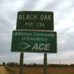 Black Oak Sign
Black Rock (Lawrence County)
The city of Black Rock in Lawrence County is situated on the Black River at the edge of the Ozark Mountains. It reportedly takes its name from black rocks in the area. The city was a boomtown, rising due to the development of railroads and timber interests, and it was later sustained by the pearling industry. Black Rock consisted of only a few houses and some cleared farmland prior to the 1882 construction of the Kansas City, Fort Scott, and Gulf Railroad through the area. Immediately, the area was transformed into a boomtown as lumber interests moved in to take advantage of the offerings of the Ozark Mountains. General stores were quickly established, and a sawmill was built on the …


