calsfoundation@cals.org
Maysville (Benton County)
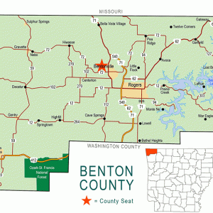
Although it is unincorporated, Maysville is one of the oldest settlements in Benton County. Located on Arkansas Highway 43 near the Oklahoma state line, Maysville is the westernmost community in Arkansas.
The Osage hunted and fished in northern Arkansas until they were removed farther west by a series of treaties. The first white resident of the land that would become Maysville was Adam Beatie, who arrived in 1828. The area became known as Beatie’s Prairie, which was the name of the post office from 1840 to 1850. John Martin May arrived in 1831. The community was named for him, and the post office changed its name to Maysville in 1850.
A merchant named Hugh Tigret arrived in 1838; he is said to have made most of his money selling whiskey to Native Americans from the nearby Indian Territory. A school, one of the earliest in Benton County, opened around 1845. Histories of Benton County report that Maysville was the largest settlement in the county during the 1840s.
Shortly before the outbreak of the Civil War, the Harmonial Vegetarian Society was established near Maysville by several families owning 520 acres of farmland. They built a three-story building of eighty to ninety rooms, serving as their home, hospital, bathhouse, machine shop, and general store. The society operated a large farm, tried to be self-sufficient, advocated communal living and vegetarian diets, and did not recognize marriage. The commune survived about four years before it was disbanded in the face of violence and chaos due to the war.
The first commercial apple orchard in Arkansas was established near Maysville by a Cherokee woman whose name is no longer remembered. During the Civil War, the buildings of the settlement were destroyed, and the orchard was abandoned.
At least four skirmishes were fought near Maysville—in January 1863, September 1863, May 1864 and July 1864—some of which involved Indian troops from both Federal and Confederate forces. A Confederate training camp took over the property of the Harmonial Vegetarian Society. Wartime violence, including the activity of guerrilla bands not attached to either government, caused the community to fall into decline. The area had a reputation for violent crime, in part because it was easy for criminals to escape across the boundary of Indian Territory.
After the Civil War, Hugh S. Mundell purchased the land where the apple orchard had stood before the war and reestablished the business. The lack of a railroad through the area hindered the community’s growth in the later part of the nineteenth century. Nevertheless, by 1888, Maysville had three general stores, a grocery and hardware store, a grist mill, a hotel, four physicians, and a harness and saddle shop, as well as the post office and the school.
On March 12, 1891, the downtown buildings of Maysville were destroyed by fire. Losses due to the fire are estimated to have totaled more than $40,000. By 1915, the community had been rebuilt, with a milling company, a drugstore, a hardware and grocery store, two general stores, a blacksmith, and a printer and stationery store. By 1900, the Maysville school had been designated School District 26 by Benton County officials. Around this time, a commercial apple orchard was established near Maysville.
The school district was consolidated into the Gravette (Benton County) school district in the summer of 1949. In 1975, the community was said to be only “a town with a past,” as better roads allowed residents to travel to stores in larger cities, leading to the closing of stores in Maysville. However, by 1991, Maysville was again growing, with a new restaurant, a garage to service automobiles, and an annual community festival. In 2015, Maysville had two businesses along Highway 43: a restaurant and a convenience store. Two structures in Maysville are on the National Register of Historic Places: a one-room schoolhouse built around 1905 and a farmhouse built around 1910. The population of Maysville in 2010 was 130. A few miles away on the Oklahoma side of the state line lies the remnants of the historic site Fort Wayne.
For additional information:
Benton County Heritage Committee. History of Benton County, Arkansas. Rogers, AR: Benton County Heritage Committee, 1991.
Black, J. Dickson. History of Benton County, 1836–1936. Little Rock: International Graphic Industries, 1975.
Jines, Billie. “Quiet Little Maysville—It Had a Rip-Snortin’ History.” Arkansas Gazette, January 8, 1967, p. 4E.
Steven Teske
Butler Center for Arkansas Studies
 Benton County Map
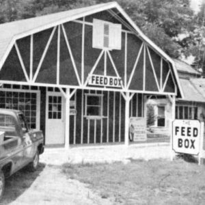
  Feed Box


Comments
No comments on this entry yet.