501-918-3025
calsfoundation@cals.org
calsfoundation@cals.org
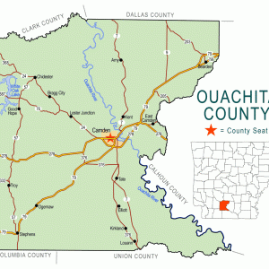
Harmony Grove (Ouachita County) is an unincorporated community located about five miles northeast of Camden (Ouachita County) and about four miles northwest of East Camden (Ouachita County).
Early landowners in the area included the Stone family. Moving to the Camden area in 1844, the family included Thomas Stone, his wife Jemina Stone, and their seven children. Thomas Stone received 120 acres as a federal land patent in the area in 1849. The previous year, he obtained eighty acres west of Camden. He died in 1849, and his sons continued to acquire land in the Harmony Grove area. George Stone acquired forty acres in the area in 1856, and his brother followed suit with another forty acres the following year. When combined with the land previously owned by their father, the Stone brothers were major landowners in the area. The two brothers also owned a total of thirty slaves in 1860.
Located in the bottomlands near the Ouachita River, the area around Harmony Grove proved to be a valuable location for farming. Early names of the area included Shady Grove, with another community called Canaan located to the west. These communities were centered on the churches in the area. By the 1840s, a thriving agricultural community existed at what would become known as Harmony Grove. Many of the early settlers to the community came from Alabama, with most of these originating in Autauga County. Children in the area attended school at the Shady Grove Church.
During the winter of 1861–1862, the church at Shady Grove burned, and a replacement was constructed nearby in 1863. Children continued to attend school at the new church, which was named Harmony Grove. The 1864 Federal occupation of Camden during the Civil War likely led to the closure of the church, but a map created by the Union army in 1865 marked the location of the church, although it appeared as Caney on the document.
At the conclusion of the war, families returned to the area, and the church once again served the community. A revival in 1879 led to a new church building being constructed the following year across the road from the 1863 building. The wood frame building topped with hand-drawn shingles was constructed by local members of the community using lumber from a nearby mill. A cemetery was established nearby.
The current church was constructed in 1919 approximately a mile from the location of the 1880 building, built on land donated by Frank Hawkins and his wife. The Hawkins family helped construct the new building. The wood frame building includes a community room open to all in the Harmony Grove area.
The community is well known throughout southern Arkansas for the school that shares the same name. The Harmony Grove School District serves portions of Ouachita and Dallas counties. The Sparkman School District consolidated with Harmony Grove on July 1, 2004.
The community contains few businesses in the twenty-first century. A volunteer fire department is located in the community, and a service station is located east of the community. A sawmill is also located southwest of Harmony Grove. St. Paul Christian Church and Harmony Grove Methodist Church are located in the community. Located about one and a half miles to the west of U.S. Highway 79 and one and a half miles to the east of Arkansas Highway 7, the community is served by county roads. Harmony Grove does not have a post office and is served by the office located in Camden.
For additional information:
Fountain, Sarah, ed. “Letters of War.” Ouachita County Historical Quarterly 27 (Winter 1995): 15–32.
Fountain, Sarah. “People History—A Closer Look at the Letter Writers of Harmony Grove.” Ouachita County Historical Quarterly 27 (Winter 1995): 33–35.
Harris, Theresa. “Thomas Stone Home.” Ouachita County Historical Quarterly 36 (Winter/Spring 2005): 8–9.
Russell, Sue. “Harmony Grove Methodist Church.” Ouachita County Historical Quarterly 15 (Spring 1984): 49–57.
David Sesser
Southeastern Louisiana University


Comments
No comments on this entry yet.