501-918-3025
calsfoundation@cals.org
calsfoundation@cals.org
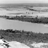
Cane Creek is a tributary of the Black River, beginning in the Ozarks of southeastern Missouri and terminating in the swamps of the Delta of northeastern Arkansas. It was named after canebrakes that grew along its banks.
The creek begins just west of Ellsinore in Carter County, Missouri, flowing between the valleys of the Ozark Mountains in the Mark Twain National Forest. From Ellsinore, Cane Creek flows southwest, entering Butler County, Missouri, where it crosses U.S. Highway 60 west of Poplar Bluff and then crosses U.S. Highway 67 south of Poplar Bluff. As the creek leaves the Ozarks and reaches the Delta, it becomes a muddy slough.
It continues south to Harviell, Missouri, where the Missouri Conservation Department has a boat ramp access. It then moves south toward Neelyville, Missouri, and eventually to the Missouri-Arkansas state line. A ditch was dug east of the creek, named Cane Creek Ditch, to help alleviate flooding from Cane Creek and Black River. This ditch creates a lower water level on Cane Creek, which has led to several portions of Cane Creek being drained and filled in with soil for agricultural pursuits between Harviell and Neelyville.
Past Neelyville, 1.8 miles north of the Missouri-Arkansas state line, Cane Creek forks into Little Cane Creek and Big Cane Creek. After entering Arkansas, the two streams merge together 0.60 miles south of the state line just before draining into the Black River, 2.70 miles east of Moark (Clay County). Cane Creek Ditch also drains into the Black River 0.70 miles east of Cane Creek. There was a section of Little Cane Creek that branched off from the main slough before the point at which it merged back with Big Cane Creek, but being located west of the Black River Levee, it was drained and filled in for farming.
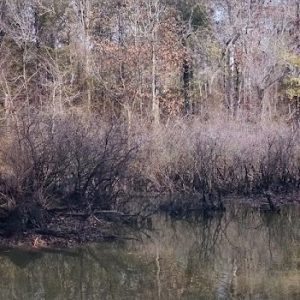
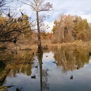
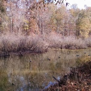
On the Missouri side of the state line, 2,154.5 acres of the Black River bottomland are preserved as Big Cane Conservation Area by the Missouri Conservation Department. It provides eight parking lots, one canoe launch, one boat ramp, and three primitive camping locations. On the Arkansas side of the state line, the Arkansas Game and Fish Commission has a 191.67-acre exclave of the 25,000-acre Dave Donaldson Black River Wildlife Management Area. Arkansas does not provide any facilities in this section, and camping in undesignated spots is not allowed. Both preserves are popular spots for deer and duck hunting.
With the low elevation and high flood risk, no permanent settlement was made on the Clay County sections of Cane Creek. About two miles west on the northern end of Buckeye Ridge, a community was able to develop away from the swamps and went by the name of Cane Hill, named after the creek. When the Cairo and Fulton (St. Louis, Iron Mountain and Southern Railroad) was being built through the area in 1872, the railroad renamed it Moark. The railroad used the ridge to avoid flooding from Cane Creek and the Black River.
For additional information:
“Big Cane Conservation Area.” Missouri Department of Conservation, https://mdc.mo.gov/discover-nature/places/big-cane-conservation-area (accessed September 17, 2025).
“Dave Donaldson Black River WMA.” Arkansas Game and Fish Commission. https://www.agfc.com/wma/dave-donaldson-black-river-wma/ (accessed September 17, 2025).
“Iron Mountain Railroad.” Perryville Weekly Union, December 20, 1872, p. 2.
Webb, Robert T., Bruce Brown, and Patsy Truscott, compilers. History and Traditions of Clay County. Piggott, AR: Webb, Truscott, and Brown, 1933.
Drew A. Calhoun
Clay County Genealogical and Historical Society


Comments
No comments on this entry yet.