 Bellingrath House
 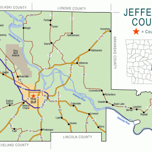 Jefferson County Map
  White Hall
  White Hall
 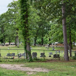 White Hall Cemetery
 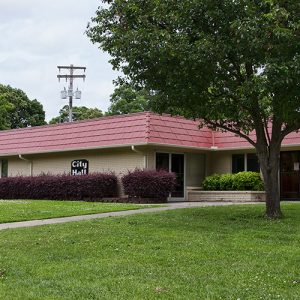 White Hall City Hall
 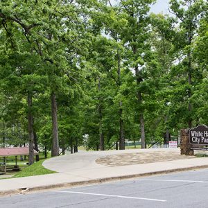 White Hall City Park
 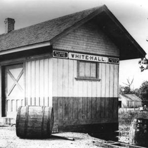 White Hall Depot
 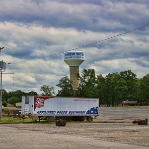 White Hall Water Tower
501-918-3025
calsfoundation@cals.org
calsfoundation@cals.org
| Latitude and Longitude: | 34º16’26″N 092º05’27″W |
| Elevation: | 300 feet |
| Area: | 7.06 square miles (2020 Census) |
| Population: | 5,581 (2020 Census) |
| Incorporation date: | July 27, 1964 |
Historical Population as per the U.S. Census:
|
1810 |
1820 |
1830 |
1840 |
1850 |
1860 |
1870 |
1880 |
1890 |
1900 |
|
– |
– |
– |
– |
– |
– |
– |
– |
– |
– |
|
1910 |
1920 |
1930 |
1940 |
1950 |
1960 |
1970 |
1980 |
1990 |
2000 |
|
– |
– |
– |
– |
– |
– |
1,300 |
2,214 |
3,849 |
4,732 |
|
2010 |
2020 |
|
|
|
|
|
|
|
|
|
5,526 |
5,581 |
|
|
|
|
|
|
|
|
White Hall (once called Grenshaw Springs and Grenshaw “Hall” Springs) is on Arkansas Highway 365 North in Jefferson County. The city developed slowly—first as an early nineteenth-century rest stop for early settlers who were drawn to the pristine water that flowed freely in pools above the ground, then later, during the early twentieth century, as the most direct route for the early Dollarway Road, the first paved (concrete) road in Arkansas, which ran approximately 22.2 miles from the city limits of Pine Bluff (Jefferson County) to Little Rock (Pulaski County). During World War II, the United States Army’s Chemical Warfare Division began construction of the Pine Bluff Arsenal on December 4, 1941, near the future city’s northern boundaries. The 6.8 square miles of city boundaries run irregularly west of the Arkansas River and extend to Interstate 530, which is about forty miles from Little Rock. The eastern boundary extends to the Pine Bluff Arsenal.
When and how White Hall got its name is a matter of undocumented oral traditions—legend and speculation—handed down through oral accounts not always recorded judiciously. The late Ida Mae Gandy, a teacher and early member of the White Hall Methodist Church who interviewed residents and recorded her findings, probably had the most reliable account. According to her, settlers began to move to the area in the mid-nineteenth century for use of the underground water that flowed into above-ground pools of clear, pure drinking water. Area cemetery records and tombstones indeed record deaths in the 1880s. The pools were called Grenshaw or Grenshaw “Hall” Springs. One can still see where one of the pools was located, and water still flows above the ground.
Tradition holds that a nondenominational church was built near the springs along with a building to shelter travelers and early settlers. The name White Hall supposedly was derived from an itinerate preacher named White who preached at the church and a man named Hall who supposedly found the springs. A more plausible explanation is that the area was named after the church and identified as White Hall because it was the only whitewashed wood structure nearby and not always identified as a church. Early settlers and travelers often referred to the area by the building’s white washed color as that “White Hall” building.
Nonetheless, all oral traditions and accounts seem to revolve around the establishment and history of the first church in White Hall. The first tombstone in the church’s cemetery is that of Richard Ammons, who died in 1885. By 1895, White Hall Church had become White Hall Methodist Church. Around 1898, the first community school was established where the present-day White Hall Junior High is now located on Arkansas Hwy 365 North.
In 1913, the Arkansas State Legislature passed Act 164, the General Assembly Road Improvement District 4 Bill, allowing Jefferson County to raise a special tax for the construction of the Dollarway Road, the first concrete road in Arkansas.
On July 14, 1964, White Hall was incorporated, and twenty-four candidates ran for seven municipal seats. The first mayor was W. F. “Jack” Moody. Because of the tremendous wartime growth of the Pine Bluff Arsenal—which began construction on December 4, 1941, just three days before the Japanese attacked Pearl Harbor, Hawaii—and the construction of a multimillion-dollar incinerator to destroy World War II toxic agents and nerve gas, White Hall became one of the state’s ten fastest-growing cities. Its median family income was well above average, as indicated by the 2010 census. With the National Center for Toxicological Research (NCTR), established in January 1971 and located eight miles north of the White Hall on Arkansas Highway 365 North, White Hall has continued to experience rapid growth and economic development. Today, it also serves as a bedroom community for those who work in Pine Bluff and Little Rock.
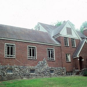
The Bellingrath House, completed in 1935 and located in White Hall, was listed on the National Register of Historic Properties in 1994.
For additional information:
Bolton, Charles S. “Turning Point: World War II and the Economic Development of Arkansas.” Arkansas Historical Quarterly 61 (Summer 2000): 124–144.
Leslie, James W. Land of Cypress & Pine. Little Rock: Rose Publishing Company, 1976.
Russell E. Bearden
White Hall, Arkansas


Comments
No comments on this entry yet.