

501-918-3025
calsfoundation@cals.org
calsfoundation@cals.org
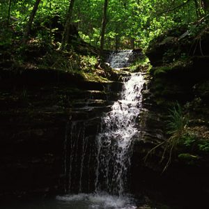
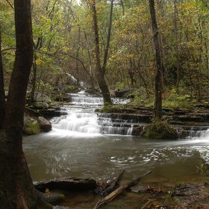
Waterfalls often form as a stream flows over different bands of rock, with the soft rock eroding more quickly to undercut the hard rock. Unsupported, the overhanging rock eventually collapses. This fallen rock crashes down into a pool of water where the water’s swirling action results in more erosion. Over time, this process is repeated, resulting in a series of stair-step waterfalls retreating up a hillside.
Nature creates an array of different types of vertical water runoffs. Experts have different ideas about what constitutes a waterfall. Although there are no definitive criteria, two methods have been developed to categorize waterfalls. Geometrical Classification categorizes waterfalls based on shapes and physical features. This method is helpful to identify falls for their visual qualities. With the visualization these labels provide, a visitor will have an idea of the general appearance of a waterfall without seeing it. However, this method depends on individual interpretation, which results in inconsistencies within the defined categories. The second method, Water Volume Classification, categorizes waterfalls purely on the amount of water flowing over a vertical drop. This is a more exact scientific approach; however, this provides minimal data regarding the appearance of the falls. Geometrical Classification is generally the more helpful tool.
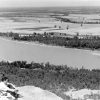
Arkansas has two distinct mountain ranges that provide the required vertical drop in elevation to form a waterfall: 1) the Ozark Mountains, a series of plateaus that fills the northwestern corner of Arkansas and extends into Missouri, representing one of the largest mountain ranges between the Appalachians and the Rockies; and 2) the Ouachita Mountains, located in the west-central portion of the state; these are fold mountains that once reached heights of the present-day Rocky Mountains, but their peaks have worn away with age.
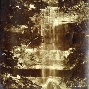
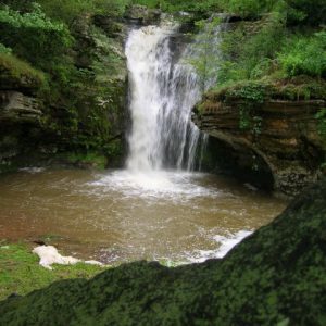
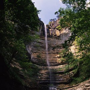
The Ozarks are composed of sedimentary rocks containing high-density materials such as limestone and dolostone, in addition to the same sandstone, siltstone, shale, and chert found in the Ouachitas. With the addition of these dense materials, the Ozark terrain possesses greater resistance to weathering and erosion, resulting in more vertical drops, or waterfalls. Consequently, although the highest mountain in Arkansas, 2,753-foot Mount Magazine, is located within the Ouachita Mountain Range, the tallest waterfall between the Appalachians and the Rockies is found in the Ozarks, the 209-foot Hemmed-In-Hollow Falls in Newton County.
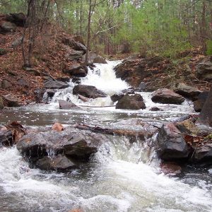
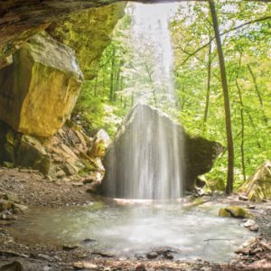
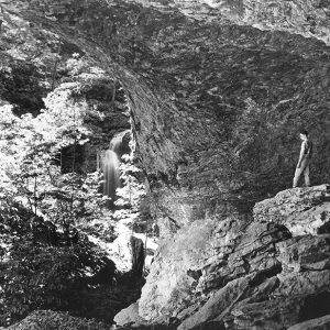
Arkansas possesses hundreds of waterfalls, satisfying every type of falls within the Geometrical Classification other than those associated with glaciers. There is a waterfall within a cave found at Eden Falls in Newton County and a waterfall that has drilled down through the roof of an overhanging bluff to form Glory Hole Falls, also in Newton County. Many waterfalls in Arkansas are located in remote forests and require extended hikes to reach, more so for those located in the isolated Ozark Mountains. However, there are numerous beautiful waterfalls in the state, such as seventy-one-foot High Bank Twin Falls, located near Ozark (Franklin County), which can be accessed via a short hike. The ninety-five-foot Cedar Falls at Petit Jean State Park, also accessible via a short trek, is among the best-known waterfalls in the state.
Directions to reach many of the falls in both mountain ranges are documented on various websites, though one can also find directions, GPS coordinates, and other useful information in Tim Ernst’s guidebook Arkansas Waterfalls. More adventurous hikers may purchase topographical maps and scan for multiple elevation lines that are grouped closely together and collectively form rows of V-shapes, with a blue line flowing down the center of the V-shapes. This is an indication of terrain possessing the steep bluffs and water pour-off suited for waterfalls.
Arkansas waterfalls are generally short-lived, as they lack the elevation, snow melt, and expansive watershed that feed a steady source of water for, for example, Rocky Mountain waterfalls. The majority of Arkansas’s waterfalls can be seen only during or immediately following heavy rains.
For additional information:
Ernst, Tim. Arkansas Waterfalls: How to Find 400+ Waterfalls and Cascades in the Natural State . 3rd ed. Pettigrew, AR: Cloudland Publishing, 2025.
Robinson, Bob. “Water Takes a Plunge.” Arkansas Democrat-Gazette, May 8, 2017, pp. 1E, 6E.
———. “Winter Waterfall.” Arkansas Democrat-Gazette, March 14, 2022, pp. 1D, 6D. Online at https://www.arkansasonline.com/news/2022/mar/14/snow-day-hike-to-madison-countys-tea-kettle-falls/ (accessed March 14, 2022).
“Waterfalls.” Arkansas.com. https://www.arkansas.com/outdoors/hiking/waterfalls/ (accessed December 4, 2017).
Bob Robinson
Little Rock, Arkansas


Comments
No comments on this entry yet.