501-918-3025
calsfoundation@cals.org
calsfoundation@cals.org
| Latitude and Longitude: | 36°00’26″N 091°15’08″W |
|---|---|
| Elevation: | 358 feet |
| Area: | 2.31 square miles (2020 Census) |
| Population: | 258 (2020 Census) |
| Incorporation Date: | August 6, 1963 |
Historical Population as per the U.S. Census:
|
1810 |
1820 |
1830 |
1840 |
1850 |
1860 |
1870 |
1880 |
1890 |
1900 |
|---|---|---|---|---|---|---|---|---|---|
|
– |
– |
– |
– |
– |
– |
– |
– |
– |
– |
|
1910 |
1920 |
1930 |
1940 |
1950 |
1960 |
1970 |
1980 |
1990 |
2000 |
|
– |
– |
– |
– |
– |
– |
274 |
345 |
299 |
315 |
|
2010 |
2020 | ||||||||
|
288 |
258 |
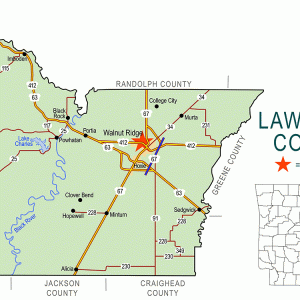
Lynn is a town on State Highway 25 in western Lawrence County. Although the area has long been settled, the population of Lynn has grown little.
Osage from the north hunted and fished in northern Arkansas for many years until the Louisiana Purchase added the land to the United States. The Black River runs through the area where Lynn would be established. During territorial times, a military road known as the Southwest Trail connected Missouri to Fulton (Hempstead County), and this route reportedly ran through the area where Lynn is today. As a result, the land was soon claimed by settlers: Dempsey Trotman in 1820 and both John Kylor and John D. Williams in 1824.
Lawrence County survived the Civil War relatively unscathed. A post office was established in 1891 and given the name Lynn; the reason for the name is no longer remembered. A few years later, the Black River became famous as a source of mussels useful in the manufacture of buttons. A button factory opened nearby in Black Rock (Lawrence County), and the population gradually increased. A Methodist church was established in 1894.
The road traveling through Lynn was designated Arkansas State Highway 25 in 1926. Over the years, the highway was improved to make travel easier. This brought more traffic through the area, and a few businesses were established along the highway. The Methodist congregation built a new building in 1924, and it was later joined by a Missionary Baptist congregation. The school district of Smithville (Lawrence County) was consolidated into the Lynn School District in 1946. Later, Lynn and Strawberry (Lawrence County) combined their school districts, creating the Hillcrest School District, with grades 1–6 in Lynn and grades 7–12 in Strawberry.
Early in the 1960s, a watershed and flood protection reservoir were built near Lynn. First constructed by the Arkansas Game and Fish Commission (AGFC), the project eventually became Lake Charles State Park. The lake and park draw thousands of tourists into the area every year, providing customers for the businesses in Lynn.
In 2017, Lynn had three churches, two restaurants, a grocery store, a quick shop, a combined gas station/farm store cooperative, a bank, a community center, a volunteer fire department, and a lodge for duck hunters. The town’s public library is named the Driftwood Library for an abandoned nearby community; the library moved into a new building in 2015. The Hillcrest School District serves about 400 students from Lawrence and Sharp counties. The population of Lynn in 2010 was 288, all of whom were white.
For additional information:
Heard, Kenneth. “Small-town Libraries Struggle to Stay Open When Funding Is Short.” Arkansas Democrat-Gazette, May 25, 2015, pp. 1, 8A.
Lawrence County, Arkansas: 1815–2001. Paducah, KY: Turner Publishing Company, 2001.
Perkins, Blake. “A History of the Lynn Post Office and How It Gave the Town Its Name.” Lawrence County Historical Journal (2021, no. 1): 6–22.
Steven Teske
Butler Center for Arkansas Studies


The town of Lynn’s farm store cooperative, named Farm Service, Inc., was established in 1966. There are three churches: Lynn Church of Christ, Lynn Methodist Church, and Pleasant Hill Missionary Baptist Church. The gas station is the Farm Service Store. There used to be another station, but it has now closed. There is a quick shop that also offers gas and many other services (Sheilas Quick Shop). There is a bank (Bank of Cave City). There is a volunteer fire department and a community center. Theres a park central to town with swings, a slide, and a covered picnic table.