501-918-3025
calsfoundation@cals.org
calsfoundation@cals.org
| Latitude and Longitude: | 33°30’36″N 092°23’56″W |
|---|---|
| Elevation: | 203 feet |
| Area: | 0.55 square miles (2020 Census) |
| Population: | 210 (2020 Census) |
| Incorporation Date: | December 3, 1934 |
Historical Population as per the U.S. Census:
|
1810 |
1820 |
1830 |
1840 |
1850 |
1860 |
1870 |
1880 |
1890 |
1900 |
|---|---|---|---|---|---|---|---|---|---|
|
– |
– |
– |
– |
– |
– |
– |
– |
– |
– |
|
1910 |
1920 |
1930 |
1940 |
1950 |
1960 |
1970 |
1980 |
1990 |
2000 |
|
– |
– |
– |
273 |
342 |
267 |
269 |
302 |
258 |
293 |
|
2010 |
2020 |
|
|
|
|
|
|
|
|
|
254 |
210 |
|
|
|
|
|
|
|
|
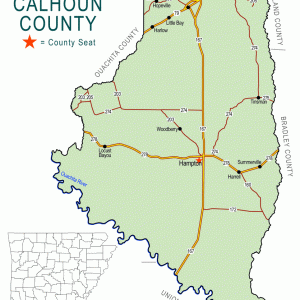
Established as a railroad depot early in the twentieth century, the town of Harrell is in eastern Calhoun County, about five miles east of Hampton (Calhoun County), the county seat. Harrell still maintains a working sawmill in the twenty-first century.
Calhoun County is part of the Gulf Coastal Plain. Caddo lived in these forested hills long before European exploration, and the county contains many reminders of their presence, including two prehistoric mounds and roughly 350 archaeological sites. European explorers entered the area by means of the Ouachita River, but more inland areas like what would become Harrell were not frequented until long after the county was created in 1850.
After the Civil War, northern developers began to purchase land in southern Arkansas to harvest the many hardwood trees that grew there. Railroads were built to carry workers to the trees and the lumber to markets. The Choctaw, Oklahoma, and Gulf Railroad was established for this purpose, and depots were built on the line every few miles in order to keep the steam engines supplied with water and with fuel. The depot that was constructed at the place that would become Harrell was first called Rolyart, probably for a railroad executive or worker. By 1908, the name had been changed to Harrell for Martha Wood Harrell, who operated a boarding house near the depot to provide lodging for railroad personnel. A post office was established there in 1906 and has operated continuously ever since. Methodist and Baptist churches were established, and a one-room schoolhouse was built. The town was incorporated in 1934.
The Choctaw, Oklahoma, and Gulf Railroad was acquired by the Chicago, Rock Island, and Pacific Railroad in 1902. It continued to use the Harrell stop to pick up timber and also began to ship oil from that depot, oil having been discovered in southern Calhoun County in the 1920s. Ironically, the mining and refining of oil led to the decline of the rail industry as travel by automobiles and shipping by trucks became more common. Highway 4, which connects Harrell to Hampton and to Banks (Bradley County), paralleled the Rock Island tracks and eventually made them obsolete. The railroad fell into bankruptcy in the 1970s and ceased all operations in 1980.
Some railroad towns disappeared, but Harrell remained. In the early twenty-first century, it remains home to one sawmill and a handful of trucking firms and churches. Children attend schools of the Hampton School District. The population of Harrell in the 2010 census was 254.
For additional information:
Calhoun County, Arkansas, ArGenWeb Page. http://www.rootsweb.com/~arcalhou/ (accessed August 22, 2025).
Hull, Clifton E. Railroad Stations and Trains through Arkansas and the Southwest. Hart, MO: Whiteriver Productions, 1997.
Steven Teske
Butler Center for Arkansas Studies


Comments
No comments on this entry yet.