calsfoundation@cals.org
Greenbrier (Faulkner County)
| Latitude and Longitude: | 35º14’02″N 092º23’16″W | |||
| Elevation: | 361 feet | |||
| Area: | 7.94 square miles (2020 Census) | |||
| Population: | 5,707 (2020 Census) | |||
| Incorporation Date: | April 5, 1880 | |||
Historical Population as per the U.S. Census:
|
1810 |
1820 |
1830 |
1840 |
1850 |
1860 |
1870 |
1880 |
1890 |
1900 |
|
– |
– |
– |
– |
– |
– |
– |
– |
– |
– |
|
1910 |
1920 |
1930 |
1940 |
1950 |
1960 |
1970 |
1980 |
1990 |
2000 |
|
– |
– |
– |
– |
375 |
401 |
582 |
1,423 |
2,130 |
3,042 |
|
2010 |
2020 |
|
|
|
|
|
|
|
|
|
4,706 |
5,707 |
|
|
|
|
|
|
|
|
Greenbrier is a small second-class city in Faulkner County twelve miles north of Conway (Faulkner County) on Highway 65. It is home to Woolly Hollow State Park and Lake Bennett.
Louisiana Purchase through Early Statehood
Recorded white settlement of the area dates back to at least 1818, when four brothers named Wiley settled in the vicinity the East Fork of Cadron Creek about eight miles east of Greenbrier’s current location. In 1837, Jonathan Hardin, after whom Hardin Township is named, settled in the Cadron Valley area near the Wileys and eventually became an influential landowner. Other families who settled in the area included the Hubbards, who settled near the current site of Greenbrier’s public schools on Greenbrier Creek, and Henderson Moore, who came to the area from North Carolina with his family and eighteen slaves in 1853.
Moore purchased some land from the Hubbards south of the Des Arc-Lewisburg road near the present business section of Greenbrier. His cousin Sid Moore joined him in 1856, settling across the road and to the northwest of Henderson Moore’s land. A log house that Sid Moore built was in use until it was torn down in the early 1960s.
Fertile soil ideal for growing corn attracted settlers to the area. Henderson Moore built a horse-driven gin, water-powered grist mill, general store, and blacksmith’s shop to cater to the new arrivals. In 1857, he built a home that became an inn for travelers on the Des Arc-Springfield road. Although the community was briefly called Mooresville, its name was later changed to Greenbrier, a common name for the wild smilax, or saw brier, that grew along Greenbrier Creek near Henderson’s general store. Upon the establishment of the community’s post office on September 15, 1857, Henderson Moore became its first postmaster. By his death in 1859, he owned 640 acres of land and many of the community’s businesses.
Civil War through Reconstruction
Aided by the availability and variety of cheap land surrounding it, Greenbrier continued to grow throughout the Civil War and Reconstruction periods. Oats, wheat, sorghum, as well as peas and other vegetables, were harvested, and valuable virgin hardwood oak ringed the ridges that surrounded the valley. By 1871, cotton was beginning to be harvested.
Travel and communication between Little Rock (Pulaski County), Conway, and Greenbrier were becoming more frequent as families ventured out to sell crops and buy supplies. Mail service to Quitman (Cleburne and Faulkner counties) was established in 1875. Toll roads were constructed, and the county granted William S. Terry a permit in 1879 to build a bridge over Cadron Creek in order to connect Greenbrier with Conway and Little Rock. The first church in the community was built by the Baptist congregation in 1860, and a large two-story building was constructed in 1878 to serve as a school, church for the Baptist and Methodist congregations, and Masonic lodge.
Post Reconstruction through the Gilded Age
Greenbrier, with a population of about 300, was incorporated as a second-class city on April 5, 1880. A steam-powered flour and grist mill replaced Henderson Moore’s original horse-drawn one in 1882. As cotton production increased, larger, more numerous gins were required. By 1900, four gins were operational in the city. By 1905, the city of 350 also had eight general stores, two additional grist mills, a steam sawmill, a shingle mill, and a six-room school.
Early Twentieth Century
By 1905, Greenbrier began to decline as the growing city of Conway drew people south. Inflationary pressures on the price of cotton during World War I caused more cotton to be grown, depleting the soil and decreasing yield. Recession in 1920–21, in addition to the 1923 construction of Highway 65 from Little Rock to Harrison (Boone County) via the nearby village of Wooster (Faulkner County) six miles to the west, drew more people away from Greenbrier. Throughout the 1920s and 1930s, farmers attempted to diversify their crops as the falling price of cotton, bank failures resulting from the Great Depression, floods, and droughts threatened the city.
Greenbrier was rescued from economic ruin by various New Deal programs in the 1930s, the most important of which was the Soil Conservation Program under the leadership of Dr. Hugh Bennett, for whom Lake Bennett in Woolly Hollow State Park is named. This was the first program in North America to study the effects of soil erosion on a specific watershed with the intention of finding ways to rejuvenate depleted soil. In 1936, Arkansas Power and Light (AP&L) provided the first electricity to the city. A road was built by the Works Progress Administration (WPA) from Greenbrier to the Civilian Conservation Corps’s Camp Halsey in Centerville (Faulkner County) ten miles to the east. A post office, two general stores, and a small heating plant were also constructed. In 1938, Dr. Earl T. Williams established a summer baseball program that produced several nationally known players of the time, including Otis and Doyle Brannon, Royce and Dibrell Williams, Fred and Lois Cato, Dibrell Lyons, and Alton Briggs. The program continued until Williams died in 1951.
From the 1930s through 1960, Greenbrier consolidated twenty-four formerly separate one-room schoolhouses into a single entity.
World War II through the Faubus Era
During World War II, nonmilitary men and women worked in defense plants in Maumelle (Pulaski County) and Jacksonville (Pulaski County), which diversified Greenbrier’s economy. In 1942, the relocation of Highway 65 through Greenbrier boosted the city. Farmers continued to diversify and make use of the soil conservation strategies that they had developed during the New Deal programs of the 1930s. After the drought of 1950, many farmers switched from cotton to dairy. As a result, average farm income tripled. In 1950, a new gymnasium, which has since been improved, was built for Greenbrier schools. Allied Telephone Company (later Alltel) began providing service in 1960, and water service was provided by four wells beginning in 1963.
Modern Era
On November 2, 1973, the 370-acre Woolly Hollow State Park opened. This area, which includes the forty-acre Lake Bennett, was initially a U.S. Soil Conservation Service project constructed in 1935. After the completion of the project, Faulkner County renamed it Centerville Park and used the site as a recreation area until 1972, when the county sold the land to the state for the creation of a new state park.
By 1980, Greenbrier had a population of 1,423. Many new families, attracted by Conway’s institutions of higher learning and rapid industrial growth, moved into nearby Greenbrier. As of the 2010 census, Greenbrier has a population of 4,706. Aided by its suburban relationship with Conway and its proximity to Little Rock, Greenbrier is one of many rapidly growing small communities in Faulkner County.
In 2023, the placement of a bitcoin “mine,” or a series of thousands of computers engaged in cryptocurrency data processing, near Greenbrier raised the ire of local residents, who complained about the noise and the ill health effects it was producing. The project, however, was protected by the Arkansas Data Centers Act, passed by the Arkansas General Assembly in 2023 and signed by Governor Sarah Huckabee Sanders, which prevents local communities from taking action against such projects. The site became the subject of a February 2024 article in the New York Times.
Attractions and Notable Residents
Greenbrier is home to Woolly Hollow State Park. Stores such as Fleas and Tiques, The Mall Flea Market & Antiques, and Through the Years Flea Market sell glassware, collectibles, log furniture, crafts, and antiques. Battles Orchard Farm Market sells produce from Battles Cadron Crest Orchard. Cadron Creek offers fishing and boating. Riddle’s Elephant and Wildlife Sanctuary, a 330-acre non-profit sanctuary established in 1990 by Scott and Heidi Riddle, is the only internationally recognized wildlife refuge that unconditionally accepts elephants regardless of species, gender, or disposition. It is located northeast of Greenbrier on a dirt road about two miles off Highway 25 between Guy (Faulkner County) and Quitman.
Olympic trap shooter Kayle Browning graduated from Greenbrier High School.
For additional information:
Dance, Gabriel J. X. “Anxiety, Mood Swings and Sleepless Nights: Life near a Bitcoin Mine.” New York Times, February 3, 2024. https://www.nytimes.com/2024/02/03/us/bitcoin-arkansas-noise-pollution.html (accessed February 5, 2024).
Faulkner County Historical Society. Faulkner County: Its Land and People. Conway, AR: Faulkner County Historical Society, 1986.
“Greenbrier.” Faulkner County Historical Society. https://www.faulknerhistory.org/communities/greenbrier/?msclkid=d6733c80c4c811ec922685b2c123aa43 (accessed June 4, 2022).
Aaron Rogers
Conway, Arkansas
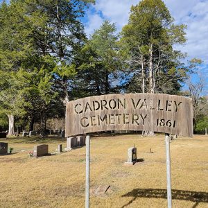 Cadron Valley Cemetery
 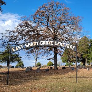 East Shady Grove Cemetery
 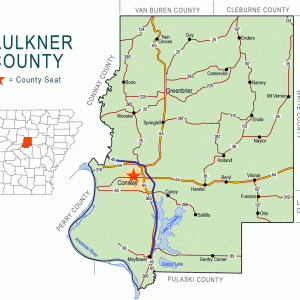 Faulkner County Map
 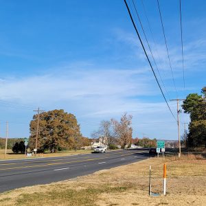 Entering Greenbrier
 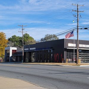 Greenbrier Fire Department
 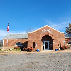 Greenbrier Library
 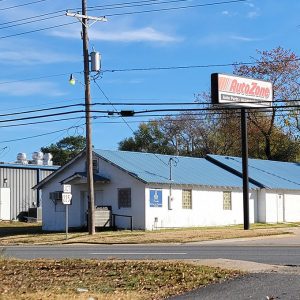 Greenbrier Masons
 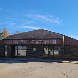 Greenbrier Post Office
 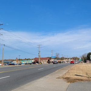 Greenbrier Street Scene
 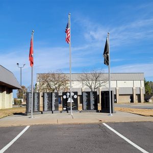 Greenbrier Veterans Memorial
 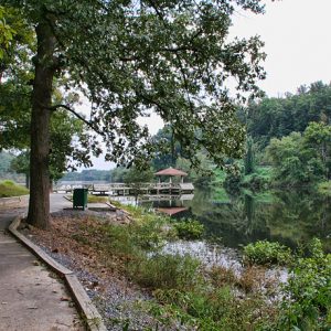 Lake Bennett
 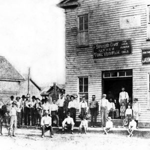 McCracken Drug Store


Comments
No comments on this entry yet.