


501-918-3025
calsfoundation@cals.org
calsfoundation@cals.org
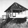 Forest Fire Lookouts
to
Forest Fire Lookouts
to
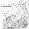 Newport Fire of 1926
Little Rock (Pulaski County) suffered its seventy-first consecutive rainless day. The devastating Flood of 1927, financial upheaval from the 1929 stock market crash, and killer tornadoes preceded the drought that struck Arkansas in the spring of 1930. Rainfall during June and July 1930 was the lowest on record. July temperatures, typically in the nineties, reached 107 degrees. August temperatures peaked at 113 degrees with successive 110-degree days. Arkansas’s worst drought of the twentieth century took place during this in 1930–1931. Twenty-three states across the Mississippi and Ohio river valleys and into the mid-Atlantic region were caught in its grip. The severest drought centered upon eight Southern states, with Arkansas sixteen percent worse than the other states based on weather statistics.
The CALS Encyclopedia of Arkansas is a free, authoritative source of information about the rich history, geography, and culture of Arkansas. It is updated regularly to ensure the people of Arkansas have an accurate and accessible resource to explore our heritage. We invite you to browse our text entries and media galleries to learn more about the people, places, events, legends, and lore of the 25th state. We are continually adding new entries, photographs, maps, videos, quizzes, lesson plans, and more, so check back frequently to see what’s new.


Our overview page covers everything you would want to know about our beautiful state, including state symbols, demographics, and more!
See Overview


