Stone

Subcategories:
  • No categories
Clear

Entry Category: Stone

Alco (Stone County)

Alco is an unincorporated community in Locust Grove Township on Highway 66 between Timbo (Stone County) and Leslie (Searcy County), about fourteen miles west of Mountain View (Stone County), the county seat. At the invitation of the Cherokee in 1817, Shawnee from the Ohio River Valley entered the Ozark Mountains and settled west of the White River on Crooked Creek, with their main settlement at Shawneetown, what is today Yellville (Marion County). The Cherokee may have expected the Shawnee to aid them against the Osage. Shawnee villages could also be found in the Livingston and Sylamore Creek valleys along the White River and along Bear Creek in Searcy County. The role played by the Shawnee Cornstalk family in Searcy County …

Arlberg (Stone County)

Arlberg is a remote and sparsely populated community in Red River Township of Stone County on the west side of the middle fork of the Little Red River near the Van Buren County line. Arlberg is located two miles off Arkansas 110 in southwestern Stone County at the bottom of Angora Mountain. The Arlberg Arch, also known as Rainbow Rock, is a prominent natural monument in the area, located near the settlement on private property with limited access. In the twenty-first century, the area is mainly of historic interest and a place for hunting, fishing, and swimming. In the region where Arlberg was later built, Civil War guerrilla and outlaw Bill Dark terrorized the hill people until early 1863, when …

Big Springs (Stone County)

Big Springs is located in Sylamore Township on Big Springs Road just off Highway 66 (West Main Street) about a mile and a half northwest of Newnata (Stone County) and four miles northeast of Timbo (Stone County). The county seat, Mountain View, is about seven and a half miles east via West Main Street. The community received its name from a large spring where the early settlers built their cabins. The spring, a church, a store, the nearby Avey family home place and barn, and Big Springs Cemetery on the hill made up the main part of the Big Springs community. The Avey family had a home atop the hill above the spring. They got their water by attaching a …

Chalybeate Springs (Stone County)

Chalybeate Springs (a.k.a. Chalybeate) is located in the township of Arbana about three and a half miles southwest of Pleasant Grove (Stone County) and about eleven miles southeast of Mountain View (Stone County), the county seat. The community is south of Misenheimer Road, near the confluence of Chalybeate Spring Creek and Little Raccoon Creek, off Tuttle Ridge Road. The locals pronounce the name of the community “Clee’-bit.” Chalybeate Spring is located at the foot of the Boston Mountains about two miles to the east of the Chalybeate community. It forms the waters of one of the small tributaries of Coon Creek, which flows into the Devil’s Fork of the Little Red River. Water from the spring was believed to have …

Fifty-Six (Stone County)

Fifty-Six is one of two cities in Stone County. It stands on State Highway 14 in the northern part of the county. Fifty-Six (sometimes spelled without the hyphen) is located near Blanchard Springs Caverns, one of the most visited tourist sites in the Ozark National Forest. The forested hills and mountains of northern Arkansas were claimed as hunting and fishing land by the Osage, who lived in southern Missouri, when the United States first acquired the land as part of the Louisiana Purchase. White settlers gradually arrived in the area, but the rugged land remained only sparsely settled for many years. Stone County, which was formed in 1873 from parts of four other counties, had about 5,000 residents at the …

Fox (Stone County)

Fox is located on Highway 263 between Timbo (Stone County) and Rushing (Stone County). Turkey Creek flows a few miles north and northeast of Fox, while Jimmys Creek is to the northwest. With the passage of the Homestead Act in 1862, early settlers began to eke out a living by growing crops along Meadowcreek and the Little Red River. A few hardy frontier families slowly moved up the hill from the river; their settlements would become the community of Fox. Fox was originally called Smart, but when the post office was opened in 1905, another name was required, as there was already a Smart in Arkansas. As the debate over a name was taking place, someone caught a fox in …

Hedges (Stone County)

Hedges is a historic community located on Gunner Pool Road (Highway 93) about a mile northeast of Fifty-Six (Stone County) and about two miles north-northeast of the recreational area known as Gunner’s Pool, a popular camping, swimming, and fishing site in Stone County. This area is part of the Ozark National Forest. Native Americans hunted and fished in the Hedges area at least 1,000 years ago, as evidenced by a skeleton discovered in 1955 during the first systematic exploration of the caverns by cavers. The skeleton had a fractured skull, fractured ribs, and a fractured leg. How this explorer entered the cave is unknown. Radiocarbon dating of the remains of a cane and wooden torch indicates that prehistoric human exploration …

Herpel (Stone County)

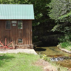
Herpel is located in Washington Township off Highway 5 on Herpel Road (64) in Cave Hollow on Rocky Bayou Creek. Herpel is about five miles west-southwest of Guion in Izard County and about six miles east-northeast of Mountain View, the county seat of Stone County. Herpel is approximately two miles south of the White River. An early settler of Herpel was Harmon Van Ness, who was originally from Albany, New York, and a Civil War veteran of Company G, Twenty-Fourth Regiment, New York Infantry. Van Ness was wounded in battle and taken as a prisoner of war but escaped and changed his name to Harrison Williams. When the war ended, he worked for the government in military departments, which took …

Kahoka (Stone County)

Kahoka is in Arbana Township located southwest of Highway 5 (Mountain View Road) on Misenheimer Road (Highway 28) just before its intersection with Berry Lane. Mountain View (Stone County), the county seat, is approximately nine miles northwest of Kahoka, and Pleasant Grove (Stone County) is four miles to the east. The Osage were in the hills when French and Spanish explorers first entered the wilderness. The Cherokee began arriving in the Ozark Mountains around 1817. At the invitation of the Cherokee, Shawnee from the Ohio River Valley entered the Ozarks and settled west of the White River on Crooked Creek, with their main settlement at Shawneetown, which later became Yellville (Marion County). The Cherokee may have expected the Shawnee to aid …

Marcella (Stone County)

Marcella is located on Highway 14 about halfway between Batesville (Independence County) and Mountain View (Stone County). Marcella lies across the White River from the historic community of O’Neal (Independence County). The community of Marcella has its origins in a settlement called Hess Town, one of the first settlements in the Missouri Territory. Samuel and Sarah Hess married in 1810 in Kentucky (some sources say Tennessee). Following the birth of their first child, they traversed the wilderness trails to the White River bottoms near Polk (a.k.a. Poke) Bayou in 1812, in the newly created Missouri Territory. They were among the first to settle across the White River in an area eventually called Hess Town. Only a few scattered members of …

Mountain View (Stone County)

Situated in the Ozark Mountains of north-central Arkansas, Mountain View is an isolated community that has long been known for its preservation of traditional folk music and culture. The Mountain View area attracts thousands of visitors each year, with features including the Ozark Folk Center, Blanchard Springs Caverns, the White River, and the Ozark National Forest, as well as the unique musical gatherings on the courthouse square. The Gilded Age through the Early Twentieth Century Until the Civil War, the area now known as Stone County was part of Izard County; no city of Mountain View existed and very few settlers resided on its soil. However, when Stone County was formed in 1873, a site at the center of the …

Mozart (Stone County)

The community of Mozart is located between Timbo (Stone County) and Fox (Stone County) in Union Township of Stone County on Highway 263 near Lick Fork Creek. The hilly, wooded, rocky-soil terrain of the region attracted no permanent settlers until the passage of the Homestead Act of 1862. A few sturdy subsistence farmers trickled in and grew a few crops, mainly grain, along Meadowcreek and the Little Red River. The community that would eventually become Mozart developed as an extension of Timbo and Fox. The two cemeteries close to Mozart are the Ramsey and Roby cemeteries, with many tombstones bearing names of families living in Timbo and Fox. The Mozart post office opened in 1926. Before it opened, mail was …

Onia (Stone County)

Onia (pronounced Ownie) is located on Highway 263 three and a half miles north of Timbo (Stone County) near Roasting Ear Creek. The creek—popular for swimming, fishing, and baptisms—reportedly received its name when ears of corn were washed downstream during a flood. The two main landmarks of Onia are the Bethany Baptist Church and the post office in the center of the community. At one time, the area was part of the large community of Locust Grove, which was located in Searcy County before Stone County was created on April 17, 1873. What is today Onia was often referred to by locals as Lower Clark, with Upper Clark being in the Thola area of Searcy County. Near the old Roasting …

Optimus (Stone County)

Optimus is an unincorporated Stone County community in Optimus Township on Highway 5 across the White River from Calico Rock (Izard County), which is five miles to the north. Optimus is about twelve miles north of Mountain View (Stone County), the county seat, and about twelve miles west of Melbourne (Izard County). Bannerstones (stone artifacts whose function is much debated) have been found at Optimus, indicating early habitation by Native Americans in the caves and bluffs of the area. One of these caves, the Clay Cave, is easily accessible from Sylamore Road. Miles Ware Jeffery was born in 1816 in what is today Mount Olive (Izard County), three and a half miles south-southeast of present-day Optimus. His parents, Johoiada Jeffery …

Pleasant Grove (Stone County)

aka: Redstripe (Stone County)
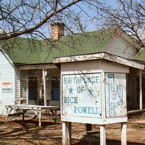
The community of Pleasant Grove is located along Highway 14 about twelve miles east-southeast of Mountain View (Stone County), the county seat. Pleasant Grove is between Marcella (Stone County) and St. James (Stone County). The White River lies just over two miles to the east, accessible via the Martin Public Access. What is left of the old Hess/O’Neal/Grigsby Ferry is used by a local farmer to transport goods across the river. Pleasant Grove was originally known as Red Stripe, but the name of the community changed its name following the infamous Connie Franklin murder case. One of the first settlers of Red Stripe was a veteran of the War of 1812, Jacob Hollandsworth from Virginia by way of Tennessee. He …

Rushing (Stone County)

Rushing is located in Turkey Creek Township on Highway 9 just south of where Highway 263 merges with it for a short distance traveling east. Rushing is in the rugged hills of the Ozark Mountains, with rocky soil unsuited for large crops. Because of the difficulty in making a living from farming there and because of its isolation, Rushing did not attract settlers until after the Civil War. Only a few hunters and trappers ventured through the wooded mountains, which were full of small game such as squirrels and rabbits as well as deer and bears. Turkey Creek had plentiful fish and beavers. Settlers began subsistence farming along Turkey and Brushy creeks following the Civil War. The passage of the …

St. James (Stone County)

St. James is a community on Highway 14 (East Main Street) between Batesville (Independence County) and Mountain View (Stone County). The White River is about two and a half miles west and can be reached by the Younger Access. Nearby Penters Bluff (Izard County) overlooks the river. St. James was first known as Shave Navel (a.k.a. Shaved Navel), though the origin of the name is unknown; it was later called Buck Horn (a.k.a. Buckhorn). How it received the name St. James is unclear, although a few residents have associated the name with the outlaw Jesse James. Buck Horn resident Walter Canard maintained that Jesse James had spent the night at his house when the outlaw was on his way to …

Stella (Izard County)

Stella is located on Highway 69 about four and a half miles northwest of the center of Mount Pleasant (Izard County). The county seat, Melbourne (Izard County), is seven miles to the northwest. Within a radius of five miles are the hamlets of Sage, Bone Town, Gid, and Zion. The White River is about ten miles to the southwest. When Highway 69 was constructed in 1926, it bypassed the original Stella settlement. In the twenty-first century, Stella lies within the city limits of Mount Pleasant. One of the pioneer trails into the interior of Izard County followed Polk Bayou (a.k.a. Poke Bayou) from Batesville (Independence County) northward and then traced Barren Fork Creek northwest toward present-day Melbourne. During the 1860s, …

Timbo (Stone County)

Originally part of the Locust Grove community, Timbo is located on Highway 66 thirteen miles west of Mountain View, the county seat of Stone County. During the Civil War, it served as one of the induction centers for Searcy County. At the time, the area was also a hotbed of wartime dissention, with the Arkansas Peace Society active in the region. Timbo is today perhaps most well known for its association with musician Jimmy Driftwood. The pioneers to the area first settled in Campbell, today almost a ghost town, in Searcy County, sixteen miles southwest of Timbo. The Campbell brothers—Wash, John, James, Alex, and David—along with their families from Tennessee, were the first white settlers in the area, having followed …

Turkey Creek (Stone County)

Turkey Creek is a valley of rugged, rocky soil, isolated in the hills. It is located at the intersection of Highway 9 and Brushy Creek Road, almost nine miles southwest of Mountain View, the seat of Stone County. Fox (Stone County) is five miles north-northwest, and Rushing (Stone County) is about four miles southwest. The community is named for the creek that flows nearby and joins Brushy Creek. Settlers began subsistence farming along Turkey and Brushy creeks following the Civil War. The passage of the Homestead Act in 1862 encouraged a few hardy farmers to make claims along the Little Red River at Meadowcreek (Stone County) about ten miles away. Gradually, some of the farmers inched their way up the …