Scott

Subcategories:
  • No categories
Clear

Entry Category: Scott
Abbott (Scott County)

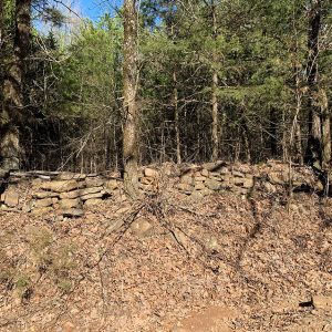
Abbott is an unincorporated community located in northern Scott County along Highway 71. Established in 1899 near the town of Mansfield (Scott and Sebastian counties), Abbott was likely named after certain members of the Abbott family who lived in the area during the late nineteenth century. The agricultural, mining, and natural gas industries have traditionally been important economic resources in Abbott and the surrounding area. Prior to European exploration, the area surrounding Abbott was a wilderness. Species of wildlife that no longer inhabit the area, such as elk and buffalo, were present throughout the region. Archaeological findings have provided evidence of early inhabitants dating to the Archaic, Woodland, and Mississippian periods. Additional evidence has indicated that the Caddo tribe had …

Anderson (Scott County)

Located between Highway 80 and Highway 71 along Sweet Gum Lane, Anderson is an unincorporated community in central Scott County one mile northwest of Waldron (Scott County). The agricultural industry was vital to area settlers and later residents. The area’s first inhabitants included natives from the Archaic, Woodland, and Mississippian periods. Archaeological discoveries suggest that natives of the Caddo Nation made their homes along the Poteau River and other prominent waterways in the area. Thousands of archaeological sites can be found along the Fourche La Fave River and Poteau River valleys nearby. Throughout the late seventeenth and early eighteenth centuries, French hunters and tradesmen traveled west from Arkansas Post along the Arkansas River. From there, they began traversing smaller tributaries …

Bates (Scott County)

Bates is an unincorporated community in western Scott County. It is located along Highway 28 west, between the junction of Shadley Creek and East Shadley Creek just north of the Poteau River. Bates was established in 1907 and named after the Bates family who settled in the area. Agriculture, timber, and coal mining have historically been important industries in Bates. Prior to European exploration, Bates was a wilderness lush with native vegetation and numerous species of wildlife, some of which no longer inhabit the area. Early inhabitants of the area were present during the Woodland, Archaic, and Mississippian periods. There are numerous archaeological sites located along the Poteau River south of Bates. This evidence indicates that the people of the …

Beauchamp (Scott County)

Beauchamp is an unincorporated community located in southwestern Scott County. Named for the family who settled in the area, Beauchamp was established in 1901 along Black Fork Creek three miles west of Blansett (Scott County). The agricultural and timber industries have contributed to the economy and way of life in Beauchamp. Prior to European exploration, the area surrounding Beauchamp was an explored wilderness. Several species of wildlife that no longer inhabit the area, such as elk and buffalo, were present throughout the region. Numerous archaeological sites and burial mounds are located along the banks of prominent waterways such as the Fourche La Fave River. Archaeological findings have provided evidence of early inhabitants dating to the Archaic, Woodland, and Mississippian periods. …

Black Fork (Scott County)

Black Fork is an unincorporated community located in southwestern Scott County, just north of Black Fork Mountain. Black Fork was named after a creek—supposedly with dark, murky water—that flows through the area. Black Fork Creek is a distributary of the Fourche La Fave River and a tributary of the Poteau River. The agriculture and timber industries have traditionally been important in Black Fork. Archaeological findings have provided evidence of early inhabitants dating to the Archaic, Woodland, and Mississippian periods. Further archaeological evidence has indicated that people of the Caddo tribe inhabited the area. During the late seventeenth and early eighteenth centuries, French hunters and tradesmen traveled west from the Arkansas Post exploring portions of western Arkansas. Several rivers that flow …

Blansett (Scott County)

Blansett is an unincorporated community in west-central Scott County. It was established in 1877 along the Black Fork of the Fourche La Fave River, which flows west through the Ouachita National Forest. The small community is surrounded mostly by forest, with some areas containing pastures. Evidence from the Archaic, Woodland, and Mississippian periods has been found throughout the area. The Caddo tribe once had a strong presence throughout Scott County, especially along prominent bodies of water. Numerous archaeological mounds have been discovered along waterways throughout the area, including Black Fork Creek. There is little evidence of early European exploration around Blansett. However, it is likely that French trappers and explorers traversed the rivers and creeks around Blansett in the late …

Blue Ball (Scott County)

Blue Ball is an unincorporated community in eastern Scott County located on Highway 80. Blue Ball was established in 1873 along Dutch Creek. Blue Ball’s name originated from resident Salina Millard, who awoke on a cold morning and noticed how the mountain directly in front of her house looked like a large blue ball. The agriculture and timber industries have contributed to the economy and way of life in Blue Ball. Prior to European exploration, the area surrounding Blue Ball was a wilderness. Several species of wildlife that no longer inhabit the area, such as elk and buffalo, were present throughout the region. Numerous archaeological sites and burial mounds are located along the banks of prominent waterways such as Dutch Creek. Archaeological findings have provided evidence of early …

Bluff Ridge (Scott County)

Bluff Ridge is a historical community located north of Highway 378 in northern Scott County. Bluff Ridge was established just north of Poteau Mountain and two miles west of the Petit Jean River. Agriculture and timber have been important to the area. Prior to European exploration, Bluff Ridge was a wilderness lush with native vegetation and numerous species of wildlife—including buffalo and elk, which no longer inhabit the area. Archaeological evidence from the Archaic, Woodland, and Mississippian periods has been discovered throughout the area. Additional evidence has indicated that the Caddo tribe had a strong presence along the Petit Jean River and other prominent waterways. Throughout the late seventeenth and early eighteenth centuries, French trappers and explorers traveled west from the Arkansas …

Boles (Scott County)

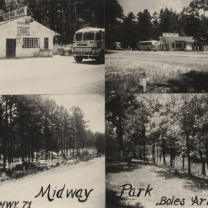
Boles is an unincorporated community located along Highway 71, nine miles south of Waldron (Scott County). Boles was established in the mid-nineteenth century along the Fourche La Fave River, which runs through the Fourche River Valley of the Ouachita Mountains. The first inhabitants of the area arrived thousands of years before Europeans, leaving archaeological evidence from the Archaic, Woodland, and Mississippian periods. The Caddo tribe had a strong presence along the Fourche Le Fave River and other prominent waterways. Burial grounds have also been discovered in the southern portion of Scott County near Boles. Throughout the late seventeenth and early eighteenth centuries, French trappers and explorers likely traveled the waters of the Petit Jean, Fourche La Fave, and Poteau rivers …

Boothe (Scott County)

Boothe is an unincorporated community in northern Scott County located along Highway 71. Boothe was established in 1889 just north of the Petit Jean River and named after the Booth family who settled in the area. The community was known as Tumlinsonville and later Tomlinson prior to being named Boothe. Agriculture has traditionally been an important way of life in the area. Prior to European exploration, the area surrounding Boothe was a wilderness. Several species of wildlife that no longer inhabit the area, such as elk and buffalo, were present throughout the region. Numerous archaeological sites and burial mounds are located along the banks of prominent waterways such as the Fourche La Fave and Poteau rivers. Archaeological findings have provided …

Brawley (Scott County)

Brawley is an unincorporated community in western Scott County located near Lake Hinkle. Named for the family who settled in the area, Brawley was established in 1860 at the base of Walker Mountain along Jones Creek, a tributary of the Poteau River. Agriculture and timber have contributed to the economy and way of life in Brawley. Prior to European exploration, the area surrounding Brawley was an unexplored wilderness. Several species of wildlife that no longer inhabit the area, such as elk and buffalo, were present throughout the region. Numerous archaeological sites and burial mounds are located along the banks of prominent waterways such as the Fourche La Fave and Poteau rivers. Archaeological findings have provided evidence of early inhabitants dating …

Bryan (Scott County)

Bryan is an unincorporated community located in northwestern Scott County along Highway 28 north of the Poteau River. The community of Bryan was also known as Center Point and Bryan’s Spur. Agriculture has traditionally been important to the area. Prior to European exploration, Bryan was a wilderness lush with native vegetation and numerous species of wildlife—including buffalo and elk, which no longer inhabit the area. Archaeological evidence from the Archaic, Woodland, and Mississippian periods has been discovered throughout the area. Additional evidence has indicated that the Caddo tribe had a strong presence along the Poteau River and other prominent waterways. Throughout the late seventeenth and early eighteenth centuries, French trappers and explorers traveled west from the Arkansas Post along the Arkansas River. From there, they began traversing smaller …

Buffalo (Scott County)

Buffalo is a historical community in southern Scott County located along U.S. Highway 71. The community was established along Buffalo Creek. The agriculture and timber industries have contributed to the economy and way of life in Buffalo. Prior to European exploration, the area surrounding Buffalo was a wilderness. Several species of wildlife that no longer inhabit the area, such as elk and buffalo, were present throughout the region. Numerous archaeological sites and burial mounds can be found along the banks of prominent waterways such as the Fourche La Fave River. Archaeological findings have provided evidence of early inhabitants dating to the Archaic, Woodland, and Mississippian periods. Further archaeological evidence has indicated that the people of the Caddo tribe later inhabited the area. During the late …

Cauthron (Scott County)

The town of Cauthron is an unincorporated community located in western Scott County along Highway 28. The town was established along the Poteau River, which runs west into eastern Oklahoma. Cauthron was incorporated circa 1876; however, the area was initially known as Piney. Piney was never officially an incorporated town, and it is unclear when the area began being called Cauthron, although it was likely in the 1870s when the first governmental buildings were being built. Before European contact, the wilderness area’s first inhabitants included natives from the Archaic, Woodland, and Mississippian periods. The Caddo later made their homes along the Poteau River and other waterways in the area. It is probable that during the late seventeenth and early eighteenth …

Cedar Creek (Scott County)

The unincorporated community of Cedar Creek is located along Highway 28 in eastern Scott County. The town was established in 1852 near the Fourche La Fave River between two of its tributaries. Originally, Cedar Creek was broken up into two different communities that were about three miles apart: Little Cedar and Big Cedar. The communities were named after the two tributaries of the Fourche La Fave River: Little Cedar Creek and Big Cedar Creek; to avoid confusion, the residents simply began calling the area Cedar Creek. Before European exploration, Cedar Creek was a wilderness containing various species of wildlife, some of which no longer inhabit the area. Early inhabitants included peoples of the Archaic, Woodland, and Mississippian periods. Several hundred …

Chant (Scott County)

Chant is a historical community in southern Scott County located along Highway 71. At various times known as Pleasant Valley and Texas, the town was established in 1906 near the Fourche La Fave River and Mill Creek between Boles and Y City. Agriculture has contributed significantly to the economy and way of life in Chant. Prior to European exploration, the area surrounding Chant was a wilderness. Several species of wildlife that no longer inhabit the area, such as elk and buffalo, were present throughout the region. Numerous archaeological sites and burial mounds are located along the banks of prominent waterways such as the Poteau River. Archaeological findings have provided evidence of early inhabitants dating to the Archaic, Woodland, and Mississippian …

Coaldale (Scott County)

Coaldale is an unincorporated community in western Scott County located along Highway 28 West. The town was established in 1903 and named for the extensive coal mines that were established in the area. Mining was a significant industry in Coaldale, along with agriculture and timber. Prior to European exploration, Coaldale was a wilderness lush with native vegetation and numerous species of wildlife, some of which no longer inhabit the area. Archaeological findings have provided evidence of early inhabitants dating to the Archaic, Woodland, and Mississippian periods. Further evidence has indicated that the people of the Caddo tribe later inhabited the area. During the late seventeenth and early eighteenth centuries, French hunters and tradesmen traveled west from the Arkansas Post along …

Colburn Spring (Scott County)

Colburn Spring is a historical community located in northeastern Scott County. The community was established south of the Petit Jean River near the Cedar Creek tributary in what is now the Ouachita National Forest. Agriculture and mining contributed significantly to the way of life in Colburn Spring. Prior to European exploration, the area surrounding Colburn Spring was a wilderness. Several species of wildlife that no longer inhabit the area, such as elk and buffalo, were present throughout the region. Numerous archaeological sites and burial mounds can be found along the banks of prominent waterways such as the Petit Jean River. Archaeological findings have provided evidence of early inhabitants dating to the Archaic, Woodland, and Mississippian periods. Further archaeological evidence has …

Denton (Scott County)

Denton is an unincorporated community located in western Scott County. Established in 1877 near the confluence of Denton Creek and Ross Creek, the community is named after the Denton family, which settled in Scott County in the 1850s. The agriculture and timber industries have traditionally contributed to the economy and way of life in Denton. Before European contact, the area where Denton is located was a wilderness teeming with native vegetation and wildlife. The area’s first inhabitants included natives from the Archaic, Woodland, and Mississippian periods. Archaeological discoveries suggest that natives of the Caddo tribe made their homes along the Fourche La Fave River near Denton and other prominent waterways in the area. Throughout the late seventeenth and early eighteenth …

Elm Park (Scott County)

Elm Park is an unincorporated community located in north-central Scott County along the Petit Jean River between where Highways 378 and 23 form a junction with Highway 71. The date of Elm Park’s establishment is unclear. Agriculture has traditionally been an important way of life in the community. Prior to European exploration, Elm Park and the surrounding area was an unexplored wilderness. Species of wildlife that longer inhabit the area, such as elk and buffalo, were present throughout the region. Archaeological findings have provided evidence of early inhabitants dating to the Archaic, Woodland, and Mississippian periods. Additional archaeological evidence has indicated that the Caddo tribe had a strong presence along the Petit Jean River and other prominent waterways. Throughout the …

Evening Shade (Scott County)

Evening Shade is an unincorporated community in north-central Scott County located along Highway 28 West. The community was established at the base of Poteau Mountain, which played an important role in naming the community. Agriculture has traditionally been important to the area. Prior to European exploration, Evening Shade was a wilderness with native vegetation and numerous species of wildlife, some of which no longer inhabit the area. Early inhabitants were present during the Archaic, Woodland, and Mississippian periods. There are numerous archaeological sites located along the Poteau River near Evening Shade, and evidence from these sites indicates that the Caddo Indians once lived in the area. Throughout the late seventeenth and early eighteenth centuries, French trappers and explorers traveled west …

Forester (Scott County)

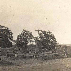
Forester was a self-contained sawmill town owned by the Caddo River Lumber Company. It was founded and built by Thomas Whitaker Rosborough in 1930 in southeastern Scott County. At first, a prominent Waldron (Scott County) businessman wanted the mill built in his town, but after hearing that Rosborough intended to employ African Americans, this businessman was happy with the chosen location and later was instrumental in getting the railroad extended from Waldron into Forester. The mill became the largest and most productive in the state, with its huge lumber shed measuring eighty feet wide and 1,000 feet long and storing millions of board feet of kiln-dried, planed lumber. The company town was named after Waldron businessman Charles A. Forrester. Contractors …

Gate (Scott County)

The town of Gate is a historical community that was located in southern Scott County near the Polk County border. The community was originally established along a gated toll road (now Nella Road) and was subsequently named because of the actual “gate” that controlled the flow of traffic along the road. Gate was originally situated between the junction of Johnson Creek and Cedar Creek, which are tributaries of the Fourche La Fave River. Prior to European exploration, Gate was a wilderness lush with native vegetation and numerous species of wildlife, some of which no longer inhabit the area. Early inhabitants of the area were present during the Woodland, Archaic, and Mississippian periods. There are numerous archaeological sites located along Clear …

Gipson (Scott County)

Gipson is an unincorporated community in northwestern Scott County just south of Highway 28. The community was established circa 1887 just south of Bates along the Poteau River. Agriculture has traditionally been important in the area. Prior to European exploration, Gipson was a wilderness lush with native vegetation and numerous species of wildlife—including buffalo and elk, which no longer inhabit the area. Archaeological evidence from the Archaic, Woodland, and Mississippian periods has been discovered throughout the area. Additional evidence has indicated that the Caddo tribe had a strong presence along the Poteau River and other prominent waterways. Throughout the late seventeenth and early eighteenth centuries, French trappers and explorers traveled west from the Arkansas Post along the Arkansas River. From …

Girard (Scott County)

Girard is a historical community located in northeastern Scott County. The community was established approximately three miles east of where the Petit Jean River begins in Scott County in what is now the Ouachita National Forest. Agriculture contributed significantly to the way of life in Girard. Prior to European exploration, the area surrounding Girard was a wilderness. Several species of wildlife that no longer inhabit the area, such as elk and buffalo, were present throughout the region. Numerous archaeological sites and burial mounds can be found along the banks of prominent waterways such as the Petit Jean River. Archaeological findings have provided evidence of early inhabitants dating to the Archaic, Woodland, and Mississippian periods. Further evidence has indicated that the …

Green Ridge (Scott County)

Green Ridge is an unincorporated community located in east-central Scott County along Highway 248. Green Ridge was established in 1872 near Prairie Creek. Agriculture and religion have traditionally been important to Green Ridge’s culture and economy. Prior to European exploration, Green Ridge was a wilderness lush with native vegetation and numerous species of wildlife—including buffalo and elk, which no longer inhabit the area. Archaeological evidence from the Archaic, Woodland, and Mississippian periods has been discovered along the Poteau River to the south. Additional archaeological evidence has indicated that the Caddo tribe had a strong presence along the Poteau River and other prominent waterways. Spanish explorer Hernando De Soto is credited with being the first European to explore the territory around …

Harvey (Scott County)

Harvey is an unincorporated community in eastern Scott County, near the border of Yell County. Harvey is within close proximity to the community of Nola (Scott County), just two miles east along Highway 28. The area where Harvey and Nola are located was once known as Nebraska (Scott County). The area along the Fourche La Fave River valley was once a wilderness thick with timber and wildlife. Archaeological evidence shows Archaic, Woodland, and Mississippian peoples living in the area. Prior to European exploration of Arkansas, the Caddo tribe lived along the Fourche La Fave River valley, and burial mounds and other archaeological sites can be found along the river. In the late seventeenth and early eighteenth centuries, French hunters and …

Hon (Scott County)

The town of Hon is located along Highway 28, about seven miles west of Waldron (Scott County). Hon was established between Poteau Mountain and Chalybeate Round Top near Bull Creek, which is a tributary of the Poteau River. The town was named after John Hon, whose father, Jackson Hon, established the community in 1836; it was first known as Valley Forge and later Poteau. Hon was officially established sometime in the late nineteenth century. Prior to European exploration, Hon was a wilderness whose inhabitants included peoples of the Mississippian, Archaic, and Woodland periods. Eventually, the native people of the Caddo Nation settled near Hon along the Poteau River. There are numerous archaeological sites from several periods located near Hon. Throughout …

Kings Creek (Scott County)

Kings Creek is a historical community in northwestern Scott County located along Highway 378. The community of Kings Creek is situated along a tributary of the Petit Jean River that carries the same name. Agriculture has traditionally been important to Kings Creek and the surrounding area. Prior to European exploration, the area surrounding Kings Creek was an unexplored wilderness. Species of wildlife that longer inhabit the area, such as elk and buffalo, were present throughout the region. Archaeological findings have provided evidence of early inhabitants dating to the Archaic, Woodland, and Mississippian periods. Additional evidence has indicated that the Caddo tribe had a strong presence along the Petit Jean River and other prominent waterways. Throughout the late seventeenth and early …

Little Texas (Scott County)

Little Texas is an unincorporated community located in eastern Scott County. The community was established in 1870 south of the Fourche La Fave River along Weaver Creek. Weaver Creek was named for the Weaver family who settled in Little Texas. Agriculture has traditionally contributed to the economy and way of life in Little Texas. Prior to European exploration, the area surrounding Little Texas was a wilderness. Several species of wildlife that no longer inhabit the area, such as elk and buffalo, were present throughout the region. Numerous archaeological sites and burial mounds can be found along the banks of prominent water ways such as the Fourche La Fave River. Archaeological findings have provided evidence of early inhabitants dating to the …

Mansfield (Sebastian and Scott Counties)
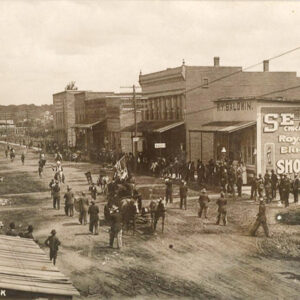
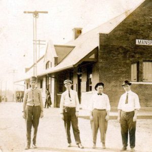
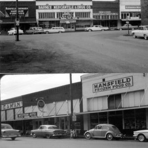
Mansfield is located in west-central Arkansas, twenty-five miles south of Fort Smith (Sebastian County) on U.S. Highway 71 and ten miles east of the Oklahoma state line. A portion of the city lies in Scott County. Mansfield is an economic and educational center serving the region between Greenwood (Sebastian County) and Waldron (Scott County). Louisiana Purchase through Early Statehood Mansfield represents the combining of two local communities on the Sebastian/Scott county line: Coop Prairie and Chocoville. Overlooking a small valley south of the county line and north of the Poteau Mountain range, Coop Prairie was formed in 1849 on land given by Martin T. Taylor, a settler from Tennessee. A trading post, the Coop Prairie Cumberland Presbyterian Church, and Coop …

Nebraska (Scott County)

Nebraska is a historical community that was located in eastern Scott County along the Fourche La Fave River valley. The town was established in 1854 as an agricultural community prior to the Civil War. Nebraska was originally located between the current communities of Harvey (Scott County) and Nola (Scott County). Archaeological evidence from the Archaic, Woodland, and Mississippian periods shows native people living along the Fourche La Fave River valley near Nebraska. Prior to European exploration, the Caddo tribe lived along the valley. Thousands of archeological sites and burial mounds are located throughout the area. During the late seventeenth and early eighteenth centuries, French hunters and tradesmen explored the waters of the Fourche La Fave River and other tributaries of …

Needmore (Scott County)

The community of Needmore is located along Highway 71 in south-central Scott County. Never officially incorporated as a town, the community stretches from the top of a large hill, known as Needmore Hill, to the hill’s base. Buffalo Creek and the Fourche La Fave River are within a few miles of Needmore. The area where Needmore is now located was once a wilderness inhabited by natives of the Archaic, Woodland, and Mississippian periods. Prior to European exploration, the Caddo tribe lived along the Fourche River Valley. Burial mounds and other archaeological sites can be found along the Fourche La Fave River near Needmore. During the late seventeenth and early eighteenth centuries, French trappers and traders traveled west from Arkansas Post, …

Nella (Scott County)

The unincorporated community of Nella is located in southwestern Scott County. It was established in 1903 along Clear Fork Creek, which is a distributary of the Fourche La Fave River. The agriculture and timber industries have traditionally been important economic resources for the community. Prior to European exploration, the area surrounding Nella was a wilderness. Numerous archaeological sites and burial mounds are located along the banks of prominent waterways such as the Fourche La Fave River. Archaeological findings have provided evidence of early inhabitants dating to the Archaic, Woodland, and Mississippian periods, and the Caddo tribe later inhabited the area. During the late seventeenth and early eighteenth centuries, French hunters and tradesmen traveled west from Arkansas Post exploring portions of …

Nola (Scott County)

Nola formed as a small farming town in eastern Scott County. The unincorporated community was established within the Fourche La Fave River valley near the Yell County border. It is located near Harvey (Scott County), just two miles west along Highway 28. The area where Nola and Harvey are now located was once known as Nebraska. Prior to European exploration, the area where Nola is located was lush with native vegetation and wildlife. Archaeological evidence from the Archaic, Woodland, and Mississippian periods indicate that native people long lived along the river valley where Nola is located. Native American people of the Caddo tribe began settling along the valley around AD 1000. Several thousand burial mounds and other archaeological sites are …

Olio (Scott County)

Olio is an unincorporated community in eastern Scott County located along Highway 80. Olio was established in 1858 along Dutch Creek. Agriculture and timber have contributed to the economy and way of life in the region. Prior to European exploration, the area surrounding Olio was a wilderness. Several species of wildlife that no longer inhabit the area, such as elk and buffalo, were present throughout the region. Numerous archaeological sites and burial mounds are located along the banks of prominent waterways such as Dutch Creek. Archaeological findings have provided evidence of early inhabitants dating to the Archaic, Woodland, and Mississippian periods. Further archaeological evidence has indicated that the people of the Caddo tribe later inhabited the area. During the late …

Oliver (Scott County)

Oliver is an unincorporated community located in northwestern Scott County along Highway 28 north of the Poteau River. Agriculture has traditionally been important to the area. Prior to European exploration, Oliver was a wilderness lush with native vegetation and numerous species of wildlife—including buffalo and elk, which no longer inhabit the area. Archaeological evidence from the Archaic, Woodland, and Mississippian periods has been discovered throughout the area. Additional evidence has indicated that the Caddo tribe had a strong presence along the Poteau River and other prominent waterways. Throughout the late seventeenth and early eighteenth centuries, French trappers and explorers traveled west from the Arkansas Post along the Arkansas River. From there, they began traversing smaller tributaries such as the Fourche La Fave River and Poteau River. It is likely that …

Parks (Scott County)

Parks is an unincorporated community located along Highway 28 twelve miles southeast of Waldron (Scott County) in eastern Scott County. Originally known as White Church, it was established in 1838 along the Fourche La Fave River as an agricultural community. The earliest people inhabited the area during the Archaic, Woodland, and Mississippian periods. Later inhabitants include Native American people of the Caddo tribe. Several thousand archaeological sites are located throughout the Fourche La Fave River valley, including small burial mounds. During the late seventeenth and early eighteenth centuries, French hunters and tradesmen explored various portions of western Arkansas. These Frenchmen traversed rivers and streams throughout the region, including the Poteau, Petit Jean, and Fourche La Fave rivers. It is probable …