Mississippi

Subcategories:
  • No categories
Clear

Entry Category: Mississippi

Bassett (Mississippi County)

  The town of Bassett is located on Highway 61 in southern Mississippi County. It is about halfway between Wilson (Mississippi County) and Joiner (Mississippi County). Bassett sits on higher ground that, for most of recorded history, was surrounded by swampland and hardwood forests. Artifacts unearthed in the area indicate that the knoll has been inhabited for many centuries. Mississippi County historian Mabel Edrington wrote in 1962 that a 100-acre Native American cemetery had existed at the site. Several Indian nations have been associated with northeastern Arkansas, but over time, they all signed treaties with the federal government and moved west to Indian Territory, now the state of Oklahoma. The first construction in Bassett that was not done by Indians …

Birdsong (Mississippi County)

  Located in the extreme southwestern corner of Mississippi County, Birdsong is an African American community that gained national recognition in 1935 due to the plight of sharecroppers in northeastern Arkansas and southeastern Missouri. There, local planters and sheriff deputies threatened the life of Norman Thomas, leader of the Socialist Party, forcing him out of town after dispersing a crowd of some 500 men, women, and children. Birdsong is located in the Mississippi River Delta; at 220 feet above sea level, Birdsong at its founding was in a swamp. The community is about eleven miles from the Mississippi River on the east. To the west, about four miles away, is the Tyronza River, with Right Hand Slough (Little River) and the St. Francis …

Blytheville (Mississippi County)

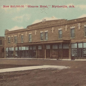
Blytheville is located in the low, flat Mississippi Delta on land that was inhabited by Native Americans for thousands of years. Two prominent natural forces shape Blytheville. The first is the New Madrid Seismic Zone. Blytheville, which is prone to tremors, lies near the epicenters of the record-setting New Madrid Earthquakes of 1811–1812. Almost two centuries later, abundant evidence of these quakes is still visible in the Blytheville area. The second shaping force is the Mississippi River. The river’s impact includes flooding (such as in 1882–83 and the Flood of 1927), the creation of fertile farming soil, and providing waterway transportation for industry. Early Statehood through the Gilded Age Blytheville, originally known as Blythesville, is named for the Reverend Henry …

Burdette (Mississippi County)

Burdette (Mississippi County) is located nine miles south of Blytheville (Mississippi County) on State Highway 148 just off U.S. Highway 61, known as the Great River Road. Burdette is named after Alfred Burdette Wolverton, who in the early 1900s was one of the first lumbermen to settle in the area. It was incorporated as a company town by workers of the Three States Lumber Company of Wisconsin in May 1905. Prior to Three States Lumber Company’s arrival, the area had been swampland and uninhabitable. Burdette Township split from Fletcher Township in 1908 to create the community of Burdette. Burdette proper is located within the larger Burdette Township (a township being a division of a county), which includes farming and lumber …

Dell (Mississippi County)

Dell is a town in Mississippi County, a few miles southwest of Blytheville (Mississippi County). State Highways 18 and 181 pass through Dell. When Arkansas became a state, the region around Dell was swampy and forested. Pemiscot Bayou runs into the Little River near Dell, so travelers passed through the area by flatboat and by steamboat. The first landowner in what would become Dell was Thomas J. Blackmore, who acquired about 160 acres of swampland in 1855 through the Swamp Land Act of 1850. Blackmore may not have even visited the land before he sold it, as the land went through several absentee owners until it was purchased by W. B. Sizemore in 1878. During the Civil War, a skirmish …

Dyess (Mississippi County)

aka: Dyess Colony Resettlement Area
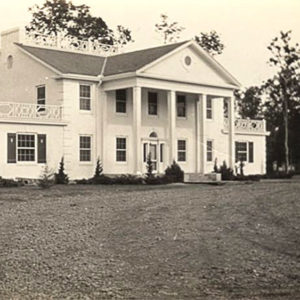
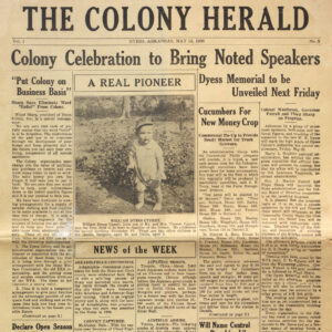
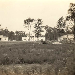
One of the most famous “resettlement colonies” for impoverished farmers during the Great Depression was in Dyess (Mississippi County). The Dyess Colony became one of the most well known because one of its early residents was singer Johnny Cash. National attention focused on Arkansas when First Lady Eleanor Roosevelt visited the community in 1936. Although smaller now and no longer a government project, Dyess still attracts tourists to northeast Arkansas. While the Roaring Twenties had a euphoric effect on much of the nation, the agricultural economy of Arkansas did not share in the prosperity. By the end of the 1920s, one disaster after another devastated the small independent farmers of the state. The Flood of 1927 was followed by drought. …

Etowah (Mississippi County)

Etowah is a town in Mississippi County. It is located on State Highway 136 about fifteen miles west of Osceola (Mississippi County). The first inhabitants of Mississippi County were Native Americans who established villages and built mounds at various sites around the county. When European explorers first traveled through the area, they found a swamp with many cypress trees. The land under the swamp was very fertile, but no efforts were made to remove the trees and drain the swamp until late in the nineteenth century. One Civil War event took place in the Etowah area, according to a monument that was dedicated in 2010. An expedition of 100 soldiers from the Second Missouri Artillery set out from Osceola on …

Gosnell (Mississippi County)

The city of Gosnell is a bedroom community near Blytheville (Mississippi County), a few miles south of the Missouri bootheel in northeastern Arkansas. The region was lightly populated in the late nineteenth and early twentieth centuries, and Gosnell grew only as a result of its proximity to Eaker Air Force Base, remaining unincorporated until 1968. It has hosted the Cotton Pickin’ Festival and Tractor Pull every fall since 1991. Pre-European Exploration Like much of the Delta region along the Mississippi River in Arkansas, the area that would become Gosnell was inhabited by various Native American tribes. A fifteen-foot mound built during the Mississippian Period (AD 900–1600) stands about two miles southeast of Gosnell. This mound is surrounded by a large …

Hickman (Mississippi County)

Hickman is an unincorporated community in northeastern Mississippi County, near the Mississippi River. It is the easternmost community in the state of Arkansas. In the twenty-first century, Hickman is more of an industrial park than a residential community. Native Americans traveling on the Mississippi River undoubtedly stopped at the future site of Hickman, and some groups may have lived in the area for a time. The first Europeans to see the location were the members of the Marquette-Joliet expedition in 1673. The United States first gained possession of the land through the Louisiana Purchase in 1803. The river landing was frequently used during territorial times, and a post office named Buford Landing was established there in 1836, the year Arkansas …

Joiner (Mississippi County)

The city of Joiner (Mississippi County) is located at the intersection of U.S. Highway 61 and State Highway 118, within an area widely recognized for its fertile farmland and its proximity to the Mississippi River and the city of Memphis, Tennessee. There are varying accounts regarding Joiner’s beginnings. One story states that the locale was first associated with a hotel of the same name that was established by Rufus L. Joiner. This account also asserts that the spelling was originally Joyner and somehow evolved into Joiner over the years. However, Rufus L. Joiner’s biography, as published by Goodspeed’s history of the area, makes no mention of his association with a hotel, describing him only as a prominent farmer. On the …

Keiser (Mississippi County)

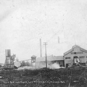
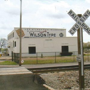
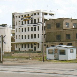
Keiser is a second-class city in Mississippi County. Located on State Highway 181, Keiser is one of several northeastern Arkansas cities founded by the logging and farming operations of Lee Wilson & Company. Until the early twentieth century, the land that would become Keiser was swampland dotted with hardwood forests. Late in the nineteenth century, efforts began to drain the swamps and to protect the newly claimed land with levees. This process, along with the harvesting of the hardwoods, was accelerated by entrepreneur Lee Wilson. Acquiring thousands of acres of land, Wilson profited from building railroads, clearing trees, and establishing new farmland. He and his company established several cities, naming most of them for family members. Keiser is an exception: …

Leachville (Mississippi County)

Leachville of Mississippi County was once known as “The Cleanest Town on Buffalo Island, Where Agriculture and Industry Meet.” Established about 1896, Leachville is thirty miles east of Jonesboro (Craighead County) and twenty-eight miles west of Blytheville (Mississippi County). Leachville’s founding fathers were James Wiseman Honnoll, Joshua Gilbert Leach, and Sam McNamee of Holly Springs, Mississippi. Leach and Honnoll incorporated the Leach-McNamee Land Development Company on March 15, 1898. Honnoll named the town in honor of Leach. Although founded in 1896, the town was not incorporated until February 2, 1916. The Gilded Age through Early Twentieth Century The late nineteenth century brought business and industry to the settlement. In 1898, the Cannon family, which had moved to Leachville early on, …

Luxora (Mississippi County)

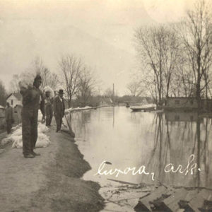
Latitude and Longitude:        35º45’22″N 089º55’41″W Elevation:                                  246 feet Area:                                           0.85 square miles (2020 Census) Population:                               942 (2020 Census) Incorporation Date:                June 3, 1897 Historical Population per the U.S. Census: The city of Luxora is located in Mississippi County at the junction of U.S. Highway 61 and Arkansas State Highway 158, twelve miles south of Blytheville (Mississippi County) and five miles north of Osceola …

Manila (Mississippi County)

In many ways, Manila is like other small towns of the northeastern Arkansas Delta. During the 1950s, such towns were vital to the development of the area and provided essential goods and services to farmers and their families, but the mechanization of agriculture led people to migrate to urban areas. In that respect, Manila has not experienced the population decrease of its Mississippi County contemporaries, primarily because “white flight” from the nearby towns of Blytheville and Osceola has led people to relocate to Manila. John U. Needham came to the Manila area in 1868 to establish a permanent camp for his grazing stock. He selected the highest, driest spot of the land that was once a part of the “Great …

Marie (Mississippi County)

Named for the youngest daughter of Robert E. Lee Wilson, Marie is one of several towns founded by Lee Wilson & Company early in the twentieth century. It is located on State Highway 14 about two miles east of Interstate 55. Periodically flooded by the Mississippi River, eastern Mississippi County was long a wooded swampland unattractive to early settlers of the state. Late in the nineteenth century, Lee Wilson began investing in this unwanted land, seeing its potential for production of wealth, first in timber and then in cotton. After funding a railroad, Wilson began harvesting the timber with his own lumber company. Clearing the land of trees, he exposed rich soil that had been frequently replenished by Mississippi River floods. …

Milligan Ridge (Mississippi County)

Milligan Ridge is a small farming community located along State Highway 158 in the western portion of Mississippi County. It is a part of what is known as “Buffalo Island.” Big Lake and Little River separate the island from the remainder of Mississippi County on the east. The area has the distinction of being one of the last in the state to be claimed for farming from the swampy land around the Mississippi River. A few people inhabited the mosquito-infested swamplands as late as the 1890s. They came to the area to trap, hunt, and fish, or to hide from the law. For example, Lucilius Steven Milligan and his sons, James Riley and Jacob Minton Milligan, were running from the …

Osceola (Mississippi County)

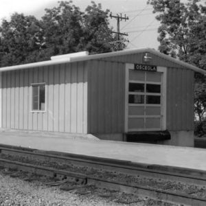
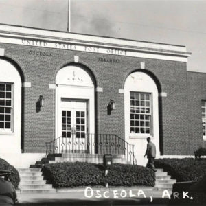
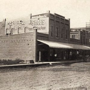
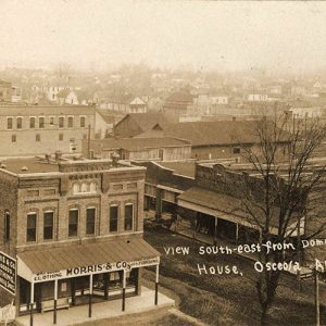
Osceola is located in northeastern Mississippi County on the Mississippi River, approximately fifty miles upriver from Memphis, Tennessee. Osceola is named for Chief Osceola of the Seminole tribe. Local historians have written that he visited the area in 1832 to explore the possibility of exchanging Florida land for Arkansas land, but no historical evidence supports this story. The community was the only county seat of Mississippi County until 1901, when Osceola and Blytheville were named dual county seats. Louisiana Purchase through Early Statehood Originally acquired by the United States in 1803 as part of the Louisiana Purchase, the area was largely populated by Indians. The series of severe earthquakes on the New Madrid fault from December 1811 to February 1812 …