Clay

Subcategories:
  • No categories
Clear

Entry Category: Clay

Corning (Clay County)

Corning, incorporated in August 1877, was the first of Clay County‘s two seats (Piggott is the other). Corning is the judicial seat for the county’s Western District and is the commercial and educational center of western Clay County. There is little record of western Clay County’s earliest settlers. The land was heavily forested and cut by many rivers and streams. Swamps covered large parts of the area, making transportation and farming difficult. The state sold most of the land as swamp and overflowed lands. Land speculators and timbering interests bought large tracts. The many rivers aided in the movement of cut timber to mills in other towns. In the 1850s, the Cairo and Fulton Railroad secured the right to build a …

Datto (Clay County)

Datto is a town in Clay County situated just north of U.S. Highway 67. Created when the railroad was built through the area at the beginning of the twentieth century, Datto is five miles from Success (Clay County). Although most of Clay County is farmland today, it was once heavily forested. Four rivers flow through the county, providing early transportation corridors. Osage, Shawnee, Delaware, and Quapaw tribes—as well as French explorers—are all known to have visited the area. A military road known as the Southwest Trail was constructed through the area during Arkansas’s territorial period, linking Missouri to the southwestern corner of the territory, which was then Fulton (Hempstead County). Isaac Day came to the area late in the nineteenth …

Greenway (Clay County)

Greenway is a city on U.S. Highway 49 in Clay County, three miles south of Piggott (Clay County). Built as a stop on the St. Louis and Texas Railroad, Greenway is one of the small agricultural centers of the Mississippi Delta region. Frequently flooded by the Mississippi River and shaken by the New Madrid Earthquakes of 1811–1812, northeastern Arkansas remained sparsely settled until after the Civil War. The region consisted largely of swampland and hardwood forests, although a Military Road had been built across the region to link Missouri to Texas. Elihu and William Davis built a log cabin around 1837 in what would become the west side of Greenway, and a few other farming families also arrived and began …

Knobel (Clay County)

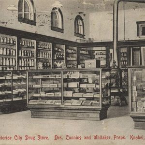
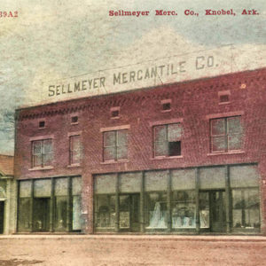
Knobel is a city in Clay County, about seven miles south of Corning (Clay County). Once a stop on the Iron Mountain Railroad, Knobel remains a minor agricultural center for the surrounding region. Frequently flooded by the Mississippi River and shaken by the New Madrid Earthquakes of 1811–1812, northeastern Arkansas remained sparsely settled until after the Civil War. The region consisted largely of swampland and hardwood forests, and no one lived permanently in the place that would become Knobel until after the Civil War. Many people passed through the area, however, since the site was on the road that connected Chalk Bluff (Clay County) on the St. Francis River to Pocahontas (Randolph County). In 1866, J. H. Allen began farming …

McDougal (Clay County)

McDougal is a city in Clay County on U.S. Highway 62 about halfway between Piggott (Clay County) and Corning (Clay County), the two county seats. Established as a railroad depot early in the twentieth century, McDougal did not incorporate as a city until 1954. Because of its location on the highway, it has survived into the twenty-first century while similar railroad towns have disappeared. Northeastern Arkansas is part of the Mississippi Alluvial Plain (commonly called the Delta). As such, the land was covered with swamps and hardwood forests when it was acquired by the United States in the Louisiana Purchase of 1803. The New Madrid Earthquakes of 1811–1812 changed the contour of the area, diminishing the interest of settlers in …

Nimmons (Clay County)

Nimmons is a small town in eastern Clay County. It is near the St. Francis River, which forms the border between northeastern Arkansas and the bootheel of Missouri. Nimmons was created as a rail crossing and lumber town early in the twentieth century. Prior to Euro-American settlement, the land that would become northeastern Arkansas and southeastern Missouri was dominated by swamps and hardwood forests. The area was sparsely inhabited, although the Osage and other Native American nations frequently visited the area to hunt and to fish. French explorers traveled on the St. Francis River, but the location that would become Nimmons remained uninhabited throughout the nineteenth century. With the advent of railroads, businessmen began seeking opportunities to harvest the forests …

Peach Orchard (Clay County)

Although it was not incorporated until 1910, Peach Orchard is the oldest extant settlement in Clay County. Located on state Highway 90 a few miles south of the Black River, the city reached its peak during the timber harvesting in Clay County that followed construction of the railroad. Since that time, Peach Orchard has slowly dwindled. French explorers traveled the Black River late in the eighteenth century and into the nineteenth century, and their presence in Arkansas did not abruptly end when the United States acquired the land in the Louisiana Purchase of 1803. Pierre Le Mieux owned a small estate on the south shore of the Black River that may have existed earlier than 1800. In 1816, he deeded that land …

Piggott (Clay County)

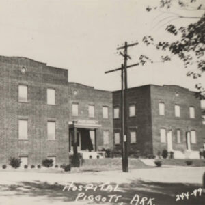
Piggott, a thriving agricultural town in northeast Arkansas, has several claims to fame that have left their mark on the community. Among them are its relationship with American writer Ernest Hemingway, its selection as a site for filming the classic movie A Face in the Crowd, and its reputation as a “marrying mecca.” Established in 1882, the town had its origins in 1873, when Dr. James A. Piggott and some of his pioneering neighbors from Dow, Illinois, settled near the current town site. While Piggott was respected as a doctor, he endeared himself even more to his neighbors by successfully petitioning for a post office for the remote settlement. In those days, the area was dense forest broken only by …

Pollard (Clay County)

Pollard is a city in Clay County, a few miles west of Piggott (Clay County) on U.S. Highway 62, in the foothills of Crowley’s Ridge. Pollard has witnessed the emergence and decline of the railroad and the timber industry; its focus in the twenty-first century is on local agriculture. Even before the Civil War, several families had settled in the hills adjacent to Crowley’s Ridge. A store was operated by a man remembered only as McElroy. New Hope Baptist Church was established before the war began. The Pollard family moved into the area after the war, with Jack Pollard opening the first general store in the area with partner Tom Irwin, and Bill Pollard obtaining a post office (which was …

Rector (Clay County)

Rector, a railroad town on the St. Louis and Texas railroad line (Cotton Belt), was platted by the Southwestern Improvement Association in 1882 and incorporated in 1887. Rector and the surrounding land has served as an area of timber harvest and agriculture, religion, education, business, and politics. Named for former governor Henry Massie Rector, the town has served many politicians who visit for its annual Labor Day parade and picnic. Pre-European Exploration through European Exploration and Settlement Eastern Arkansas has been inhabited for thousands of years. The area long has provided abundant hunting and fishing, as well as fertile soil for native populations. Indian artifacts have been found on farmland around Rector. Spanish explorer Hernando de Soto entered present-day Arkansas …

St. Francis (Clay County)

The city of St. Francis in northeastern Arkansas was a prosperous community relying on the timber industry in the late nineteenth and early twentieth centuries. Since that time, it has remained a quiet community adjacent to the Missouri bootheel. North of St. Francis lies Chalk Bluff, the name of the white clay outcroppings that constitute the northern face of Crowley’s Ridge. A military road crossed the St. Francis River at this location, and a ferry served travelers using the road. Around 1840, the first permanent settlers arrived. They included Abraham, Jacob, David, and George Seitz, who raised horses and cattle, operated the ferry, and ran a small store to provision travelers. In 1850, a post office with the name of Chalk …

Success (Clay County)

Located at the intersection of State Highways 211 and 328 in the northwestern corner of Clay County, about three miles south of the Arkansas-Missouri state line, Success has its origins as a timber town near the railroad. Settlers came slowly to northeastern Arkansas, both before and after Clay County was established in 1873 from parts of Randolph and Greene counties. The first settlers in the area that would become Success were associated first with the Heckt community that became Corning (Clay County) and then with the Bridgeport settlement that became Datto (Clay County). All this changed with the construction of the St. Louis, Iron Mountain and Southern Railway (later acquired by the Missouri Pacific Railroad) through Clay County. With modern …