Entry Category: Cities and Towns

Haynes (Lee County)

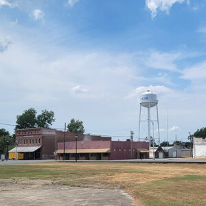
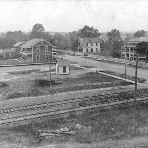
Haynes is a town in north-central Lee County, about one mile from the St. Francis County line and two miles from the L’Anguille River. Cotton and the railroad brought Haynes into existence, but the town’s population has varied over the years. Before Arkansas became a state, its eastern Delta region was dotted with large cotton plantations, with a slave population that largely outnumbered the white landowners. Several homes were built in the area that would become Haynes from the 1820s to the 1840s. Stores, a Baptist church, and a school for white children had already been established by 1850. The Civil War changed the economy of the region, bringing an end to slavery, but the African-American tenant farmers of the area lived much the same lives as …

Hazel Grove (Independence County)

The historic community of Hazel Grove is in Dota Township on Walden Road about four miles north-northeast of Cord (Independence County). It was once located on a main thoroughfare built in the early 1830s, the Military Road, which paralleled the Southwest Trail. Curia Creek is nearby, and the Black River lies a few miles to the east. Batesville, the county seat, is sixteen miles to the west-southwest. Hazel Grove is just south of the point at which Independence, Lawrence, and Sharp counties meet. The French LaBass family played a leading role in establishing Hazel Grove. The deed records at Powhatan (Lawrence County) show that five French settlers claimed lands along the Black River: Joseph Janis, son of Anthony Janis; John …

Hazen (Prairie County)

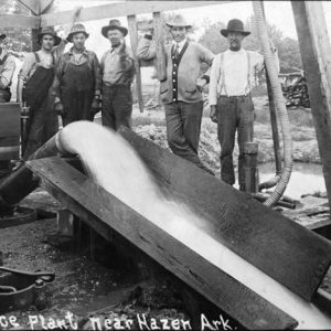
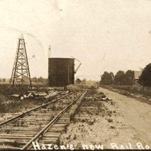
Hazen is located near the center of Prairie County, approximately forty-three miles directly east of Little Rock (Pulaski County) on Highway 70 and Interstate 40. It is in the northern part of the Grand Prairie, land once thought good only for growing prairie hay and wild animals. Louisiana Purchase through Early Statehood The town is named for Dr. William Cogswell Hazen, who came to the area from Covington, Tennessee, with his family and twenty-one slaves in 1854. He settled in a spot 1.3 miles north of present-day Highway 70 and one mile west of Highway 63, in a place where the prairie ends. Hazen persuaded family friend the Reverend John W. Hudson to come with them. Hudson settled three miles …

Hearn (Clark County)

Hearn is an unincorporated community located about four miles northwest of Arkadelphia (Clark County) along Arkansas Highway 8 in Clark County. The community is closely tied with Arkadelphia. Early settlers include Gabriel Denton, who obtained a federal land patent for just over 439 acres in 1837. John Buck obtained forty acres in 1839. Buck lived on the land with his family, totaling fifteen people according to the 1840 federal census. He appeared in the 1850 census along with his wife, son, and daughter, owning $600 of real estate. Buck appeared in the 1860 census with his wife and daughter and is listed as owning $800 of real estate, with $2,400 of personal property. He also owned an enslaved sixteen-year-old girl …

Heber Springs (Cleburne County)

Heber Springs, the county seat of Arkansas’s youngest county, has been identified as a tourist area from the beginning. Even before the town was formed, the area was known for its mineral springs. Since the formation of Greers Ferry Lake on the Little Red River in the early 1960s, the town has become a popular resort for camping, boating, and other water sports. Pre-European Exploration At least 10,000 years ago, people hunted and foraged in the land that would become Cleburne County. At some point nearly 2,000 years ago, they began to domesticate plants, including corn and squash, and around 1,000 years ago they established settled communities with substantial houses, especially in the river valleys. Over 200 archaeological sites are known …

Hebron (Clark County)

Hebron is a rural community in Clark County located about nine miles east of Gurdon (Clark County). Extremely isolated and only accessible by county roads, the community looks much as it did when it was founded in the nineteenth century. An alternative spelling of the name of the community is Hebren. Early landowners in the area include James Nunn, who obtained a Federal Land Patent for forty acres in 1855 and an additional forty in 1859. Appearing in the 1860 federal census, Nunn was listed as a blacksmith with no family members, $600 of real estate, and seventy-five dollars of personal property. Eli Cole and Levi Whitton together acquired 160 acres in 1858, and no other patents were issued in …

Hector (Pope County)

The town of Hector is on Arkansas State Highway 27, about seventeen miles north of Atkins (Pope County) and just south of the Ozark-St. Francis National Forest. It has an elementary school and a high school that serve the children of northern Pope County. One of the first settlements in Pope County was Boiling Springs, about a mile west of what became Hector. A large Methodist camp meeting was held at Boiling Springs early in the 1830s, while Arkansas was still a territory. After the meeting, a Methodist congregation was established at the site, led by five preachers: Mahlon Bewley and his sons John, Robert, George, and Nelson. A log building was constructed for the congregation in 1832. School classes …

Hedges (Stone County)

Hedges is a historic community located on Gunner Pool Road (Highway 93) about a mile northeast of Fifty-Six (Stone County) and about two miles north-northeast of the recreational area known as Gunner’s Pool, a popular camping, swimming, and fishing site in Stone County. This area is part of the Ozark National Forest. Native Americans hunted and fished in the Hedges area at least 1,000 years ago, as evidenced by a skeleton discovered in 1955 during the first systematic exploration of the caverns by cavers. The skeleton had a fractured skull, fractured ribs, and a fractured leg. How this explorer entered the cave is unknown. Radiocarbon dating of the remains of a cane and wooden torch indicates that prehistoric human exploration …

Helena-West Helena (Phillips County)

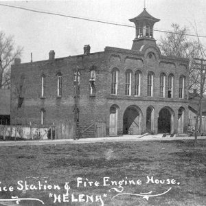
Helena-West Helena is located on the Mississippi River about seven and a half miles below the mouth of the St. Francis River. Helena was incorporated in 1833 and prospered as a river port, while West Helena began as a railroad town, incorporated in 1917. The two cities united their school systems in 1946 and merged into one city (preserving both names) on January 1, 2006. Louisiana Purchase through Early Statehood Two land speculators, Sylvanus Phillips and William Russell, created the present town site of Helena, which was originally part of a Spanish land grant. Phillips, who played the major role in the establishment of the town, arrived in the area about 1797 and moved to the present site of Helena …