calsfoundation@cals.org
Boeuf River
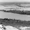
Flowing from southeastern Arkansas into northeastern Louisiana, the Boeuf River is a shallow stream important to agricultural efforts in both states. The drainage basin for the river in Arkansas includes more than 1.24 million acres.
According to the U.S. Geological Survey, the river begins in Chicot County, west of Ashton (Chicot County). Maps show various drainage ditches originating as far north as Jefferson County traveling southward and eventually feeding into the river.
The name of the river comes from the French word for beef. The Spanish commandant of the Ouachita District in 1784 is credited with one of the earliest uses of the name. However, other sources state that the river was mentioned as early as 1685. The beef referenced in the name are buffalo that once lived along the banks of the stream.
Various roadways cross the river in Chicot County, including U.S. Highway 82, Arkansas Highway 160, and Arkansas Highway 8. At least one county road also crosses the river, and all crossings include modern concrete bridges. Highway 8 is also known as Boeuf Street in Eudora (Chicot County).
The river does not flow through any settlements while in Arkansas. Surrounded by farmland, the stream serves to drain excess water from the surrounding countryside. The lower portion of the river is navigable, and steamboats regularly used the waterway in the late nineteenth and early twentieth centuries. The inconsistent water levels of the stream prevented these boats from reaching the upper portion of the river, however, and reports claim that even in times of high water, steamboats could not come within thirty miles of the Arkansas state line. Unpowered rafts and boats could be used to descend the river, allowing some early settlers a way to move materials, although the river was not typically utilized in this manner due to its proximity to the Mississippi River, just ten to fifteen miles to the east. During the Civil War, the river marked the extent of Federal excursions launched from landings along the Mississippi River in Chicot County.
The river serves as an important waterway in northeastern Louisiana. Multiple businesses and organizations there are named for it, as well as the Boeuf River Wildlife Management Area. The Boeuf joins the Ouachita River north of Harrisonburg, Louisiana. William Dunbar recorded the location of the mouth of the river in his journal during his 1804–1805 expedition up the Ouachita River with Robert Hunter.
In Arkansas, the most important aspect of the river is the flood control it provides to the surrounding countryside. Much of the area drained by the river is low lying and flat, making it ideal for large fields filled with row crops. With numerous creeks and drainage canals feeding into it, the Boeuf River provides an important avenue for flood relief in the area. Efforts in the early twentieth century to build a floodway relief structure incorporating the Boeuf River from Eudora downstream into Louisiana did not come to fruition, as other projects completed in a more timely manner made the effort unnecessary.
The Boeuf River continues to be an important waterway for the agricultural industry in southeastern Arkansas.
For additional information:
Barks, C. Shane, James C. Petersen, and Faron D. Usrey. “Water-Quality, Biological, and Habitat Assessment of the Boeuf River Basin, Southeastern Arkansas, 1994-96 / Prepared in Cooperation with the Arkansas Soil and Water Conservation Commission.” Water-Resources Investigations Report: 02-4187. Little Rock, AR and Denver, CO: U.S. Dept. of the Interior, U.S. Geological Survey; U.S. Geological Survey, Branch of Information Services, 2002.
“By the Boeuf.” Richland Beacon-News, February 2, 1963, p. 5.
Dickinson, Samuel Dorris. “Colonial Arkansas Place Names.” Arkansas Historical Quarterly 48 (Summer 1989): 137–168.
Doyle, Daniel R. “The Civil War in the Greenville Bends.” Arkansas Historical Quarterly 70 (Summer 2011): 131–161.
Wernet, Mary Linn. “The United States Senator Overton Collection and the History It Holds Relating to the Control of Floods in the Alluvial Valley of the Mississippi, 1936–1948.” Louisiana History: The Journal of the Louisiana Historical Association 46, no. 4 (2005): 449–464.
David Sesser
Southeastern Louisiana University


Comments
No comments on this entry yet.