
501-918-3025
calsfoundation@cals.org
calsfoundation@cals.org
| Latitude and Longitude: | 34°02’10″N 093°25’15″W |
|---|---|
| Elevation: | 299 feet |
| Area: | 0.51 square miles (2020 Census) |
| Population: | 113 (2020 Census) |
| Incorporation Date: | October 26, 1897 |
Historical Population as per the U.S. Census:
|
1810 |
1820 |
1830 |
1840 |
1850 |
1860 |
1870 |
1880 |
1890 |
1900 |
|---|---|---|---|---|---|---|---|---|---|
|
– |
– |
– |
– |
– |
– |
– |
– |
– |
197 |
|
1910 |
1920 |
1930 |
1940 |
1950 |
1960 |
1970 |
1980 |
1990 |
2000 |
|
– |
– |
210 |
233 |
209 |
163 |
182 |
194 |
160 |
156 |
|
2010 |
2020 |
|
|
|
|
|
|
|
|
|
117 |
113 |
|
|
|
|
|
|
|
|
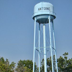
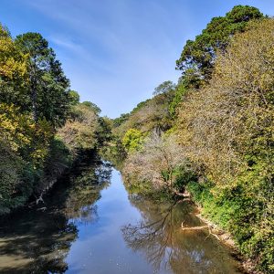
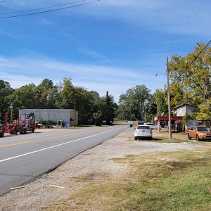
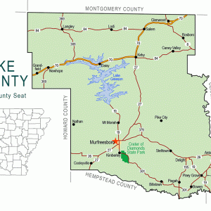
Antoine is located in the southeastern corner of Pike County on Highway 26, between Murfreesboro (Pike County) and Arkadelphia (Clark County). It was one of the first settlements in what is now Pike County. The town sits on a hill with an elevation of 300 feet above sea level. The Antoine River, which is thirty-five miles long, rises from multiple streams in the Ouachita Mountains and flows by Antoine, running into the Little Missouri River near Okolona (Clark County).
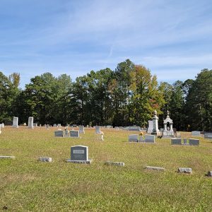
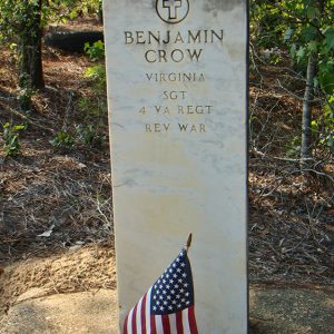
Native Americans and French trappers operated on the land around Antoine during the 1700s. The town was reportedly named for one of the French trappers. He was found dead at his camp, near the road, and the only identification to be found was the name “Antoine.” The citizens buried him on a hill above the river. People covered his grave with small stones and chiseled “Antoine” on a large stone and placed it on his grave. The area around the grave became the town’s cemetery. Antoine’s tombstone disappeared in later years.
Antoine was one of the finest settlements in that area. It was a stopping place for travelers on the Southwest Trail (Old Military Road) on their way to Texas in the early 1800s. Two bois d’arc (or bodark) trees marked the Southwest Trail, which followed what is now Antoine’s Main Street, on Highway 26.
Antoine did not see much military action during the Civil War, though the Skirmish at Terre Noire Creek took place near the community. During the war, Union soldiers reportedly encountered two young boys who were coming back with their family’s corn from the local grist mill, took the corn, and then hanged the boys from a large chinquapin tree.
In the late 1860s and early 1870s, a major railroad was established through southwestern Arkansas. The route ran about twenty miles southeast on the former main artery of commerce, bypassing Antoine. Towns situated on the old route saw their customers leaving also. Antoine experienced a slow decline and never recovered.
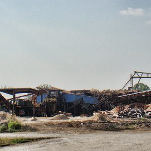
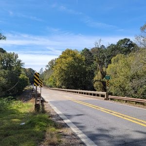
In the early 1890s, there was a logging and railroad boom, so the citizens had work that lasted through the Depression years. During this time, the railroad connected with Gurdon (Clark County) to the south, Amity (Clark County) to the north, and Delight (Pike County) to the west. A railroad trestle over the Antoine River was built in 1908. It remains across the road, but the train is not in use today. By 1890, Antoine included a bank, a school, a cotton gin, a post office, several churches, a grist mill, a bottling works, a blacksmith, a cafe, and a pool hall.
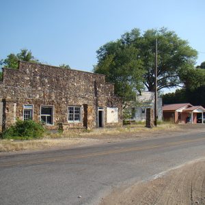
About 1911, the entire south side of Antoine—which had the bank, hardware store, and several other stores—burned. Another fire, sometime later, destroyed a hotel. In 1947, the school burned. The citizens decided to not replace it but to consolidate with Delight, as Antoine’s high school students were already going to Delight. One of the state’s surviving Rosenwald Schools for African Americans is 2.3 miles west of Antoine.
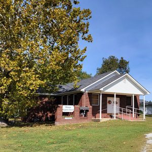
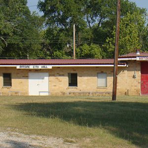
Twenty-first-century residents of Antoine depend on ranching, logging, and truck farming. Many work in nearby towns. As of 2012, Antoine has three churches, a city hall, a fire department, and a small collection of businesses.
For additional information:
Early History of Pike County, Arkansas: The First Hundred Years. Murfreesboro, AR: Pike County Archives and History Society, 1989.
Pike County Archives: A Look at the Past. Murfreesboro, AR: Pike County Archives and History Society, 1995.
Pike County Archives and History Society. http://www.pcahs.org/ (accessed February 7, 2024).
Doris Russell Foshee
Murfreesboro, Arkansas


Comments
No comments on this entry yet.