calsfoundation@cals.org
Alpena (Boone and Carroll Counties)
| Latitude and Longitude: | 36°17’41″N 093°17’32″W |
| Elevation: | 1,142 feet |
| Area: | 1.33 square miles (2020 Census) |
| Population: | 374 (2020 Census) |
| Incorporation Date: | May 31, 1913 |
Historical Population as per the U.S. Census:
|
1810 |
1820 |
1830 |
1840 |
1850 |
1860 |
1870 |
1880 |
1890 |
1900 |
|
– |
– |
– |
– |
– |
– |
– |
– |
– |
– |
|
1910 |
1920 |
1930 |
1940 |
1950 |
1960 |
1970 |
1980 |
1990 |
2000 |
|
– |
250 |
361 |
313 |
304 |
283 |
309 |
344 |
319 |
371 |
|
2010 |
2020 |
|
|
|
|
|
|
|
|
|
392 |
374 |
|
|
|
|
|
|
|
|
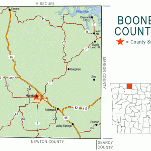
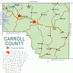
Alpena is a town located predominately in western Boone County, although the town has, since the 2000 census, recorded some of its population also living across the county line in Carroll County. Created by the railroad early in the twentieth century, Alpena is on U.S. Highway 62 and is home to about twenty small businesses.
The area was originally part of Carroll County when white settlers began claiming land in the Ozark Mountains. The fertile land along Long Creek attracted John Boyd, who received a land grant in 1849. He was joined by William J. Estes in 1860 and Bailey Stone in 1861. As Carrollton (Carroll County), then the county seat, was only a few miles away, the residents could not escape the upheaval caused by the Civil War. In 1862, some 3,000 Union troops camped in the area, and after the Battle of Prairie Grove in December of that year, more than 20,000 Union soldiers were stationed at Carrollton. Skirmishes were fought in the area in 1863 and 1864, and guerrilla fighters controlled the area until the end of the war. The only structures surviving in Carrollton at the end of the war were two stables. Violence even continued after the war. The new county courthouse was burned to the ground in 1866.
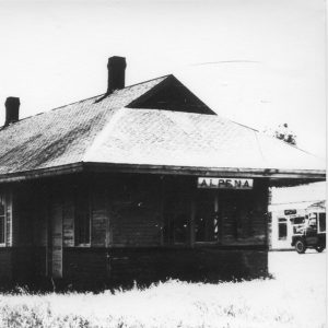
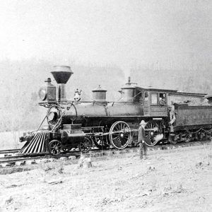
Construction of the Missouri and North Arkansas (M&NA) Railroad in the opening years of the twentieth century spelled the end of Carrollton and the beginning of Alpena. Alpena was originally a railroad workers’ camp, but when the route of the railroad missed Carrollton by three miles, businesses began to relocate at the camp, sometimes disassembling their buildings in Carrollton to reassemble them at the camp. A post office was approved in 1901; it was briefly known as Estes before it was renamed Alpena Pass. When the town was incorporated in 1913, the name was shortened to Alpena. The town’s website claims that the name was that of one of the railroad cooks. Local farmers cut timber to sell ties to the railroad, and the town was platted in November 1900.
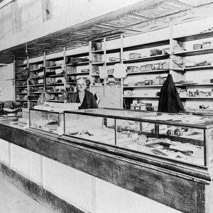
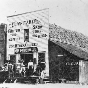
A Methodist church was established in 1902. At first, members met in the building of Mount Pisgah Baptist Church (which had been established in 1893), but the Methodists built a church of their own in 1921. Soon after its founding, the town of Alpena had three general stores, two hotels, a drugstore, a poultry house, a livery stable, a school with fifty pupils, a lumber yard, two churches, three real estate agents, a restaurant, a barber shop, two blacksmith shops, a physician, a printing office, and a population estimated at 450. By 1908, it had six general stores, a millinery shop, a bank (organized in 1907), and a flour mill, as well as retaining most of the earlier features. A tomato-canning factory opened in 1910.
By 1920, Alpena had become a timber and lumber shipping point and a trade center for the surrounding area, with farm products from Boone County and Carroll County being loaded onto the trains at Alpena. Along with the bank, churches, and school, the town also had a sawmill, a hub and spoke factory, and several woodworking mills.
William Halbrook became county examiner for Boone County’s schools in 1925, and he spent the next eight years consolidating the county’s many schools into eight school districts. The Alpena school district was one of eight that remained; in 2013–14, the Alpena School District served about 500 students in grades K–12.
The Flood of 1927 overflowed Long Creek, threatening many homes and businesses, and the Depression devastated the local businesses after the flood. The bank closed in 1931. Highway 62 was extended to Alpena in 1933, providing some stability to local businesses.
Flooding around the middle of the century doomed the M&NA, which went out of business in 1961. Alpena continued to thrive, however, depending upon business provided by the highway. Several thousand vehicles pass through Alpena each day. Its twenty businesses include a car wash, auto service and repair shops, a beauty shop, a monument works, two gas stations with convenience stores, three restaurants, a sewing center, two resale stores, and several quilt shops and arts/crafts/gift shops. There are three Baptist churches, a Methodist church, and an Assembly of God.
For additional information:
Alpena, Arkansas. https://carrollcountyar.com/alpena.php (accessed November 19, 2025).
Cecil, Earnest H. “Alpena High School 1927, A Backward Look.” Boone County Historian 13 (1990): 246–250.
Handley, Lawrence R. “Settlement Across Northern Arkansas as Influenced by the Missouri & North Arkansas Railroad.” Arkansas Historical Quarterly 33 (Winter 1974): 273–292.
Logan, Roger V., Jr. History of Boone County Arkansas. Paducah, KY: Turner Publishing Company, 1998.
Steven Teske
Butler Center for Arkansas Studies



Comments
No comments on this entry yet.