501-918-3025
calsfoundation@cals.org
calsfoundation@cals.org
As one of the twelve wilderness areas partially or entirely located in the state, the Upper Buffalo Wilderness Area preserves the beauty of the Buffalo River and the surrounding Ozark Mountains. The wilderness area is notable for the inclusion of Hawksbill Crag, a popular hiking location, and is entirely located in Newton County. Wilderness areas are locations of notable natural beauty with no or minimal development by humans.
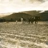
Settlers in what would become the Upper Buffalo Wilderness Area began to arrive in the mid-nineteenth century. The first land patent issued in the area was recorded in 1860 when Henry McLaughlin received forty acres. His land was located about one mile west of Arkansas Highway 21, near the location of Magnolia Falls. More substantial numbers of settlers began to arrive in the 1880s, with large numbers of land patents being issued from 1882 through the first two decades of the twentieth century.
President Theodore Roosevelt established the Arkansas National Forest in 1907, including lands located south of the Arkansas River that later became the Ouachita National Forest. The following year, he established the Ozark National Forest by proclamation for lands located on the north side of the river. Additional lands have been added to the forest over the decades, and by 2025, the forest included more than one million acres.
The Wilderness Act of 1964 led to the preservation of more than nine million acres of land across the country. Signed into law by President Lyndon B. Johnson, it created additional protections for land already under federal control to preserve undeveloped areas of the country. The first areas under the act were created in September 1964. Additional lands continued to be designated, and the Upper Buffalo Wilderness was officially created on January 3, 1975, along with the Caney Creek Wilderness, located in the Ouachita National Forest. The two areas were the first in Arkansas to be so designated.
The Upper Buffalo Wilderness Area contains more than 12,000 acres of land and is located about seventeen miles northwest of Deer (Newton County) and about fourteen miles southwest of Ponca (Newton County). The area that includes the wilderness was purchased by the National Forest over a period spanning the 1930s and 1940s. Additional acreage was added following the 1984 Arkansas Wilderness Act. Access to the extremely rugged terrain is available via gravel National Forest roads. The only trail located in the wilderness leads from a parking area to Hawksbill Crag. Several old logging roads also cross the wilderness and are available to hikers and equestrians. The area includes a variety of plants, with second- and third-growth hardwoods covering much of the wilderness. Isolated pockets of shortleaf pine are located in former agricultural fields.
The Upper Buffalo Wilderness preserves the stark beauty of the Ozarks and offers visitors a glimpse into what the area looked like before settlement.
For additional information:
“Upper Buffalo Wilderness Area.” Ozark-St. Francis National Forest. https://www.fs.usda.gov/r08/ozark-stfrancis/recreation/upper-buffalo-wilderness-area (accessed June 18, 2025).
David Sesser
Southeastern Louisiana University


Comments
No comments on this entry yet.