calsfoundation@cals.org
Narrows Dam
aka: Lake Greeson
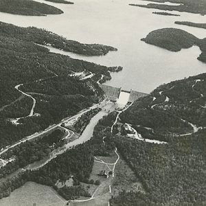
Narrows Dam is located six miles north of Murfreesboro (Pike County). Authorized by the Flood Control Act of 1941, it was constructed on the Little Missouri River as a project for flood control and hydroelectric power. The Little Missouri River flows through the Ouachita Mountains and enters Pike County at its northwest upper corner, dropping 1,035 feet before it runs into Lake Greeson. Before the dam was constructed, heavy rains in the mountains often caused the area around Murfreesboro to become flooded, causing damage to houses and resulting in loss of livestock and farm crops.
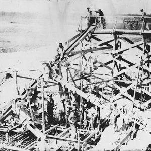
Martin White Greeson, the owner of the Murfreesboro-Nashville Southwest Railroad, urged the development of the watershed in order to control the water of the Little Missouri for beneficial purposes. Greeson was also a lawyer and a member of Arkansas State Flood Control Commission. In 1900, he began campaigning for a dam to control the Little Missouri River. The project was approved by Congress in 1941. The work was delayed by World War II, but construction by the U.S. Army Corps of Engineers finally began in April 1947. The first bucket of concrete was poured on June 1, 1948. The dam was completed in 1950, the year following Greeson’s death, and was dedicated in 1951.
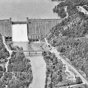
The dam, which is a gravity dam with a concrete core and a rock foundation, blocks a 941-foot valley between two bluffs. The dam rises 183.5 feet above the Little Missouri, protecting some 93,000 acres of farmland and residential homes. As this area was known as “the Narrows,” the dam was called Narrows Dam. The reservoir was named Lake Greeson after the project’s main proponent. The powerhouse of the dam is located adjacent to the east abutment and has three 8,500-kilowatt-hour (KWh) generating machines, the third one having been installed in 1969. The average power annually generated is 28,000,000 KWh. Its maximum discharge is 42,300 cubic feet per second.
A spillway at the top of the dam contains walls to control the flow of the water. A stilling basin at the foot of the spillway protects the base from erosion. The water has spilled over the spillway twice, in 1968 and 2009. Each time, the areas below the dam along the river were flooded, but not nearly as badly as in the days before the dam was built.
For additional information:
Gettinger, Aaron. “Power Generation Halted at Narrows Dam.” Arkansas Democrat-Gazette, January 6, 2024, p. 4D. https://www.arkansasonline.com/news/2024/jan/06/us-army-corps-hydropower-production-at-lake/ (accessed January 8, 2024).
“Lake Greeson.” U.S. Army Corps of Engineers. http://www.mvk.usace.army.mil/Missions/Recreation/LakeGreeson.aspx (accessed March 9, 2022).
Miller, John. “Greeson’s Hard Work Built Dam.” Nevada County Picayune. July 5, 1995; online at http://depotmuseum.org/articles.php?article=23 (accessed March 9, 2022).
“The Narrows Is Newest Arkansas Dam.” Arkansas Gazette. September 17, 1950, p. 1B.
Doris Russell Foshee
Murfreesboro, Arkansas




Comments
No comments on this entry yet.