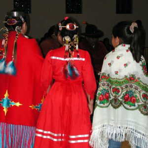
 Caddo Dancers
Race and Ethnicity: Native American - Starting with C
Caddo Dancers
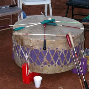 Caddo Drum
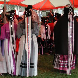 Caddo Hair Ornaments
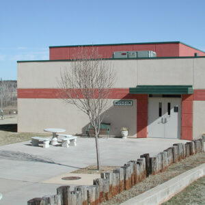 Caddo Heritage Museum
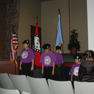 Caddo Honor Guard
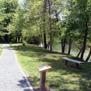
Caddo Indian Memorial
The Caddo Indian Memorial is located on the site of a Native American burial ground on the outskirts of Norman (Montgomery County) on Arkansas Highway 8 East. Open year-round and free to the public, it contains the Elmo Clark Honor Path, which runs a quarter of a mile along the perimeter. This allows visitors easy access to the twenty-one signs that explain the culture and history of the Caddo Indians. The path runs parallel to the Caddo River and its tributary, Huddleston Creek, which form the southwestern and northwestern boundaries. In October 1988, the city of Norman had begun excavation at this site for construction of a sewage treatment plant, but digging was stopped abruptly when bones and artifacts were …
 Caddo Indian Memorial
Caddo Nation
Caddo Indians enter written history in chronicles of the Hernando de Soto expedition, which describe encounters during the Spanish passage through southwest Arkansas. When the Spaniards crossed the threshold to Caddo country on June 20, 1542, they entered a nation uniquely distinguished by language, social structure, tradition, and way of life. Caddo people were sedentary farmers, salt makers, hunters, traders, craftsmen, and creators of exquisite pottery who buried their dead in mounds and cemeteries with solemn ritual and a belief that the dead traveled to a world beyond this. Caddo language was unlike any spoken by other groups the Spaniards met as they explored northeast Arkansas and the Southern states east of the Mississippi River. Caddo communities—called villages or towns …
Carden Bottom
Carden Bottom (also known as Carden’s Bottom or Carden Bottoms) is a rich alluvial flood plain in northeastern Yell County created by the Arkansas River and internationally known for its rich archaeological heritage. Named for the James Carden family who settled there in the early 1800s, it is bounded by the Petit Jean River and Petit Jean Mountain, Holla Bend National Wildlife Refuge, and the Arkansas River. The area’s farmers produce large crops of sorghum, soybeans, corn, winter wheat, and hay. Archaeological investigations from the early 1990s indicate that some of these acres were also farmed from 500 to 1,500 years ago by Native Americans (Woodland through Mississippian cultures). A foraging lifeway extended as far back as 11,500 years ago …
Casqui
Casqui was a Native American chief who ruled over a province in northeastern Arkansas in the 1500s. He was the first Indian leader in Arkansas whose 1541 dealings with the Spanish explorer Hernando de Soto are recorded in detail in the accounts of the expedition. Casqui was thus the earliest Arkansan about whom we have written historical information. In the Spanish writings, his name was variously recorded as Casqui, Casquin, or Icasqui. The explorers used his name to refer to him, the town in which he resided, and the area over which he ruled. Knowledge of Casqui himself is limited, but the narratives provide interesting details about his people and the territory under his control, as well as some of …
Cherokee
The Europeans named the Cherokee as one of the Five Civilized Tribes. (The other four were the Chickasaw, Choctaw, Creek, and Seminole.) At the time of European contact, the Cherokee inhabited a region consisting of what is now western North Carolina and parts of Virginia, Georgia, and eastern Tennessee. Over the next two centuries, the tribe expanded through the southern Appalachians, reaching further into Georgia as well as into South Carolina, northeastern Alabama, and across the Cumberland River into Kentucky and West Virginia; some of this expansion occurred following the displacement of other tribes. By the 1780s, Cherokee migration into Arkansas had begun, largely in response to pressure to move away from Euro-American settlements in the East following the Revolutionary …
 Cherokee Bill
Cherokee Boundary Line
aka: Old Cherokee Boundary Line
The Old Cherokee Boundary Line served as the eastern border of the first land set aside for Native Americans in Arkansas. The Treaty of the Cherokee Agency of 1817 created the definition for the line as beginning at the confluence of Point Remove Creek and the Arkansas River near present-day Morrilton (Conway County). The line was then to be marked in a northeasterly direction to Shields Ferry on the White River. General William Rector, along with commissioners appointed by the Cherokee, conducted the original survey and filed a report with the Government Land Office in 1819. Rector reported a distance of seventy-one miles and fifty-five chains. Rector’s survey and report were intended to satisfy both some Cherokee residents and some …
Chickasaw
Heading east, the ancestral Chickasaw crossed Arkansas looking for a new homeland at some point in prehistory. Heading west beginning in 1836, the Chickasaw crossed Arkansas again as the tribe was removed to its new home in Indian Territory. Between these two events, the Chickasaw interacted periodically with tribes living in Arkansas, most notably the Quapaw, whom they warred against during much of the eighteenth century. In all versions of the Chickasaw migration story, the people came from the west, usually from central Mexico. They were led by twin brothers Chatah and Chikasa, who followed a divinely inspired fabusa, or leaning pole. In these versions, the people necessarily must have passed through the land that became Arkansas to get to …
Childers, John (Execution of)
On August 15, 1873, a Cherokee man named John Childers was hanged at Fort Smith (Sebastian County) for the 1870 murder of Reyburn Wedding. In his book Law West of Fort Smith, Glenn Shirley describes Childers as “strong, of muscular build, five feet eleven inches in height,…twenty-four years old.” Childers, whose father was white, was born in Cowskin Creek in the Cherokee Nation. According to Shirley, “He had spent his childhood in wickedness.” In October 1870, Childers met a man named Reyburn Wedding, an Indian trader, near Caney Creek in the Cherokee Nation, just below the Kansas line. Wedding’s wagon was pulled by a splendid black horse, and Childers tried to negotiate a trade. After an extended bargaining session, Wedding …
Choctaw
The Choctaw are of the Western Muskogean language stock, which is also the same stock as the Chickasaw. When first encountered by Europeans, the Choctaw were located in three geographic divisions in the area that is now Mississippi and western Alabama. The three divisions each had some distinguishing cultural practices, which may indicate they had separate origins and that the Choctaw came together as a single people only in more recent times. There are two widespread traditions within the Choctaw about their origins. One is that they came from the far west and were led eastward by a sacred pole that was placed in the ground each night; one morning, the pole did not lean but stayed straight upright near …
Choctaw Boundary Line
Determining the Choctaw Boundary Line and thus the western boundary of Arkansas below the Arkansas River was a process that involved political maneuvering, treaties with the Choctaw tribe, and other negotiations. The line was not even determined for one small strip of land until 1905. The Louisiana Purchase opened up a vast territory for the United States, and a few pioneers began to move into the lands west of the Mississippi River. In 1818, the first treaty was negotiated with the Quapaw tribe for the land west of a line that ran south from the “little rock” on the Arkansas River. The formation of Arkansas Territory in March 1819 brought more settlers. The settlers considered the lands to be in …
Choctaw Scrip
Land ownership was the desire of many individuals moving west across the United States in the nineteenth century. A person who obtained the initial title for a parcel of land in the public domain states, such as Arkansas, was issued a patent—that is, a deed transferring land ownership from the U.S. government to a buyer. Patents were obtained by various methods. Perhaps the least understood method was the use of Choctaw Scrip certificates to obtain a patent. Descendants of original Arkansas land owners finding Choctaw names on their patents often believed their ancestors either bought the land directly from the Choctaw or were, in fact, Choctaw themselves. The origins of Choctaw Scrip go back to the U.S. government’s plan to …
 Ned Christie
Crenshaw Site
The Crenshaw Site was a large village and ceremonial center occupied from about AD 700 to 1400 along the Red River in Miller County in southwestern Arkansas; the site is listed on the National Register of Historic Places. The large size of the site (estimated at approximately eighty acres), along with limited archaeological investigations, hampers reconstruction of the site’s cultural history. The prevailing archaeological interpretation of the site is that it was first occupied by the Fourche Maline culture (AD 700–900) and developed into a significant village. Numerous earthworks were constructed, including at least four (and perhaps six) mounds and a raised causeway that connected two of the larger mounds. Evidence for a sizeable population includes a midden deposit (soil …
Crumpton, Boudinot (Execution of)
aka: Bood Burris (Execution of)
Boudinot Crumpton, twenty-two, sometimes known as Bood Burris, was hanged on June 30, 1891, in Fort Smith (Sebastian County) for a murder he denied having committed. Boudinot Crumpton, who was a Cherokee man, and his companion Samson Monroe Morgan, a twenty-six-year-old native of Georgia, set out from Morgan’s residence in the Indian Territory (present-day Oklahoma) on the morning of Sunday, November 3, 1889, riding a pair of Morgan’s horses. Crumpton returned later that day riding one horse and leading the other and “having in possession Morgan’s overcoat, gun and pistol.” Crumpton explained that they had encountered a man in a buggy who had offered Morgan a job herding horses in the Pawnee Nation, and so he had returned alone. Around …


