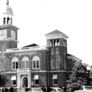
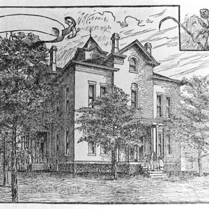
 Bradley County Courthouse
Entry Type: Place - Starting with B
Bradley County Courthouse
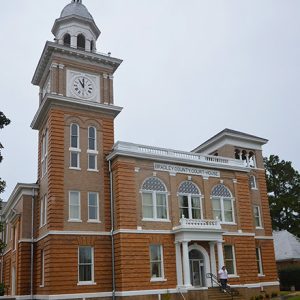 Bradley County Courthouse
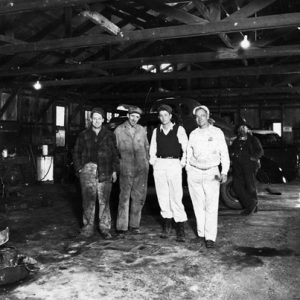 Bradley Motor Co.
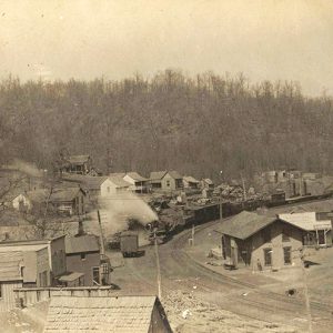
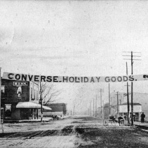
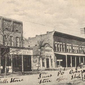
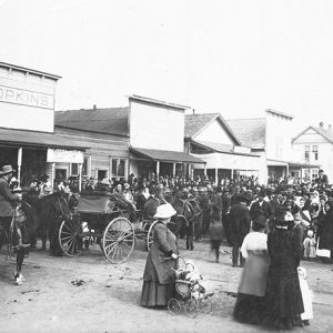 Branch Street Scene
Branch (Franklin County)
The city of Branch developed in southern Franklin County around the beginning of the twentieth century as coal mining was being conducted in the area. Located on the rail line, the city began to decline when the railroad ceased operation, but it has since become an educational hub for the region. What is now Franklin County was hunting and fishing land for the Osage when the United States first acquired the land in the Louisiana Purchase of 1803. For a decade, the area was granted by treaty to the Cherokee, but after the Osage and the Cherokee had both been moved farther west, the land opened for settlement. Land claims were slow to develop in the area, but brothers Samuel and …
 Branch Normal College
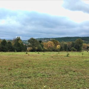 Brawley Environs
Brawley (Scott County)
Brawley is an unincorporated community in western Scott County located near Lake Hinkle. Named for the family who settled in the area, Brawley was established in 1860 at the base of Walker Mountain along Jones Creek, a tributary of the Poteau River. Agriculture and timber have contributed to the economy and way of life in Brawley. Prior to European exploration, the area surrounding Brawley was an unexplored wilderness. Several species of wildlife that no longer inhabit the area, such as elk and buffalo, were present throughout the region. Numerous archaeological sites and burial mounds are located along the banks of prominent waterways such as the Fourche La Fave and Poteau rivers. Archaeological findings have provided evidence of early inhabitants dating …
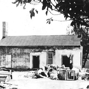
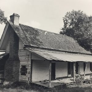 Brazeale Homestead
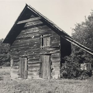 Brazeale Homestead
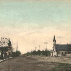
 Brentwood Street Scene
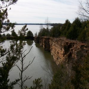 Brewer Lake
Briarcliff (Baxter County)
Briarcliff is a resort community located on Highway 5 between Mountain Home (Baxter County) and Norfork Lake. It is adjacent to the similar community of Salesville (Baxter County). The first non–Native American family to live on the land that is now Briarcliff was the James Tracy family. They were descendants of a French veteran of the American Revolutionary War who had lived in both North Carolina and South Carolina before moving west to seek new farmland. Tracy arrived in northern Arkansas in the 1850s and purchased land in what was then eastern Marion County. According to family accounts, Tracy was murdered and his store pillaged by freed slaves during the Civil War. His son continued to farm the land after …
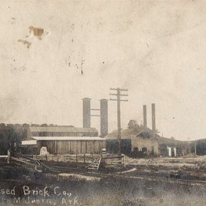 Brick Company
Brickeys (Lee County)
The town of Brickeys existed in Lee County for about forty years before its incorporation was allowed to lapse. Its name remains in the twenty-first century as the location of the East Arkansas Regional Unit of the Arkansas Department of Correction. When Lee County was created in 1873, much of the county consisted of plantations that had been worked by slaves before the Civil War and continued to be worked by tenant farmers after the conclusion of the war. The remaining areas were wetlands, interspersed with a few spots of high ground. In 1913, the Missouri Pacific Railroad created a line connecting Marianna (Lee County) with Memphis, Tennessee. Brickeys was one of the stops along that line (known locally as the Marianna …
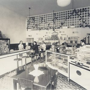 The Bright Spot Interior
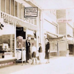 The Bright Spot
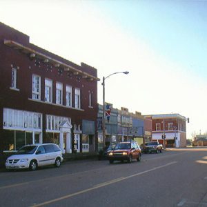
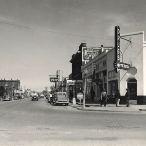
 Brinkley Street Scene
Brinkley (Monroe County)
The town of Brinkley in Monroe County sits just south of Interstate 40, halfway between Little Rock (Pulaski County) and Memphis. In addition to being a center for railroad traffic and agriculture, Brinkley has become known for its recreational opportunities, which include hunting, fishing, hiking, and boating. Since 2004, Brinkley has also associated its image with the ivory-billed woodpecker, which was seen in the nearby Dagmar Wildlife Management Area. Early Statehood through Reconstruction In 1852, the state of Arkansas presented a land grant in the northern part of Monroe County to the Little Rock and Memphis Railroad Company, an enterprise promoted by Robert Campbell Brinkley, a leading resident of Memphis, Tennessee. The community was incorporated in 1872 and named for this early …
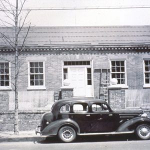
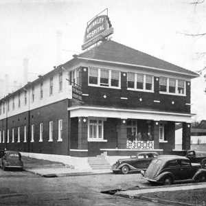 Brinkley Hospital
 Brinkley Street Scene
 Brinkley Street Scene
 Brinkley Street Scene
 Brinkley Street Scene
Britt (Clark County)
Also known as Britts and Britt’s Switch, Britt is an unincorporated community located in southern Clark County. Situated about three miles west of Beirne (Clark County), the community lies about three miles east of the Little Missouri River. The community lies near the railroad tracks constructed by the Cairo and Fulton Railroad in 1873, continuing to be used today by the Union Pacific Railroad. Few records exist on the history of Britt. A post office opened in the community on July 6, 1901, under the direction of postmaster Phillip H. Gleaves. He was replaced by Frank Skinner on June 12, 1902. The post office ceased operations on March 31, 1903, with the office in Beirne taking over the service. Neither …
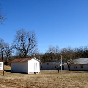 Brockwell Gospel Music School
Brockwell Gospel Music School
The Brockwell Gospel Music School offers instruction in choral and instrumental musical techniques for those who desire the improvement of church music. It operates every summer on a small campus in Brockwell (Izard County) at the intersection of State Highways 9 and 56. It was founded in 1947 as the Brockwell Music School, assumed its present name in 1962, and operates at its original site. The singing-school tradition goes back to the time of the Second Great Awakening on the American frontier in the first years of the nineteenth century. This tradition contributed significantly to the growth and power of the great revivals that especially captivated gospel-hungry settlers in the frontier South in the first third of the century. Itinerant …
Brookland (Craighead County)
The city of Brookland has been closely linked over the years to Greensboro, the earliest settlement in what is now Craighead County. Construction of railroads led to the establishment of Brookland at its current location, and the city was incorporated in 1911. When Arkansas became a state, much of its northeastern corner consisted of sloughs and swamps in the St. Francis and Cache river bottoms. The exception was Crowley’s Ridge, a narrow highland that begins in southeastern Missouri and runs south to Helena-West Helena (Phillips County). Joseph Willey moved from North Carolina to land on Crowley’s Ridge in 1835, erecting a grist mill on Lost Creek, about eleven miles north of the current city of Jonesboro (Craighead County). Other settlers joined Willey, and …
Brown Springs (Hot Spring County)
Brown Springs is an unincorporated community in Brown Springs Township located in southern Hot Spring County on Arkansas Highway 51 just north of the Clark County line. The community is about four miles northeast of Joan (Clark County) and about seven miles south of Donaldson (Hot Spring County). The name of the settlement comes from a number of springs in the area, with various sources listing the number of springs as three or five. The water emanating from the springs was infused with sulfur, iron, and copper. The Brown family arrived in the area around 1855 and placed boxes over the springs in an effort to control the flow of the water. Two of the earliest settlers in the area …
 Brownlee House
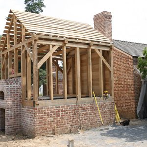 Brownlee House Renovation
 Brownlee House; 1940s
 Brownsville Baptist Church
 Brownsville Cemetery
Brownsville (Lonoke County)
Brownsville served as the county seat of Prairie County for approximately twenty-two years. Located on the Memphis to Little Rock Road, commonly known as the Military Road, it became an important trade center and was the site of a Civil War skirmish in 1863. Many settlers lived in the area by the early 1820s, but when the federal government authorized the construction of the road connecting Memphis, Tennessee, to Little Rock (Pulaski County) in 1824, more settlers were attracted to the area. Early area settler and local contractor Samson Gray was given the contract to construct the road from the White River to the north shore of the Arkansas River. The road was a major avenue of trade being used …
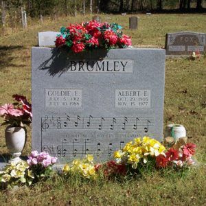 Brumley Gravesite
 Bruno
Bruno
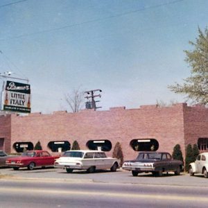 Bruno's Little Italy, 1960s
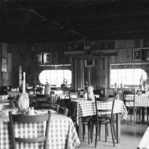 Bruno's Dining Room, 1960s
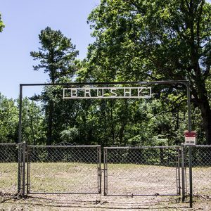 Brushy Cemetery
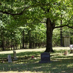 Brushy Cemetery
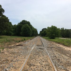 Bryan Railroad
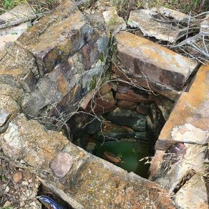 Bryan Well
Bryan (Scott County)
Bryan is an unincorporated community located in northwestern Scott County along Highway 28 north of the Poteau River. The community of Bryan was also known as Center Point and Bryan’s Spur. Agriculture has traditionally been important to the area. Prior to European exploration, Bryan was a wilderness lush with native vegetation and numerous species of wildlife—including buffalo and elk, which no longer inhabit the area. Archaeological evidence from the Archaic, Woodland, and Mississippian periods has been discovered throughout the area. Additional evidence has indicated that the Caddo tribe had a strong presence along the Poteau River and other prominent waterways. Throughout the late seventeenth and early eighteenth centuries, French trappers and explorers traveled west from the Arkansas Post along the Arkansas River. From there, they began traversing smaller …
Bryant (Saline County)
Bryant (Saline County) is a small city that is currently growing and developing into an extension of the Little Rock (Pulaski County) metropolitan area. It has a long history of local and regional significance, although it has had few residents for most of its history. The Geographical Center of Arkansas marker is located within Bryant city limits. From the early days of the railroad in central Arkansas to the construction of an interstate, Bryant has been at the forefront of transportation in the state. Louisiana Purchase through Early Statehood Bryant’s earliest inhabitants of European descent settled along Hurricane Creek in the early part of the nineteenth century. Local legend holds that these pioneers were traveling to Texas when they came upon …
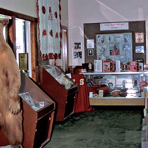 "Bear" Bryant Exhibit
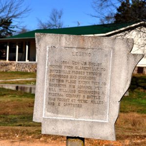 Buck Horn Marker
Buckner (Lafayette County)
Buckner is a town in northern Lafayette County, a few miles east of Stamps (Lafayette County) on U.S. Highway 82. Established by the Cotton Belt Railroad, Buckner was a lumber center early in its history, but the economy of the town in the twenty-first century is shaped more by its proximity to oil and gas fields and to poultry farms. What would become northern Lafayette County was heavily forested when Arkansas became a state in 1836. Caddo, who lived along the Red River valley, moved through the area regularly. Gradually, white settlers began to claim and clear land in the region. Because the area remained sparsely populated, the Civil War had little effect upon the area. John Colvin was farming …
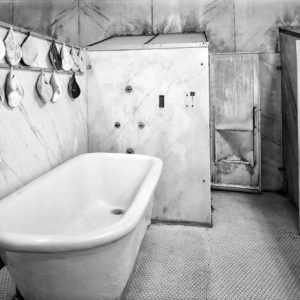 Buckstaff Bathhouse Facilities
Buckville (Garland County)
The community of Buckville, located on the upper Ouachita River in Garland County, emerged as a small town amidst the sparsely settled Ouachita Mountains after the Civil War. The town typified rural upland Arkansas with its small farms and reliance on agriculture. Following the construction of Blakely Mountain Dam in the 1950s, the waters of Lake Ouachita covered the site of Buckville. The lake’s completion necessitated a total, permanent evacuation of the town. Extensive archaeological remains exist in the upper Ouachita River valley; many fields bordering on the river contain evidence of Native American presence in the area. Caddo occupied the Ouachita Mountains in relatively small, widely dispersed settlements in the northern part of the region. By 1700, no European or Indian resident …


