 Bono
Bono
Entry Type: Place - Starting with B
Bono
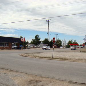
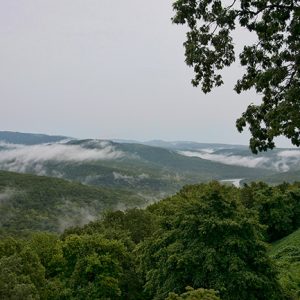
Bono (Craighead County)
Bono, originally named Bonnerville, was established in the Big Creek Township, a community formed in Greene County before Craighead County was created in 1859. After the Kansas City, Fort Scott & Memphis Railroad (Frisco) erected a train stop near Big Creek, it became one of the county’s most important business centers during the late nineteenth century. Big Creek Township, one of the oldest communities in Craighead County, was begun in 1837 by John Anderson and his son, who settled in the northwest part of the county. At that time, Big Creek Township included several small settlements, among them Trinity, Union Grove, Fifty-Six, and Paul’s Switch. Oak Ridge was the site of a Delaware village. Native Americans, including a community of …
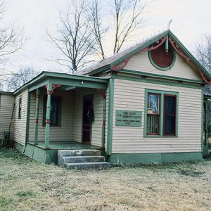
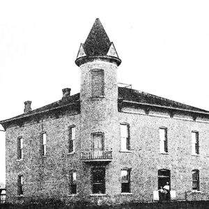
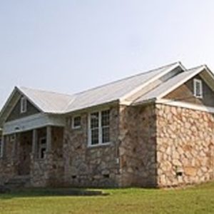
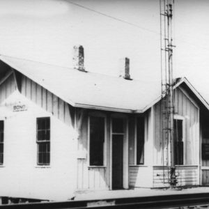 Bono Train Depot
Boone County
Located in the Ozark Mountain highlands, Boone County has endured struggles from its creation. Political, racial, and union conflicts have drawn national attention, often overshadowing the contributions of the county’s residents and businesses. Pre-European Exploration Archeological examinations of sites in Boone County indicate that Native American groups from a variety of time periods either lived or worked in the area. An examination of the Chaney-Crawford Site included points from the Archaic and Woodland periods, with a few from the Mississippian period. Evidence supports the idea that the site was occupied seasonally rather than permanently and served as a location to make tools. Louisiana Purchase through Early Statehood Although they had no communities in the area, the Osage had claims to …
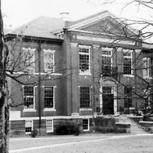 Boone County Courthouse
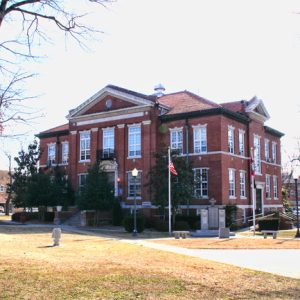 Boone County Courthouse
 Boone-Murphy-Moore House
Boone-Murphy-Moore House
The Boone-Murphy-Moore House, now located at 714 West 4th Avenue in downtown Pine Bluff (Jefferson County), was built in 1860 by Thomas A. Boone. The home played a significant role during and after the Action at Pine Bluff in 1863. Serving as the Union headquarters during the Civil War, the Boone-Murphy-Moore House was utilized as the residence of Federal commander Colonel Powell Clayton. The small wooden-frame home is a one-story, single-pile weatherboard house with one-story additions to the east and west. It is raised slightly above grade on concrete pier foundation (alteration) with a tin shingle gable roof and shed roofs on the additions. The house has flat-roofed porches with turned posts and sawn brackets that flank the building on …
Booneville (Logan County)
Booneville, one of the two Logan County seats, is a progressive community with a wide range of facilities in addition to the normal municipal services. Its commercial activity consists of retail stores and small industries. Booneville supports a community center, a senior citizens center, a community hospital, and a municipal airport. Recreational facilities include two parks and a baseball complex. Louisiana Purchase through Early Statehood One of the oldest towns in western Arkansas, Booneville was founded about 1828, when Walter Cauthron built a log cabin and opened a store near the Petit Jean River in what was then Crawford County. According to the Cauthron family tradition, he intended to name the settlement Bonneville in honor of his friend Captain Benjamin …
 Booneville
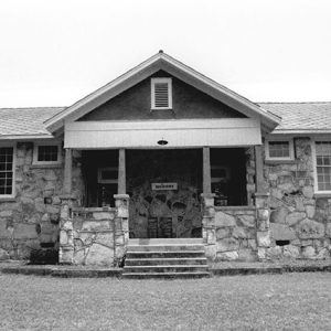
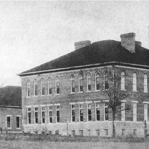 Booneville High School
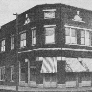 Booneville Bank
 Booneville Courthouse
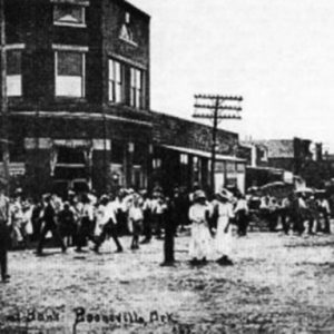
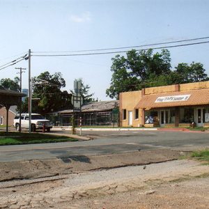
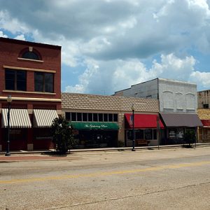 Booneville Street Scene
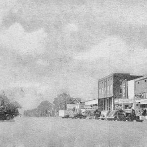 Booneville Street Scene
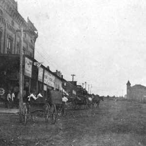 Booneville Street Scene
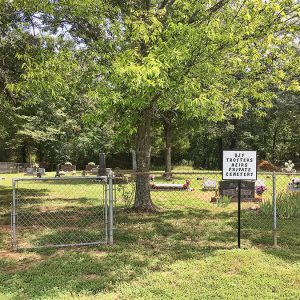 B. J. F. Trotter Cemetery
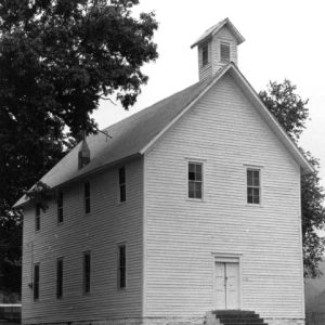
 Boothe Church
Boothe (Scott County)
Boothe is an unincorporated community in northern Scott County located along Highway 71. Boothe was established in 1889 just north of the Petit Jean River and named after the Booth family who settled in the area. The community was known as Tumlinsonville and later Tomlinson prior to being named Boothe. Agriculture has traditionally been an important way of life in the area. Prior to European exploration, the area surrounding Boothe was a wilderness. Several species of wildlife that no longer inhabit the area, such as elk and buffalo, were present throughout the region. Numerous archaeological sites and burial mounds are located along the banks of prominent waterways such as the Fourche La Fave and Poteau rivers. Archaeological findings have provided …
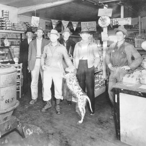
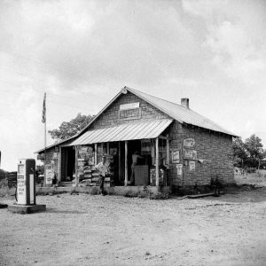 Boston General Store
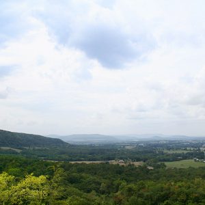 Boston Mountains
Boston Mountains
The Boston Mountains in north-central Arkansas are the southern portion of the Ozark Plateau geologic area. The Ozark Mountains extend across northern Arkansas and southern Missouri; this dome of rocks has been a relatively high area for the past 1.5 billion years. The most recent uplift of the Ozarks, including the Boston Mountains, occurred about 300 million years ago, and the mountains have been weathering and eroding since that time. This highland has the greatest relief (difference in the elevation from the valley bottoms to the mountain tops) of any formation between the Appalachian Mountains and the Rocky Mountains. The Boston Mountains portion of the Ozarks extends north of the Arkansas River Valley as a rectangle twenty to thirty-five miles …
 Boston Mountains
Boswell (Clark County)
Boswell is a community in Clark County that was most active in the late nineteenth and early twentieth centuries. Located about five miles northeast of Okolona (Clark County), the area was first settled in the 1830s. The Southwest Trail passed through the community, bringing travelers and settlers. Around 1845, Hawes Coleman moved into the area and built a plantation called “Will-Be-Do.” Coleman was a lawyer and farmer who originally lived south of Arkadelphia (Clark County) along the Ouachita River but moved his family west in an effort to escape malaria. The area was in the South Fork Township during this period. The land was sparsely settled during the Civil War. A Federal army under the command of Major General Frederick …
Boswell (Izard County)
The unincorporated community of Boswell is located in the White River valley on the western boundary of Izard County. Some of the earliest pioneers to settle there were the Jeffery, Wood, and Langston families. The Langston family arrived at Boswell during Christmas week of 1814. The Jeffery family settled in the Boswell area in 1816, and William Wood settled at Boswell in 1820. The settlers were dependent upon the river as a primary source of transportation, using keelboats and flatboats powered by men using long poles. The early pioneers erected a building that was used as a school as well as a social center. They named this small pioneer community Wideman after the creek that flowed through it. The community …
 Boswell School
 Boswell Store
 Boswell School
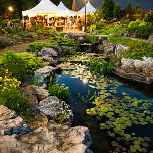 Botanical Garden of the Ozarks
Botanical Garden of the Ozarks
The Botanical Garden of the Ozarks (BGO) in Fayetteville (Washington County) opened in 2007 on acreage leased from the City of Fayetteville. The nonprofit organization is the result of a grassroots effort to establish a botanical garden with a mission of offering education, entertainment, and recreation to adults and children through a variety of events, programs, classes, and community connections. The Botanical Garden of the Ozarks is a member of the American Horticulture Society—which allows BGO members reciprocal admission to gardens and arboretums across the country—and the American Public Gardens Association, which encourages involvement in gardening for all ages. The Botanical Garden Society of the Ozarks was incorporated in January 1994. The founder and first director was Donna Porter, who …
Boughton (Nevada County)
Boughton (Nevada County) is an unincorporated community in Boughton Township. Boughton is about four miles northeast of Prescott (Nevada County) and about ten miles southwest of Gurdon (Clark County). The area around Boughton belonged to Hempstead County before Nevada County was formed in 1871. J. T. Cooper opened a general store in the Boughton area in 1872. Created by the Cairo and Fulton Railroad, Boughton served as a stop on the rail line. It was laid out in the summer of 1873 by R. F. Elgin, along with townsites at Prescott and Emmet (Nevada and Hempstead counties). Boughton and the others grew quickly as people from across the countryside were attracted to the new settlements. In 1875, the Nevada County …
Boxley (Newton County)
Located in the Buffalo River valley in the Boston Mountains of northern Arkansas, the unincorporated community of Boxley has a long and colorful past. A key strategic area during the Civil War, Boxley is now associated with conservation efforts of the late twentieth and early twenty-first centuries. Northern Arkansas was claimed by the Osage when the United States first acquired the land from France as part of the Louisiana Purchase of 1803. Although they lived in scattered communities in southern Missouri, the Osage frequented Arkansas for hunting and fishing. After a treaty removed the land from Osage control, the United States granted what would become Newton County as part of a Cherokee settlement. That treaty lasted approximately ten years, from …
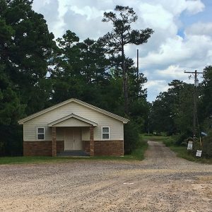
 Boxley Community Building
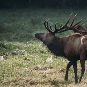 Boxley Elk
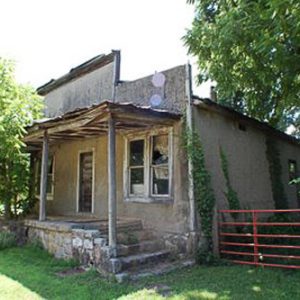
 Boyd's Store
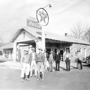 Boyd's Texaco
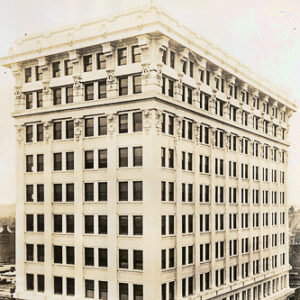 Boyle Building
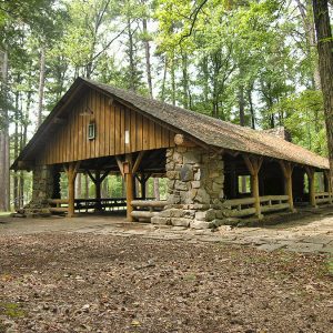 Boyle Park Pavilion
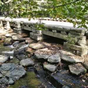 Boyle Park Bridge
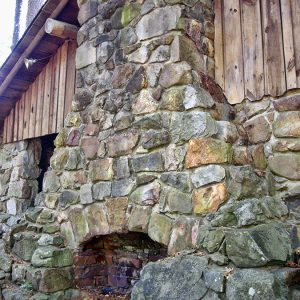 Boyle Park Chimney
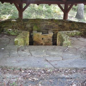 Boyle Park Fire Pit
Boyle Park
Boyle Park was created when John F. Boyle (1874–1938) donated a 231-acre tract of land in the southwestern area of the city to the City of Little Rock in 1929. The park was later expanded to include 243 acres. The park begins at 26th Street and Boyle Park Road, and Rock Creek runs through the park. In the deed, Boyle stipulated that the land was to be allocated for recreational use. If the property ever ceased to be used as a park, the title of the land would revert back to the Boyle family. Boyle Park was the third of its kind in the city. It was preceded by MacArthur Park in downtown Little Rock (Pulaski County) and Allsopp Park …
 Boys Dormitory
 Bozeman House
 Bradford Street Scene
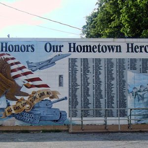 Bradford Veterans Memorial
Bradford (White County)
Bradford is the northernmost incorporated community in White County, located to the west of U.S. Highway 67, just south of the border with Jackson County. Bradford coalesced around a train depot, named Bradford Allen Station, when the Cairo and Fulton Railroad built its line to the White River in Newport (Jackson County) in 1872. The railroad enabled commerce in early Bradford to expand beyond subsistence farming and opened distant markets to its agricultural bounty. White settlers began coming to the Bradford area about sixty years before the construction of the railroad; the community during that time was on the White River at Old Grand Glaise, located in Jackson County about six miles northeast of present-day Bradford. River access provided a …
Bradley (Lafayette County)
The city of Bradley, located near Conway Cemetery State Park in Lafayette County, has been a center for agriculture and recreation since its establishment by the Southwestern Improvement Association in the southern part of the county late in the nineteenth century. The Conway plantation, which became the town of Walnut Hill (Lafayette County), was an early center of political power in the state of Arkansas when James Conway was elected the state’s first governor in 1836. Traffic on the Red River and on the Military Road carried many people through the area, including eastern tribal groups who were relocated to Indian Territory (present-day Oklahoma). Southern Lafayette County remained sparsely settled, though, until after the Civil War. Railroad lines connecting Lewisville …
Bradley County
Bradley County, located in southern Arkansas in the West Gulf Coastal Plain, has become known nationally as one of the prime production areas for tomatoes. The “Bradley Pink” variety is the standard for quality for the entire tomato market in the United States. The tomato has been labeled “Arkansas’s gift to the nation,” and the pink tomato is the official fruit and vegetable of the state. The Bradley County Pink Tomato Festival draws thousands of visitors each year. The county is bounded on the west by Calhoun County, with Moro Bayou the dividing line, and on the north by Cleveland County. To the east is Drew County, the dividing line being the Saline River. The Ouachita River divides the …
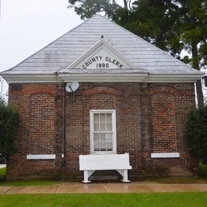 Bradley County Clerk


