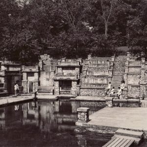
 Mineral Springs
Entry Type: Place - Starting with M
Mineral Springs
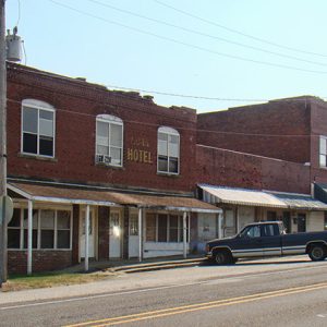
Minturn (Lawrence County)
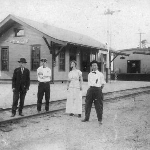
Minturn is a town on U.S. Highway 67 in Lawrence County. Created as a railroad depot, the town prospered while the timber industry flourished in the county, but it has since declined in population. Margarete Ethel Neel, a poster-child of the Red Cross during World War II, was born in Minturn. The first white dwellers in the area were French settlers who built homes along the Black River. Although the Minturn area is watered by a pair of creeks, it probably was not settled until after the Civil War. During Arkansas’s territorial period, the U.S. government created a military road that passed through the future location of Minturn. Known as the Southwest Trail, it stretched from Missouri to Texas along …
 Minute Man, Jacksonville
 Minute Man, Jacksonville, Opening
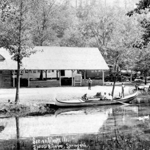
 Mirror Lake
 Miss Laura's Social Club
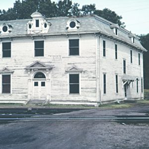 Miss Laura's Social Club before Restoration
Miss Laura’s Social Club
The former Miss Laura’s Social Club, a house of prostitution, serves as a unique visitor center for Fort Smith (Sebastian County) and is a reminder of the town’s rich history. Located at 123 First Street, it is the only former bordello in Arkansas listed on the National Register of Historic Places. On the border between what was the known United States and Indian Territory, Fort Smith was one of the historic Old West towns. Being a border town invited the business of prostitution into the town, and several bordellos were established around the turn of the century. Built in 1896 as the Riverfront Commercial Hotel, the house at 123 First Street was bought by Laura Ziegler in 1898. Zeigler borrowed …
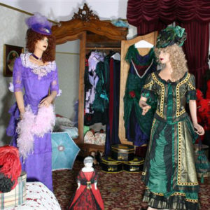 Miss Laura's Social Club Costume Room
Mississippi Alluvial Plain
aka: Mississippi Delta
aka: Arkansas Delta
aka: Delta
aka: Mississippi River Delta
aka: Mississippi River Valley
The Mississippi Alluvial Plain (a.k.a. Delta) is a distinctive natural region, in part because of its flat surface configuration and the dominance of physical features created by the flow of large streams. This unique physiography occupies much of eastern Arkansas including all or parts of twenty-seven counties. The Alluvial Plain, flatter than any other region in the state, has elevations ranging from 100 to 300 feet above sea level. In Arkansas, the Alluvial Plain extends some 250 miles in length from north to south and varies in width from east to west from only twelve miles in Desha County to as much as ninety-one miles measured from Little Rock (Pulaski County) to the Mississippi River. The work of large rivers …
Mississippi County
Mississippi County, in the northeastern corner of the state, is named for the river that forms its eastern boundary. It is noted for its agricultural production (especially cotton, soybeans, rice, and corn), which has contributed greatly to the economy of the area and the state. Eight steel-related industries have located in the county in recent years, making it the largest steel-producing county in the nation. These and other industries have chosen Mississippi County because of its transportation system that combines river, rail, and interstate highway movement. Pre-European Exploration Mississippi County was home to many prehistoric cultures. About 800 known archeological sites exist in the county. Numerous Indian mounds can be seen throughout the county, and many artifacts of the Nodena …
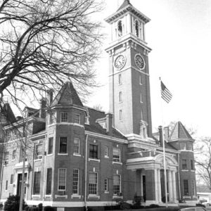
 Mississippi County Courthouse
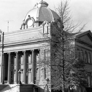 Mississippi County Courthouse
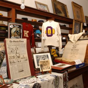 Mississippi County Historical Museum
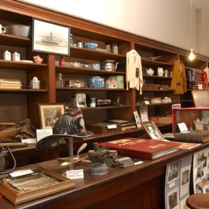 Mississippi County Historical Museum
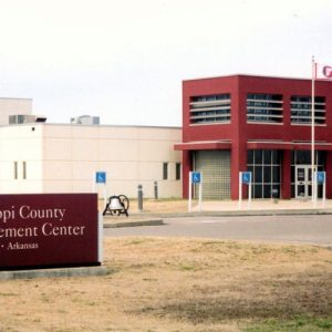 Mississippi County Law Enforcement Center
Mississippi Flyway
The Mississippi Flyway is one of four loosely defined routes used by some species of migratory birds as they travel each autumn from breeding areas in northern North America to wintering sites in the southern United States, Mexico, and Central and South America, and back again in spring. Other North American flyways are the Atlantic, to the east of the Mississippi Flyway; the Central, through the Plains states; and the Pacific, west of the Rocky Mountains. In northern latitudes, summer brings long days and abundant insects and other invertebrates for food, conducive to nesting success for birds. Winter, however, means harsh weather conditions, the disappearance of invertebrates, and frozen lakes and rivers. As a result, most birds nesting in the …
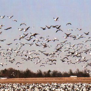 Mississippi Flyway
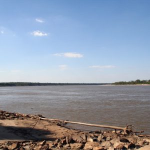 Mississippi River
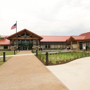 Mississippi River State Park
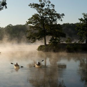 Mississippi River State Park
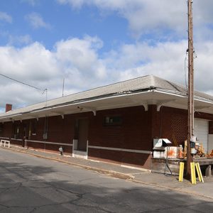 Missouri Pacific Depot
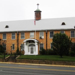
 Missouri Pacific Hospital
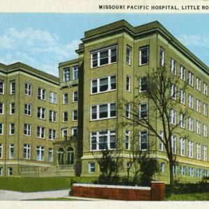 Missouri Pacific Hospital
Mitchellville (Desha County)
Mitchellville, a city in the Arkansas Delta that borders Dumas (Desha County), is the result of experiments in city planning. A church association acquired the land in the 1940s, divided it into lots, and sold the lots to a specific group of buyers, while also planning the placement of roads and electric service. With the highest percentage of African-American citizens of any city in Arkansas, Mitchellville is also one of the poorest cities in the state. The rich soil of the Arkansas Delta drew investors who created plantations and grew cotton. Until the Civil War, work on the plantations was performed almost entirely by slaves. The Thirteenth Amendment to the U.S. Constitution abolished slavery, but many of the former slaves and their descendants …
 Mollhausen Woodcut
 Monastery and Order of Our Lady of Charity
 Monastery of the Order of Our Lady of Charity
Monastery of Our Lady of Charity and Refuge
aka: Good Shepherd Home
The Monastery of Our Lady of Charity and Refuge, also known as the Good Shepherd Home, has provided education and childcare in Hot Springs (Garland County) since its inception in the early twentieth century. The Sisters of Our Lady of Charity and Refuge, a Catholic order of nuns who operate the monastery daycare, attracted national and state attention in 2007 when most of their members were excommunicated by the Roman Catholic Church for heresy; these constitute the only excommunications issued in the history of the Diocese of Little Rock. The monastery began with the arrival of five French-speaking Canadian nuns to Hot Springs from Ottawa on September 18, 1908. They came at the request of Bishop John Baptist Morris, who …
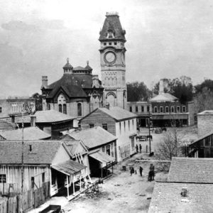
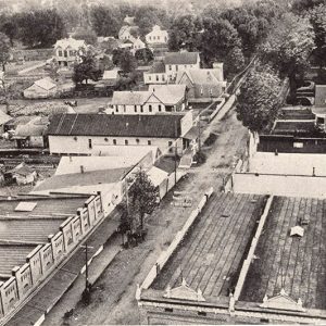
Monette (Craighead County)
Monette in Craighead County is one of the principal cities in the region of northeastern Arkansas called Buffalo Island. Founded when the railroad was built across the region around the beginning of the twentieth century, Monette quickly became an agricultural center and later added light industry, surviving the economic changes that have sent so many similar cities in Arkansas and other southern states into decline. Buffalo Island was shaken by the New Madrid Earthquakes of 1811–1812, causing much of the land to sink and become swampland. The hardwood forests and marshy areas made travel and settlement difficult, but a few families made their homes in the region during the nineteenth century. Arnold Stotts (some sources show the name as Stott) acquired high …
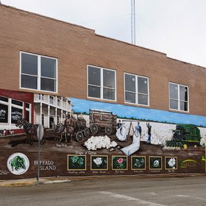 Monette Mural
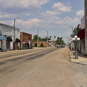 Monette Street Scene
Monkey Run (Baxter County)
The small community of Monkey Run is located in a narrow valley on the western border of modern-day Baxter County. During its heyday in the early 1920s, it was home to a number of thriving businesses and as many as seven zinc mining operations. The settlement reportedly came into existence with the establishment of the nearby Pilgrim’s Rest Baptist Church in 1872. Early families who helped settle the area included the Hodges, Reeds, Staffords, and Messicks. By the early 1900s, a school had been established and a few businesses were in operation. A name change came sometime shortly after its founding as Pilgrim’s Rest. At least three versions of the story regarding the name change exist, though all concern a …
Monroe County
Monroe County, named for President James Monroe, is located approximately halfway between Little Rock (Pulaski County) and Memphis, Tennessee. Notable communities include Brinkley, Clarendon, Holly Grove, Indian Bay, Blackton, Fargo, and Roe. Monroe County is adjacent to Arkansas, Prairie, and Woodruff counties. The White River separates Monroe and Arkansas counties, while the Cache River separates Monroe and Prairie counties. The county’s economic base is farming, and the land is among some of the most fertile in the state. About 1,500 acres in the county’s southeastern corner are protected by levee, but much of the remainder is subject to flooding. The area is drained by the White and Cache rivers, DeView and Roc Roe bayous, and several sloughs and creeks. Pre-European …
 Monroe County Courthouse
 Monte Ne Amphitheater
Monte Ne (Benton County)
Monte Ne (Benton County) was a resort town founded by William H. “Coin” Harvey in 1900. It had the world’s largest log hotels, designed by architect A. O. Clark, and attracted visitors from across the country for more than two decades. It was the site of Harvey’s nomination to the Liberty Party’s 1932 presidential ticket and the location for his planned monument to the future. It was added to the National Register of Historic Places in 1978. Located five miles southeast of Rogers (Benton County), Monte Ne began as the community of Silver Springs. Betty Blake Rogers, financial advisor and spouse to entertainer Will Rogers, was born here in 1879. Harvey, who had worked all over the country as a lawyer, silver …
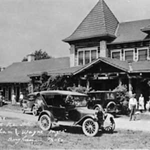 Monte Ne Club House Hotel
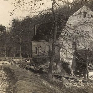 Monte Ne Mill
 Monte Ne Train Depot
Montgomery County
Montgomery County is noted for its quartz crystal deposits, the rugged beauty of the Ouachita Mountains and its sparkling, clear waters. Every year, thousands enjoy hunting, hiking, observing nature, fishing, and participating in water sports on Lake Ouachita, Arkansas’s largest lake with 48,300 surface acres, and the Ouachita, Caddo, and Little Missouri rivers; the latter drops thirty-five feet per mile in its twenty-nine-mile journey through southern Montgomery County. The county is also the home of fictional characters Lum and Abner. Pre-European Exploration through European Exploration and Settlement The Arkansas Archeological Survey has listed a number of sites in the county. Stone spear or dart points indicate that people of the Dalton culture (ca. 8500 BC) and Tom’s Brook culture (ca. …
 Montgomery County Courthouse
Monticello (Drew County)
Monticello is the largest town in southeast Arkansas south of Pine Bluff (Jefferson County). Its history is one of continued growth and prosperity. Located at the intersection of two major roads and served early by railroads, it became an enduring commercial hub. A diversified infrastructure consisting of commerce, agriculture, and the timber industry created a strong foundation and sustained the town’s growth. The town also became an important educational and medical center. Louisiana Purchase through Early Statehood The first center of business and county court were at nearby Rough and Ready Hill, which was settled by 1836. Soon after Drew County formed in 1846, leading citizens decided that a new town should be built for the county seat. In 1849, …
Monticello Academy
Monticello Academy in Drew County was under the sponsorship of the Board of Missions for Freedmen of the Presbyterian Church in the U.S.A. (PCUSA), or the “Northern” Presbyterian Church, which first began opening schools for freed slaves in the South in the 1860s. However, it was not until the 1880s, when a new presbytery had been established in the state and numbers of African Americans from the eastern states were resettling there, that the board felt confident enough to begin its work in Arkansas. The academy was started in 1891 by the Reverend C. S. Mebane, who had come to Monticello (Drew County) in 1888 as the pastor of Second Presbyterian Church there. He was closely aided in his work …
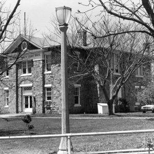
 Monticello City Scene
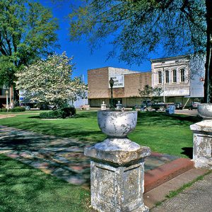 Monticello Downtown Square
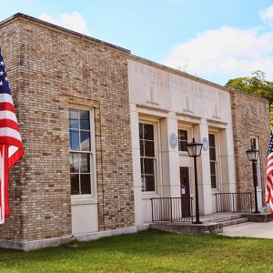 Monticello Post Office
 Monticello Street Scene
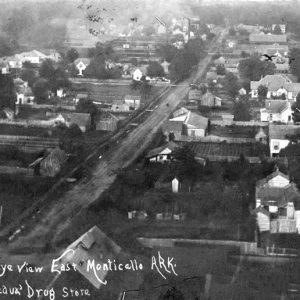
 Monticello View
 Montrose Depot


