 Horsehead Lake
Entry Type: Place - Starting with H
Horsehead Lake
Horseshoe Bend (Izard County)
Horseshoe Bend is the only city in Arkansas that includes land from three counties within its city limits. The bulk of the retirement and resort community lies in Izard County—in fact, it is the largest city in Izard County, with a population of 2,184 as of the 2010 census—but parts of Horseshoe Bend extend into Sharp and Fulton counties as well. The Strawberry River runs ninety miles through the forested hills of northern Arkansas. About half the river has been designated part of the Arkansas Natural and Scenic Rivers System. Prior to 1960, no single bend of the river was called “Horseshoe Bend.” The descriptive name was used to identify several parts of the winding stream. At the time of …
 Horseshoe Lake
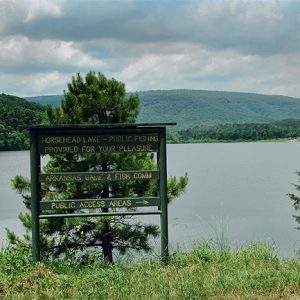
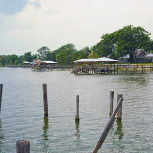
Horseshoe Lake (Crittenden County)
The town of Horseshoe Lake is located on the old Seyppel area in Crittenden County at the east end of the lake from which it takes its name. Horseshoe Lake is predominately a bedroom community, with the surrounding area consisting of farmland where cotton, feed corn, soybeans, and milo are grown. Some cattle are also raised on the high ground of the levee. The Great River Road encircles the lake. Several legendary blues musicians, including B. B. King, Howlin’ Wolf, and Hurbert Sumlin, once played in juke joints on the plantations. Pre-European Exploration The remnants of Native American civilizations surround Horseshoe Lake. The oldest recorded Indian mounds in the area are believed to be pre-Mississippian, as evidenced from artifacts found dating back to around …
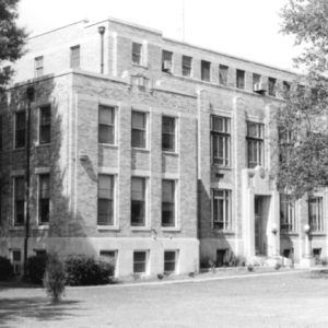
Hot Spring County
Hot Spring County was established by an act of the territorial legislature in 1829 with land taken from Clark County. Located southeast of the Ouachita National Forest, Hot Spring County is bisected by the Ouachita River and includes landforms ranging from mountains to lowlands once covered in hardwood and pine forests. The combination of rock types and fault lines is responsible for the hot spring that provides the name for the county. This county, located in the southwest region of the state, has a diverse economy based on timber, manufacturing, mining, and agriculture (corn, cotton, and some rice). Ironically, the spring for which Hot Spring County is named is no longer within the county limits. Garland County was created in …
 Hot Spring County Courthouse
 Hot Spring County Museum
Hot Springs (Garland County)
Hot Springs is situated along the Ouachita River in the Central Ouachita Mountains division of the Ouachita Mountains. It is the largest city in the Ouachita Mountains and has been a resort center since its establishment in the early nineteenth century, but it is also known as a historic locus of illegal gambling, mafia activity, and political corruption. President Bill Clinton, born in Hope (Hempstead County), grew up in Hot Springs, and the city has attracted and produced many noteworthy politicians, artists, and writers throughout the years, including Mary Lewis and Marjorie Florence Lawrence. The daily newspaper the Sentinel-Record, in one incarnation or another, has been circulating in Hot Springs since its inception in 1874. Pre-European Exploration through European Exploration and …
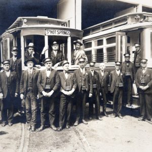 Hot Springs Conductors
 Hot Springs Central Avenue
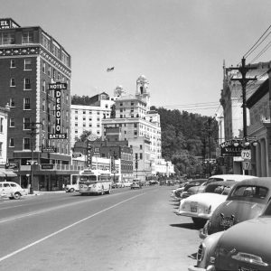 Hot Springs Central Avenue
Hot Springs Central Avenue Historic District
The Hot Springs Central Avenue Historic District extends from 205 Park Avenue to 702 Central Avenue in Hot Springs (Garland County). It contains some of the state’s finest historic buildings built between 1886 and 1930. The district was added to the National Register of Historic Places on June 25, 1985. The buildings reflect the growth of Hot Springs as one of the nation’s premier resort destinations in the late 1800s through the mid-1900s. The Central Avenue area has traditionally been the main commercial district of Hot Springs. Fronting Bathhouse Row, the stores, hotels, offices, and restaurants located on Central Avenue served local residents as well as the visitors who drove the city’s booming tourist trade until the last half of …
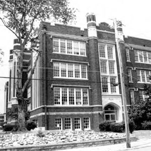 Hot Springs High School
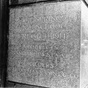 Hot Springs High School Cornerstone
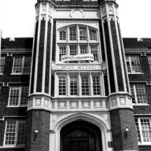 Hot Springs High School Entrance
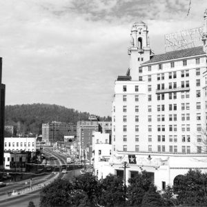
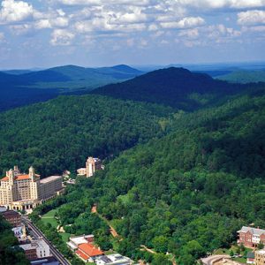
 Hot Springs National Park
Hot Springs National Park
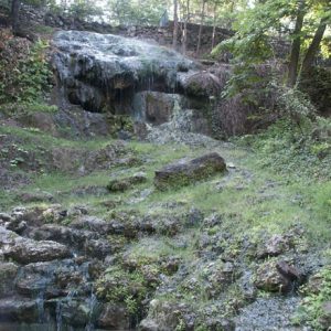
When the United States acquired the “hot springs of the Washita” as part of the Louisiana Purchase in 1803, the practice of medicine was still in its infancy, but the therapeutic benefits of hot mineral spring water had been well established worldwide for millennia. Over the next twenty-nine years, a few local settlers worked to turn the springs into a privately owned health resort, while others petitioned the federal government to make them accessible for everyone. The latter group prevailed. On April 20, 1832, the United States Congress set aside the area now known as Hot Springs National Park to preserve the springs for public benefit. As the “Government Spa” evolved, it continued to operate for the benefit of the …
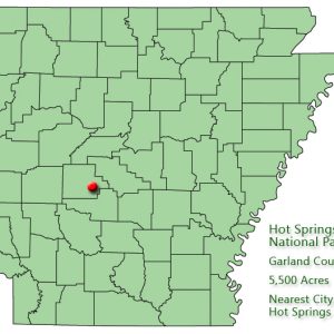 Hot Springs National Park: Park Location
 Hot Springs National Park
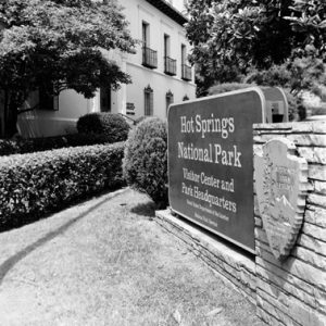 Hot Springs National Park Visitor Center
Hot Springs Normal and Industrial Institute
aka: Mebane Academy
The Board of Missions for Freedmen of the Presbyterian Church in the U.S.A. (PCUSA), or the “Northern” Presbyterian Church, began opening schools for freed slaves in the South as early as the 1860s. However, no schools were started in Arkansas until 1889, when a new presbytery was established and significant numbers of African Americans from the eastern states were resettling in the state. During the early 1890s, the Reverend A. E. Torrence, pastor of the Second Presbyterian Church, opened a parochial school for black students in Hot Springs (Garland County). He conducted it independently but did receive some aid from the Board of Missions. By 1895, there were 100 students in attendance. According to Inez Parker, while the school was …
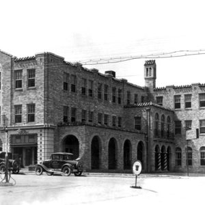
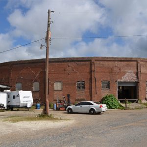 Hot Springs Railroad Roundhouse
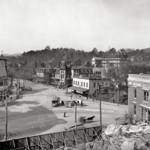
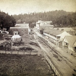 Hot Springs Street Scene
 Hot Springs Trolley
Hot Springs Village (Garland and Saline Counties)
Hot Springs Village, which stretches across the Garland–Saline County line, began as a developmental project and became a gated community. As the population grew, Hot Springs Village began to attract wealthy retired citizens. Its golf courses and trails also make the town a regional tourist destination. As of the 2020 census, the population is 15,861 (Garland County and Saline County populations combined). A frequently repeated claim that Spanish explorer Hernando de Soto traversed what is now Hot Springs Village accounts for the use of de Soto’s name for one of the lakes in the village and one of its main streets, as well as his image in the community logo. French trappers were probably the first Europeans to enter the …
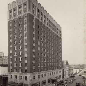 Hotel Ben McGehee
 Hotel Charmaine
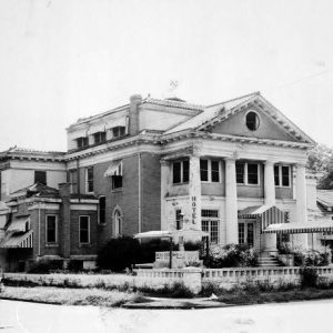
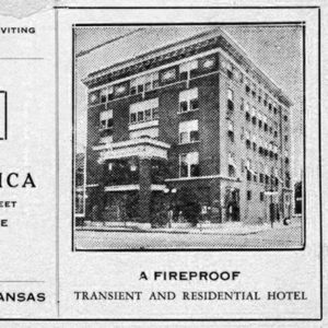
 Hotel Frederica, 2021
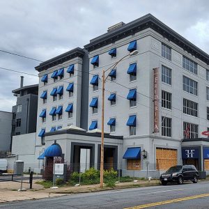
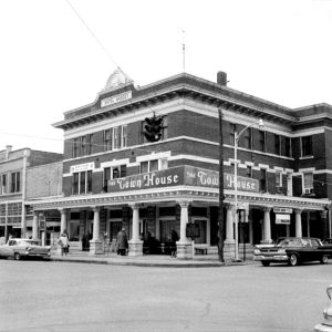
 Hotel Freiderica
 Hotel Massey
 Hotel Noble
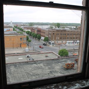
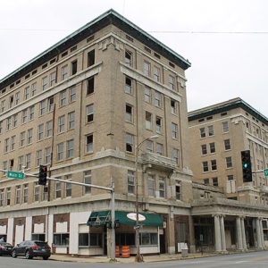
Hotel Pines
The Hotel Pines, located at the northwest corner of Main Street and West 5th Avenue in downtown Pine Bluff (Jefferson County), was conceived and built to attract more business to the section of Main Street that lies to the south of the city’s railroad tracks. As such, it provides a glimpse at one effort to alter a city’s main business and shopping area in the early twentieth century. This classically designed hotel was listed on the National Register of Historic Places on August 10, 1979. Since the area north of the tracks was a thriving commercial area, the city’s Main Street property owners believed that the presence of a modern hotel would lure business south of the tracks. Many of …
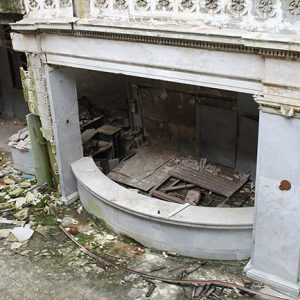
 Hotel Pines Lobby
 Hotel Pines View
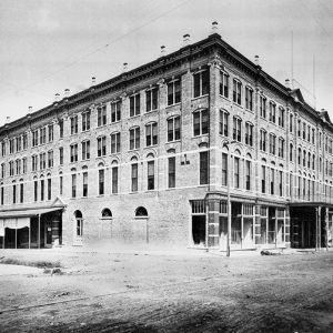
 Hotel Pines
 Hotel Pines Ballroom
 Hotel Pines Front Desk
 Hotel Richelieu
 Hotel Seville
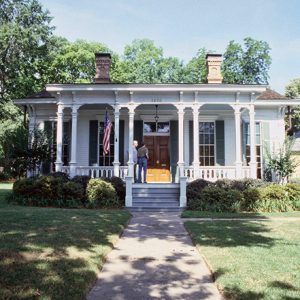 First Hotze House
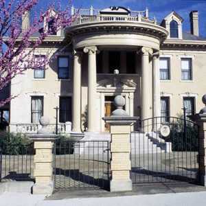 Hotze House
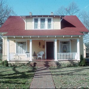 House at 712 North Mill Street
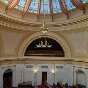 House Chamber
Houston (Perry County)
The town of Houston, in northern Perry County, is one of several communities in Arkansas that relocated to be near a railroad line. Although it is often assumed to have been named for Sam Houston, who lived in Arkansas Territory before relocating to Texas, stronger evidence suggests that the town of Houston was named for John L. Houston, who operated a ferry nearby on the Fourche La Fave River around 1847. One of Huston’s ferry stops was called Brown’s Landing, named for Robert Brown, who led a group of settlers from Kentucky into the area around 1835. The area was sparsely settled, with a few houses, a blacksmith shop, two or three small stores, and a schoolhouse that was also …
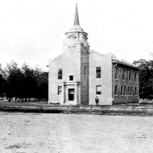
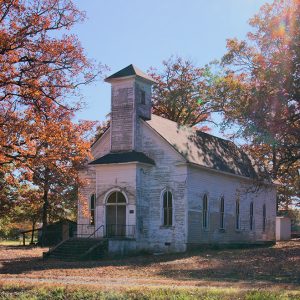 Houston Methodist Episcopal Church
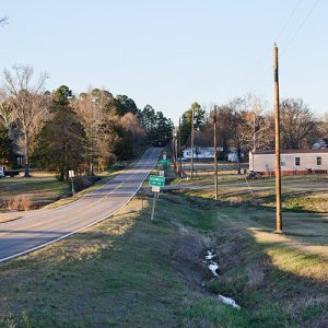 Houston Street Scene
Hovey, Charles Edward
Charles Edward Hovey was a major general in the Union army during the Civil War, serving as the Federal commander at the Action at Hill’s Plantation (a.k.a. Battle of Cotton Plant) and leading a brigade at the capture of Fort Hindman. While he served only briefly in Arkansas, Hovey was involved in these two major actions, which helped ultimately to secure the state for the Union. Born in Thetford, Vermont, on April 26, 1827, Hovey was the son of Alfred Hovey and Abigail Howard Hovey. One of eleven children, Hovey attended school until the age of fifteen, when he was hired as a teacher. After several years in the education field, Hovey worked as a lumberman before entering Dartmouth College in …
Howard County
Howard County encompasses the Ouachita Mountains to the north and the Coastal Plain to the south. It was created in 1873 from portions of Pike, Polk, Hempstead, and Sevier counties. Nashville in eastern Howard County was the birthplace of the Dillard’s department store chain. Howard County was also the location of one of the state’s most notorious race riots. European Exploration and Settlement The first accounts of the inhabitants from this area come from the chronicles of the Hernando de Soto expedition in the sixteenth century. The area is known to have been inhabited by the Caddo tribe. By the mid-1800s, however, the U.S. government had relocated the Caddo to what is now Oklahoma. This area was also part of the …
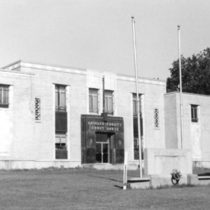 Howard County Courthouse
 Howard County Courthouse


