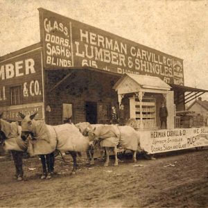
 Carvill Store
Entry Type: Place - Starting with C
Carvill Store
Casa (Perry County)
Casa may be one of the oldest settlements in Perry County, although it remained a small community until the arrival of the railroad and the discovery of coal in the area around 1900. The town’s name (the Spanish word for “house”) reflects the largely residential nature of Casa in the twenty-first century. Local historians record that the earliest white settlers of Casa arrived during the 1830s. The first two families were named Grace and McGhee; they were joined by other families moving west from Georgia and South Carolina. A general store opened around 1850, and a post office was established in 1854. A log-cabin schoolhouse was also built before the Civil War. A cemetery was established around 1860. During the war, …
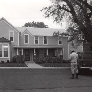 Case-Shiras-Dearmore House
Casey House
The Casey House, the oldest existing house in Mountain Home (Baxter County), is a pioneer home built in the “dog-trot” style. The house is unusual, principally for the materials used in its construction. It was the home of Colonel Randolph D. Casey, who is considered one of the first citizens of Mountain Home. The Casey House was accepted into the National Register of Historic Places in 2000. Built in the pioneer dog-trot style, which is named for the breezeway that offers dogs protection from the elements, the Casey House has two large rooms on either side separated by an open breezeway through the middle. Architecturally, the Casey House is unusual in that clapboard siding sheathes the exterior and wide flush-boards …
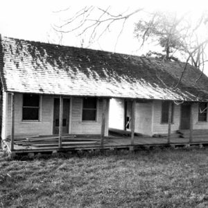 Casey House
 Cash Street Scene
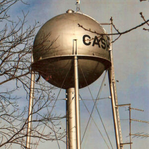 Cash Water Tower
Cash (Craighead County)
Cash is a small, incorporated community in western Craighead County located at the junction of Highway 226 and Highway 18 west of Jonesboro (Craighead County). Once an important center for the lumber industry, it is now primarily a farming community. The first permanent settlers in the area were W. R. and Lynn Cureton, brothers who came from Alabama with their families and slaves. However, the area remained sparsely settled until the late 1800s, when railroads and the lumber industry penetrated into eastern Craighead County. The first school was established on August 12, 1881. In 1894, a tram road, the Bonnerville and Southern Railroad, was built connecting the St. Louis–San Francisco Railway (Frisco) line at Bono (Craighead County) to the Cache River …
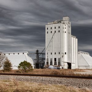 Cash Grain Elevator
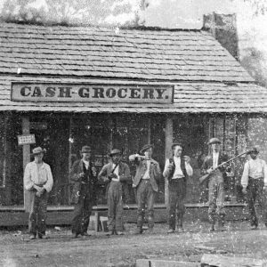 Cash Grocery
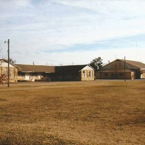 Cash Schools
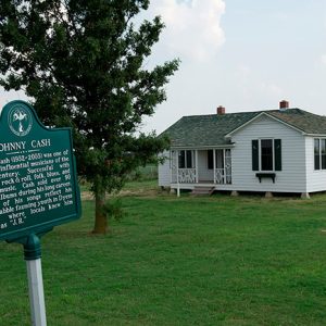 Johnny Cash Boyhood Home
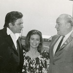 Johnny Cash at Cummins
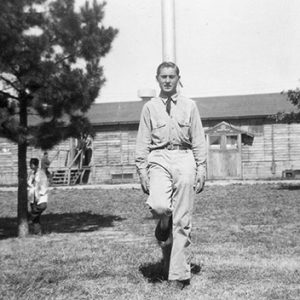
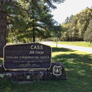 Cass Job Corps Center
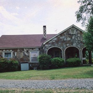 Hinkle and Ermin Castleberry House
Castleberry-Harrington Historic District
The Castleberry-Harrington Historic District in Republican (Faulkner County) consists of three Mixed-Masonry houses, all rocked by mason Silas Owens Sr. of Twin Groves (Faulkner County). The district, which was placed on the National Register of Historic Places on June 5, 2007, contains the Loyd and Willie Castleberry Cottage, the Hinkle and Ermon Castleberry House, and the Wilbur and Mary Harrington House. It is an example of a rural farm family compound featuring rockwork by Owens. The homes were built using local sandstone for economy and exhibit the typical low, Craftsman styling of rural post–World War II houses in Arkansas. Owens was a rock mason who was well known in central Arkansas for his meticulous coursing method and his work ethic. …
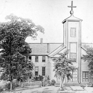
Cathedral of St. Andrew
aka: St. Andrew's Catholic Cathedral
The Cathedral of St. Andrew is the oldest continuing place of worship in Little Rock (Pulaski County). It was dedicated in 1881 by Bishop Edward Fitzgerald, the second bishop of the Roman Catholic Diocese of Little Rock. Built in Gothic Revival style, the Cathedral of St. Andrew is made of rusticated granite mined from the Fourche Mountains, the northern section of the Ouachita Mountains. The structure, which was designed by architect Thomas Harding, is located at 617 South Louisiana Street, between 6th and 7th streets. Seating a maximum of 450, it is a comparatively small Catholic cathedral. The bell tower contains a 3,400-pound bell, the heaviest in Pulaski County. The bell tower stands 231 feet tall and was completed in …
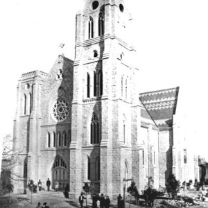 Cathedral of St. Andrew
 Cathedral of St. Andrew
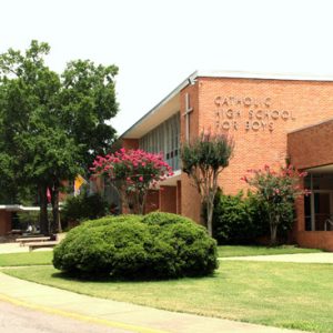 Catholic High School for Boys
Catholic High School for Boys (CHS)
aka: Little Rock Catholic High School for Boys
Catholic High School for Boys (CHS) in Little Rock (Pulaski County) has educated boys for three quarters of a century. Previous to the school’s inception, Subiaco Academy, a boarding school at Subiaco Abbey in Logan County, was the only secondary education option for Catholic boys, while Catholic girls have been attending Mount St. Mary Academy, operated by the Sisters of Mercy, since the 1850s. CHS was the diocese’s first inter-parochial high school, meaning that the school was to serve every parish in the Little Rock area, ensuring that Catholic boys could receive a quality, Catholic secondary education. CHS remains different from the other Catholic high schools in the Diocese of Little Rock, which encompasses the entirety of the state, given …
Catholic Point (Conway County)
Catholic Point, which began in 1878 in rural northern Conway County, is a small Italian community associated with the large European immigration of the last quarter of the nineteenth century. The community is best known for the Catholic Point Picnic, which has been held since 1929 on the third Saturday in June at the parish hall of St. Joseph’s Catholic Church. Catholic Point maintains its cultural identity, and the afternoon picnic attracts more than 2,500 each year. From the mid-1870s until 1890, Bishop Edward M. Fitzgerald, the second prelate of the Diocese of Little Rock, promoted and successfully attracted Roman Catholic families from Europe, many of whom were facing difficult economic conditions, to the state. While not necessarily identified as a part …
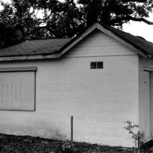 Cato Church Bathrooms
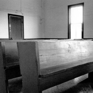 Cato Church Pews
Caulksville (Logan County)
Caulksville is a town in northwestern Logan County, located at the intersection of State Highways 22 and 23. While it incorporated at a much later date than the bordering town of Ratcliff (Logan County), Caulksville is the older settlement of the two. Caulksville was named for Robert Caulk, who received a land patent at the location of the town in 1860. He and his family are said to have arrived in the area in the 1830s. Available records do not show that Caulk served in any army during the Civil War. After the war, more settlers arrived in the area, and Caulk opened a post office in 1870. A Missionary Baptist church was built a few miles north of …
Cauthron (Scott County)
The town of Cauthron is an unincorporated community located in western Scott County along Highway 28. The town was established along the Poteau River, which runs west into eastern Oklahoma. Cauthron was incorporated circa 1876; however, the area was initially known as Piney. Piney was never officially an incorporated town, and it is unclear when the area began being called Cauthron, although it was likely in the 1870s when the first governmental buildings were being built. Before European contact, the wilderness area’s first inhabitants included natives from the Archaic, Woodland, and Mississippian periods. The Caddo later made their homes along the Poteau River and other waterways in the area. It is probable that during the late seventeenth and early eighteenth …
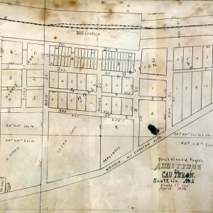 Cauthron Map
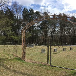 Cauthron Cemetery
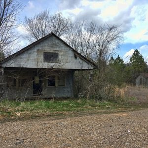 Cauthron Post Office
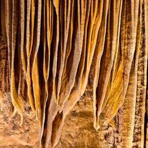 Cave Bacon
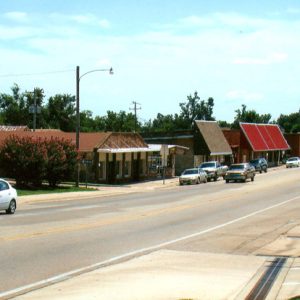 Cave City Street Scene
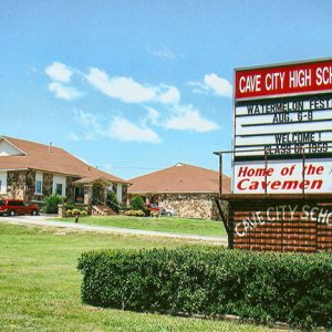 Cave City High School
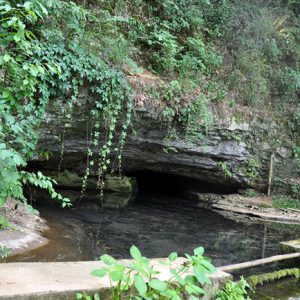
Cave City (Sharp and Independence Counties)
Cave City is a small community that straddles the northern Independence and southern Sharp County border in north-central Arkansas, having ended up there when a three-mile strip of Independence County was transferred to Sharp County in 1879. For administrative purposes, the town belongs to Sharp County, but it hosts voting stations for townships in both Independence and Sharp counties. The town takes its name from the large multi-room Crystal River Cave, which is located directly beneath the city. The cave has played a pivotal role in the history of the entire community. For thousands of years, it has served as a temporary shelter, source of water, and a fascinating place to visit. Settlers in the nineteenth century also used the …
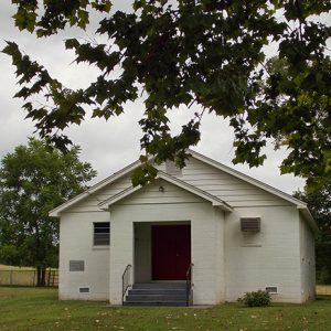 Cave Creek Church
Cave Springs (Benton County)
The city of Cave Springs, nestled in the hills of northwest Arkansas, Benton County, is known more for recreational opportunities than for its role in industry or agriculture. Incorporated in 1910, the second-class city stands on Highways 112 and 264 and is often the first community seen by visitors to Arkansas who arrive at the Northwest Arkansas National Airport. Cave Springs is named for two caves and for the water source that flows from the northernmost of those caves. The north cave, which has been closed to the public since the 1980s, is said to consist of several rooms and to contain two beautiful waterfalls. It is home to many bats and to the largest known population of the rare …
 Cave Springs Cave Natural Area
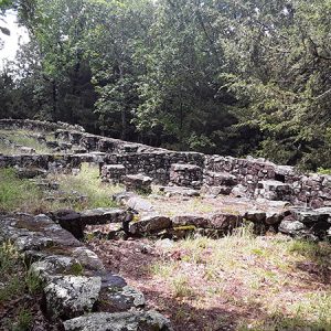
CCC Company 3767 Powder Magazine Historic District
The CCC Company 3767 Powder Magazine Historic District, located near Jessieville in Garland County, consists of two small stone and concrete structures originally constructed to store powder and blasting caps for use by the Civilian Conservation Corps (CCC). It was listed on the National Register of Historic Places on March 30, 2007. Civilian Conservation Corps Company 3767 was established on June 1, 1935, in Warrensburg, Missouri, and moved to Jessieville on July 8, 1935. The company built the powder magazine and blasting cap magazine to store explosives for use on road and bridge construction or conservation projects within the Ouachita National Forest. Company 3767 was transferred to Camp Hollis in Perry County in December 1936. The powder magazine is the …
CCC Company 741 Powder Magazine Historic District
The CCC Company 741 Powder Magazine Historic District, located near Norman (Montgomery County), consists of two small stone and concrete structures originally constructed to store powder and blasting caps for use by the Civilian Conservation Corps (CCC) while working on projects in the Ouachita National Forest. The CCC was established in 1933 as part of a New Deal effort to provide jobs while accomplishing important natural resource conservation projects during the Great Depression. There were 106 CCC camps established in Arkansas. Civilian Conservation Corps Company 741, the oldest CCC company in the Arkansas District, was formed on May 1, 1933, at Camp Pike and moved to Crystal Springs Camp on May 17, 1933. Four side camps were established from the …
 CCC Company 747
 CCC Lodge
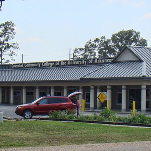 CCCUA Campus
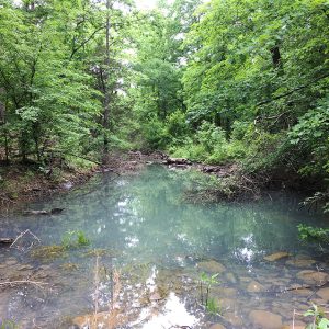 Cedar Creek
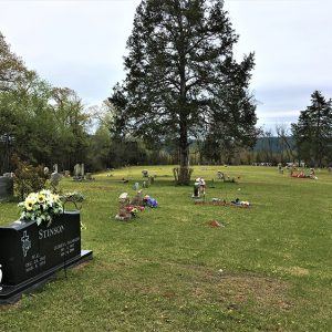 Cedar Creek Cemetery
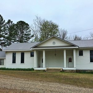 Cedar Creek Community Church
Cedar Creek (Scott County)
The unincorporated community of Cedar Creek is located along Highway 28 in eastern Scott County. The town was established in 1852 near the Fourche La Fave River between two of its tributaries. Originally, Cedar Creek was broken up into two different communities that were about three miles apart: Little Cedar and Big Cedar. The communities were named after the two tributaries of the Fourche La Fave River: Little Cedar Creek and Big Cedar Creek; to avoid confusion, the residents simply began calling the area Cedar Creek. Before European exploration, Cedar Creek was a wilderness containing various species of wildlife, some of which no longer inhabit the area. Early inhabitants included peoples of the Archaic, Woodland, and Mississippian periods. Several hundred …
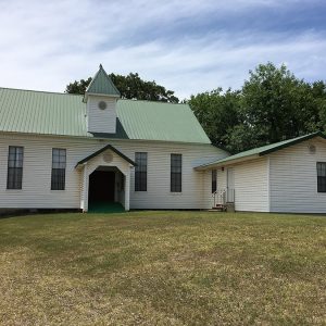 Cedar Creek Baptist Church
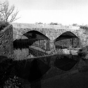 Cedar Creek Bridge
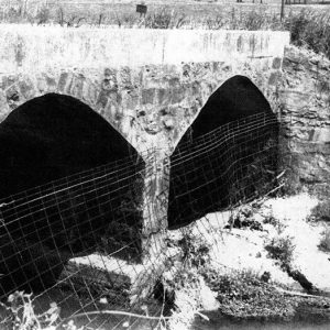 Cedar Creek Bridge
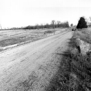 Cedar Creek Bridge Road Bed
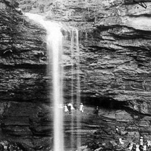 Cedar Falls


