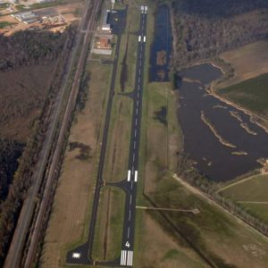
 Dexter B. Florence Memorial Field
Entry Type: Place - Starting with D
Dexter B. Florence Memorial Field
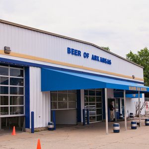 Diamond Bear Brewery
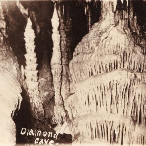
Diamond Cave
Diamond Cave, one of Arkansas’s many noteworthy caves, is located on Henson Creek, three miles from Jasper (Newton County). Diamond Cave is an underground natural wonder, containing a display of stalactites, columns, and stalagmites running many miles into the mountain. The discovery of Diamond Cave is credited to Samuel Hudson, a veteran hunter, an early settler in Newton County, and a member of the eleventh Arkansas General Assembly. Folklore has it that he and some companions discovered this cave while hunting bear early in the nineteenth century; he followed his dogs into the cave, discovered two of them dead from a battle with bears, and then killed one of the bears. The name Diamond Cave probably came from the abundant …
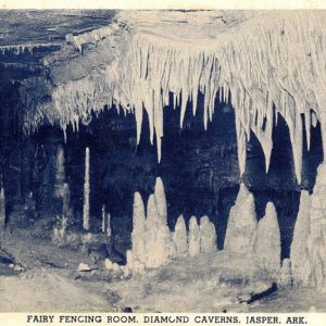
 Diamond Cave Postcard
 Diamond Cave
Diamond City (Boone County)
At a site that once was the northernmost steamboat stop on the White River, Diamond City is now a center for tourism on the shores of Bull Shoals Lake, with many lakeside weekend homes belonging to families from Harrison (Boone County) and other parts of Arkansas. Diamond City is also home to many retirees from other states. Aside from Harrison, which is the county seat, Diamond City is the largest city in Boone County. The Osage hunted in the White River valley when the United States first acquired this land in the Louisiana Purchase in 1803. Even after the Osage signed treaties with the U.S. government, which moved them farther west, the area that would become Boone County remained sparsely …
 Diamond Field
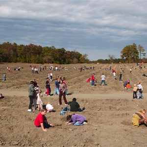
 Diamond Washing
Diaz (Jackson County)
The city of Diaz, created by the railroad industry in the late nineteenth century, is just north of Newport (Jackson County) about halfway between Jacksonport State Park and the Newport Municipal Airport. It is bypassed by Highway 67 (the Rock ’n’ Roll Highway) but connects with Highway 367 as well as several state highways. Jacksonport (Jackson County), and later Newport, were important cities built along the White River, but the area that became Diaz was first cleared for farmland. Some residents referred to the incipient community of farmers as Shiloh. Elijah Blansett and George Sink were the first landowners to settle there, shortly before the Civil War began. They were soon joined by several other families, including that of William F. Cox. …
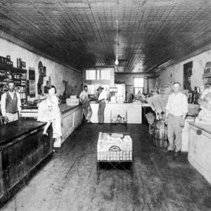 Dick Evans Store
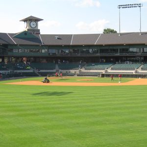 Dickey-Stephens Infield
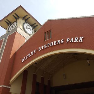 Dickey-Stephens Park Entrance
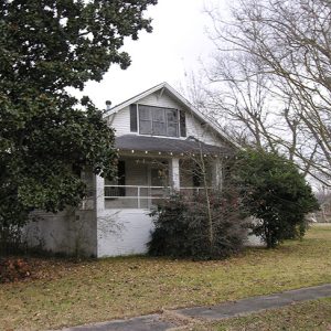 Dickinson-Moore House
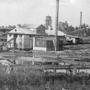
Dierks (Howard County)
The city of Dierks in Howard County rose to prominence due to the thriving timber industry of the early twentieth century. Named for a well-known lumber businessman, the city has maintained its identity with an annual Pine Tree Festival but is also known as a tourist center in the Ouachita Mountains of western Arkansas. The first families to acquire land in the township were Henry Block, John Cesterson, and James Wallen, all of whom arrived in 1848. A few more families gradually bought land in the area, which was then a dense forest of pine, oak, and hickory trees. One wagon trail connected the settlement—which they named Hardscrabble—to the town of Center Point (Howard County), ten miles south. During the …
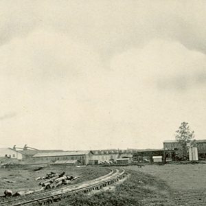 Dierks Lumber Mill
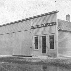 Dierks Lumber and Coal Co.
 Dierks Mill
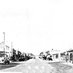 Dierks Street Scene
 Dill School
 Dipsey Doodle
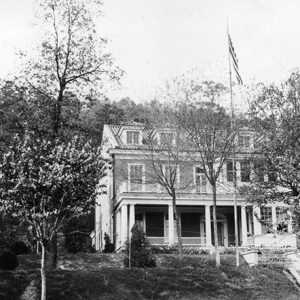 Director’s Residence
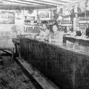
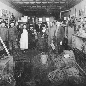 Dixon's Grocery
Dobyville (Clark County)
Dobyville is a small community in Clark County located about eight miles northwest of Gurdon (Clark County) and four miles northeast of Okolona (Clark County). The earliest settlers in the area include Henry and Joel Robinson and Thomas Franklin. They obtained 560 acres in 1837, but little additional information is known about the men. James and Ann Sloan moved to the area in the late 1830s. James obtained almost 400 acres of land, and the couple had at least four sons and two daughters. By the 1850 federal census, James Sloan held real estate worth more than $1,200 and owned twelve enslaved people. By 1860, he owned fourteen slaves and had more than $3,500 of real estate and more than …
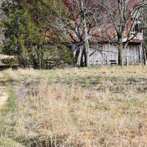 Doc Rice Barn
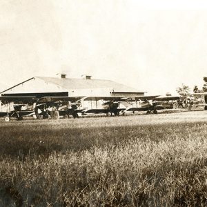 Dockery Airport
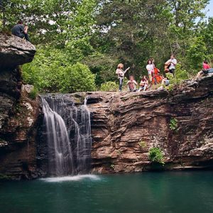 Dodd Hole and Falls
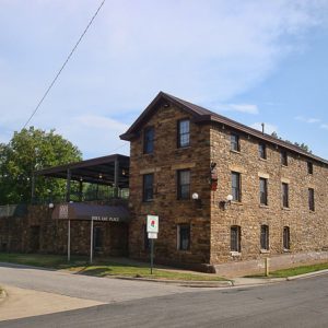 Doe's Eat Place
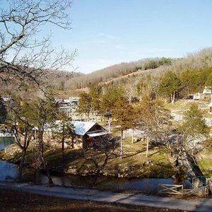
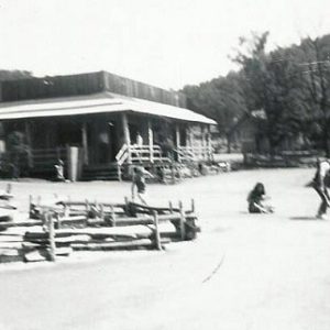
Dogpatch USA
Dogpatch USA operated from 1968 to 1993 as an amusement park based on characters and locations in Al Capp’s popular “Li’l Abner” comic strip. The town of Marble Falls (Newton County) between Jasper (Newton County) and Harrison (Boone County) changed its name officially to Dogpatch to help promote the park. The name was changed back in 1997. Harrison real estate broker Oscar J. Snow conceived the park when Albert Raney Sr. listed his Ozark trout farm for sale in 1966. Snow and nine other investors formed Recreation Enterprises, Inc. (REI) and approached Bostonian Al Capp with the idea. Capp, who had rejected such offers in the past, agreed to be a partner in the enterprise. The partners acquired 1,000 acres, …
 Dogpatch USA
 Dogpatch USA Performers
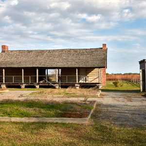 Dogtrot Cabin
Dollarway Road
The Dollarway Road represents Arkansas’s early twentieth-century efforts at road building for automobiles. Called the Dollarway Road because of its cost, it is important as an early example of the state’s short-lived system of road improvement districts. The Dollarway Road was also the longest continuous concrete pavement in the United States when complete, and it marked the first use of reinforced concrete for bridge construction in Arkansas. Bicyclists started Arkansas’s Good Road Movement, which led to the establishment of the Good Roads League of the State of Arkansas in 1896. Upgrading road conditions and funding roads was a major concern. In 1907, the state legislature created road improvement districts, locally controlled groups that determined where roads would go and who …
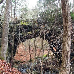 Dolph Natural Bridge
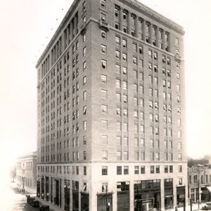 Donaghey Building
Donaldson (Hot Spring County)
The community of Donaldson in Hot Spring County was established in the 1870s. The timber industry and the Missouri Pacific Railroad were important to the town’s development. John Easley was appointed the first postmaster in 1876. There are two local stories regarding the town’s naming. One version posits that the town was named for a Mr. Donaldson who owned a sawmill there. According to another, there was a railroad superintendent named Donald there in the 1870s. His son opened a store for railroad employees, and so when people were going shopping, they were going to “Donald’s son.” A third possibility is that the community was named after William Rhind Donaldson (1843–1917), the son-in-law of Thomas Allen, president of the Cairo …
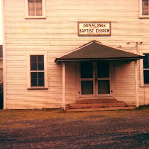 Donaldson Baptist Church
 Dooley's Ferry Fortifications
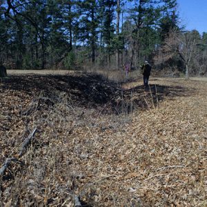
Dooley’s Ferry Fortifications Historic District
The Dooley’s Ferry Fortifications Historic District features a series of redoubts and trenches that Confederate soldiers constructed in 1864 and 1865 to protect the approaches to Texas via the Red River during the waning days of the Civil War. In mid-September 1864, Major General Sterling Price led a force of 12,000 men—including most of the Confederate cavalry serving in the state—on a raid into Missouri, leaving the remaining Confederate troops in Arkansas under the command of Major General John Bankhead “Prince John” Magruder. Magruder faced the challenge of defending southwestern Arkansas as aggressive Federal patrols probed the region in the absence of Maj. Gen. Price and the Rebel cavalry. His ability to defend the region was further complicated by a …
Dota (Independence County)
Dota (pronounced Doe-dee or Doe-tee) is a historic community near Dota Creek, which runs into the Black River. Dota is located just off the WPA Road between Cord (Independence County), which is two and half miles to the north-northeast, and Charlotte (Independence County), which is about four miles to the north-northwest. Dota Old River is a lake near where Dota Creek empties into the Black River. Dota is a corruption of the French word d’eau, meaning water. D’eau became Doty and then Dota. The old military road ran through D’eau Bayou (which later became known as Dota Creek). The Jackson Military Road was laid out in 1831 from St. Louis, Missouri. It roughly parallels the old Southwest Trail as it …
Dover (Pope County)
Dover was once the county seat of Pope County and the major site of a series of violent post-Reconstruction events known collectively as the Pope County Militia War. Though its influence diminished after it was bypassed by the railroad in the early 1870s, it remains an important community within the county. Louisiana Purchase through Early Statehood Stories vary regarding the origin of Dover and its name. According to one, Joseph Brearley, who migrated to Pope County in the 1830s, settled near present-day Dover and named the site either after his hometown in Delaware or after the city in England. Another story holds that a man named Stephen Rye settled in the area in 1832 and named the city he laid …
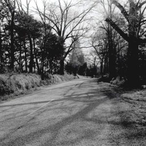 Dover to Clarksville Road
Dowdy (Independence County)
Dowdy is located on Highway 25 near the intersection with Upper Lockhart Road about three miles northeast of Cord (Independence County) and about five miles south of Saffell (Lawrence County). Dowdy is about three miles west of where the Lockhart Ferry crossed the Black River and about a mile south of Curia Creek. The Black River bottoms area has rich alluvial soil, and Native Americans made it their home in pre-Columbian times. Prehistoric sites are numerous. At the beginning of the twentieth century, archaeologist Clarence Bloomfield Moore excavated several sites, including Little Turkey Hill, near what is today Dowdy. By 1818, John Milligan II had settled along Reeds Creek in Lawrence County. He became a minister of the Cumberland Presbyterian …
 Dowdy Building
 Downs Historic District
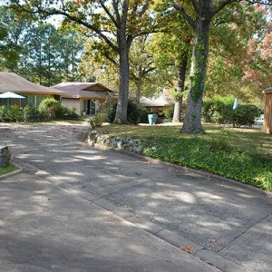
Downs Historic District
The Downs Historic District consists of the main Downs House, eleven small cottages and their associated carports, and a community swimming pool, all of which were built during the latter half of the 1960s and early 1970s in the Hillcrest neighborhood of Little Rock (Pulaski County). In addition, the district also encompasses some elements that were retained from the previous estate that stood on the property, including the driveway and stone retaining walls. It was added to the National Register of Historic Places on January 21, 2020. The thirteen lots that make up the Downs Historic District were purchased in 1909 by Fred Allsopp, and the site included one of the best views of the valley and the Arkansas River …
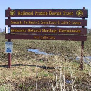 Downs Prairie Natural Area
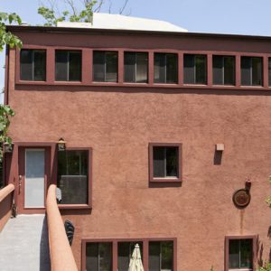 Ed W. Dozier House
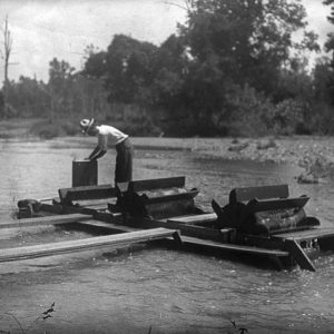
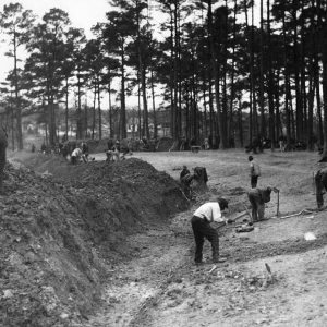 Drainage Operations
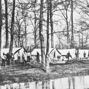 Drainage Survey Camp
 Drake Field


