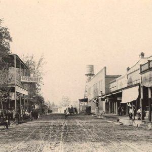
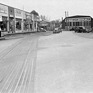
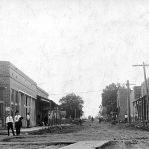
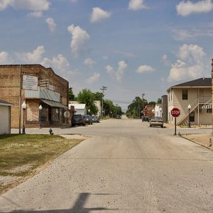
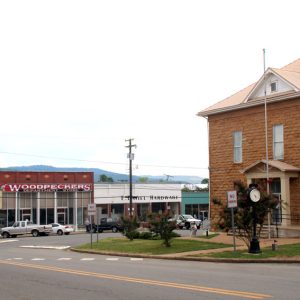
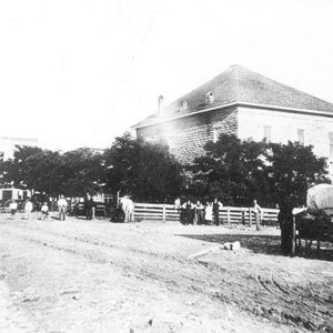
 Marianna Street Scene
Entry Type: Place - Starting with M
Marianna Street Scene
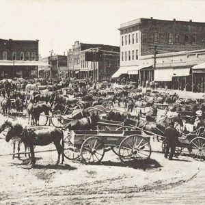 Marianna Street Scene
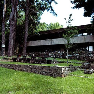
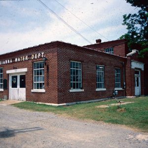 Marianna Waterworks
Marie (Mississippi County)
Named for the youngest daughter of Robert E. Lee Wilson, Marie is one of several towns founded by Lee Wilson & Company early in the twentieth century. It is located on State Highway 14 about two miles east of Interstate 55. Periodically flooded by the Mississippi River, eastern Mississippi County was long a wooded swampland unattractive to early settlers of the state. Late in the nineteenth century, Lee Wilson began investing in this unwanted land, seeing its potential for production of wealth, first in timber and then in cotton. After funding a railroad, Wilson began harvesting the timber with his own lumber company. Clearing the land of trees, he exposed rich soil that had been frequently replenished by Mississippi River floods. …
Marine Corps Legacy Museum
The Marine Corps Legacy Museum (MCLM) officially opened on November 10, 2001 (November 10 being the birthday of the United States Marine Corps). The MCLM is the country’s only private, historically comprehensive Marine Corps museum. It is sponsored by the Association for the Preservation of U.S. Marine Corps History, Inc., an educational non-profit corporation chartered in Arkansas in 1998. The museum, located on the town square in Harrison (Boone County), is the culmination of ten years of planning and effort by the father and son founders, Captain D. A. Millis and Gunnery Sergeant D. A. Millis II, both retired marines. They and their families serve as volunteer officers of the corporation and the museum; there are no salaried staff members. …
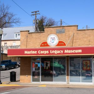 Marine Corps Legacy Museum
Marion (Crittenden County)
Marion is located in eastern Crittenden County, along the Mississippi River. Marion became the county seat in 1836 thanks largely to better accessibility than the original county seat of Greenock, combined with a donation of land by the Talbott family for the purpose of building a courthouse. The fourth Crittenden County Courthouse, completed in 1911, is listed on the National Register of Historic Places. Pre-European Exploration through European Exploration and Settlement Marion’s history can be traced back to its settlement by Native American tribes, including the Quapaw. Spanish exploration of the region occurred in the 1500s, and Spanish land grants in the area that is now Marion were later granted to Francis Gragen and Justo Mecham. Fort Esperanza, established in …
Marion County
Marion County is located in north-central Arkansas on the Missouri border, within the Ozark Mountain range. The White River, the Buffalo River, Crooked Creek, and the Little North Fork of White River are the county’s principal streams. The county’s topography ranges from Kings Prairie in the southwestern portion of the county to the mountainous regions in the north. Chief agricultural products through the years have included cotton, tomatoes, and beef and dairy cattle. Lumber, including pine, cedar, and hardwoods, has also been exported from Marion County. Pre-European Exploration through European Exploration and Settlement Spear point finds indicate that early humans hunted animals native to the Ozark Plateau, including what is now Marion County, as early as 12,000 years ago, although …
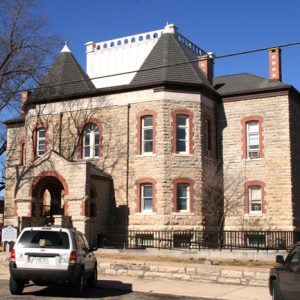 Marion County Courthouse
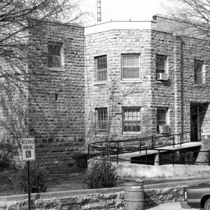 Marion County Courthouse
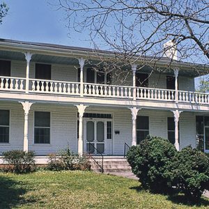
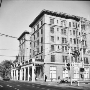 Marion Hotel
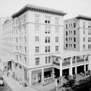 Marion Hotel
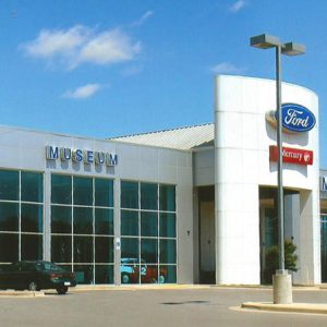 Mark Martin Museum
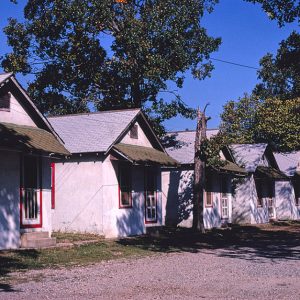 Mark's Motel
Marked Tree (Poinsett County)
Marked Tree is a small town in Poinsett County in the northeastern part of Arkansas. It is possibly the only town in the world with the name Marked Tree. It is also unique because it is located between two rivers, the St. Francis River and the Little River, which, in some places, are only a quarter of a mile away from each other yet flow in opposite directions. Marked Tree is perhaps best known for the Marked Tree Lock and Siphons, just a few miles out of the city limits, which were constructed for flood control and are on the National Register of Historic Places. Post Reconstruction through the Gilded Age Poinsett County was formed on February 28, 1838, but …
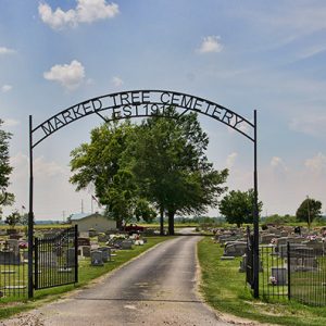 Marked Tree Cemetery
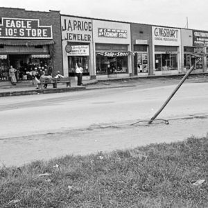
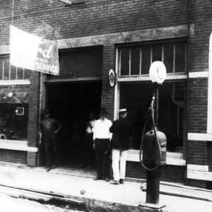
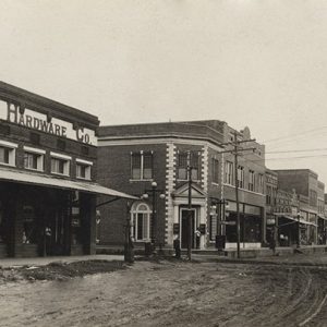
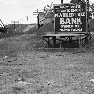 Marked Tree Businesses
 Marked Tree Street Scene
 Marked Tree Street Scene
 Marked Tree Street Scene
Marks’ Mills Battleground State Park
Location: Cleveland County Size: 6.2 acres Marks’ Mills Battleground State Park, in Cleveland County on the old Camden-Pine Bluff Road, commemorates a Civil War action that was part of the Camden Expedition of General Frederick Steele. The park contains interpretive exhibits and a picnic area. The park is named for John H. Marks, who in 1834 constructed a sawmill and flour mill at this location. The mills were still operating during the Civil War, making them landmarks for both Union and Confederate troops. In March 1864, General Steele led approximately 14,000 soldiers out of Little Rock (Pulaski County) to join in the Union army’s Red River Campaign. The goal of this campaign was to join General Nathaniel Banks’s troops in …
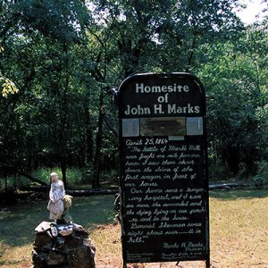 John H. Marks Home Site
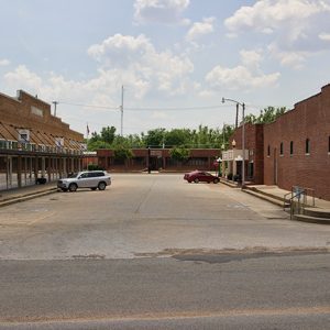
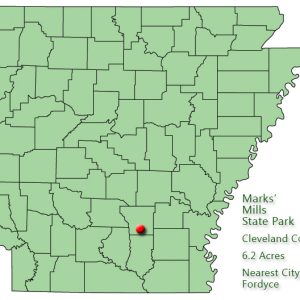 Marks' Mills State Park: Park Location
Marlsgate and the Dortch Plantation
Marlsgate sits at the center of the Dortch plantation, located near Scott (Pulaski and Lonoke counties). Marlsgate occupies the site of an earlier plantation house and faces Bearskin Lake, one of the many small lakes formed by the changing course of the nearby Arkansas River. Marlsgate was designed by noted Arkansas architect Charles L. Thompson and was completed in 1904. Together, the house and outbuildings represent plantation life in the mid-South during the late nineteenth and early twentieth centuries. While serving as the primary residence for three generations of the Dortch family, Marlsgate was also the headquarters for farming operations of the Dortch plantation. Under the stewardship of William Dortch, approximately 100 tenant families lived on the Dortch plantation. By the …
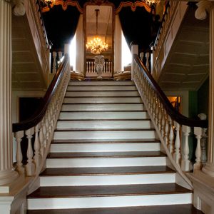 Marlsgate Interior
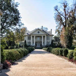 Marlsgate
Marmaduke (Greene County)
Marmaduke played a big role in the history of Greene County. A booming lumber, cotton, and railroad town in its early heyday, Marmaduke is located twelve miles northeast of Paragould, the county seat, in the northeast corner of Greene County. Civil War through Reconstruction One theory holds that the town was named for Confederate General John Sappington Marmaduke. Marmaduke was said to have established a camp for his soldiers near the site of the present town. After crossing the St. Francis River at Chalk Bluff (Clay County) in 1863, Marmaduke and his troops marched south into Greene County to find a place to camp. They occupied the site for several weeks, and the general used it as his headquarters while …
 Marmaduke Street Scene
 Marmaduke Street Scene
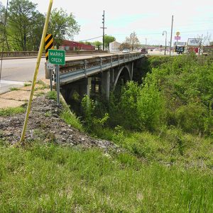 Marr's Creek Bridge
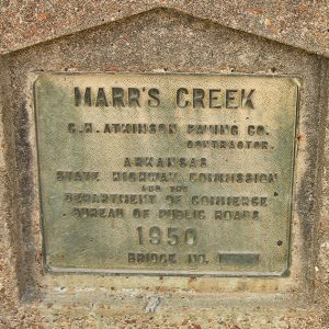 Marr's Creek Bridge Plaque
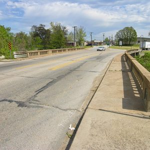 Marr's Creek Bridge
Marshall (Searcy County)
Marshall is the county seat and market town for poor and rural Searcy County, which contains 23,372 acres of the Buffalo National River and its surrounding lands, and 31,286 acres of the Ozark National Forest. Its only sustained industry has been timber processing. Beyond that, it is dependent upon cattle and the tourism brought in by the Buffalo National River. Mostly destroyed during the Civil War, Marshall grew slowly during the nineteenth century. The Missouri & North Arkansas Railroad sped Marshall’s growth from 1905 to 1910, but the post–World War I slump hit Searcy County’s and Marshall’s industries hard. Between spurts of economic activity and a series of celebrations, such as the Strawberry Festival from the late 1940s to mid-1980s …
 Marshall Courthouse Square
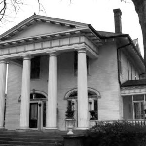 Marshall House
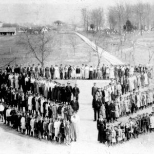 Marshall School
 Marshall Street Scene
 Marshall Street Scene
 John Wilson Martin House
 Mark Martin Museum
Marvell (Phillips County)
The city of Marvell began as a railroad town in the 1870s. Best known as the hometown of musician Levon Helm, Marvell is one of the largest communities in Phillips County. Rich soil deposited by Mississippi River floods over the years made Phillips County attractive to cotton farmers, who created large plantations throughout the area in the early nineteenth century. In 1835, John Sanford acquired ownership of the land where Marvell would be built. Slaves worked the plantations until the Civil War, and many of the former slaves remained as tenant farmers after the war. Several railroads had been planned before the war, but their construction did not take place until Reconstruction. The Arkansas Central Railroad, planned to link Helena (Phillips County) and Little Rock (Pulaski …
 Marvell Street Scene
Marylake Monastery
Founded in 1952 and located thirteen miles south of Little Rock (Pulaski County), Marylake Monastery was a residence for Discalced Carmelite friars of the Province of St. Thérèse, which includes Louisiana, Texas, Arkansas, and Oklahoma. The monastery was a novitiate for the province, which is a type of religious “boot camp” for young men entering the Carmelite Order of the Roman Catholic Church. As solitude is sought as an aid to contemplative prayer, the rural site was chosen because it offered a more secluded setting than the former novitiate within the urban setting of San Antonio. In 1895, brothers of the Tull family bought a 400-acre tract in East End (Saline County) and dammed Clear Creek to form a fifty-acre …
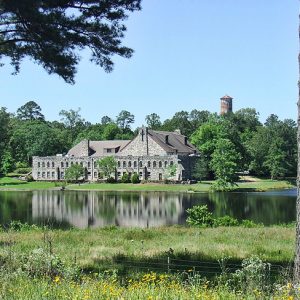 Marylake Monastery
 Dr. James D. Mashburn House
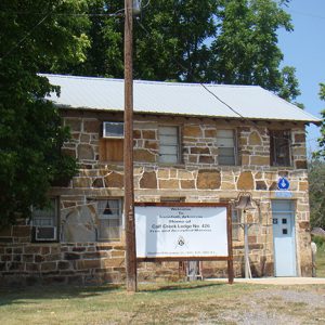 Masonic Lodge 426
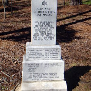 Masonic Monument
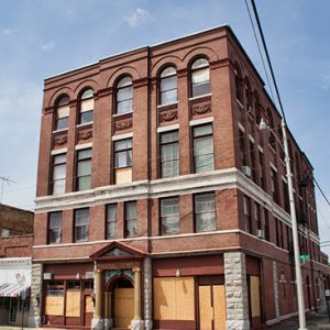 Masonic Temple
Massard Prairie
As one of three naturally occurring prairies located near Fort Smith (Sebastian County), Massard Prairie was first described in Thomas Nuttall’s A Journal of Travels into the Arkansas Territory During the Year 1819. The prairie gave its name to a community that is now within the city limits of Fort Smith; the prairie itself has largely been developed and is no longer recognizable as such. These prairies were described and mapped well before the Louisiana Purchase. According to local tradition, Massard Prairie takes its name from T. Jean Massard, a French captain whose land grant was approximately 18,000 acres, the northern boundary being the Arkansas River. It was laid out in a French fashion called “longlots,” with strips of land …
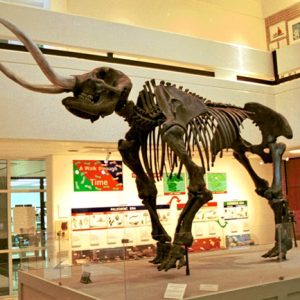 Mastodon Display


