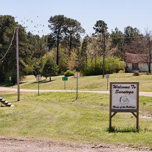
 Saratoga
Entry Type: Place - Starting with S
Saratoga
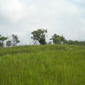 Saratoga Blackland Prairie Natural Area
Sardis (Saline County)
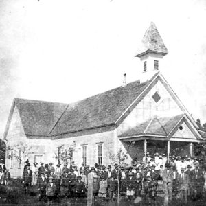
Sardis is a small unincorporated community located roughly twelve miles east of Benton (Saline County). Sardis is one of two communities that make up Saline County’s Hurricane Township, the other being Fairview. For many years, Sardis had a unique and beloved landmark known as the Shoe Tree. Saline County was cut from Arkansas’s Pulaski County on November 2, 1835, by the Territorial Legislature. Afterward, the county was divided into townships, with the area around Hurricane Creek being named Hurricane Township. White settlers and farmers began to move into what are now Sardis and Fairview before statehood. In 1869, Sardis Methodist Church South was built on a parcel of land that had been donated by a woman called “Grandmother” Roark. Members …
 SAU Student Center
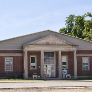 Saunders Museum
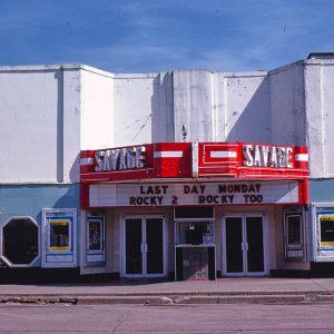 Savage Theater
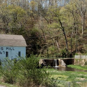 Spring Mill
 School for the Deaf
Scott (Pulaski and Lonoke Counties)
Scott is a small community on the line between Pulaski County and Lonoke County, north of the Arkansas River. Surrounded by farmland and by oxbow lakes, Scott is also near two state parks and several historic properties. Over the centuries, events such as floods, droughts, and—most recently—human construction have altered the path of the Arkansas River. Remnants of former sections of the river remain near Scott as oxbow lakes, particularly Bearskin Lake, Horseshoe Lake, and Willow Beach Lake. More than 1,000 years ago, a complex formation of mounds was created near what is now called Mound Pond. The site was farmed in the nineteenth century but was later preserved as Plum Bayou Mounds Archeological State Park. Not only did the …
Scott County
Scott County is located on the west-central boundary of Arkansas in the Ouachita Mountain region of the state. The topography of the area is mountainous and interspersed with expansive valleys along the Fourche LaFave, Petit Jean, and Poteau rivers and associated tributaries. The community of Waldron and portions of Mansfield are the two primary municipalities within Scott County. Major communities in Scott County are Abbott, Bates, Blue Ball, Boles, Cauthron, Cedar Creek, Harvey, Hon, Needmore, Nola, Parks, Union Hill, Winfield, and Y City. Pre-European Exploration Although little is known of those living in the area prior to 1,000 years ago, the first inhabitants of the Scott County area arrived millennia prior to any European exploration of the area. Over 2,500 …
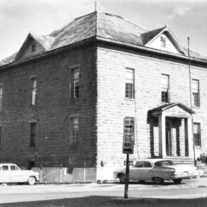
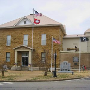
 Scott County Courthouse
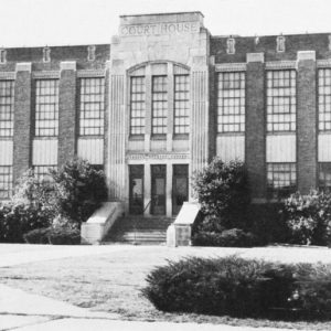 Scott County Courthouse
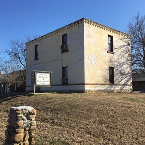 Scott County Jail
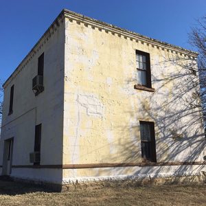 Scott County Jail
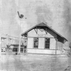 Scott Depot
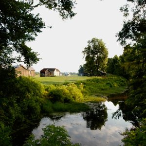
Scott Plantation Settlement
The Scott Plantation Settlement, with its twenty-five exhibits, represents plantation history for the first 100 years of Arkansas statehood. It rests on more than eight acres of the Illallee Plantation donated by Virginia Alexander, daughter of Arthur Alexander and Otelia George Alexander, who purchased the land in 1898. The historical sequence of plantation culture can be seen in the preserved buildings and other exhibits dating from the antebellum period through the early twentieth century. The Scott Plantation Settlement is located in Scott, on the Pulaski–Lonoke county line, approximately twelve miles east of Little Rock (Pulaski County). Its original owner, Chester Ashley, was a prominent attorney, land speculator, and U.S. senator. Joan Dietz, daughter of Virginia Alexander, is credited with the …
 Scott Plantation Settlement
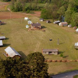 Scott Plantation Settlement Aerial View
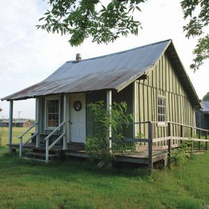 Scott Plantation Settlement Building
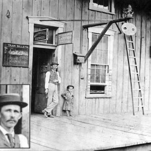
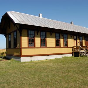 Scott Train Station
Scranton (Logan County)
Investors seeking to profit from coal mining established the city of Scranton in Logan County early in the twentieth century. Although the nearby coal mines did not prove to be profitable, Scranton survived and flourished, becoming for a time one of the largest cities in Logan County. James Murphey was the first owner of the land on which Scranton would be built. His deed to the land was registered in 1838, and Murphey bought additional land adjacent to his first lot in 1839 and in 1843. It remained farmland until 1907, when Harmon Remmel led a group of investors to purchase land in Logan County for a city that would be a center of mining operations. They named their city for …
 St. Ignatius Church
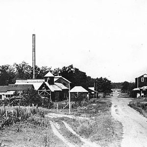 Scranton Cotton Gin
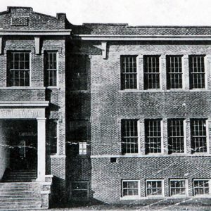 Scranton High School
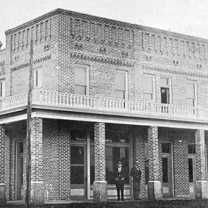 Scranton Hotel
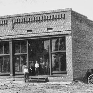 Smith & Cox Hardware
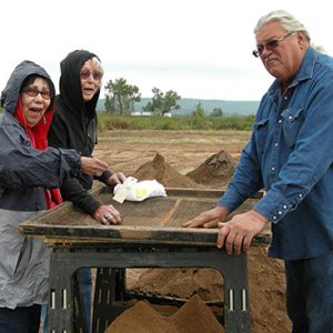 Screening for Artifacts
Searcy (White County)
Searcy has been the White County seat since the county’s organization in 1835. Located on the Little Red River near the county’s geographic center, the city continues to be the county’s commercial, educational, and healthcare center. Louisiana Purchase through Early Statehood The Little Red River and the White Sulphur Springs figure in Searcy’s founding. On the west bank of the Little Red, below the mouth of Gin Creek, a Spanish land grant was surveyed for Frenchman Jean LaFayac (LaBass) and patented to him in 1805. By 1834, the White Sulphur Springs, developed by Samson Gray, were attracting visitors with their healing properties. The home of David Crise, about halfway between the springs and the river, was the site of the …
Searcy County
Searcy County is in the Boston Mountains and the Springfield Plateau sections of the Ozark Plateau. Marshall is the county seat and commercial center; Leslie is significant for the Missouri and North Arkansas (M&NA) railroad and timber products; and St. Joe, an old mining center, was also on the railroad and is the first town along Arkansas 65 north of the Buffalo River. Farther northwest is Pindall, an old railroad stop first known as Kilburn Switch, and the old regional commercial center became home to two timber manufacturing companies. Gilbert, another railroad stop, and on the Buffalo River, was originally a point for logs and cotton taken down the river to be placed on the M&NA. In the early 1920s, …
 Searcy County Courthouse
 Searcy County Courthouse
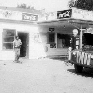 Searcy Garage and Cafe
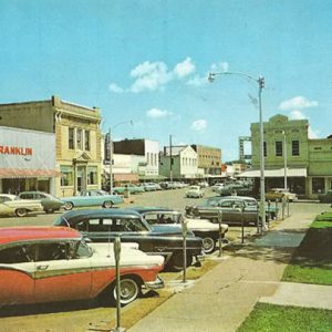 Searcy Street Scene
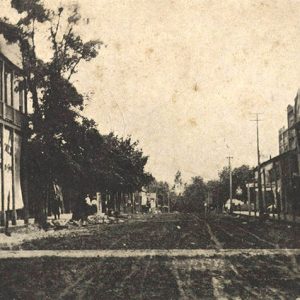 Searcy Street Scene
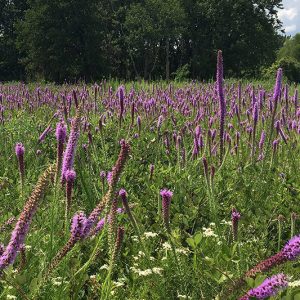 Searles Prairie Natural Area
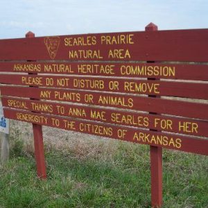 Searles Prairie Natural Area
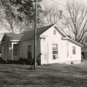 Sears House
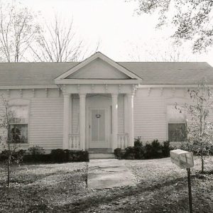 Sears House
Sebastian County
Sebastian County is located on Arkansas’s western border in the natural division known as the Arkansas Valley. The Arkansas River forms the county’s northern border, while its southern border touches upon the Ouachita Mountains. The county is home to Fort Smith, one of the state’s largest cities, as well as Fort Chaffee, and in the late nineteenth and early twentieth centuries, it was the site of the state’s largest coal-mining operations. From the earliest days of the territorial period to the present, Sebastian County has served as a major transportation corridor to points west. Pre-European Exploration The Arkansas Valley region served as a place of residence to Native Americans since the last Ice Age, and there are hundreds of pre-contact …
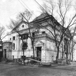
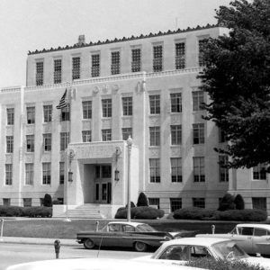 Sebastian County Courthouse, Fort Smith
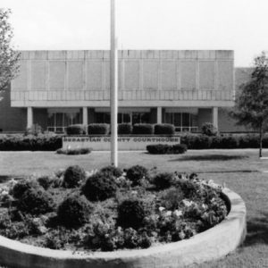 Sebastian County Courthouse, Greenwood
 Second Baptist Church
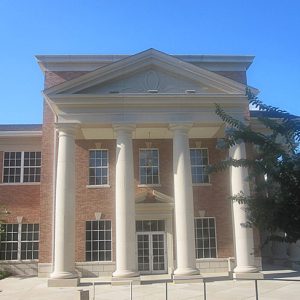
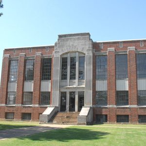
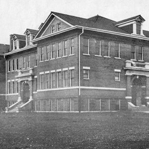 Second District Agricultural School Main Building
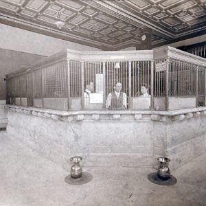 Security Bank
Sedgwick (Lawrence County)
Sedgwick, a town in eastern Lawrence County, is located on U.S. Highway 63 between Hoxie (Lawrence County) and Jonesboro (Craighead County). At the beginning of the nineteenth century, Osage from farther north hunted and fished in the area that would become northeastern Arkansas, but they had no permanent settlements there. Even after Arkansas became a state, settlement in the Cache River basin remained sparse. Eventually, after the Civil War, investors began to consider harvesting the timber in this part of Arkansas. The Kansas City, Fort Scott and Memphis Railroad built a line in the 1880s that ran through Hoxie and Jonesboro on the way to Memphis, Tennessee. George Washington Sedgwick, one of the railroad’s organizers, built a sawmill near the …
 Segregated Waiting Room
 Sensation
Sensation (Scott County)
Sensation is a historical community in western Scott County located near Lake Hinkle. Sensation was officially established circa 1916, although people had been living in the area prior to that time. The origin of its name is unknown. Agriculture and timber have contributed to the economy and way of life in the area. Prior to European exploration, the area surrounding Sensation was a wilderness. Several species of wildlife that no longer inhabit the area, such as elk and buffalo, were present throughout the region. Numerous archaeological sites and burial mounds are located along the banks of prominent water ways such as the Fourche La Fave and Poteau rivers. Archaeological findings have provided evidence of early inhabitants dating to the Archaic, …
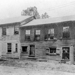
 Servants' Quarters
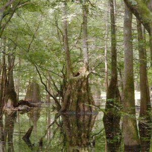 Seven Devils Swamp Natural Area


