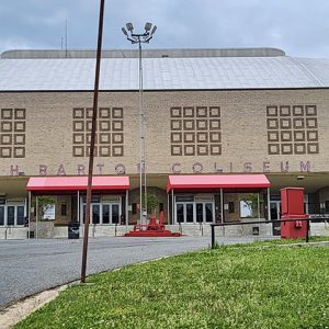
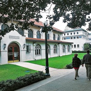
 Barton Coliseum
Entry Type: Place - Starting with B
Barton Coliseum
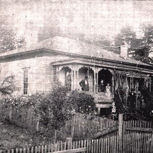 Barton House
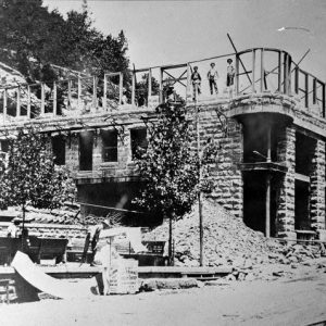 Basin Park Hotel
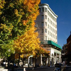 Basin Park Hotel
Bassett (Mississippi County)
The town of Bassett is located on Highway 61 in southern Mississippi County. It is about halfway between Wilson (Mississippi County) and Joiner (Mississippi County). Bassett sits on higher ground that, for most of recorded history, was surrounded by swampland and hardwood forests. Artifacts unearthed in the area indicate that the knoll has been inhabited for many centuries. Mississippi County historian Mabel Edrington wrote in 1962 that a 100-acre Native American cemetery had existed at the site. Several Indian nations have been associated with northeastern Arkansas, but over time, they all signed treaties with the federal government and moved west to Indian Territory, now the state of Oklahoma. The first construction in Bassett that was not done by Indians …
Bates (Scott County)
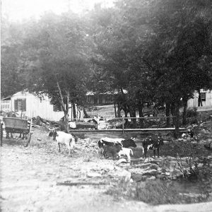
Bates is an unincorporated community in western Scott County. It is located along Highway 28 west, between the junction of Shadley Creek and East Shadley Creek just north of the Poteau River. Bates was established in 1907 and named after the Bates family who settled in the area. Agriculture, timber, and coal mining have historically been important industries in Bates. Prior to European exploration, Bates was a wilderness lush with native vegetation and numerous species of wildlife, some of which no longer inhabit the area. Early inhabitants of the area were present during the Woodland, Archaic, and Mississippian periods. There are numerous archaeological sites located along the Poteau River south of Bates. This evidence indicates that the people of the …
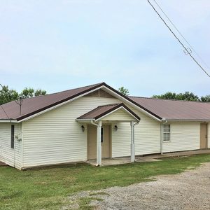 Bates Church
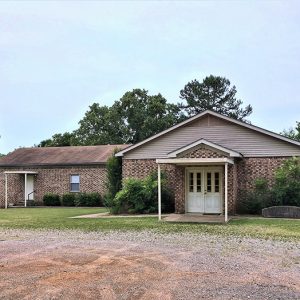 Bates Church
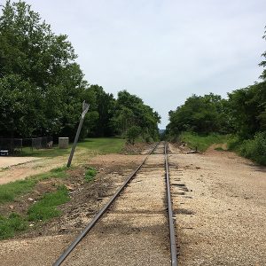 Bates Railroad
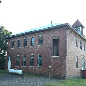 Bates School House
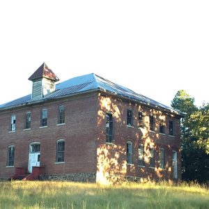 Bates School House
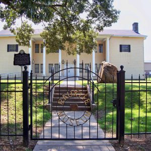
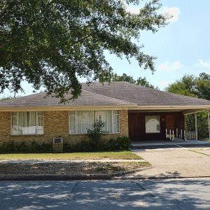 L. C. and Daisy Bates Museum
Batesville (Independence County)
Geographically, Batesville was destined to exist. It stands at the point where waters of the White River exit from the sedimentary stone of the Ozarks. River traffic was forced to stop at the shoals to offload cargo, regardless of the direction of travel. Warehouses, supply stores, and buyers of furs and produce naturally congregated there. The town became one of the major cultural centers of the region. In the nineteenth century, its leaders, many of whom moved to Little Rock (Pulaski County), exercised influence on the political development of Arkansas far beyond what its modest size promised. Louisiana Purchase through Early Statehood The first Euro-American settlers, French fur-traders who were in the valley possibly as early as the mid-eighteenth century, left …
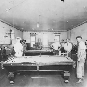 Batesville Billiards Hall
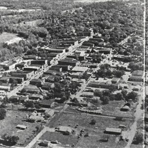 Batesville Aerial View
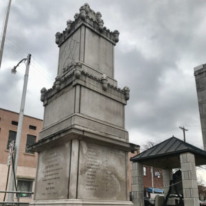 Batesville Confederate Monument
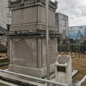 Batesville Confederate Monument Detail
 Batesville High School
 Batesville Lime Mill
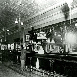 Batesville Saloon
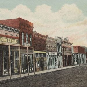
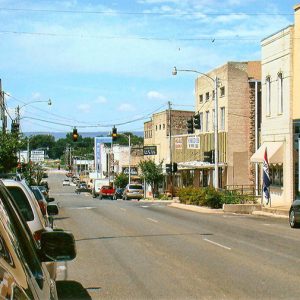 Batesville Street Scene
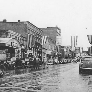 Batesville Street Scene
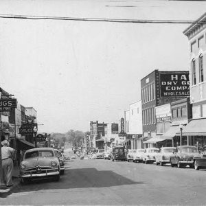 Batesville Street Scene
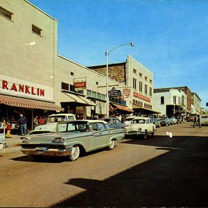 Batesville Street Scene
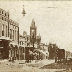 Batesville Street Scene
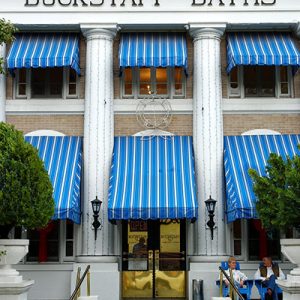 Buckstaff Bathhouse
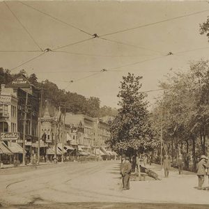 Bathhouse Row
Bathhouse Row
Bathhouse Row Historic District extends along the foot of the mountain that gives rise to the thermal springs in Hot Springs National Park. Located in downtown Hot Springs (Garland County), the scene is dominated by the most recent of a succession of bathing buildings dating back to 1830. Bathhouse Row includes eight surviving bathhouses: the Hale, Maurice, Buckstaff, Fordyce, Superior, Quapaw, Ozark, and Lamar. The landscape features sculptured fountains, water displays, and the Grand Promenade. Bathhouse Row has become the architectural core for downtown Hot Springs. History The first structures in the area to take advantage of the thermal springs were likely the sweat lodges of local Native Americans, which were followed by an unplanned conglomeration of buildings subject to …
 Bathhouse Row
 Bathhouse Row; 1867
Batteries A, B, C, and D (Battle of Helena)
Batteries A, B, C, and D are fortifications used by the Federal army during the Civil War to protect the city of Helena (Phillips County) from enemy attack. Along with Fort Curtis, these fortifications formed the core of the Helena defenses, most notably during the July 4, 1863, Battle of Helena. When the Army of the Southwest arrived in Helena after the Battle of Pea Ridge, Major General Samuel Ryan Curtis immediately began to fortify the approaches to the city. As Helena was deep in Confederate territory, the forts were necessary to prevent the destruction of the Union army in the town. The batteries were named A, B, C, and D, with A at the northern edge of the line …
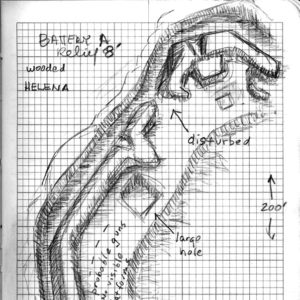 Battery A
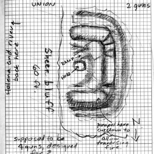
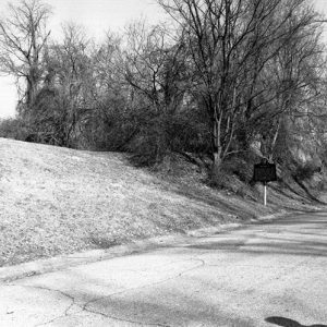 Battery B Location
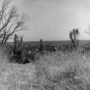 Battery C Location
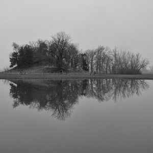
 Battery D
 Battery D Location
Battle Mound Site
The Battle Mound site is a Caddo site located along the Red River in Lafayette County. The Red River landscape is an ecologically diverse region with numerous channel scars, oxbow lakes, and back swamps. With agriculturally productive soil deposits and a web of linked navigable waterways, the region has numerous prehistoric and historic archaeological sites, many being sites left by the ancestors of the Caddo Indians who lived in this area from at least as early as circa AD 900 and as late as the early nineteenth century. The most prominent feature at Battle Mound is a large north-south-aligned earthen mound with at least three platforms. The mound is the largest in the Caddo area and one of the largest …
 Battle Mound Site
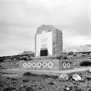 Battle of Buena Vista Memorial
 Baugh's Drug Store
 Baum Walker Hall
Bauxippi (Crittenden County)
Bauxippi was a short-lived shipping point on the Mississippi River in Crittenden County established by the American Bauxite Company in 1917. The name comes from a combination of the words “bauxite” and “Mississippi.” Very little is known about the community. The first mention of it in the Arkansas Gazette was in the March 7, 1917, issue, which noted that the American Bauxite Company was planning to “resume shipments by a combination rail and water route, sending ore via the Rock Island from here [Bauxite in Saline County] to a new shipping point on the Mississippi, called Bauxippi, and thence by river to East St. Louis.” During World War I, demand had increased for bauxite ore, which is used in the …
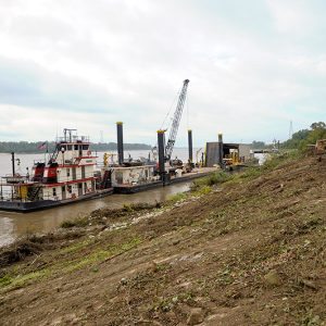 Bauxippi-Wyanoke Revetment Site
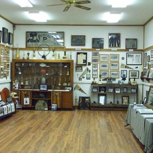
 Bauxite Historical Museum
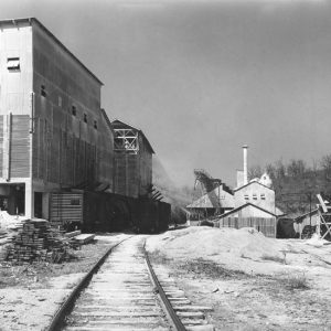
Bauxite (Saline County)
The story of Bauxite is largely the story of the bauxite mining industry. Bauxite, the ore from which the town derives its name, and which is a key component in the production of aluminum, was discovered in great abundance in this area of central Arkansas in 1887. The company that became Alcoa, which mined the ore, not only provided plants and mills but also provided a community for its workers to live in. As the company cared for its workers, the town was able to exceed all expectations and produce enough ore to supply the United States military during two world wars. With the end of World War II, however, the company found it more profitable to mine bauxite ore …
 Bono Room
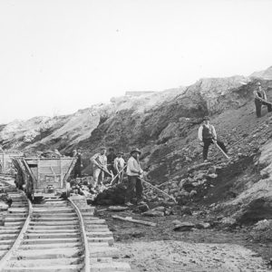
 Bauxite Miners
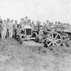
 Bauxite Mining
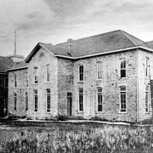
Baxter County
Governor Elisha Baxter formed Baxter County as the sixty-eighth county in Arkansas just prior to the Brooks-Baxter War. It is a county important to Arkansas history because of its flood control projects and its early educational institutions. Most of the land in Baxter County is hilly and rocky, typical of the Ozark Plateau on which it lies. Pre-European Exploration and Settlement Hundreds of prehistoric sites, representing various time periods and traditions, are found in Baxter County. The Old Joe site, which includes two prehistoric rock art images, is located near Norfork and is listed on the National Register of Historic Places. By the time of the Louisiana Purchase, the Osage claimed control over the area, but they relinquished their …
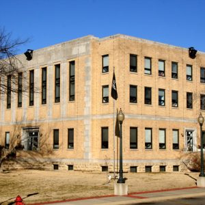 Baxter County Courthouse


