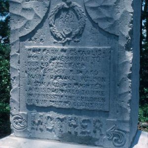
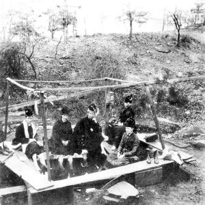
 Confederate Mothers Monument
Entry Type: Place - Starting with C
Confederate Mothers Monument
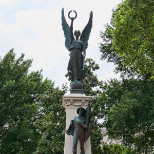
 Confederate Soldiers Memorial Detail
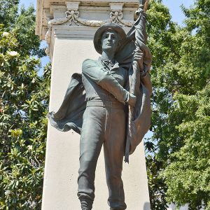
 Confederate Soldiers Memorial
 Confederate State Capitol
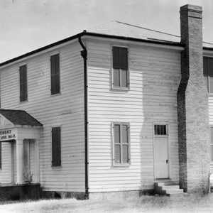
Confederate State Capitol Building (Hempstead County)
aka: Hempstead County Courthouse of 1836
The 1836 Hempstead County Courthouse located in Washington (Hempstead County) was used as the Confederate State Capitol after Little Rock (Pulaski County) fell to Union forces in 1863. Today, it is one of the attractions of Historic Washington State Park. In 1824, Washington was designated the county seat of Hempstead County; the seat had previously been located in the northeastern part of the county. By 1835, local officials recognized the need for a new county courthouse. The circuit court had previously met in a one-room building built by Tilman L. Patterson, who also supervised the construction of the new two-story courthouse. It was built in 1836 for $1,850. Between the time of its construction and the advent of the Civil …
Congo (Saline County)
Congo is an unincorporated community in Salem Township located approximately six miles north of Benton (Saline County). Primarily a rural community, it is best known for the Congo Mercantile store that served as the heart of the community for decades beginning in the 1920s. Some of the earliest settlers of the Congo area were William and Jesse Wills, Joseph Scott, Willis Pipkin, William Duncan, and Isaac Ally, who arrived in the 1830s. Prior to the Civil War, the McCray, Goodwin, and Vandergrift families settled in the area. Residents of the community farmed the rich soil, raised cattle and hogs, and hunted and fished along the Saline River. Other than agriculture, no other major industries developed in the sparsely settled area …
 Conner Grocery
Contraband Camps
aka: Slave Refugee Camps
In 1862, as a response to Confederate use of slave labor against the Federal army in Arkansas, Union general Samuel R. Curtis drew on the authority of earlier “confiscation” acts to free black slaves for use in the Union army. Issuing certificates of freedom to hundreds of “contraband” fugitives (meaning escaped or Union-freed slaves), Curtis laid the foundation for emancipation in Arkansas, and he was one of the more determined Union military leaders in the belief that slaves should be freed. Word spread among Arkansas’s slaves, and when Curtis’s army arrived at Helena (Phillips County) in the summer of 1862, more than 2,000 came with him hoping for freedom and protection. Helena would be occupied by Federal forces through the …
Convenience (Independence County)
Convenience is a historical community located on Dota Creek on Cedar Grove Road just off Highway 25 about four miles north-northwest of Charlotte (Independence County) and about seven miles southeast of Cave City (Sharp and Independence counties). It is about three and a half miles southwest of Cedar Grove (Independence County). Batesville, the county seat, is located approximately fourteen miles south-southwest. Those who live in the area in the twenty-first century have a Sulphur Rock (Independence County) address. Native Americans made the Black and White rivers area their home in pre-Columbian times. At the beginning of the twentieth century, archaeologist Clarence Bloomfield Moore excavated several sites, including Little Turkey Hill, near what is today Dowdy (Independence County), about eight and …
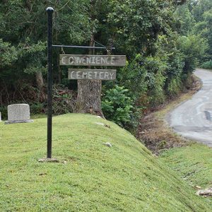 Convenience Cemetery
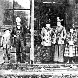
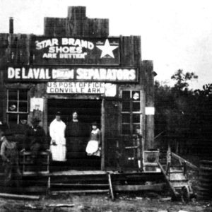 Conville Post Office
Conway (Faulkner County)
Conway, the seat of Faulkner County, is a well-known center of education in central Arkansas. It is home to Hendrix College and surrounding historic district, the University of Central Arkansas (UCA), and Central Baptist College. Louisiana Purchase through Early Statehood The Cadron Settlement, approximately five miles west of what is now Conway, was originally an early French trading post on the Arkansas River. Many of the original American settlers were veterans of the War of 1812 who were granted highly speculative “preemptive” land rights in exchange for their prior military service. These allowed them to claim land before patents were issued by the U.S. government. The settlement became the county seat of Pulaski County in June 1820, but the seat was …
Conway Cemetery State Park
Conway Cemetery State Park, near Walnut Hill (Lafayette County) in southwest Arkansas, preserves a half-acre cemetery containing the grave of the state’s first governor, James Sevier Conway. It is the second-smallest Arkansas state park. Conway was governor of Arkansas from 1836 to 1840 and a member of “The Family,” a powerful dynasty that dominated early Arkansas politics. During his tenure in office, he was responsible for a budget surplus and many of the state’s initial institutions, including roads, a prison system, and a state bank. An advocate of education, he unsuccessfully requested that the Arkansas General Assembly use the budget surplus to create a public school system and state university. The economic depression of 1837 collapsed the banking system and …
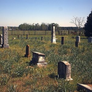 Conway Cemetery State Park
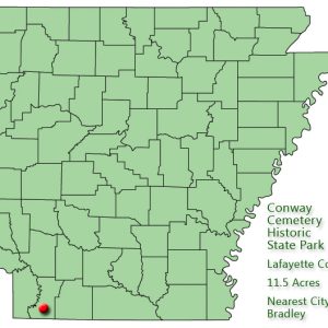 Conway Cemetery State Park: Park Location
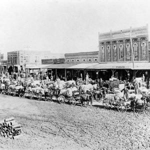 Conway Cotton Wagons
Conway County
Conway County was established by an act of the territorial legislature on October 20, 1825, from land taken from Pulaski County. It was named for Henry Wharton Conway, a member of the Arkansas Territory’s delegation to Congress. At the time, it comprised 2,500 square miles and included most of the present Conway, Faulkner, Van Buren, White, Cleburne, and Perry counties and part of Yell County. Located in the Arkansas River Valley, Conway County’s geographic structure ranges from the ridges of the Ozark foothills in the extreme northwest to the rich lowlands near the Arkansas River—a quite varied topography. The county’s native hardwood and pine forests have been a resource for the timber and recreation industries. Cotton was grown in the …
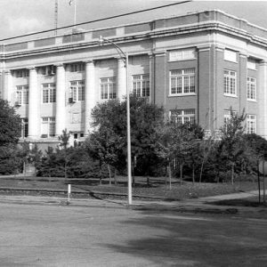 Conway County Courthouse
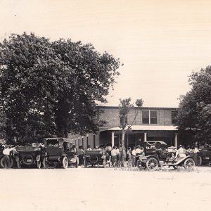 Conway Hotel
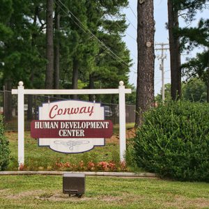 Conway Human Development Center Entrance
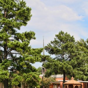 Conway Human Development Center Chapel
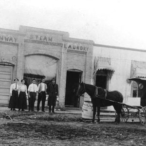 Conway Laundry
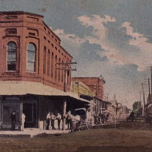 Conway Street Scene
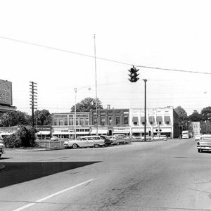 Conway Street Scene
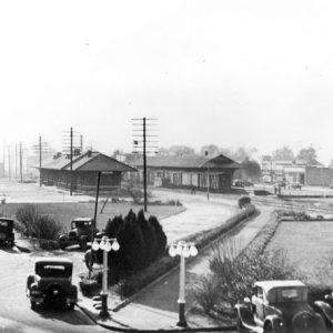 Conway Train Depot
 Cook-Morrow House
 Coolidge House
 Coolidge House
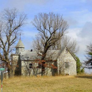
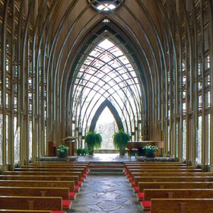 Cooper Chapel
 Cooper Chapel
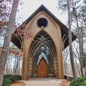
 Cooper Chapel Entrance
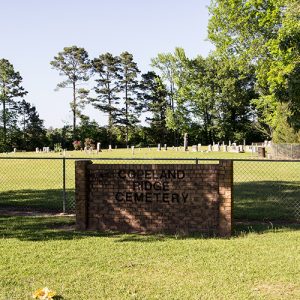 Copeland Ridge Cemetery
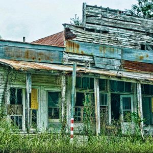 Cord Store
 Cord Church
Cord (Independence County)
Cord is located at the junction of Cord Road (Highway 122) and West Hopewell Road (Highway 37, a.k.a. Elgin Road) near Charlotte (Independence County) and Dota (Independence County). Cord grew out of the Hopewell community, and the name Hopewell is used for the main cemetery for Cord and for one of the main roads running through Cord. The Hopewell area was good for growing crops and grazing animals, becoming noted for its prosperous farmers. The early settlers of Hopewell were attracted by the nearby farmland of Big Bottom on the banks of the White and Black rivers approximately ten miles to the southwest. Eventually, a ferry across the Black River at Elgin (Jackson County), four miles to the southeast, made …
Corinth (Howard County)
Corinth, named for the local Church of Christ, was originally known as Wilton Settlement. The unincorporated community in Brewer Township in Howard County has always been an agricultural area. Since the first recorded wave of settlement in 1845, the community has lost population, and in 2009 the residents numbered seventy. Caddo Indians inhabited the area in the sixteenth century, but they had been removed to Oklahoma by the mid-1800s. A land exchange with the Choctaw in the 1820s brought more Native American settlement, which made white migrants wary of moving to the area for a time. By the 1840s, Indian Removal cleared the way for white migrants heading west, and numerous families made the area, then in Pike County, their …
 Corinth School
Corinth (Yell County)
Corinth is a town in Yell County, located between the cities of Danville (Yell County) and Belleville (Yell County). State Highway 10 is the approximate northern boundary of the town, although some businesses on the highway are just outside its limits. Petit Jean River forms the southern boundary of Corinth. As is the case for the rest of Yell County, the land that would become Corinth was sparsely populated, first by Native Americans and then by American settlers. The name “Corinth” was attached to the area during the nineteenth century. Corinth was an important city of ancient Greece and was also the location of an early Christian congregation (to which the apostle Paul wrote two epistles that are included in …
 Corn Hole Spring
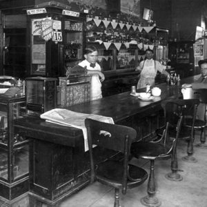 Corner Cafe
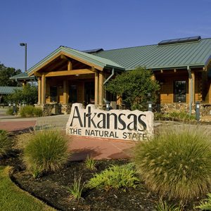 Corning Welcome Center
Corning (Clay County)
Corning, incorporated in August 1877, was the first of Clay County‘s two seats (Piggott is the other). Corning is the judicial seat for the county’s Western District and is the commercial and educational center of western Clay County. There is little record of western Clay County’s earliest settlers. The land was heavily forested and cut by many rivers and streams. Swamps covered large parts of the area, making transportation and farming difficult. The state sold most of the land as swamp and overflowed lands. Land speculators and timbering interests bought large tracts. The many rivers aided in the movement of cut timber to mills in other towns. In the 1850s, the Cairo and Fulton Railroad secured the right to build a …
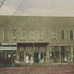 Corning Street Scene
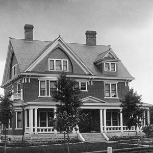
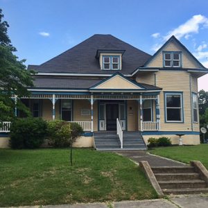
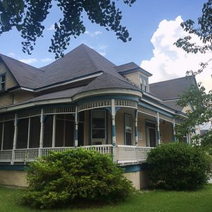
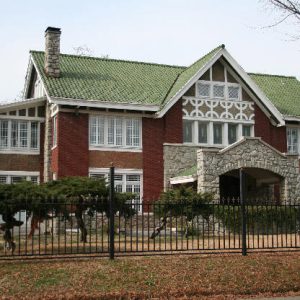 Cornish House
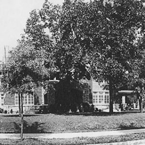 Cornish House
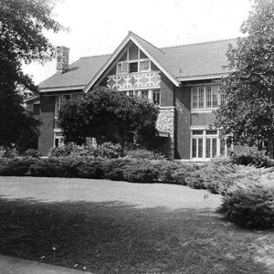 Cornish House
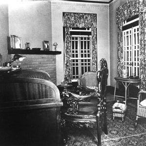 Cornish House Interior
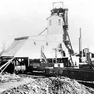 Coronado Coal Company Mine
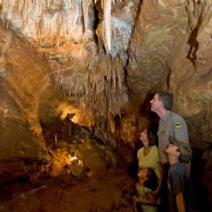 Cosmic Caverns
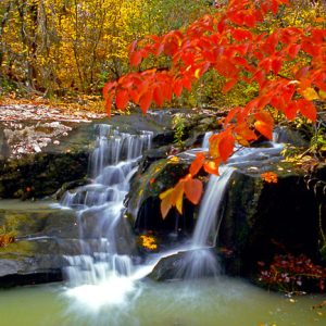 Cossatot River State Park


