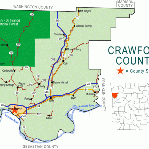
 Crawford County Map
Entry Category: Land and Resources - Starting with C
Crawford County Map
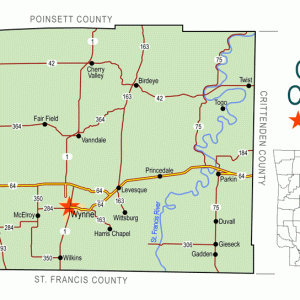
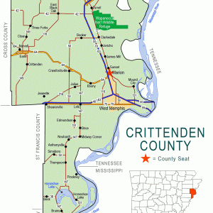 Crittenden County Map
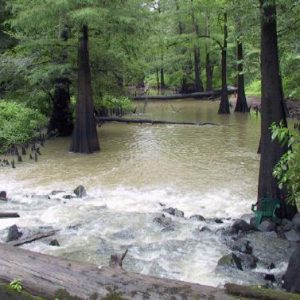
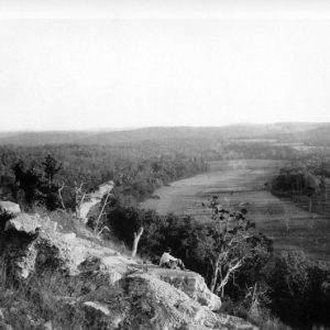 Crooked Creek
 Crooked Creek
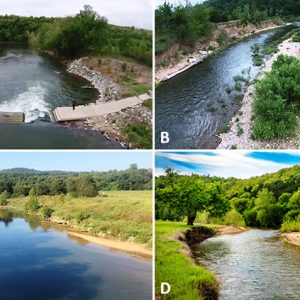
Crooked Creek (Watershed)
Crooked Creek is a 129 km (80 mi.) Ozark highland White River tributary in Boone, Marion, and Newton counties of northern Arkansas. The stream’s headwaters (36°06′47″N, 93°02′19″W) begin at Sulphur Spring (Newton County) on the north side of Sulphur Mountain just south of Harrison (Boone County) and east of Marble Falls (Newton County), the location of Dogpatch USA, and flow north, passing under Arkansas Highway 206 just west of Elmwood (Boone County). The stream continues north, traveling parallel (eastward) to Arkansas Highway 7, passing through the southeastern part of Harrison and under U.S. Highway 65. The stream immediately turns eastward, beginning a long series of meanders by which it gained its name. Crooked Creek then turns southeast, passing the communities …
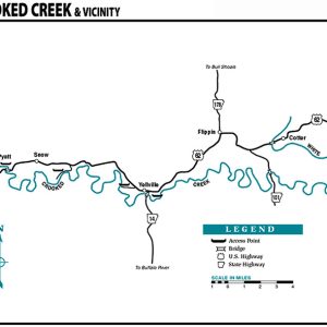 Crooked Creek Map
 Cross County Map
Crossett Experimental Forest (CEF)
Established in 1934, the Crossett Experimental Forest (CEF) of the United States Department of Agriculture (USDA) Forest Service was one of the first experimental forests in the southern United States. It has provided decades of scientific research on topics ranging from forest ecology and silviculture to wildlife, hydrology, and soils in the loblolly and shortleaf pine-dominated forests of the Upper West Gulf Coastal Plain geographic province. The scores of studies conducted on the CEF have generated hundreds of scientific publications, making the station an internationally known example of high-quality long-term forestry research. Long-term research studies and demonstration projects also serve as in-the-woods educational opportunities regarding low-cost forestry practices, and tens of thousands of students, professionals, and others have visited the …
Crossett Lumber Company
The Crossett Lumber Company (CLC) was Arkansas’s largest and most influential lumber company from its founding in 1899 until its merger with the Georgia-Pacific Company in 1962. It is notable for its growth alongside the company town of Crossett (Ashley County) and its early use of sustained-yield forestry in collaboration with Yale University’s School of Forestry. On May 16, 1899, Charles W. Gates, Edward Savage Crossett, and Dr. John W. Watzek—all from Davenport, Iowa—founded the Crossett Lumber Company in Ashley County in southeast Arkansas and Morehouse Parish in northern Louisiana. Stockholders named them president, vice president, and treasurer of the board of directors, respectively. Their first action was the purchase of 47,000 acres of land from the Michigan investment firm …
 Crossett Research
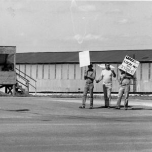 Crossett Strike
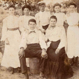
 Edward Crossett
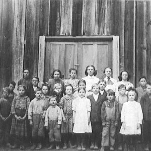 Crossroads School
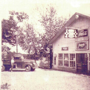 Crossroads Store
Crowley’s Ridge
Crowley’s Ridge is a small yet distinctive natural region. It ranges in width from one to twelve miles and extends from southern Missouri across eastern Arkansas to Helena-West Helena (Phillips County). It is made up of a continuous series of rolling hills except for a slight break at Marianna (Lee County); this break or gap was created by the L’Anguille River as it flowed across the ridge. The ridge received its name from Benjamin Crowley, the first white settler to reach the area near present-day Paragould (Greene County), sometime around 1820. Also of note is that the Civil War Skirmish at Chalk Bluff was fought on Crowley’s Ridge on May 1–2, 1863. The Chalk Bluff Natural Area in Clay County …
 Andy Crum
 Andy Crum
 Andy Crum
 Andy Crum Bank Note
Crushed Stone Mining
Crushed stone is an angular form of construction aggregate, made by breaking quarried rock into fragments that may be sorted, sized, and recombined into a variety of products. Crushed stone is typically quarried—that is, mined using benching methods (carrying out work from a ledge in a mine or quarry) and explosives, as opposed to the mechanical digging used for extracting sand and gravel. Consolidated rock is cut into vertical ledges, so that drilling can be done from above to place explosives within the wall for proper breakage of rock during mining. Benches typically vary from twenty to sixty feet in height, depending on how competent the rock is. The quarry stone is normally run through a primary crusher and then …
Crystal Hill (Pulaski County)
Crystal Hill is a geological formation on the north side of the Arkansas River near Murray Lock and Dam. It is also the name of a neighborhood in the city of North Little Rock (Pulaski County). Nearby Pyeatte-Mason Cemetery contains the graves of some of the early settlers of Crystal Hill. The formation, about seven miles upstream from downtown Little Rock (Pulaski County)—although many early travelers exaggerated the distance to fifteen miles—is a bluff consisting of sandstone and shale. It also contains significant amounts of iron pyrite, which sparkles in the sunlight. River travelers, seeing the sparkle, gave the hill its poetic name. East Arkansas settlers displaced by the New Madrid Earthquakes of 1811–1812 began to settle this part of …
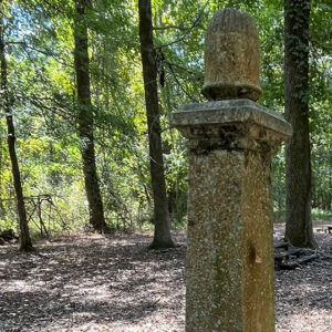 Cumby Grave
Current River
The Current River crosses into Arkansas from Missouri at the border between Randolph and Clay counties and flows for approximately forty miles before merging with the Black River near Pocahontas (Randolph County). The river was the site of four Civil War skirmishes at Pitman’s Ferry in Randolph County. This is a well-known river for canoeing and was made a part of the Ozark National Scenic Riverways, a national park located in southern Missouri, in 1964. The Current River arises in the Ozark Mountains from the confluence of Montauk Spring and Pigeon Creek in Dent County, Missouri. Numerous other springs pour into the river as it progresses through Missouri, thus giving it a fairly constant flow of water throughout the year; …
 Cut-Off Creek Ravines Natural Area
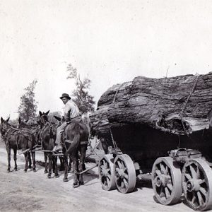 Cypress Logging


