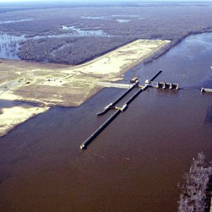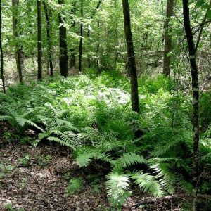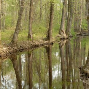
Felsenthal National Wildlife Refuge encompasses approximately 65,000 acres at the confluence of the Ouachita and Saline rivers, spreading across the borders of three counties—Union, Bradley, and Ashley—in southeastern Arkansas near the Louisiana Border. The refuge takes its name from the nearby town of Felsenthal (Union County). The refuge was established in 1975 in order to mitigate the environmental impact of the Ouachita and Black Rivers Navigation Project of the U.S. Army Corps of Engineers, which entailed the construction of locks and dams along both rivers in order to facilitate river traffic and prevent flooding. Felsenthal Lock and Dam on the Ouachita River impounds Lake Jack Lee, which the refuge surrounds. Numerous other waterways, such as Caney Bayou and Big Brushy …
The Flint Creek Power Plant, located near Gentry (Benton County) and operated by Southwestern Electric Power Company (SWEPCO), is one of four coal-fired power plants in Arkansas. On April 9, 1974, SWEPCO and the Arkansas Electric Cooperative Corporation (AECC) jointly filed an application with the Arkansas Public Service Commission (PSC) to build and operate a single-unit coal-fired power plant and related facilities in western Benton County near Gentry, close to the Arkansas-Oklahoma state line. SWEPCO would build and operate the plant. This application was the second request to build a major coal-fired generating plant in Arkansas filed within the first year after the Arkansas General Assembly adopted a law known as the Utility Facility Environmental Protection Act. The first request, …
The Civilian Conservation Corps (CCC) side camp BF-2 at Jacks Bay in Arkansas County was distinct from most other CCC camps in Arkansas in two ways: the enrollees were African American rather than white, and they were housed in floating government quarterboats rather than in barracks or tent camps. The side camp at Jacks Bay was occupied from January 1936 until May 1938, when it was abandoned, the boats removed, and the personnel integrated into another camp. The Jacks Bay side camp had its origins in President Franklin D. Roosevelt’s Executive Order 7173, issued on September 5, 1935, that authorized the Bureau of Biological Survey to acquire 110,000 acres on the Lower White River for protection and conservation of migratory …
aka: Great Flood of 1927
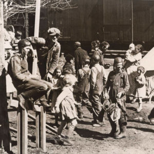
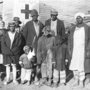
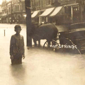
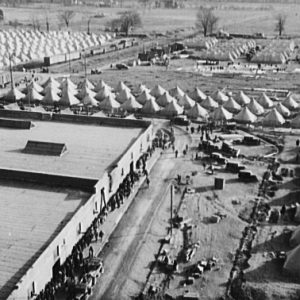
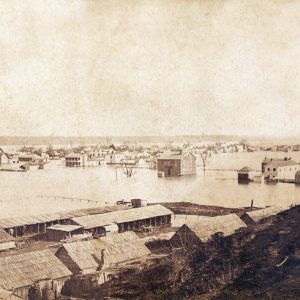
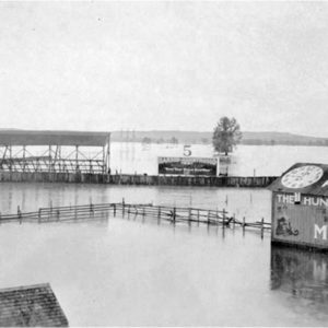
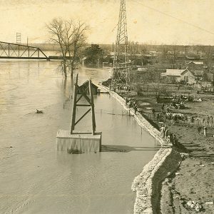
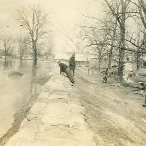
The Flood of 1927 was the most destructive and costly flood in Arkansas history and one of the worst in the history of the nation. It afflicted Arkansas with a greater amount of devastation, both human and monetary, than the other affected states in the Mississippi River Valley. It had social and political ramifications which changed the way Arkansas, as well as the nation, viewed relief from natural disasters and the responsibility of government in aiding the victims, echoing the Hurricane Katrina disaster in the present day. In largely agrarian Arkansas, the Flood of 1927 covered about 6,600 square miles, with thirty-six out of seventy-five Arkansas counties under water up to thirty feet deep in places. In Arkansas, more people …
A cold, rainy January in 1937 set the stage for one of the worst floods—if not the worst—in Arkansas. Corrective action undertaken during the preceding ten years kept Mississippi River levees along Arkansas’s border from breaking, however, thereby preventing a repeat of the Flood of 1927. Nevertheless, eleven Arkansas waterways overflowed, inundating or otherwise affecting seventeen adjacent counties. Eleven additional states flooded, from West Virginia to Louisiana, affecting 1.5 million people in 196 counties and submerging 8,141,182 acres (12,721 square miles) along the Ohio and Mississippi river valleys. This natural calamity shattered all previous disaster records, excluding World War I, according to the American Red Cross (ARC). Flood conditions developed over January and February 1937 from abnormal barometric pressure over …
On September 13, 1978, a large rainstorm subjected much of central Arkansas to record-setting amounts of rainfall. Due to the resulting flash floods, ten people drowned in Little Rock (Pulaski County) and three more died in Benton (Saline County). In addition to local authorities, Governor David Pryor activated the Benton and Little Rock National Guard units to assist in search and rescue efforts. The flood affected Arkansans in at least fifty-seven counties and caused tens of millions of dollars in damage. The storm began moving from west to east beginning on September 13. The National Weather Service reported that 8.10 inches of rain fell on September 13 alone, a record second only to the 8.81 inches that fell on April …
The flood along the Arkansas River that occurred in the spring of 2019 broke a number of high-water records and proved to be one of the costliest natural disasters in the state’s history. In addition, the flood cast light upon the state’s aging levee and transportation infrastructure. Several climatological factors combined to produce the flood. First, a mild winter and warmer than usual spring (likely exacerbated by global warming) led to early snowmelt in the Rocky Mountains, the source of the Arkansas River. During the spring months, especially in May, the Great Plains were hit by repeated storms that brought record numbers of tornadoes and record rainfall; high pressure over the southeastern states stalled this weather in the Midwest. For …
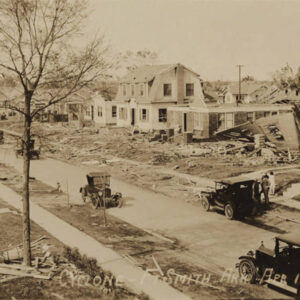
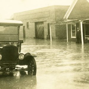
Floods are one of the most commonly occurring natural hazards in the United States. Their effects can be local, impacting a neighborhood or community, or can occur in large scale, affecting entire river basins and several states. About 3,800 towns and cities in the United Sates with populations of more than 2,500 lie on floodplains. The National Weather Service has documented some ninety-two flood deaths per year in the United States since 1903. This figure does not include flood-related deaths associated with Hurricane Katrina (2005). Since 1997, more than half (about fifty-seven percent) of all flood deaths have been vehicle-related fatalities. Throughout its history, Arkansas has been drastically affected by floods, with the most notable being in 1927 and 1937. …
The Dictionary of Forestry defines “forest management” as the application of biophysical and socioeconomic principles to predominantly tree-covered lands to meet specific objectives while maintaining productivity. To this end, forest management encompasses the art and science of manipulating timberlands for a range of renewable natural resources, including (but not limited to) wood products, wildlife, water, clean air, carbon storage, biodiversity, aesthetics, and recreation. Conservation has always been an integral part of forest management, although its definition has evolved over the decades as the practice of forestry has matured. Today, conservation has more of an emphasis on long-term sustainability, but during the earliest years of professional forestry, any effort related to the non-exploitive treatment of forests was considered conservation. In Arkansas, …
The Forrest L. Wood Crowley’s Ridge Nature Center in Jonesboro (Craighead County) was built through the efforts of the Arkansas Game and Fish Commission (AGFC). It is one of four such nature centers that were built after the 1996 passage of a one-eighth-cent conservation sales tax. Named after Forrest L. Wood, former commissioner and longtime supporter of the AGFC, the center opened on August 25, 2004, after nearly two years of construction. Located on the northern, wider part of the 200-mile-long Crowley’s Ridge, the center provides the public an opportunity to view wildlife in its habitat and learn about the area’s history. The facility maintains several interactive indoor/outdoor exhibits and offers two related films. Educational programs focus on Arkansas’s history …