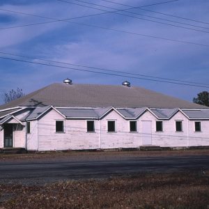
 Clarksville Skating Rink
Entry Category: Counties, Cities, and Towns - Starting with C
Clarksville Skating Rink
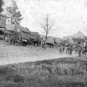
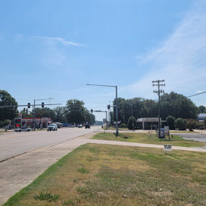
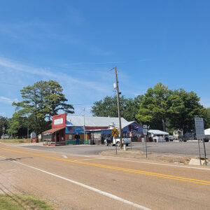
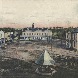 Clarksville Street Scene
 Clarksville Street Scene
Claunch (Craighead County)
Claunch was a small town in Craighead County located on a bend of the St. Francis River, about six miles north of Lake City (Craighead County) in Lester Township. The small town was primarily an agricultural center and a place on the river where flatboats docked. The town was originally called Lester, after Phill Lester, an early pioneer, who owned a large plantation prior to the Civil War. In October 1891, a post office was established, and the town was named for James Riley Claunch, a well-known farmer and physician of northeastern Arkansas. James Riley Claunch (1833–1918) was the oldest child of James Harvey Claunch (1810–1899) and Charlotte Bearden (1815–1882). He was born in Bedford County, Tennessee, and grew up …
Clay County
Clay County is a predominantly rural area with small cities and towns located in northeastern Arkansas. Light industry in the area supplements the agriculture-based economy. Hunting, fishing, and boating are the area’s primary recreational offerings. Clay County lies within the Mississippi River Alluvial Plain. The county is divided into unequal halves by Crowley’s Ridge, following a northeast to southwest direction. In general, soils in the county range from sandy to clay and gravel, and lignite deposits can be found along Crowley’s Ridge. Eastern Clay County has petrified wood, pieces of which can be seen outside the courthouse in Piggott and have even been used to make tombstones. The St. Francis, Cache, Black, and Current rivers flow through the county. Approximately …
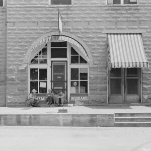
 Clay County Bank
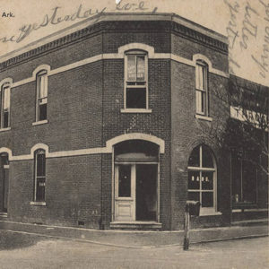
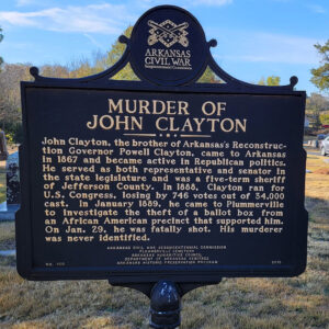 John Clayton Marker
Clear Spring (Clark County)
Clear Spring was a community that existed in western Clark County in the nineteenth and twentieth centuries. It was located about four miles east of Antoine (Pike County). It is often referred to as Clear Springs. One of the earliest families in the area was the Meeks family, who arrived from Tennessee via Independence County in 1840. Other settlers soon arrived, and a school opened in the area. The Clear Springs Post Office operated from 1856 to 1911, when operations were taken over by the post office at Okolona (Clark County). A rural community, Clear Spring consisted of several homes, a store, and a few churches. The store belonged to the Meeks family and was opened by Robert Lee Meeks …
Cleburne County
Although it was the most recent of Arkansas’s seventy-five counties to be formed, Cleburne County has proved to be a tourist mecca for the state. Thousands of Arkansans and visitors are attracted to Greers Ferry Lake and the Little Red River for fishing, swimming, and other water sports. Even before the lake was formed, summer visitors were attracted to the mineral springs in Spring Park in Heber Springs, the county seat, and to the waterfalls and unique rock formations in the surrounding hills. Cleburne County has a generally rugged terrain with elevations ranging from 270 feet above sea level in the river bottomland of the southeast part of the county to 1,400 feet in the northwest section. The valleys have …
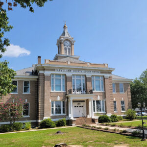
 Cleburne County Courthouse
 Cleburne County Courthouse
Cleveland (Conway County)
Cleveland, located in northern Conway County between the East and West forks of Point Remove Creek, was once a thriving center of area trade. Little remains of the farming town that once numbered over 300. The surrounding landscape that was previously planted in cotton is now dominated by sheep, beef cattle, and chicken houses. The first white settler to occupy part of the one-square-mile plot of land on which Cleveland was founded is believed to have been James T. Massey, who arrived in 1871. Though others gradually moved to the area, the town did not develop for several years. The first store was established in 1883 by John W. Todd and T. J. Hannaford. Todd had settled in the area …
 Cleveland Church
Cleveland County
Cleveland County was created on April 17, 1873 as Dorsey County, named after Republican congressman Stephen Dorsey, but the name was changed to honor President Grover Cleveland on March 5, 1885. The Saline River bisects the county from near the northwest corner to near the southeast corner. Moro Creek forms much of the western boundary. When the area was first explored, trees covered a major part of the county. Much of the economy centered on their harvest. The timber industry is still important to the county. Louisiana Purchase through Early Statehood Fossils of sea crustaceans have been found along Salty Branch, as it is known locally, which crosses Arkansas Highway 8 just east of Highway 97. According to an 1818 …
 Cleveland County Courthouse
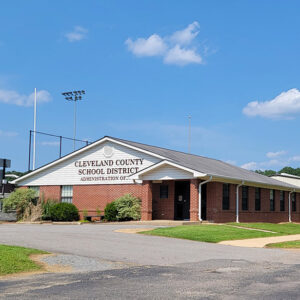 Cleveland County Schools
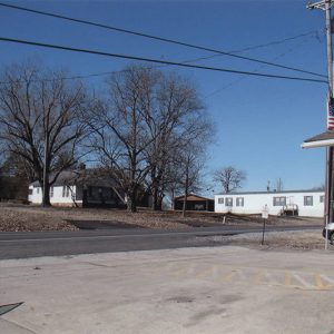 Cleveland Street Scene
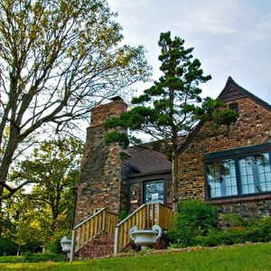
 Cliff Home
Clinton (Van Buren County)
Clinton has been the county seat of Van Buren County since 1844. Sheltered in the Little Red River valley, the city has been bypassed by many of the major events of Arkansas’s history, including Civil War battles, the building of the railroads, and the desegregation turmoil of the mid-twentieth century. Louisiana Purchase through Early Statehood When the land that would become Arkansas became part of the United States through the Louisiana Purchase in 1803, the Little Red River valley was included in land recognized as Osage hunting territory. The Osage had permanent settlements farther north but frequently visited north-central Arkansas. An 1825 treaty removed the Osage tribe to Kansas, opening the land for settlement by Americans of European descent. Van …
 Clintons' House
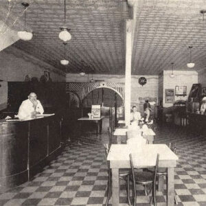 Co-ed Cafe
Coal Hill (Johnson County)
For a short time in the late nineteenth century, Coal Hill, located on U.S. Highway 64 in western Johnson County, was unofficially the largest incorporated city in the county. By the 1880s, it was a major coal-producing area, leading the state in tons mined. In 1888, it became the center of a state investigation into the mistreatment of convict labor employed in the mines. The investigation helped lead to the abolition of the much abused system. Post Reconstruction through the Gilded Age Western Arkansas is home to large coal deposits; however, until the construction of the Little Rock and Fort Smith Railroad into the area in the late 1800s, there was no reliable way to get the extracted coal to …
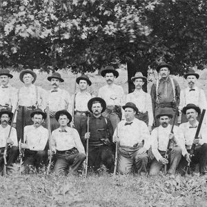 Coal Mine Guards
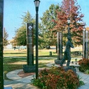 Coal Miners Monument
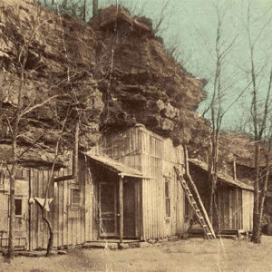
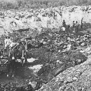 Coal Mining
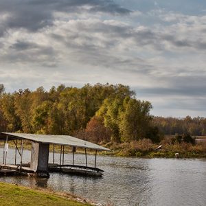 Coal Pile Lake
Coaldale (Scott County)
Coaldale is an unincorporated community in western Scott County located along Highway 28 West. The town was established in 1903 and named for the extensive coal mines that were established in the area. Mining was a significant industry in Coaldale, along with agriculture and timber. Prior to European exploration, Coaldale was a wilderness lush with native vegetation and numerous species of wildlife, some of which no longer inhabit the area. Archaeological findings have provided evidence of early inhabitants dating to the Archaic, Woodland, and Mississippian periods. Further evidence has indicated that the people of the Caddo tribe later inhabited the area. During the late seventeenth and early eighteenth centuries, French hunters and tradesmen traveled west from the Arkansas Post along …
 Cockrill Campaign Card
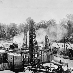 Coffer Dam
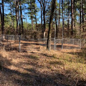 Colburn Cemetery
Colburn Spring (Scott County)
Colburn Spring is a historical community located in northeastern Scott County. The community was established south of the Petit Jean River near the Cedar Creek tributary in what is now the Ouachita National Forest. Agriculture and mining contributed significantly to the way of life in Colburn Spring. Prior to European exploration, the area surrounding Colburn Spring was a wilderness. Several species of wildlife that no longer inhabit the area, such as elk and buffalo, were present throughout the region. Numerous archaeological sites and burial mounds can be found along the banks of prominent waterways such as the Petit Jean River. Archaeological findings have provided evidence of early inhabitants dating to the Archaic, Woodland, and Mississippian periods. Further archaeological evidence has …
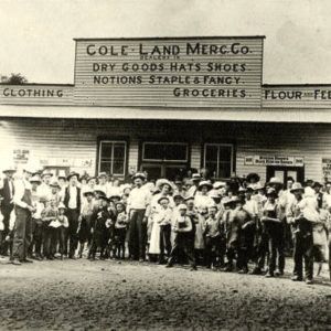 Cole-Land Mercantile Company
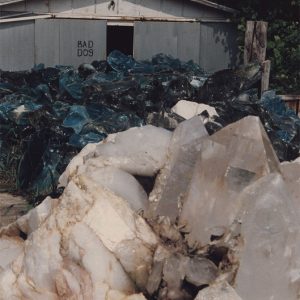 Coleman Quartz
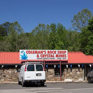 Coleman's
College City (Lawrence County)
College City of Lawrence County consisted of the campus of Williams Baptist College (now Williams Baptist University), along with residential areas north and south of the campus. Its history as a city was shaped principally by the college, as well as by the Walnut Ridge Army Flying School that preceded the college on the property. Local residents voted to consolidate their city with neighboring Walnut Ridge (Lawrence County) in 2016. Southern Baptist College was established in Pocahontas (Randolph County) in September 1941. Drawing upon the alumni and the resources of several defunct Baptist schools—including Maynard Academy and Jonesboro Baptist College—Hubert Ethridge (H. E.) Williams and Henry Watters assembled a faculty and enrolled forty-two students. Williams became the first president of the college. Three …
Collegeville (Saline County)
Collegeville is one of Arkansas’s oldest unincorporated communities and the oldest in Saline County. The area was first settled by a group of planters led by Major Ezra Owen in an area between present-day Bryant (Saline County) and Alexander (Pulaski and Saline counties) in 1824, when Arkansas was still a frontier territory. In the twenty-first century, the community of Collegeville lies alongside State Highway 5 and Interstate 30, less than twenty miles from Little Rock (Pulaski County). Ezra Owen was born in Halifax County, Virginia, on March 17, 1770. He served with distinction in the War of 1812 with the Illinois Rangers before he moved to what was then Arkansas Territory. He supposedly served with frontiersman Daniel Boone in the Indian …
 Collins Street Scene
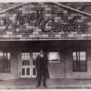 Colony Center
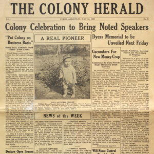 Colony Herald
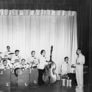 Colony House Band
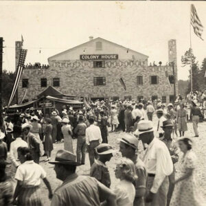 Colony House Crowd
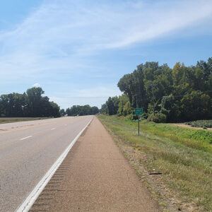 Entering Colt
Colt (St. Francis County)
Colt (St. Francis County), located at the intersection of Arkansas Highway 1 and Highway 306 between the L’Anguille River and Crowley’s Ridge, was an agricultural town that became a stop on several of the main routes through the state. It was a stopping place for many settlers moving out west on Military Road and became the home of Colt Station, a stop on the Iron Mountain Railroad from Memphis, Tennessee, to Fort Smith (Sebastian County). In the twenty-first century, it is used as a research area for agricultural sustainability for the Arkansas Delta. Louisiana Purchase through Early Statehood In 1826, William Mitchell Taylor settled near a creek one mile southeast of present-day Colt, where he built a large log house …
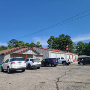 Colt City Hall and Fire Dept.
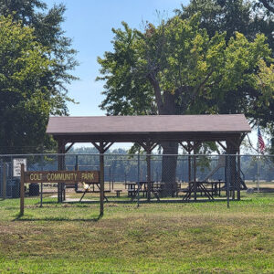 Colt Community Park
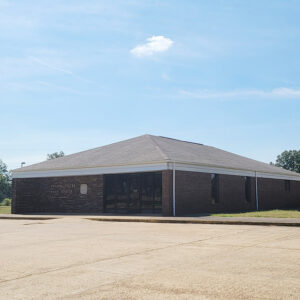 Colt Post Office
 Colt Street Scene
 Colt Street Scene
Columbia (Chicot County)
Columbia, founded during the late territorial period, was a busy settlement located on the western bank of the Mississippi River in extreme southeastern Arkansas. The one-time Chicot County seat was an important shipping point for local cotton plantations and the site of a branch of the Arkansas Real Estate Bank. Over time, the banks of the river slowly eroded the town site until it was eventually washed away. When Chicot County was established on October 25, 1823, a board of commissioners selected the settlement of Villemont as the county seat. In 1833, as the county boundaries changed, the seat of government was removed to a more central location a few miles upriver at Columbia. The added importance of being the …
Columbia (Randolph County)
The town of Columbia, cited by many as the second-oldest settlement in northeast Arkansas, was located on the banks of the Fourche Creek in present-day Randolph County. Originally known as Fourche de Thomas, it was established by some of the area’s earliest settlers in the early 1800s and is documented as the site of the first Baptist church in Arkansas. By 1811, a road later known as the Southwest Trail or Military Road, originating in Missouri and extending into the area, crossed the Fourche Creek near a small settlement. This roadway contributed to a steady stream of additional settlers, including the Fletcher, Lindsey, Jarrett, and Hoover families. Some believe that French trappers, who referred to the stream as Fourche de …


