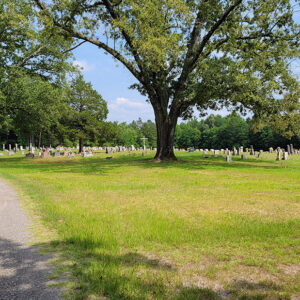
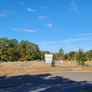
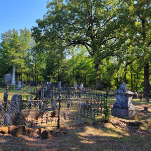
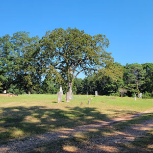
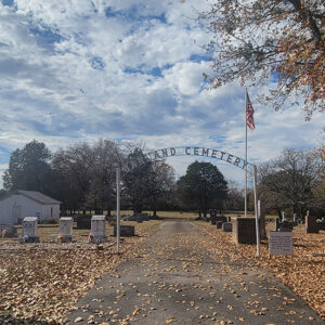
 Nimrod Cemetery
Entry Category: Counties, Cities, and Towns
Nimrod Cemetery
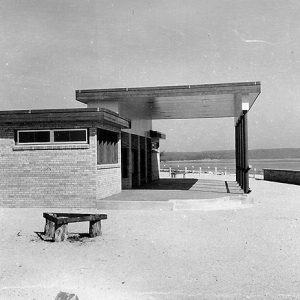
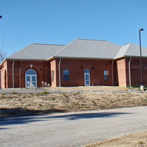
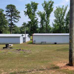 Nimrod Fire Department
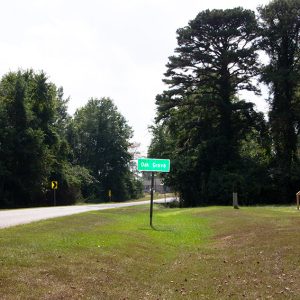
Nola (Scott County)
Nola formed as a small farming town in eastern Scott County. The unincorporated community was established within the Fourche La Fave River valley near the Yell County border. It is located near Harvey (Scott County), just two miles west along Highway 28. The area where Nola and Harvey are now located was once known as Nebraska. Prior to European exploration, the area where Nola is located was lush with native vegetation and wildlife. Archaeological evidence from the Archaic, Woodland, and Mississippian periods indicate that native people long lived along the river valley where Nola is located. Native American people of the Caddo tribe began settling along the valley around AD 1000. Several thousand burial mounds and other archaeological sites are …
Norfork (Baxter County)
Although it has been known by several names and did not incorporate as a city until the twentieth century, Norfork of Baxter County is one of the oldest extant settlements in Arkansas. Located where the North Fork River empties into the White River, the city of Norfork gave its name to the dam and lake created in the 1940s, and it still benefits from that tourist attraction in the twenty-first century. Jacob Wolf was one of the earliest homeowners in what would become Norfork. He is sometimes identified as an Indian agent, although no record exists of his appointment or activity in this vocation. Some local historians have claimed that Wolf arrived in Arkansas as early as 1811, but his presence …
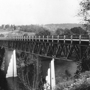 Norfork Bridge
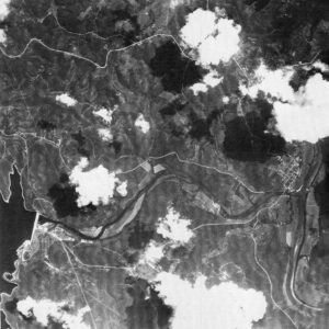 Norfork Dam Aerial View
 Norfork Lake Overlook
 Norfork School
Norman (Montgomery County)
Norman, known as Womble until 1925, is located on the Caddo River in southern Montgomery County. It was created as a result of the building of the Gurdon and Fort Smith Railroad and grew because of the lumber mills that sprang up along its right of way. It was once the home of the Presbyterian Church’s Caddo Valley Academy. In 1905, plans were announced to extend the Gurdon and Fort Smith line from Glenwood (Pike County), then its terminus, to Black Springs (Montgomery County). This announcement brought a large number of land speculators, including Walter E. Womble Sr., into the area. However, in 1907, a dispute over rights of way halted the project near the Caddo River, several miles short …
 Norman Access
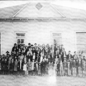
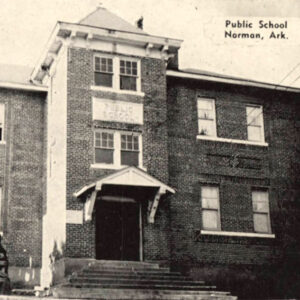 Norman School
Norphlet (Union County)
The city of Norphlet, like nearby Smackover (Union County) and El Dorado (Union County), rose to prominence due to the oil industry. The city is home to one of the most notorious disasters in Arkansas’s history of oil drilling. More recently, however, it has become a bedroom community to El Dorado, the county seat. The forested hills of Union County were thinly populated until after the Civil War and Reconstruction. The railroad industry, combined with the timber industry, brought new life to the area. The St. Louis, Iron Mountain and Southern Railway built a line running from Gurdon (Clark County) through El Dorado that was completed in January 1891. Norphlet was one of several depots created along the railway. The timber industry was …
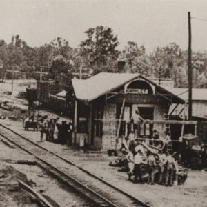 Norphlet Depot
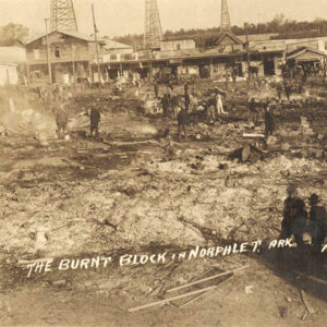 Norphlet Fire
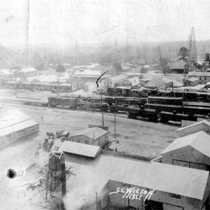 Norphlet View
Norristown (Pope County)
Norristown briefly served as the county seat of Pope County and was an important stop along the Arkansas River between Little Rock (Pulaski County) and Fort Smith (Sebastian County). It was located across the river from Dardanelle (Yell County) but no longer exists. Norristown was first settled in the late 1820s by Samuel Norris and quickly became a main shipping point, with area cotton loaded up on boats for shipment downriver and eventually to New Orleans, Louisiana. Norristown was designated the county seat in the early 1830s, though no courthouse was ever built there, and served as such until the 1840 creation of Yell County from part of Pope County necessitated the movement of the seat to Dover (Pope County), …
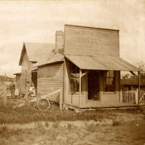 North End Grocery
North Little Rock (Pulaski County)
aka: Argenta (Pulaski County)
North Little Rock is the state’s sixth-largest city (as of 2010), though once the second largest, with historical ties to the transportation industry and the military. Before railroad companies spurred the growth of a town of mills, stockyards, and small businesses in the last three decades of the nineteenth century, the flood-prone north side of the Arkansas River across from Little Rock (Pulaski County) had few residents. But starting in the 1820s, its ferry and riverboat terminals prospered at a junction of roads on routes between St. Louis, Missouri, or Memphis, Tennessee, and Texas or Oklahoma. The military continues to have an economically viable relationship with central Arkansas, with Fort Logan H. Roots atop Big Rock Mountain since 1897; Camp …
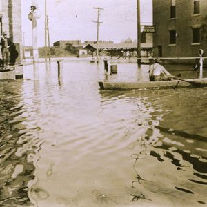 North Little Rock Flood
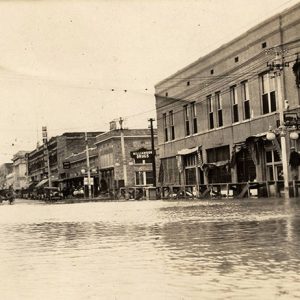 North Little Rock Flood
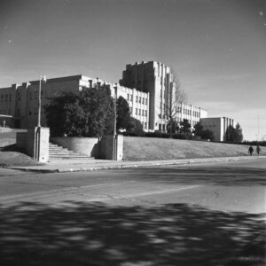 North Little Rock High School
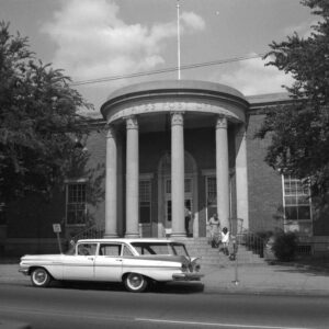
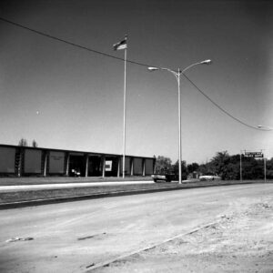 North Little Rock Police Dept. and Court
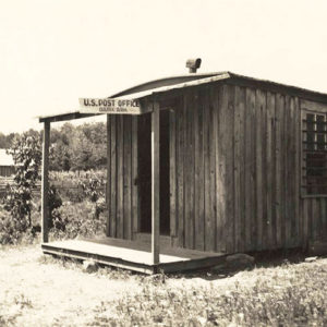
 North Little Rock Post Office
 NEARA Building
Norvell (Crittenden County)
Norvell was an incorporated town in western Crittenden County located just southeast of the Tyronza River, about one mile east of the Cross County line. In 1862, Dr. James Throgmorton arrived in what would become Norvell. In later years, he described the landscape as “a dense forest inhabited by bears, wolves and panthers,” adding that “it remained so until 1888.” The raw wilderness with abundant virgin timber invited settlement and commercial growth during the timber boom that swept Arkansas following the Civil War. This growth gave rise to Norvell and its larger neighbor Earle (Crittenden County), which were settled simultaneously and shared many of the same business and civic leaders. Population in the area was sparse until the 1880s, when the …
 Nursery Display
O’Kean (Randolph County)
The town of O’Kean (Randolph County) first developed in the Black River bottoms, the area to the south and east of the Black River in Randolph County, shortly after the Civil War. Attracted by plentiful game and productive ground, most pre-war settlers in the area lived near the road from Pocahontas (Randolph County) to old Greensboro (Craighead County) and Gainesville (Greene County), or along the Cache River. The history of the actual settlement and naming of O’Kean remains clouded. There were settlers near the junction of the track and road, but the name of that settlement, if it had one, is unknown. The name O’Kean came from Father James O’Kean, the former priest of St. Paul’s Catholic Church. He …
O’Neal (Independence County)
The O’Neal Cemetery is all that remains of a once vibrant river and railroad community located across the White River from Marcella (Stone County). Going west on Highway 106 through Bethesda (Independence County), the O’Neal Road leads to O’Neal, which is about four miles from Bethesda. In territorial days, O’Neal was in Ruddell Township, but it later became part of Washington Township. O’Neal lies on both the Union Pacific Railroad tracks and the White River, south of Lock and Dam No. 3. The rich bottomland around O’Neal is still farmed on both sides of the river. O’Neal is about twelve miles west of Batesville (Independence County), the county seat. O’Neal was founded and first settled during territorial days by John …
Oak Bower (Hot Spring County)
Oak Bower is an unincorporated community in Hot Spring County. Located about two miles south of Bismarck (Hot Spring County) and twelve miles northwest of Arkadelphia (Clark County), the community is closely associated with Bismarck and DeGray Lake. Early settlers in the area included Peter Prince, who obtained 320 acres as a federal land patent in 1859. The land was in Clark County at the time and became part of Hot Spring County in 1873. The Alabama native married Mary Williams in 1855, and the couple had at least four children. Other early settlers included Dougal Johnson, who obtained 160 acres south of the Prince settlement in 1860. The final land patent issued for the area went to George Magby …
 Oak Grove
Oak Grove (Carroll County)
Oak Grove is a town in northern Carroll County, located at the intersection of State Highways 21 and 103. A narrow strip of land in the town runs north along Indian Creek to the Missouri state line. The town is one of twelve communities in Arkansas identified as Oak Grove, and the only one to be incorporated. When a community in Greene County sought to incorporate with the same name in 1979, it was forced to incorporate as Oak Grove Heights. The forested Ozark Mountains have been sparsely inhabited for centuries. At the time of the Louisiana Purchase in 1803, the area was frequently visited by the Osage, who lived farther north but came into what would be Arkansas to …
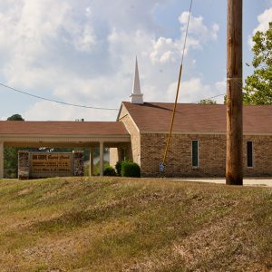 Oak Grove Baptist Church
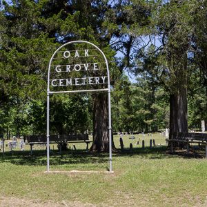 Oak Grove Cemetery
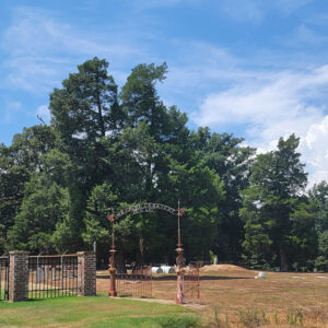 Oak Grove Cemetery
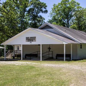 Oak Grove Church
Oak Grove Heights (Greene County)
Oak Grove Heights is a second-class city located on State Highway 135 four miles north of Paragould (Greene County). It was incorporated in 1979, roughly a century after the community came into being, and consists largely of residences for workers in neighboring communities of Greene County. The wilderness area immediately east of Crowley’s Ridge remained almost entirely uninhabited until after the Civil War, when the railroad industry began to open previously inaccessible regions of Arkansas. When the city of Paragould was established at the intersection of the Cotton Belt and Iron Mountain railways, many of the citizens of Gainesville (Greene County) relocated to the newer city, making it the county seat in 1884. Meanwhile, other settlers came to Arkansas to …
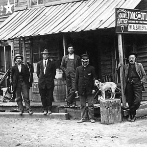 Oak Grove Store
Oak Grove[s] (Clark County)
At least three communities in Clark County have had the name Oak Grove. One is located in the southeastern corner of the county, one is located in the northwestern portion, and one was located near the middle of the county. Oak Grove Community Church served as the center of the community in the southeastern part of the county. Located near the Kansas (Clark County) community, the church was organized at an unknown date in the late nineteenth century. Serving as both a church and a school, the original building was constructed of split logs. This building burned around 1902. A replacement was constructed and continued to operate until the late twentieth century. In 1992, the church was still used for …
Oakhaven (Hempstead County)
Oakhaven is a town on State Highway 32, a few miles north of Hope (Hempstead County). Originally built as housing for officers serving at the Southwestern Proving Ground during World War II, Oakhaven has never had a post office or a school. Hempstead County was home to some of the most important communities of southwestern Arkansas in the early years of statehood. Fulton (Hempstead County) was an important port on the Red River and once served as the gateway to Mexico—later to Texas—while Washington (Hempstead County) was the county seat and an important city on the Southwest Trail; Washington even served as the Confederate state capital after Little Rock (Pulaski County) was captured by Federal forces in 1863. After the …
 Oakhill Cemetery
Oakland (Marion County)
Oakland is a populated unincorporated community in North Fork Township on State Highway 202 about twenty miles northwest of Mountain Home (Baxter County). Once a small village near the Little North Fork River’s confluence with the White River, Oakland was moved a few miles east in the late 1940s when the White was being dammed to create Bull Shoals Lake. The area was hunting territory of the Osage and earlier tribes, and archaeologists working at Oakland in 1948–1949 found possible evidence of small villages from the Woodland and Mississippian periods. White settlers—including the Yocham, Trimble, Coker, Graham, and McGarrah families—arrived in the 1810s. The explorer Henry Schoolcraft stayed overnight at the McGarrahs’ cabin in December 1818 and was given food …
 Oakland Cemetery
 Oakland Cemetery
 Oakland Cemetery
 Oark Post Office
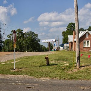 Odell & Paula's Food Center
Oden (Montgomery County)
Oden, a rural community in northwest Montgomery County, is on the north bank of the Ouachita River eight miles west of Mount Ida, the county seat. Oden’s population in 2010 was 232. In 1849, Henry Beshears settled where Oden now stands, his journey to Arkansas perhaps occasioned by the California gold rush. He wrote to his old neighbors in Mississippi about the wonderful country he had found—the Ouachita bottomlands and the abundant game. In the spring of 1848, a group left Tippah County, Mississippi, in thirteen ox-drawn wagons and arrived in Oden in January 1849. Hunting parties found game plentiful. Liking the land they saw, they cleared some ground and planted corn. A third wagon train came along and also …
 Oden School
Ogden (Little River County)
The city of Ogden is on the highway that connects Fort Smith (Sebastian County) to Texarkana (Miller County). Now a quiet residential community, Ogden was once an agricultural center for the surrounding cotton farms. Settlers first began arriving in the Red River valley around 1838. John Nunneley was the first landowner in what now is Ogden; he owned many acres of land and several slaves. Other settlers before the Civil War included Paul Bagley and Christopher Waddell. M. W. Bates arrived around 1878 and named the settlement Ogden, which was the maiden name of his second wife. Bates, who served as Little River County judge from 1884 to 1888, owned the first cotton gin, the first sawmill, and the first store …
Ogemaw (Ouachita County)
Ogemaw is an unincorporated community located in Ouachita County about four miles northeast of Stephens (Ouachita County) and fourteen miles southwest of Camden (Ouachita County). The community was founded to support timber operations in the area, but the local economy evolved in the early twentieth century with the discovery of oil nearby. Early settlers in the area included Thomas Meredith, who obtained more than 200 acres from the land patent office in 1859. Thomas lived with his wife, Mary, and their ten children on the property. They were served by the post office in the nearby community of Seminary (Ouachita County). The Cotton Belt Railroad began operations in the area around 1882. With the construction of the railroad and the …


