 Environment
 Recreation and Sports
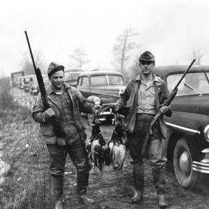 Bayou Meto Duck Hunters
 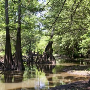 Bell Slough
 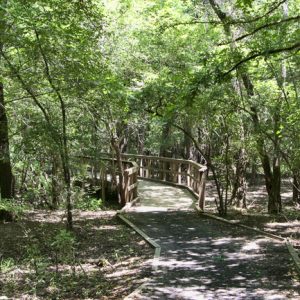 Bell Slough Trail
  Brewer Lake
 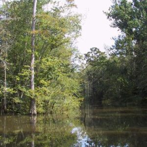 Cache River Natural Area
 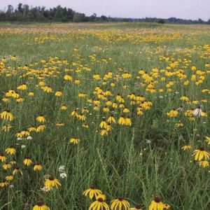 Cherokee Prairie Natural Area
 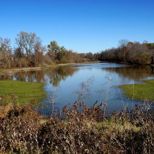 Choctaw Island WMA
 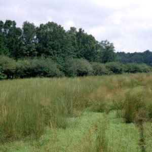 Coffee Prairie Natural Area
 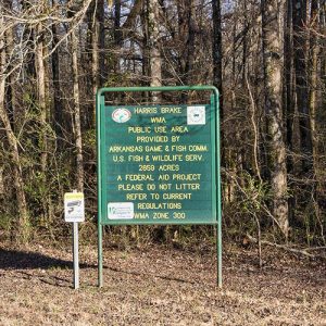 Harris Brake WMA
  Henry Gray/Hurricane Lake WMA
  Mike Freeze WMA
  Wattensaw Wildlife Management Area
501-918-3025
calsfoundation@cals.org
calsfoundation@cals.org
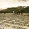
The Arkansas Game and Fish Commission (AGFC) oversees the state’s wildlife management areas (WMAs), which are places for public hunting at little or no cost to the participants, though they also have year-round potential for bird watching, seeing wild animals, picnicking, camping, and just enjoying the outdoors. There are more than 100 WMAs, large and small, around the state.
The WMA system encompasses 3,195,875 acres of the state, including tracts owned outright by the AGFC, cooperative areas, and leased lands. The largest portion of the WMA total acreage is in the Ouachita National Forest. Other cooperative WMA land is administered under agreements among the AGFC and the U.S. Army Corps of Engineers, the National Park Service, the U.S. Forest Service, and several other agencies in addition to timber companies and other private owners. Arkansans paid for the lands bought by AGFC—directly and indirectly—and funds for buying more critical wildlife habitat come from all citizens through the one-eighth of one percent conservation sales tax, inaugurated in 1997 through a constitutional amendment passed by Arkansas voters.
After the AGFC was created in its present form in 1945 by constitutional amendment, hunting and fishing license fees drove the buying of land for WMAs and for building lakes. Much of the WMA land was bought with federal funding paying three-fourths of the cost. The Pittman-Robertson Act, administered by the U.S. Fish and Wildlife Service, uses excise taxes paid by hunters and shooters on sporting equipment and supplies. Nearly all of the wildlife management areas are open to the public without fees. Some portions may be closed at times for maintenance and other work, and there are fees for quota deer hunts on a number of WMAs as well as leased-land WMAs.
A few of the more noteworthy WMAs are detailed below.
Bayou Meto WMA
Bayou Meto was the AGFC’s first WMA. Following World War II, sportsmen of the state clamored for two goals—more public land for hunting and more public waters for fishing. The call was answered in Arkansas with two immense projects—Bayou Meto WMA and Lake Conway. The lake is the largest in the nation ever built by a state agency. The WMA, located in Arkansas and Jefferson counties, is one of the largest state-owned management areas in the nation.
Bayou Meto WMA is a complex in the literal meaning. It is a system of creeks, sloughs, ditches, backwaters, and drainages partly created by nature and augmented by man. Natural rainfall and runoff are diverted, slowed, redirected, and channeled for the improvement of wildlife habitat. At times, this is a juggling act. Water is used for flooding the bottomland hardwoods, but it must be removed before stressing the trees. Too much water, and the excess backs onto rich farmlands surrounding the management area at times when landowners do not need it.
Extensive water control structures built on the area help with this work, along with relatively simple facilities like stop-log structures, where boards are added or removed by hand to hold or release water. Some thirty miles of levees, one dam, thirteen stop-log structures, seventy-seven gated pipes, seventy-three un-gated pipes, four re-lift pumps, and two high-water rock spillways, along with a few beaver dams, are used for water manipulation. Major waterfowl rest areas in the WMA give ducks respite from the heavy hunting on the WMA and in the surrounding Grand Prairie.
Rich Evans/Grandview Prairie WMA and Conservation Education Center
Grandview Prairie was the first major AGFC acquisition after Arkansas voters in November 1996 approved Amendment 75, the conservation sales tax. The 4,885 acres is now called Rick Evans/Grandview Prairie Wildlife Management Area and Conservation Education Center.
Just north of the tiny town of Columbus (Hempstead County), Grandview is a smorgasbord of opportunities for wildlife and nature viewing, fishing, and history exploration, with educational facilities attracting people interested in birds, butterflies, and wildflowers. Grandview’s conservation education center, originally a building devoted to other purposes but remodeled in 1997, is used by a variety of groups, from college field trips to school science classes, scout troops, AGFC workshops, church functions, and even family reunions. Educational use is a priority. Grandview’s staff can tailor lectures and displays to a group’s requests.
Overnight outings at modest costs can be arranged, and the center has multi-roomed sleeping accommodations and a well-equipped kitchen in addition to meeting rooms with audio-visual gear and a lounge area. The gently rolling terrain of Grandview is suitable for walking short, moderate, or lengthy distances, with extensive wildlife viewing opportunities.
Gene Rush WMA
Gene Rush WMA is a facility adjoining the Buffalo National River, mostly in Newton County, with its eastern segment in Searcy County. The management area is about 17,652 mountainous acres. The rugged terrain is a mix of second-growth forests, mostly the typical oak-hickory mix of the Ozarks. Some southern slopes have pine stands and mixed pine-hardwoods. Part of the area was obtained by the AGFC in the 1960s. The creation of the Buffalo National River took some of the land from state ownership into federal control in the early 1970s, and the AGFC has since made other additions.
AGFC personnel have made major improvements on Gene Rush in wildlife habitat. Old fields, farmed long ago, have been reseeded with native grasses and planted in other wildlife food sources. Timber has been marked and thinned. As of 2008, there are sixty-two wildlife openings—that is, manmade clearings used to encourage vegetation available to wildlife—and food plots totaling 400 acres. These are heavily used by game animals, and some of the plots are larger than normal for food plots, a design liked by elk. When elk were brought back to Arkansas beginning in 1981, they were not stocked on Gene Rush initially, but the big animals soon spread out and found the management area to their liking. Now, Gene Rush is the mecca for Arkansas’s herd.
A major strategy on Gene Rush is the use of prescribed burning. Controlled fires reduce forest litter and stimulate new plant growth eaten by wildlife.
Ed Gordon/Point Remove WMA
Ed Gordon/Point Remove WMA is in western Conway County, extending a short distance into Pope County.Its creation came through a partnership of several public agencies, conservation organizations, and interested private citizens. Blackwell Bottoms, as it was called at the time, went into public ownership as the first large North American Waterfowl Conservation Act (NAWCA) project in Arkansas. It was later given a more fitting name, linking a prominent Morrilton (Conway County) attorney and former AGFC commissioner with the major creek that flowed through the area. A lake on the northern portion of the WMA was named for W. J. Cargill, a prominent area resident and sportsman.
Ed Gordon/Point Remove is a multi-purpose facility focusing on ducks. Ducks were already using Goose Pond and other lowlands, and with some encouragement, more ducks were enticed into the area. Ducks Unlimited contributed a highly specialized machine called a Malsam Terracer. Drawn by tractor, it built low levees in a fraction of the time that conventional earth-moving equipment could do the same job, and Ed Gordon/Point Remove’s duck habitat multiplied.
Some quail lived on the higher ground of the WMA, and field trial enthusiasts pitched in with the AGFC to improve conditions; competitions and birddog trainings are now frequent. A clubhouse was built for use by field trial participants and by anyone else when not reserved. The building, located near Hattieville (Conway County), is often used for family reunions and wedding receptions.
About 8,400 acres can be flooded. Then, travel on the lowlands of the WMA is mostly by boat or borrow ditches. Deer are also abundant at Ed Gordon/Point Remove, and firearm hunting for deer is by permit. Archery deer hunting is open, and the WMA is well regarded by Arkansas bowhunters. A particularly productive dove field is located near the WMA headquarters, but the birds do not necessarily use the same areas consistently.
Management
Management activities involve several strategies for the wetlands, including working timber along the creeks. In the uplands, fields are disked in strips—that is, in alternating areas of cultivated and uncultivated ground—and planted with grain and burned when needed to encourage wild food plants to flourish. Plantings for doves include brown-top millet. Winter wheat helps attract deer and turkeys. Bush-hogging is also done to keep lanes open for horse riders in the field trial area.
Over thirty small wildlife management areas are scattered across the state. Most are lands obtained from the federal Farm Home Administration and once were farms. Natural habitat is being allowed to take over the fields on many of the areas. Public access is limited in many cases.
| WMA | Acres | County/Counties |
| Bayou Des Arc WMA | 953 | Prairie |
| Bayou Meto WMA | 33,832 | Arkansas, Jefferson |
| Beaver Lake WMA | 5,287 | Prairie |
| Bell Slough WMA | 2,040 | Faulkner |
| Benson Creek Natural Area WMA | 302 | Monroe, Woodruff |
| Beryl Anthony Lower Ouachita WMA | 7,531 | Ashley, Union |
| Big Creek WMA | 280 | Lee |
| Big Lake WMA | 12,320 | Mississippi |
| Big Timber WMA | 41,142 | Clark |
| Blevins WMA | 128 | Hempstead |
| Blue Mountain WMA | 8,200 | Logan |
| Brewer Lake/Cypress Creek WMA | 1,200 | Conway |
| Brushy Creek WMA | 215 | Cross |
| Buffalo National River WMA | 95,730 | Baxter, Marion, Newton, Searcy |
| Camp Robinson WMA | 26,675 | Pulaski, Faulkner |
| Caney Creek WMA | 85,000 | Howard, Montgomery, Pike, Polk |
| Casey Jones WMA | 83,832 | Ashley, Drew |
| Cattail Marsh WMA | 78 | Greene |
| Cedar Creek WMA | 103 | Scott |
| Cherokee Prairie Natural Area WMA | 566 | Franklin |
| Cherokee WMA | 62,203 | Cleburne, Conway, Faulkner, Franklin, Independence, Johnson, Logan, Lonoke, Perry, Pope, Pulaski, Scott, Searcy, Sebastian, Stone, Van Buren |
| Choctaw Island WMA | 7,676 | Desha |
| Cove Creek Natural Area WMA | 228 | Faulkner |
| Crossett Experimental Forest WMA | 1,675 | Ashley |
| Cut-off Creek WMA | 9,314 | Drew |
| Cypress Bayou WMA | 2,478 | Lonoke, White |
| Dardanelle WMA | 42,658 | Franklin, Johnson, Logan, Pope, Yell |
| Dave Donaldson Black River WMA | 21,150 | Clay, Greene Randolph |
| DeGray Lake WMA | 14,000 | Clark, Hot Spring |
| Departee Creek WMA | 450 | White |
| Devil’s Knob Devil’s Backbone Natural Area WMA | 519 | Izard |
| Dr. Lester Sitzes III Bois D’Arc WMA | 13,646 | Hempstead |
| Earl Buss Bayou DeView WMA | 4,435 | Poinsett |
| Ed Gordon Point Remove WMA | 8,694 | Conway, Pope |
| Electric Island WMA | 115 | Garland |
| Ethel WMA | 176 | Arkansas |
| Falcon Bottoms WMA | 2,787 | Columbia, Lafayette, Nevada |
| Fort Chaffee WMA | 66,000 | Franklin, Sebastian |
| Frog Bayou WMA | 790 | Crawford |
| Galla Creek WMA | 3,329 | Pope |
| Garrett Hollow Natural Area WMA | 670 | Washington |
| Gene Rush WMA | 17,963 | Newton, Searcy |
| Greers Ferry Lake WMA | 9,914 | Cleburne, Van Buren |
| Gulf Mountain WMA | 11,683 | Van Buren |
| Gum Flats WMA | 15,661 | Howard, Pike |
| Harold E. Alexander Spring River WMA | 13,859 | Sharp |
| Harris Brake WMA | 3,769 | Perry |
| H. E. Flanagan Prairie Natural Area WMA | 257 | Franklin |
| Henry Gray Hurricane Lake WMA | 17,524 | White |
| Hobbs State Park Conservation Area WMA | 11, 744 | Benton, Carroll, Madison |
| Holland Bottoms WMA | 6,190 | Lonoke, Pulaski |
| Hope Upland WMA | 2,115 | Hempstead |
| Howard County WMA | 26,000 | Howard |
| Howard Hensley Searcy County WMA | 170 | Searcy |
| Iron Mountain Natural Area WMA | 260 | Polk |
| Jamestown/Independence County WMA | 971 | Independence |
| Jim Kress WMA | 14,527 | Cleburne |
| Jones Point WMA | 1,200 | Marion |
| Lafayette County WMA | 16,739 | Lafayette |
| Lake Greeson WMA | 200 | Howard, Pike |
| Lee County WMA | 200 | Lee |
| Little Bayou WMA | 1,284 | Ashley |
| Little River WMA | 597 | Little River |
| Loafer’s Glory WMA | 2,616 | Searcy |
| McIlroy Madison County WMA | 14,496 | Madison |
| Mike Freeze Wattensaw WMA | 19,184 | Prairie |
| Moro Big Pond WMA | 16,000 | Calhoun |
| Mount Magazine WMA | 120,000 | Logan, Yell |
| Muddy Creek WMA | 146,206 | Montgomery, Scott, Yell |
| Nacatoch Ravines Natural Area WMA | 645 | Hempstead |
| Nimrod/Lloyd Millwood WMA | 3,550 | Yell |
| Norfork Lake WMA | 10,000 | Baxter |
| Ozan WMA | 580 | Hempstead |
| Ozark Lake WMA | 7,834 | Franklin |
| Ozark National Forest WMA | 678,878 | Baxter, Conway , Crawford, Franklin, Johnson, Madison, Newton, Pope, Searcy, Stone, Van Buren, Washington |
| Petit Jean River WMA | 15,502 | Yell |
| Pine City Natural Area WMA | 870 | Monroe |
| Piney Creeks WMA | 180,000 | Johnson, Newton, Pope |
| Poison Springs WMA | 17,604 | Ouachita |
| Prairie Bayou WMA | 453 | Lonoke |
| Provo WMA | 11,327 | Sevier |
| Railroad Prairie Natural Area WMA | 244 | Lonoke, Prairie |
| Rainey WMA | 488 | Pope |
| Rex Hancock Black Swamp WMA | 7,221 | Woodruff |
| Rick Evans Grandview Prairie WMA | 4,885 | Hempstead |
| Ring Slough WMA | 83 | Clay |
| River Bend WMA | 0 | Perry |
| Robert L. Hankins Mud Creek Upland WMA | 1,023 | Randolph |
| Roth Prairie WMA | 41 | Arkansas |
| Sandhills Natural Area WMA | 143 | Miller |
| Seven Devils Swamp WMA | 5,032 | Drew |
| Sheffield Nelson Dagmar WMA | 9,720 | Monroe |
| Shirey Bay Rainey Brake WMA | 10,711 | Lawrence |
| Slippery Hollow Natural Area WMA | 705 | Marion |
| Smoke Hole Natural Area WMA | 455 | Prairie |
| Spring Brake WMA | 701 | Lafayette |
| St. Francis Forest WMA | 21,201 | Lee, Phillips |
| St. Francis Sunken Lands WMA | 27,643 | Craighead, Poinsett |
| Stateline Sandponds Natural Area WMA | 4,000 | Clay |
| Steve N. Wilson Raft Creek Bottoms WMA | 4,000 | White |
| Sulphur River WMA | 16,681 | Miller |
| Sweden Creek Natural Area WMA | 137 | Madison |
| Sylamore WMA | 150,000 | Baxter, Lonoke, Madison, Stone |
| Terre Noire Natural Area WMA | 415 | Clark |
| Truston Holder WMA | 8,173 | Arkansas |
| Two Bayou Creek WMA | 1,250 | Ouachita |
| Village Creek WMA | 521 | Jackson |
| Warren Prairie WMA | 2,128 | Bradley, Drew |
| Wedington WMA | 16,000 | Washington |
| White Cliffs WMA | 573 | Little River |
| Whitehall WMA | 111 | Poinsett |
| White Rock WMA | 280,000 | Crawford, Franklin, Madison, Johnson, Washington |
| William E. Brewer Scatter Creek WMA | 3,898 | Greene |
| Winona WMA | 160,000 | Garland, Perry, Saline |
| Wittsburg Natural Area WMA | 167 | Cross |
For additional information:
Arkansas Game and Fish Commission. http://www.agfc.com/ (accessed April 19, 2022).
Butcher, Russell D. America’s National Wildlife Refuges: A Complete Guide. Lanham, MD: Roberts Rinehart Publishers, 2003.
Southeastern Outdoors. http://www.southeasternoutdoors.com/outdoors/hunting/arkansas-wildlife-management-areas.html (accessed April 19, 2022).
Joe Mosby
Conway, Arkansas


Comments
No comments on this entry yet.