 Historic Preservation
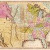 Louisiana Purchase through Early Statehood, 1803 through 1860
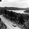 Roads and Highways
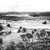 Telegraph Road (Northwestern Arkansas)
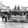 Transportation
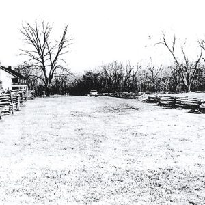 Elkhorn Tavern on the Springfield to Fayetteville Road
 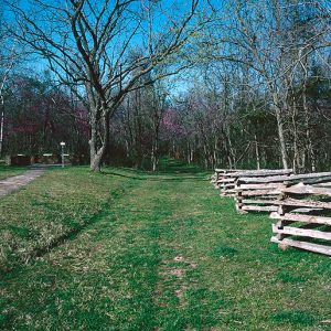 Springfield to Fayetteville Road
 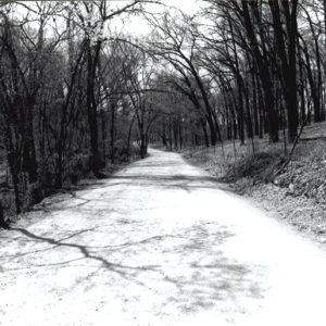 Springfield to Fayetteville Road—Cross Hollow
501-918-3025
calsfoundation@cals.org
calsfoundation@cals.org
The Springfield to Fayetteville Road was built upon elaborate networks of horse trails that were likely established by the Osage. The trails extended into northwestern Arkansas and as Springfield, Missouri, was being established in southwestern Missouri in the late 1820s, settlers co-opted the established trails for their own use. The trail from Springfield to Fayetteville (Washington County) came to be called by that name and was established in 1835, totaling 146 miles. It was the major road prior to the 1838 establishment of what later became known as the Wire Road or Telegraph Road by the United States military.
Also called Pioneer Road, the Springfield to Fayetteville Road was employed by the U.S. Army in 1838 to remove Native Americans from their ancestral homelands in the southeast to what was then called Indian Territory (present-day Oklahoma). The road was ultimately extended from St. Louis, Missouri, to Fort Smith (Sebastian County). The Cherokee took a northern route to St. Louis, then to Springfield, and then on to Fayetteville on their way to Indian Territory. Tremendous hardships, privations, and death were endured by the Cherokee along the trek, known as the Trail of Tears.
In 1858, John Butterfield’s Overland Mail Company brought mail service from St. Louis to San Francisco, California, twice monthly, making use of the road. The 2,795-mile journey was believed to be the longest mail route in the world. The beginning of the Civil War ended Butterfield’s twice-monthly runs.
During the Civil War, the Union Army of the Southwest under the command of General Samuel Ryan Curtis came to Arkansas in February 1862. Curtis chased Confederate general Sterling Price and his army down the road in his retreat to the Boston Mountains. The Confederate Army of the West, under the command of General Earl Van Dorn, went into northwestern Arkansas and used the road to descend upon the right rear flank of Curtis’s army on Little Sugar Creek at the Battle of Pea Ridge. General Van Dorn also used the road to retreat north, down Huntsville Road, and then on to Van Buren (Crawford County). Two segments of the road are listed on the National Register of Historic Places. The Cross Hollow Segment was added on January 19, 2005, and the Elkhorn Tavern Segment was added on May 25, 2005.
After the Civil War, the road returned to being a major trade route. It was also a major approach for migration to the southwest. Eventually, the railroads supplanted the road as the major transportation thoroughfare. With the advent of automobiles and better roads, the Springfield to Fayetteville Road began to disappear. Today, bits of the road are still visible. Visitors to Wilson’s Creek National Battlefield and Pea Ridge National Military Park can see the original historic roadbeds when they travel to these Civil War battlefields.
For additional information:
Christ, Mark K. ed. Rugged and Sublime: The Civil War in Arkansas. Fayetteville: University of Arkansas Press, 1994.
De Black, Thomas A. With Fire and Sword, Arkansas, 1861–1874. Fayetteville: University of Arkansas Press, 2003.
Hess, Earl J., Richard W. Hatcher III, William Garrett Piston, and William Shea. Wilson’s Creek Pea Ridge, and Prairie Grove: A Battlefield Guide, with A Section on the Wire Road. Lincoln: University of Nebraska Press, 2006.
Wood, Larry E. The Civil War on the Lower Kansas–Missouri Border. Joplin, MO: Hickory Press, 2003.
Kerry King Jones
Fayetteville, Arkansas


Comments
No comments on this entry yet.