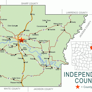
 Independence County Map
 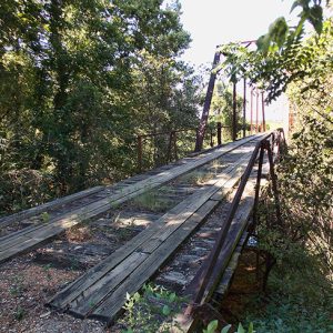 Padgett Island Bridge
 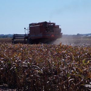 Padgett Island
501-918-3025
calsfoundation@cals.org
calsfoundation@cals.org
Padgett Island is bottomland along the White River across from the Oil Trough (Independence County) bottoms and about four miles from Magness (Independence County). To the north and east lies the backwater Big Bottom Slough (a.k.a. Island Sough), forming the “island” surrounded by the White River and the slough. Padgett Island is named for William Benjamin Padgett from Fairfax, Virginia, who farmed the area before the Civil War and married Phoebe Engles, member of a prominent Independence County pioneer family. By 1876, the Padgett Island area was called Big Bottom and appeared on Frank A. Gray’s map of Arkansas.
The Sulphur Rock (Independence County) post office served Big Bottom before it had its own post office. A post office was opened at Big Bottom in 1854; it closed in 1880 when the name of Big Bottom was changed to Akron (Independence County), with the population given as 100.
A ferry constructed and operated by William Thomas Magness provided easy access across the slough in 1878. As more farmers worked the lands, the need for a bridge became apparent. The Independence County Court in 1907 appropriated $1,000 for a steel bridge, provided the farmers pay the rest. Work on the bridge was finished in 1909. The Big Bottom Slough Bridge (a.k.a. Padgett Island Bridge) still stands in the twenty-first century, although it is closed to all traffic. The bridge is on the National Register of Historic Places.
William Benjamin Padgett was active in Arkansas politics, serving in the Arkansas General Assembly. Padgett’s younger brother, Thomas Benton (Tom) Padgett, became a successful businessman and banker in Batesville (Independence County). He married Martha Elvena Maxfield, whose family owned and operated the Maxfield Store on Main Street in Batesville. Tom Padgett was the first president of the Independence County Bank and Trust Company, Batesville’s third bank, and was also active in county government. William Benjamin Padgett and his wife are buried at Oaklawn in Batesville.
One of the early settlers of Padgett Island was Alford Arnold from Tennessee, who married Lucretia Magness and farmed the bottomland. He died at Big Bottom at the beginning of the Civil War. His grandson, James Burton Arnold, was born in Big Bottom and was active in Independence County politics, serving several terms as Independence County clerk and treasurer. He married Ida Luster, member of an early Independence County family. In 1904, Burton Arnold and Ida Luster Arnold moved across Polk (a.k.a. Poke) Bayou in western Batesville; the Burton Arnold house became a showcase for that part of the city. Their son, James Burton Arnold Jr., was elected county sheriff in 1948, serving for six terms.
Although farming continues in the alluvial bottomlands, all that remains of the Big Bottom pioneer village is the Akron Cemetery on Highway 122 south of Newark (Independence County). The cemetery is on the National Register of Historic Places. Volunteers periodically undertake efforts to reclaim the resting places of the early settlers, cleaning gravestones and clearing away brush. A few of the stones are still readable, and eighty-six stones have been transcribed. No Padgett graves have been found.
For additional information:
“Big Bottom Slough Bridge.” National Register of Historic Places nomination form. On file at Arkansas Historic Preservation Program, Little Rock, Arkansas. Online at http://www.arkansaspreservation.com/National-Register-Listings/PDF/IN0623.nr.pdf (accessed October 22, 2020).
Biographical and Historical Memoirs of Northeast Arkansas. Chicago: Goodspeed Publishing Co., 1889.
McGinnis, A. C. “A History of Independence County, Ark.” Special issue. Independence County Chronicle 17 (April 1976).
Wolf, John Quincy, Sr. “My Fifty Years in Batesville, Arkansas, Part I.” Independence County Chronicle 23 (October 1981–January 1982): 1–49.
Kenneth Rorie
Van Buren, Arkansas


Comments
No comments on this entry yet.