 Environment
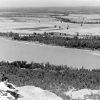 Geography and Geology
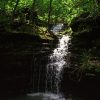 River Designations
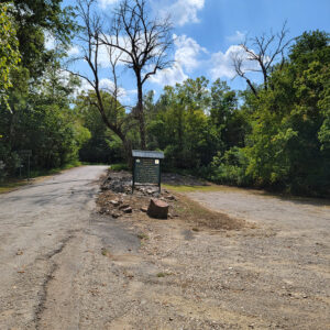 Amity Access
 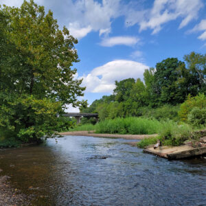 Amity Access
 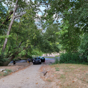 Amity Boat Launch
 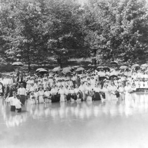 Baptism Service on Caddo River
 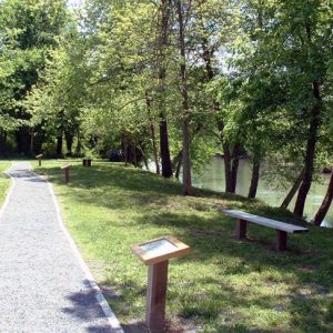 Caddo Indian Memorial
 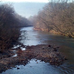 Caddo River
 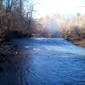 Caddo River
 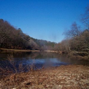 Caddo River
  Caddo River
 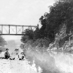 Glenwood Railroad Bridge
  Norman Access
501-918-3025
calsfoundation@cals.org
calsfoundation@cals.org
The Caddo River of west-central Arkansas is known widely as the Natural State’s premier family float stream. This scenic river is named after the Caddo Indians who settled the Ouachita Mountain drainage area. Since that time, many generations have settled, explored, and enjoyed this watercourse. This spring fed Ouachita Mountain stream offers something for everyone. Visitors to the Caddo can experience diverse recreational opportunity in a safe, easily accessible, natural setting. For centuries, this unique waterway has carved its way through sedimentary rock formations, creating a broad shallow river valley and leaving miles of gravel along its path. In some places, the nearly vertical beds of sandstone and novaculite create rapids and water gaps.
The Caddo, known for extremely clear water, originates from cold-water springs southeast of Mena (Polk County). In this region, the springs flow from the Bigfork Chert Ridge, which sits atop the Ouachita Mountains Aquifer, known for its high water quality. Bigfork Chert Ridge is often referred to as the “Potato Hills” due to uneven weathering that has left it looking like a potato patch. The stream flows generally from west to east through the Ouachita National Forest. After leaving the National Forest, the Caddo meanders its way through the Athens Piedmont Plateau, where the U.S. Army Corps of Engineers impounds it at DeGray Lake. From its origin to DeGray Lake, the Caddo flows some forty-five miles and drains approximately 453 square miles. From the base of DeGray Dam, the Caddo continues its trek southeasterly some seven miles before joining its sister stream, the Ouachita.
The upper Caddo above the community of Norman (Montgomery County) is designated as wild and scenic. Development has not affected this section of the stream as much as the rest of the river. This section of the Caddo is accessible from U.S. Forest Service Road No. 73, northwest of Norman off Arkansas Highway 8. This stretch can be navigated only after considerable rainfall, primarily during the spring months. The river channel is narrow, and the river drops steeply, averaging some twenty-nine feet per mile. This section ends at Norman, some seven miles downstream.
Norman to Caddo Gap, the next section of the Caddo, is also very scenic. This area has long been popular with wade and float fisherman because it is an ideal smallmouth bass habitat. Numerous creeks enter the river along this section. Limestone rock limbs and gravel shoals produce eddies that hold numbers of “brownie” bass. Road construction has begun to affect the Caddo along this stretch. Some cabins and portions of Norman can be spotted from the river. Gravel mining above Norman has caused some of the deeper holes to fill with gravel; however, for the most part, the river corridor is still natural in appearance.
Towering sycamore, sweet gum, cottonwood, ash, water and willow oak, and river birch line the banks. During the summer, cardinal flower, composites, and other wild flowers give the river a colorful look. The woodland appearance is interspersed with a pastoral setting. Even an old logging railroad tram parallels the river and gives it an added flavor. Deer, beaver, river otter, wild turkey, osprey, and bald eagles are present in the Caddo River drainage area. This section ends either at the old swinging bridge near the town of Caddo Gap, approximately eight miles total from Norman.
The Caddo Gap to Glenwood (Pike County) section is the most popular among canoeists. Generally, this section can be floated year around, except during the very driest weather. The main attraction here is the Caddo Gap, a narrow, boulder-strewn gorge. The ancient Caddo River created the Gap as it slowly eroded the Arkansas novaculite. Naturally occurring thermal springs rise from the riverbed approximately 200 yards northwest of the old low water bridge. The hot springs average ninety-five degrees Fahrenheit and can be felt as the thermal waters rise from the depths into the river.
For centuries, the Caddo and other Native American tribes were attracted to the springs for religious and medicinal purposes. According to legend, the Tula Indians rolled enormous novaculite boulders off the mountain pass on to the Hernando de Soto expedition in the 1540s. According to some accounts, the de Soto expedition traveled down the Caddo as they departed the Ouachita. The Jessie James Gang reportedly robbed a toll bridge operator at the gap as they fled local law enforcers to the Oklahoma Territory.
A few miles below the gap, the south fork of the Caddo enters the main river from the southwest. The south fork originates near the Albert Pike Recreation Area in the Ouachita National Forest. Barite mining during the 1970s adversely influenced this fork of the Caddo. Barite began to leach into the south fork during the early 1980s, killing fish and much of the food chain. Reclamation efforts have helped the south fork to recover and have brought back several varieties of fish.
The Caddo continues its journey southeasterly past Glenwood. In the early 1900s, Glenwood was a thriving sawmill town that used the Caddo for pine log transport, storage, and milling. At Glenwood, the Caddo leaves the Ouachita Mountains behind. As the Caddo leaves the Athens Piedmont Plateau, the gradient drops dramatically and the river holes become longer and deeper. This section can generally be floated year around. It covers approximately eight miles and ends near Arkansas Highway 182, approximately one mile north of Amity (Clark County).
From Highway 84 to the headwaters of DeGray Lake, the lower Caddo is accessible via Highways 84 and 346. DeGray Lake Corps of Engineers Project lands start approximately one half mile below the 84 bridge. The boundary line is marked with yellow paint and can be seen from the river. This section is also popular with float and wade fishing enthusiasts, especially during the seasonal white and hybrid bass spawning runs.
From the headwaters of DeGray Lake to DeGray Dam, this plateau impoundment covers some 13,400 acres, has 205 miles of shoreline, and is approximately twenty-seven miles in length. The total project acreage is 31,800 acres and is governed by the U.S. Army Corps of Engineers, DeGray Lake. Prior to impoundment, the Caddo and its tributaries carved their way into the plateau forming deep ravines. These topographical features are responsible for the ultra deep waters of DeGray. Behind DeGray Dam, the water is almost 200 feet deep with much of the old river channel around 100 feet. These depths rank DeGray as one of the deepest average-depth lakes in Arkansas at approximately forty-six feet.
As the Caddo leaves the Lower Lake, the river meanders some seven miles through the Gulf Coast Plain where it meets its sister stream, the Ouachita. High bluffs and a pastoral setting are the distinct topographical features on this section of the Caddo.
Virtually the entire Caddo River corridor is privately owned, with the exception of government land. The Caddo River and many other rivers in America are viewed as the last frontiers in recreation. The Caddo is presently rated as one of the top ten most “threatened” rivers in Arkansas.
For additional information:
DeGray Lake Resort State Park. http://www.degray.com (accessed July 30, 2023).
Steward, Dana F. A Rough Sort of Beauty: Reflections on the Natural Heritage of Arkansas. Fayetteville: University of Arkansas Press, 2002.
Brian C. Westfall
Corps of Engineers, DeGray Lake


About twenty years ago, we vacationed in Arkansas. When we got to the town Norman, we decided to have a picnic and wade in the river. While I was wading, I saw a bright green, long rock. All the other rocks were black, brown, and gray, so it really stood out! I picked it up and washed off the green slime. We were all shocked at what I found! It looked like a knife blade and was solid rock. In shape it resembled a butcher knife.The rock is speckled gray on one side and pretty black on the other. It is 13 1/2″ long. I have looked at hundreds of pictures of stone knives, but cannot find even one that looks even somewhat like it.