 Environment
 Baby Buzzards
 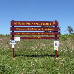 Baker Prairie Natural Area
 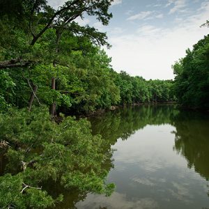 Bayou De View
 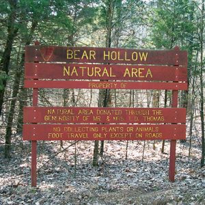 Bear Hollow Natural Area
 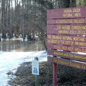 Benson Creek Natural Area
  Big Creek Natural Area
  Big Fork Creek Natural Area
 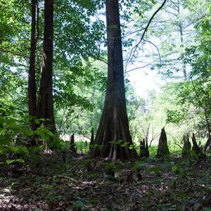 Byrd Lake Natural Area
 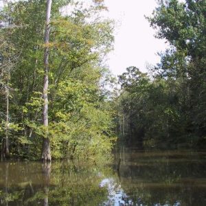 Cache River Natural Area
 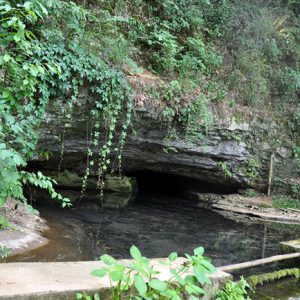 Cave Springs Cave Natural Area
  Chalk Bluff Natural Area
 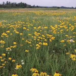 Cherokee Prairie Natural Area
 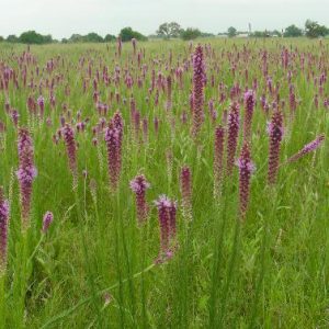 Chesney Prairie Natural Area
 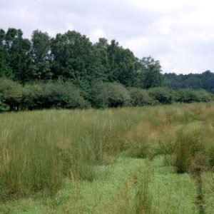 Coffee Prairie Natural Area
 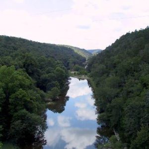 Cossatot River State Park - Natural Area
 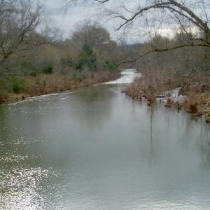 Cove Creek Natural Area
 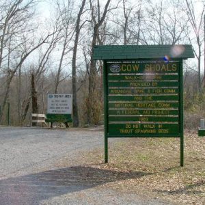 Cow Shoals Riverfront Forest Natural Area
  Cut-Off Creek Ravines Natural Area
  Dardanelle Rock Natural Area
 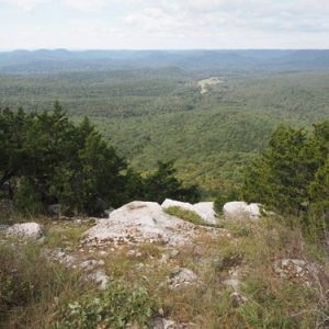 Devil's Knob - Devil's Backbone Natural Area
 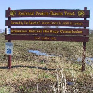 Downs Prairie Natural Area
 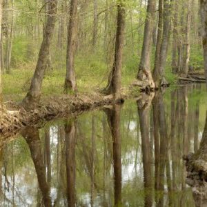 Falcon Bottoms Natural Area
 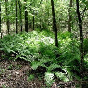 Fernwood Seep Natural Area
 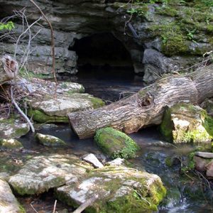 Foushee Cave Natural Area
 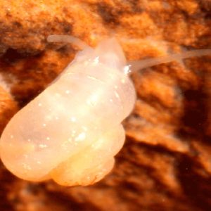 Foushee Cave Snail
  Gap Creek Natural Area
  Garrett Hollow Natural Area
  Geocarpon Minimum
  Goose Pond Natural Area
  H. E. Flanagan Prairie Natural Area
  Hell Creek Natural Area
 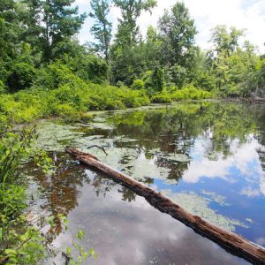 Holland Bottoms Willow Oak Forest Preserve
 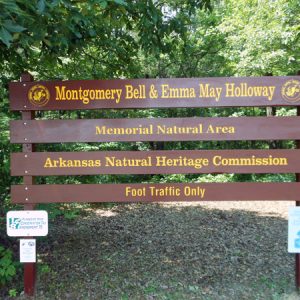 Holloway Memorial Natural Area
  Iron Mountain Natural Area
 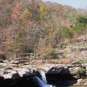 Kings River Falls Natural Area
 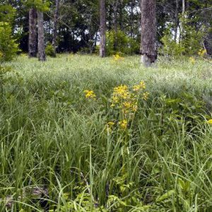 Konecny Grove Natural Area
  Konecny Grove Natural Area
 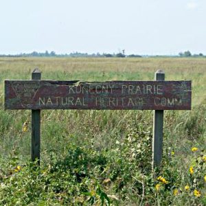 Konecny Prairie Natural Area
  Logoly Natural Area
 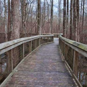 Lorance Creek Natural Area
 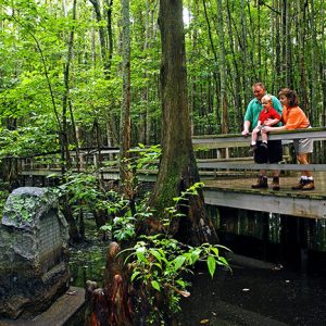 Louisiana Purchase Historic State Park
 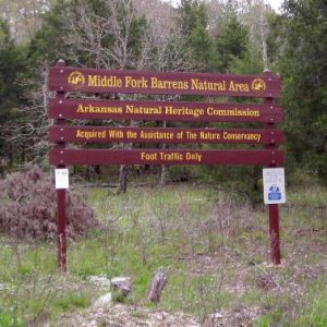 Middle Fork Barrens Natural Area
  Miller County Sandhills Natural Area
 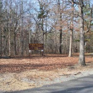 Mills Park Natural Area
 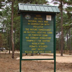 Moro Big Pine Natural Area
 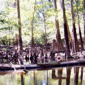 Moro Creek Bottoms Natural Area
 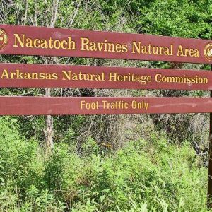 Nacatoch Ravines Natural Area
 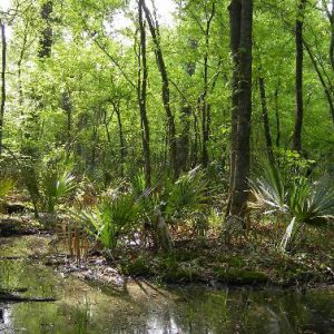 Palmetto Flats Natural Area
 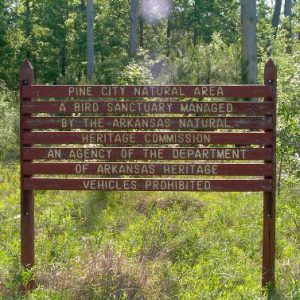 Pine City Natural Area
  Pine Hollow Natural Area
 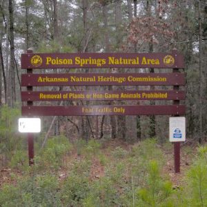 Poison Springs State Forest Sand Barren & Oak-Pine Forest Preserve
 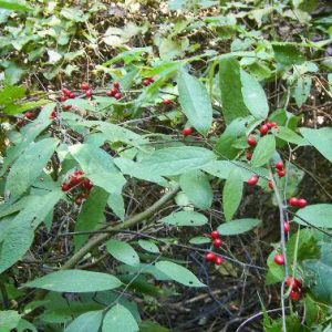 Pondberry
 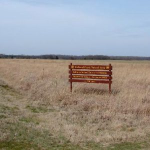 Railroad Prairie Natural Area
 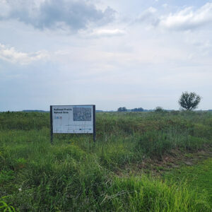 Railroad Prairie Natural Area
 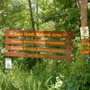 Rock Creek Natural Area
 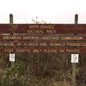 Roth Prairie Natural Area
  Saratoga Blackland Prairie Natural Area
 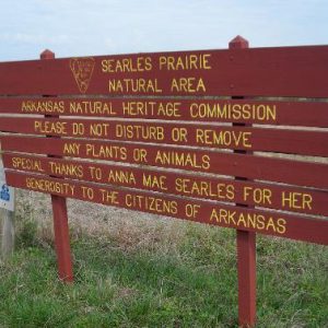 Searles Prairie Natural Area
  Seven Devils Swamp Natural Area
  Singer Forest Natural Area
 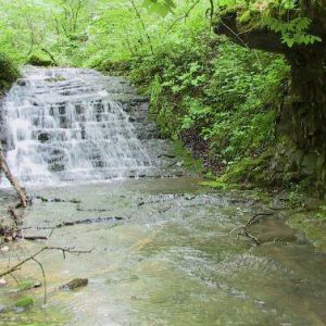 Slippery Hollow Natural Area
 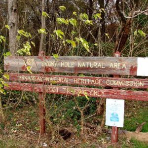 Smoke Hole Natural Area
 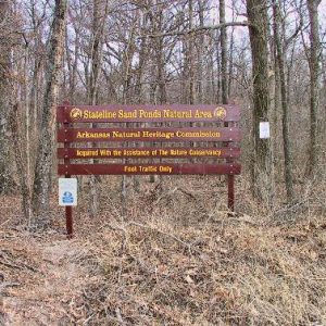 Stateline Sand Ponds Natural Area
 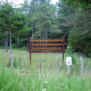 Stone Road Glade Natural Area
 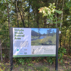 Striplin Woods Natural Area
  Sweden Creek Falls Natural Area
 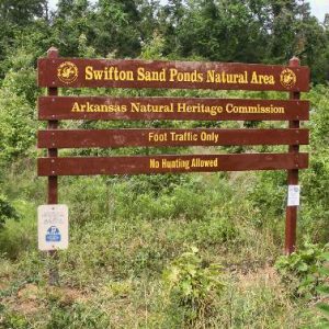 Swifton Sand Ponds Natural Area
 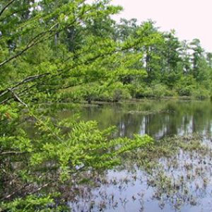 Taylor Woodlands Natural Area
 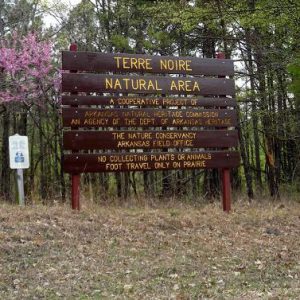 Terre Noire Natural Area
 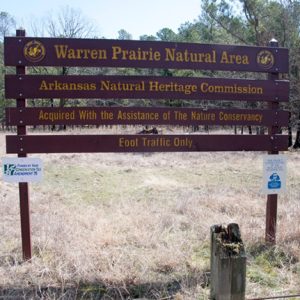 Warren Prairie Natural Area
  White Cliffs Natural Area
  Wittsburg Natural Area
501-918-3025
calsfoundation@cals.org
calsfoundation@cals.org
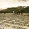
The Arkansas Natural Heritage Commission’s (ANHC) System of Natural Areas contains some of the best examples of many of the state’s ecosystems. Natural areas such as Railroad and Roth prairies protect the last few acres of tallgrass in east Arkansas’s Grand Prairie. The Gap Creek Natural Area and Cossatot River State Park–Natural Area preserve quality examples of Ouachita Mountain upland streams. The Terre Noire Natural Area represents the best remaining tracts of blackland prairie in the state. Natural areas such as these protect the rarest elements of Arkansas’s natural heritage.
Birth of the System
Arkansas’s System of Natural Areas underwent three periods of development. From 1975 to 1980, sites were chosen from those well known to conservationists. The Singer Forest Natural Area, donated by the Singer Company, was Arkansas’s first natural area. Roth Prairie in Arkansas County was the first natural area purchased by the ANHC, on February 27, 1976.
Since 1980, the commission’s Natural Heritage Inventory has enabled the commission to make choices based on scientific data. The inventory is a comprehensive source of information regarding Arkansas’s natural diversity. This dynamic database tracks the location and status of rare species and the location and condition of high-quality ecosystems throughout the state.
In the early 1980s, the commission concentrated on small tracts to protect habitat of certain rare plants and animals. The Warren Prairie Natural Area was acquired in 1983. It is one of only a handful of sites in the world where the federally threatened plant Geocarpon minimum grows. Near the White River in Stone County, the Hell Creek Cave Natural Area supports one of only two known populations of the endangered Hell Creek crayfish. This natural area was acquired in 1985.
Reforming Landscapes
From the mid-1980s to the present, the commission has focused on larger and more complex projects. In 1987, a partnership between Arkansas State Parks and the ANHC made possible the acquisition of 4,230 acres along eleven miles of the Cossatot River. The purchase was funded through a Natural and Cultural Resources Council grant to the ANHC. This was the first such grant given to any state agency by the newly formed council. The first tract to become the Falcon Bottoms Natural Area was acquired in 1991. Additional tracts were added throughout the early 1990s. Acquisitions to this natural area from 2000 to 2003 enabled the commission to link isolated fragments of bottomland habitat. Connecting these fragments benefits the area’s inherent natural values and increases public access opportunities.
Development of the System of Natural Areas is made possible through a variety of funding sources, including state general revenue, federal funds, and Natural and Cultural Resources Council grants. Passage of a one-eighth-cent conservation tax in the late 1990s proved to be a boon to the ANHC and other state agencies working to conserve natural resources. The commission’s share of the tax supports conservation work needed to identify, protect, and manage lands in the system.
Donations and Easements
While the ANHC has bought some natural areas, others have been acquired through donations from private citizens. Natural areas created through donations include Bear Hollow, Downs Prairie, Fernwood Seep, Gap Creek, and Searles Prairie. Other natural areas in the system have been acquired through conservation easements provided at no cost to the commission, generally from other state and federal agencies. Examples are the Holland Bottoms Willow Oak Forest Preserve, the Poison Springs State Forest Sand Barren & Oak-Pine Forest Preserve, and the Striplin Woods Natural Area.
Managing Natural Areas
Many of Arkansas’s natural areas exist as “islands” of natural habitat in a sea of disturbed land. What happens or, in some cases, does not happen on surrounding lands can have a profound impact on the area’s ecological integrity. As a result, the lands cannot be fenced in and ignored. Long-term viability of remnant ecosystems requires active and sound management to offset the often negative influences of surrounding land uses. Human influences have so interrupted natural ecological processes that some natural areas require restoration.
A perfect example is fire suppression. Many Arkansas ecosystems, including tallgrass prairies and oak woodlands, were historically maintained by periodic fires. The absence of fire makes it easier for undesirable plant species to take root and change the character of the site. Restoration requires reintroduction of carefully planned fires. For that reason, heritage commission staff, along with partners such as the Nature Conservancy and the Arkansas Forestry Commission, work to conduct prescribed burns on natural areas containing fire-maintained ecosystems.
Ecological integrity of natural areas is also maintained through the detection and management of invasive species of animals and plants. Besides providing habitat for native species, natural areas can harbor nonnative, invasive plant species. Invasive plants such as kudzu, Japanese honeysuckle, and Chinese privet can spread aggressively, effectively eliminating native species. Detection and removal of invasive species is a critical component of stewardship activities if native species and their habitats are to be conserved.
The Value of Natural Areas
Lands in the System of Natural Areas belong to all Arkansans. Natural areas represent some of the only opportunities that present and future generations will have to experience what Arkansas was like before settlement. They also represent vital habitat for a host of animal and plant species.
Arkansas’s natural areas are more than just a glimpse into the past or a last refuge for rare species. What these areas can provide are blueprints for understanding of how Arkansas ecosystems originally functioned. Such information will be especially vital as Arkansas continues to develop and address environmental issues into the future.
| Name | County | Division | Acres | Date |
| Arkansas Natural Oak Area | Nevada | West Gulf Coastal Plain | 30.31 | 1992 |
| Arkansas Oak Natural Area supports a number of plant species considered to be rare in Arkansas. Four different landscape types are present on the site: an open sand barren, a dry upland forest dominated by Arkansas oak, a creek-bottom community along Mill Branch, and a seep community containing an exceptionally diverse flora. The natural area adjoins Poison Springs State Forest and is comanaged with the Arkansas Forestry Commission. | ||||
| Name | County | Division | Acres | Date |
| Baker Prairie Natural Area | Boone | Ozark Mountains | 40 | 1980 |
| Baker Prairie Natural Area is a remnant of what was once a 5,000 acre tallgrass prairie located west and south of present-day downtown Harrison, historically stretching from Capps Road to the Boone County Regional Airport. It is the largest known remnant of Ozark Mountain prairie occurring on a chert substrate. The prairie harbors several species of plants and animals of special concern in Arkansas. Due to its location within the city limits of Harrison, local development could impact the integrity of the natural area. The area is managed cooperatively with an adjacent tract owned by The Nature Conservancy. | ||||
| Name | County | Division | Acres | Date |
| Bear Hollow Natural Area | Madison | Ozark Mountains | 397.1 | 1991 |
| Bear Hollow Natural Area includes a mile of the intermittent Bear Hollow Creek, beginning about 0.25 miles upstream from its confluence with Rockhouse Creek. The natural area is enclosed by ridges along most of its perimeter, with only one hilltop farm in prominent view. Located near the center of the site is the Ozark Natural Science Center. This center was established in 1990 to provide environmental education opportunities for the people of the Ozark Mountains region. The natural area is bounded on the north and south by the Arkansas Game and Fish Commission’s Madison County Wildlife Management Area and on the east and west by private land. | ||||
| Name | County | Division | Acres | Date |
| Benson Creek Natural Area | Monroe | Mississippi Alluvial Plain | 302 | 1993 |
| Benson Creek Natural Area provides an extension and buffer to a high-quality bald cypress–water tupelo swamp located along Bayou DeView. Previously disturbed plant communities within the natural area are the focus of restoration efforts designed to improve the ecological quality of the site. The Nature Conservancy and the Natural Heritage Commission hold undivided interests in this property. | ||||
| Name | County | Division | Acres | Date |
| Big Creek Natural Area | Cleburne | Ozark Mountains | 1527 | 1978 |
| Big Creek Natural Area includes approximately five miles of the course of Big Creek, a major tributary of the Little Red River. High water quality and diverse populations of fish and other aquatic organisms are characteristic of Big Creek. Bluffs tower as high as 200 feet above the streambed. This site’s topographic relief, varied exposures, and considerable extent provide habitat for a broad array of plant and animal species. A primitive foot-trail provides access to some of the natural area’s most interesting features. | ||||
| Name | County | Division | Acres | Date |
| Big Fork Creek Natural Area | Polk | Ouachita Mountains | 13.5 | 1978 |
| Big Fork Creek Natural Area, located in the Ouachita Mountains, is a small mesophytic tract containing an abundance of wildflowers and ferns, a free-flowing spring, and a small section of Big Fork Creek. The bluff and terrace near the spring support an excellent and very fragile plant community. | ||||
| Name | County | Division | Acres | Date |
| Blue Mountain Natural Area | Pulaski | Ouachita Mountains | 457.23 | 2021 |
| Blue Mountain Natural Area is located in the Fourche Mountains Ecoregion of the Ouachita Mountains at the boundary with the Arkansas Valley. Blue Mountain is the westernmost peak of the three mountains that make up the Maumelle Pinnacles chain, which includes Pinnacle Mountain and Rattlesnake Ridge. The natural area includes a diversity of natural communities, from the globally rare Ouachita Mountain Sandstone Outcrop Barrens community, to smaller sandstone glades and bluffs in a matrix of dry oak and oak-pine woodland. . | ||||
| Name | County | Division | Acres | Date |
| Byrd Lake Natural Area | Jefferson | Mississippi Alluvial Plain | 144 | 1978 |
| Byrd Lake is an oxbow lake that still interacts with its parent stream, Bayou Bartholomew, in times of high water. The natural area is representative of the natural boundary between the West Gulf Coastal Plain and the Mississippi Alluvial Plain. Bald cypress trees surround the lake, while adjoining lands support plant communities that respond to fluctuating water levels and rich alluvial soils. The higher slopes of the north bank of Byrd Lake are well drained and support a contrasting mixed pine–hardwood forest. A paved foot-trail provides visitors with access to the site. | ||||
| Name | County | Division | Acres | Date |
| Cache River Natural Area | Woodruff | Mississippi Alluvial Plain | 937.4 | 1983 |
| Cache River Natural Area consists mainly of a forested wetland complex along the Cache River of the Mississippi Alluvial Plain. The natural area contains a high-quality river swamp and a bottomland hardwood forest plus many miles of the Cache River itself. Much of the forested wetlands that occurred across this part of the state have been cleared for agriculture. Areas such as Cache River Natural Area represent the last remaining fragments of these once extensive forested wetlands. This natural area lies within the Rex Hancock/Black Swamp Wildlife Management Area and is comanaged with the Arkansas Game and Fish Commission. | ||||
| Name | County | Division | Acres | Date |
| Cave Springs Cave Natural Area | Benton | Ozark Mountains | 15.26 | 1985 |
| Cave Springs Cave is basically a long “solution channel” formed by a groundwater-fed stream. The stream is considered to be an outstanding example of an Ozark Mountains cave stream and hosts the largest known population of the rare Ozark cavefish. It has also harbored a summer maternity colony of gray bats. Rare plant species also occur on site, including the Ozark trillium. | ||||
| Name | County | Division | Acres | Date |
| Chalk Bluff Natural Area | Clay | Crowley’s Ridge | 54.95 | 1977 |
| Chalk Bluff is situated on the north end of the Arkansas portion of Crowley’s Ridge where the St. Francis River cuts through the Ridge and divides Missouri’s “bootheel” from Arkansas. Despite its name, Chalk Bluff has no chalk deposits. Rather, its soils are derived from sedimentary materials consisting of light-colored clays, silts, and sands. If exposed, such soils are subject to severe erosion and favor the development of steep slopes and deep ravines. At Chalk Bluff, these ravines contain a few beech trees and are characterized by extensive stands of pawpaw and Christmas fern. An upland oak-hickory forest clothes most of the remainder of the area. Clay County holds a long-term lease on this natural area for development and operation of public-use facilities on a part of it. | ||||
| Name | County | Division | Acres | Date |
| Cherokee Prairie Natural Area | Franklin | Arkansas Valley | 584.4 | 1983 |
| Cherokee Prairie Natural Area represents one of the largest remaining tracts of tallgrass prairie in the Arkansas River valley. Located just north of Charleston, this tract is a high-quality prairie representative of the more extensive Cherokee Prairies that once occurred across the western portion of the Arkansas River Valley. The natural area contains a diverse array of forb species (herbaceous species other than grasses), including compass plant, purple prairie clover, and Indian paintbrush. It also hosts several animal species that are now considered rare, or even endangered. Prairie Creek flows through the center of the natural area. | ||||
| Name | County | Division | Acres | Date |
| Chesney Prairie Natral Area | Benton | 60.27 | 2000 | |
| Chesney Prairie Natural Area is one of the few tallgrass prairie remnants left on the Arkansas portion of the Springfield Plateau. Much of its flora and fauna is representative of the once extensive upland prairies and savannas of the western Ozark Mountains. The natural area consists of a sixty-acre block separated into two areas of prairie by a wooded riparian corridor along Sager Creek. | ||||
| Name | County | Division | Acres | Date |
| Coffee Prairie Natural Area | Ashley | West Gulf Coastal Plain | 56 | 1991 |
| Coffee Prairie Natural Area preserves some of the last remaining examples of a type of grassland called “lowland sand prairie.” This type of prairie is known to occur only in extreme southern Arkansas and northern Louisiana in the bottomlands of the Ouachita River and is unlike any other prairie in Arkansas in species composition, soils, and hydrology. The natural area also supports the only known population of the federally endangered pondberry in the West Gulf Coastal Plain of Arkansas. Coffee Prairie falls within the Beryl Anthony/Lower Ouachita Wildlife Management Area and is comanaged with the Arkansas Game and Fish Commission. | ||||
| Name | County | Division | Acres | Date |
| Cossatot River State Park-Natural Area | Howard, Polk | Ouachita Mountains | 4470 | 1989 |
| The Cossatot River is an outstanding example of an upland river in the Ouachita Mountains. As the river flows southward, it cuts through a series of east-west oriented ridges, producing magnificent rapids and waterfalls. This area supports at least two fish species endemic to the Little River system and numerous special plant species, including Browne’s waterleaf. It is managed cooperatively with Arkansas State Parks (ASP). Portions of the area have been developed to enhance public visitation and environmental education opportunities. These developments include a canoe launching area, solar restrooms, picnic areas, primitive camp sites, a hiking/nature trail, and a barrier-free pedestrian river walkway. A new visitor information center has recently opened on the site. NHC worked with ASP in the overall interpretive theme for the center and funding for some exhibits. | ||||
| Name | County | Division | Acres | Date |
| Cove Creek Natural Area | Faulkner | Arkansas Valley | 228 | 1976 |
| Cove Creek Natural Area, located in the Arkansas River Valley, contains almost a mile of the course of Cove Creek near its confluence with Cadron Creek. At this point, the meandering stream cuts deeply through a ridge of sandstone, creating a spectacular gorge. A small area of creek bottom forest borders the watercourse at the lower end of the tract. An extensive cedar glade covers about 100 acres on the west side of the creek above the bluffs. | ||||
| Name | County | Division | Acres | Date |
| Cow Shoals Riverfront Forest Natural Area | Cleburne | Ozark Mountains | 63.27 | 1992 |
| Cow Shoals Riverfront Forest Natural Area lies within the floodplain of the Little Red River. The natural area contains a successional riverfront forest dominated by river birch and American sycamore. The Arkansas Game and Fish Commission holds fee title and comanages this natural area. | ||||
| Name | County | Division | Acres | Date |
| Cut-off Creek Ravines Natural Area | Drew | West Gulf Coastal Plain | 377 | 1990 |
| Cut-off Creek Ravines Natural Area contains two ravines that flow generally eastward from uplands to the adjacent bottomlands along Cut-off Creek. The ravines are forested with pine-oak forest at their heads and a mixed oak and beech forest near their mouths. The bottomland into which the ravines emerge is forested with willow oak and water oak on higher sites and overcup oak and bald cypress on lower sites. This natural area represents a valuable example of a Coastal Plain forest and of the transition from Coastal Plain to Mississippi Alluvial Plain. The natural area falls within the Cut-off Creek Wildlife Management Area and is comanaged with the Arkansas Game and Fish Commission. | ||||
| Name | County | Division | Acres | Date |
| Dardanelle Rock Natural Area | Yell | Arkansas Valley | 10 | 1976 |
| Dardanelle Rock is an exposure of Hartshorne sandstone that was folded into a synclinal structure when the Ouachita Mountains were formed and then breached through erosion by the Arkansas River to form a water gap. Dardanelle Rock has been a major landmark along the Arkansas River since the days of early Arkansas exploration. Parts of the outcrop are naturally devoid of vegetation. However, some slopes hold enough soil to support a forest of black oak, mockernut hickory, and shortleaf pine. | ||||
| Name | County | Division | Acres | Date |
| Devil’s Eyebrow Natural Area | Benton | Ozark Mountains | 1,726 | 2012 |
| Devil’s Eyebrow Natural Area is located at the northern end of Beaver Lake along Indian Creek and its tributaries. The terrain is rugged and steep, consisting of deep, bluff-lined hollows separated by steep ridges. Much of the area is underlain by alternating layers of chert and limestone that include caves and many springs. Plant communities are diverse and include high quality glades, woodlands, bluffs, rich hardwood forests, and riparian forests. Devil’s Eyebrow supports one of the highest concentrations of rare plant species in Arkansas with several species typically found far to the north and others that are restricted in distribution and considered globally rare. The Arkansas Game and Fish Commission (AGFC) and the Arkansas Natural Heritage Commission (ANHC) share undivided fee title and co-manage this natural area. | ||||
| Name | County | Division | Acres | Date |
| Devil’s Knob–Devil’s Backbone Natural Area | Izard | Ozark Mountains | 822.1 | 1976 |
| The Devil’s Knob site is a limestone-dolomite-sandstone glade occurring about ten miles southwest of Melbourne. Local topography consists of an uplift mountain with two knolls joined by a saddle known as Devil’s Backbone. The vegetation of the natural area is generally of two types: upland hardwood and a cedar glade restricted to limestone-dolomite outcrops. Two uncommon plant species occur around the glade: Ashe’s juniper and silky aster. Many of the Ashe’s junipers are very old, the largest measuring thirty inches or more in diameter. | ||||
| Name | County | Division | Acres | Date |
| Downs Prairie Natural Area | Prairie | Mississippi Alluvial Plain | 24 | 2000 |
| Down’s Prairie Natural Area is one of the few remnants of tallgrass prairie left on the Grand Prairie of eastern Arkansas (Mississippi Alluvial Plain). The natural area contains a diverse assemblage of wildflowers, including Indian paintbrush, narrow-leaved sunflower, and white wild indigo. The area also hosts several plant species that were probably once more common across this part of the state, such as prairie evening primrose. Downs Prairie supports the largest documented remaining population of prairie mole crickets in the Grand Prairie. Prior to settlement, approximately 320,000 acres of tallgrass prairie occurred across the Grand Prairie region. Today, less than one percent of those prairies remain. | ||||
| Name | County | Division | Acres | Date |
| Falcon Bottoms Natural Area | Columbia, Lafayette, Nevada | West Gulf Coastal Plain | 2070 | 1991 |
| Falcon Bottoms Natural Area is an excellent example of the narrow but highly diverse natural communities that occur along small to medium sized streams of the West Gulf Coastal Plain. Bayou Dorcheat, which flows through the natural area, is considered to be one of the most intact and important streams west of the Ouachita River. The relatively unaltered landscape of the bottomlands, and associated rare species and plant communities found along Bayou Dorcheat, contribute to the site’s overall quality. Most of the natural area is occupied by a bottomland forest community dominated by willow oak and overcup oak in seasonally flooded areas and bald cypress in wetter areas. High knolls support a lowland pine-oak forest community. The U.S. Fish and Wildlife Service holds a conservation easement on the area as a result of a North American Wetlands Conservation Act grant. | ||||
| Name | County | Division | Acres | Date |
| Fernwood Seep Natural Area | Polk | Ouachita Mountains | 9.59 | 2002 |
| Fernwood Seep Natural Area consists of a complex of Ouachita Mountain wooded acid seeps, with a spring-fed stream and upland pine-oak/hickory forests. Wooded acid seeps are rapidly disappearing from the southeastern Ouachita Mountains, and this site is the only example protected by the Arkansas Natural Heritage Commission. | ||||
| Name | County | Division | Acres | Date |
| Foushee Cave Natural Area | Independence | Ozark Mountains | 1,677 | 2011 |
| Foushee Cave Natural Area includes the mouth of Foushee Cave and a portion of its recharge zone, along with the associated forest communities that represent the White River Hills region of the Ozark Mountains. Two federally endangered species, gray and Indiana bats, inhabit the area, and the Foushee Cave snail exists only in this cave system. | ||||
| Name | County | Division | Acres | Date |
| Gap Creek Natural Area | Montgomery | Ouachita Mountains | 10.07 | 1981 |
| Gap Creek is a small upland tributary of the Caddo River located in the Ouachita Mountains. The creek is spring fed and runs year-round. The natural area is surrounded by the Ouachita National Forest. These lands have not been significantly altered in more than half a century, a factor that contributes to the high water quality of Gap Creek. Plant communities within the natural area include upland pine-hardwood forest and riparian forest along Gap Creek. Fee title is held by a private landowner. | ||||
| Name | County | Division | Acres | Date |
| Garrett Hollow Natural Area | Washington | Ozark Mountains | 670 | 2004 |
| Garrett Hollow is marked by rugged topography and consists of diverse hardwood forests and sandstone glades. Like much of the Ozarks, this natural area contains a number of karst features, where fractured bedrock allows water to drain into crevices and solution tubes, creating small caves and subterranean streams. Caves and crevices within the natural area provide critical habitat for the federally endangered Ozark big-eared bat. | ||||
| Name | County | Division | Acres | Date |
| Goose Pond Natural Area | Pope, Conway | Arkansas Valley | 391.9 | 1981 |
| Goose Pond Natural Area is a mosaic of open water and vegetated wetlands. Plant communities within the natural area include young water tupelo–bald cypress swamps, shrub swamps, American lotus/water lily marshes, and submerged beds of coontail. Many species of migratory waterfowl visit Goose Pond in the winter months, while a variety of other birds are present year round. The bird-voiced treefrog, a species of very limited distribution west of the Mississippi River, occurs here as well. Goose Pond Natural Area lies within the Ed Gordon/Point Remove Wildlife Management Area and is comanaged with the Arkansas Game and Fish Commission. | ||||
| Name | County | Division | Acres | Date |
| H.E. Flanagan Prairie Natural Area | Franklin | Arkansas Valley | 265.6 | 1988 |
| H. E. Flanagan Prairie Natural Area is an excellent example of the tallgrass prairie that once occurred across this part of the Arkansas River valley. Along with prairie grasses, the natural area hosts a wide variety of forbs. H.E. Flanagan Prairie, along with the nearby Cherokee Prairie Natural Area, comprise the few remnants of the once more extensive Cherokee Prairies that formerly occupied approximately 135,000 acres of the western portion of the Arkansas River valley. H. E. Flanagan Prairie and Cherokee Prairie are different from prairies elsewhere in Arkansas as their soils are derived from shale. | ||||
| Name | County | Division | Acres | Date |
| Hall Creek Barrens Natural Area | Cleveland | Coastal Plain | 647.3 | 2010 |
| Hall Creek Barrens Natural Area, located in the Coastal Plain, consists of a mosaic of salt slicks, saline barrens, mound woodlands, pine-hardwood flatwoods, Delta post oak flatwoods, and bottomland hardwood forest communities. Soils at the site, containing naturally high amounts of sodium and magnesium salts, account for the sparse and irregular distribution of trees and the resultant dominance of grasses and other herbaceous vegetation in the barrens and associated woodlands. Stands of dwarf palmetto are distributed irregularly and lend a tropical aspect to the natural area. The unique soils and sparse tree cover over portions of the natural area create ideal habitat for a number of rare herbaceous plant species including the federally threatened species Geocarpon minimum. | ||||
| Name | County | Division | Acres | Date |
| Hell Creek Natural Area | Stone | Ozark Mountains | 211.4 | 1985 |
| Located on the Salem Plateau of the Ozark Mountains, Hell Creek Natural Area hosts the only known population of the albinistic cave crayfish. Most of Hell Creek Cave is wet year-round, with many of its passages flooded during periods of high rainfall. Hell Creek Cave is considered an example of a “solution channel” or “tunnel cave.” Hell Creek, which flows through the cave, is spring fed and eventually empties into the White River. | ||||
| Name | County | Division | Acres | Date |
| Holland Bottoms Willow Oak Forest Preserve | Lonoke | Mississippi Alluvial Plain | 632.3 | 1986 |
| Holland Bottoms Willow Oak Forest Preserve is located in the Mississippi Alluvial Plain. Jacks Bayou, a tributary of Bayou Two Prairie, bisects the natural area. A bottomland hardwood forest containing mature stands of willow oak, mixed with various other bottomland hardwood species, largely characterize the natural area. Only twenty-five percent of the bottomland hardwood forests that formerly occurred across the Lower Mississippi Valley currently remain. The natural area falls within the Holland Bottoms Wildlife Management Area and is comanaged with the Arkansas Game and Fish Commission. | ||||
| Name | County | Division | Acres | Date |
| Holloway Memorial Natural Area | Prairie | Mississippi Alluvial Plain | 75 | 1978 |
| Holloway Memorial Natural Area is representative of the once extensive forests that occurred along terraces of the Grand Prairie of eastern Arkansas (Mississippi Alluvial Plain). These flatwoods forests typically varied with topography and underlying soils and included both bottomland and upland hardwood tree species. Prairie mounds are also scattered throughout the area, suggesting that the area was once prairie thousands of years ago. Fee title is held by Prairie County. | ||||
| Name | County | Division | Acres | Date |
| Iron Mountain Natural Area | Polk | Ouachita Mountains | 260.5 | 1979 |
| Iron Mountain Natural Area is located within the Fourche Mountain subdivision of the Ouachita Mountains. The area is bisected by Paul Branch, a small, intermittent stream which defines the valley between northern and southern ridges. The natural area preserves a typical example of the upland pine-oak-hickory forests of the Ouachita Mountains and provides protected habitat for the southern red-backed salamander, a regional endemic. | ||||
| Name | County | Division | Acres | Date |
| Kings River Falls Natural Area | Madison | Ozark Mountains | 570.7 | 1979 |
| Kings River Falls Natural Area is located at the interface of the Springfield Plateau and Boston Mountains subdivisions of the Ozark Mountains. The natural area includes Kings River, with Kings River Falls being a focal point. Kings River is a clear mountain stream originating east of Boston in Newton County. The river flows for about fifty miles through Madison and Carroll Counties, eventually merging with Osage Creek before it flows into Table Rock Reservoir. A mixed pine-hardwood forest covers slopes on the east side of the natural area. On the west side, steeper slopes are covered almost entirely with hardwood species. Rock walls, bluff shelters, and rocky slopes characterize most of the western half of the tract. A diverse and colorful shrub community borders the stream. | ||||
| Name | County | Division | Acres | Date |
| Konecny Grove Natural Area | Prairie | Mississippi Alluvial Plain | 22.17 | 1979 |
| Konecny Grove Natural Area is one of the few remaining examples of slash woodland that once occurred across certain parts of the Grand Prairie of eastern Arkansas (Mississippi Alluvial Plain). Slash represented a transitional habitat from prairie to bottomland hardwood forest. Today, less than three percent of this habitat type remains in the Grand Prairie. Persimmon, green ash, and honey locust trees dominate Konecny Grove, with hawthorns are dispersed along its boundaries. A four-acre seasonal herbaceous wetland exists in the northern portion of the natural area. The natural area protects the only known population of the rare Stern’s medlar. Fee title is held by a private landowner. | ||||
| Name | County | Division | Acres | Date |
| Konecny Prairie Natural Area | Prairie | Mississippi Alluvial Plain | 49.68 | 1977 |
| Konecny Prairie Natural Area is the largest block of high-quality tallgrass prairie left in the Grand Prairie of eastern Arkansas (Mississippi Alluvial Plain). Konecny Prairie is dominated by big bluestem, little bluestem, switchgrass, and Indian grass. Forb diversity is high, with such plant species as compass plant, prairie gayfeather, blazing star, American aloe, and black-eyed susan being common. Prior to settlement, the Grand Prairie ecosystem covered approximately 900,000 acres, with 320,000 acres of that total consisting of prairie. At present, less than one percent of the prairies that occurred across the Grand Prairie remain. A private landowner holds fee title to a portion of the natural area. | ||||
| Name | County | Division | Acres | Date |
| Logoly Natural Area | Columbia | West Gulf Coastal Plain | 200 | 1979 |
| Logoly Natural Area is used intensively for environmental education and contains various natural communities representative of south-central Arkansas. Forests of both pines and hardwoods are included. Some of the loblolly pines are very large. The area features several springs along with an assemblage of increasingly scarce plant species that are restricted to spring environments. American beech dominates the moist ravines on the property, and the beech-drops that grow parasitically on their roots are especially abundant. The natural area is contained within Logoly State Park and is managed jointly with Arkansas State Parks. | ||||
| Name | County | Division | Acres | Date |
| Lorance Creek Natural Area | Pulaski, Saline | West Gulf Coastal Plain | 294.3 | 1990 |
| Lorance Creek Natural Area is primarily a deep swamp that spreads out along both sides of Lorance Creek. This natural area occurs at the transition of the West Gulf Coastal Plain to the Mississippi Alluvial Plain. The entire system is a diverse mosaic of open water, cypress-tupelo gum, beaver ponds, and sandy washes overlain with groves of swamp blackgum. All these features are interconnected by a complex network of small streams and seeps, which support a rich aquatic flora. A portion of the natural area has been developed, using environmentally sensitive construction techniques, to enhance public visitation and environmental education opportunities. This part of the natural area features a paved foot trail, interpretive panels, and a boardwalk out into the swamp. Both the foot trail and boardwalk are universally accessible. The Nature Conservancy owns adjoining property. | ||||
| Name | County | Division | Acres | Date |
| Louisiana Purchase Natural Area | Monroe, Lee, Phillips | Mississippi Alluvial Plain | 35.1 | 1977 |
| Louisiana Purchase Natural Area preserves the initial point from which land surveys of the Louisiana Purchase Territory began in 1815. The swamp surrounding the marker is called a “headwater swamp.” Headwater swamps maintain more constant water levels than riparian swamps due to reduced drainage of the area. The swamp is about six miles long and less than a mile wide. Swamps such as these have all but vanished from the Mississippi Alluvial Plain. The headwater swamp at Louisiana Purchase is the largest remaining in the Lower Mississippi Alluvial Valley. The natural area is a cooperative project with the Louisiana Purchase Historic State Park and features an interpretive boardwalk into the heart of the swamp, providing a view of the stone survey monument. | ||||
| Name | County | Division | Acres | Date |
| Middle Fork Barrens Natural Area | Saline | Ouachita Mountains | 136 | 2004 |
| This natural area contains a complex of open glades, barrens, and dry oak woodlands on a shale substrate. Glades at the site range from seasonally wet, flat glades situated in erosional drainages to very dry hillside glades on south and west-facing slopes. Located within the glades are several globally rare, endemic plant species. The natural area also includes rich hardwood forests on north-facing slopes and terraces along the Middle Fork of the Saline River, including a 1/3-mile stretch of the river. | ||||
| Name | County | Division | Acres | Date |
| Miller County Sandhills Natural Area | Miller | West Gulf Coastal Plain | 35.52 | 1992 |
| Miller County Sandhills Natural Area is one of the few remaining examples of relatively undisturbed sandhill vegetation in southwestern Arkansas. The area is marked by rolling topography and sandy soils. The dry, sandy soil supports a very distinctive flora, which includes a number of species characteristic of similar sites in eastern Texas. Some of the area is open and supports a “sandhill prairie,” while the remainder is in hardwood forest characterized by a number of “scrub species.” The Natural Heritage Commission and The Nature Conservancy share ownership of this area. The Nature Conservancy owns additional land adjacent to the natural area. | ||||
| Name | County | Division | Acres | Date |
| Mills Park Natural Area | Saline | West Gulf Coastal Plain | 10.48 | 1990 |
| Mills Park is a unique example of an urban natural area. This small tract harbors an acidic wooded seep and represents the once extensive forests that occurred across the West Gulf Coastal Plain. The natural area consists of a wooded block within the larger context of an 80-acre city park owned by the City of Bryant. The natural area contains several plant species considered rare or uncommon in Arkansas. These special plants, along with many other species of ferns, shrubs, and sedges, grow in a series of wooded seeps that flow into an unnamed tributary of Crooked Creek. | ||||
| Name | County | Division | Acres | Date |
| Moro Big Pine Natural Area | Calhoun | West Gulf Coastal Plain | 6043 | 2007 |
| Moro Big Pine Natural Area-Wildlife Management Area is part of a 120,000 acre site that is considered the best and largest remaining loblolly pine flatwoods in the West Gulf Coastal Plain of Arkansas. The soils at this site are poorly-drained with a shallow fragipan that limits root penetration and creates wetland conditions during part of the growing season. Overall diversity is high with many rare plant communities represented including upland pine-grass savannas, saline soil barrens, and open sandy seeps. The site also hosts a variety of rare plants and animals including the federally endangered Red-cockaded Woodpecker. A conservation easement on the NA-WMA will ensure that some of this habitat is managed to support increased game species like deer, turkey, and quail as well as endangered species such as the Red-cockaded Woodpecker. | ||||
| Name | County | Division | Acres | Date |
| Moro Creek Bottoms Natural Area | Cleveland | West Gulf Coastal Plain | 81.11 | 1987 |
| Moro Creek Bottoms Natural Area supports high-quality stands of lowland oak-sweetgum and bald cypress. Several cherrybark oak, water oak, and sweetgum trees on the natural area exceed three feet in diameter and tower more than ninety feet in height. The Nature Conservancy owns adjoining property. | ||||
| Name | County | Division | Acres | Date |
| Nacatoch Ravines Natural Area | Hempstead | West Gulf Coastal Plain | 635.1 | 1989 |
| Nacatoch Ravines Natural Area is one of the largest, and most intact, examples of dry, dry-mesic, and mesic upland forests remaining in the northern part of the West Gulf Coastal Plain. Through much of the site, canopy trees average two to three feet or more in diameter, with many larger individual trees. The Nature Conservancy and the Natural Heritage Commission share undivided interests in ninety-two acres of this natural area. | ||||
| Name | County | Division | Acres | Date |
| Palmetto Flats Natural Area | Little River | West Gulf Coastal Plain | 1848 | 2008 |
| Palmetto Flats Natural Area is the largest contiguous block of alluvial terrace forest remaining in the Red River Valley in Arkansas, an area that has been almost entirely cleared and drained. It contains high-quality examples of a variety of forest types including rare wet hardwood and pine-hardwood flatwoods with a dwarf palmetto understory. | ||||
| Name | County | Division | Acres | Date |
| Pine City Natural Area | Monroe | Mississippi Alluvial Plain | 637.8 | 1988 |
| Pine City Natural Area provides vital habitat for the last remaining colony of the federally endangered red-cockaded woodpecker in the Mississippi Alluvial Plain of eastern Arkansas. The natural area also contains the “Lost Pine of Arkansas.” Fairly extensive, high-quality natural stands of loblolly pine forest occur at Pine City Natural Area. These loblolly pines are “lost” in the sense that they are an isolated population within the Mississippi Alluvial Plain. As a result, these loblolly pines have become genetically distinct from loblolly pines found elsewhere in the United States. Additional holdings at the natural area consist of cleared and former agricultural land that will be restored to loblolly pine forest in the future. | ||||
| Name | County | Division | Acres | Date |
| Pine Hollow Natural Area | Newton | Ozark Mountains | 132.5 | 1998 |
| Pine Hollow Natural Area consists primarily of second growth oak-hickory forest. Part of the natural area shelters numerous beech trees, some of them quite large. Mountain azaleas occur in the understory of certain parts of the natural area. A portion of the Upper Buffalo Wilderness Area (Ozark National Forest) partially surrounds the natural area and receives much of the tract’s surface runoff, a factor contributing to the water quality of the Buffalo National River. Fee title is held by a private landowner. | ||||
| Name | County | Division | Acres | Date |
| Poison Springs State Forest Sand Barren & Oak-Pine Forest Preserve | Ouachita | West Gulf Coastal Plain | 51.75 | 1985 |
| Poison Springs State Forest Sand Barren includes nearly twenty acres of sandhill vegetation. Margaretta oak is the principal woodland tree here. Arkansas oak and bluejack oak are also present. Shrubs fill in where trees are absent and include farkelberry and Carolina buckthorn. A large portion of the site is treeless. The oak-pine forest consists of a mixed shortleaf pine-loblolly pine-oak forest. Although not old-growth, these forest stands are relatively mature compared to others of their kind in the West Gulf Coastal Plain and represent an opportunity to set aside a forested Coastal Plain environment. The area falls within the Poison Springs State Forest and is comanaged with the Arkansas Forestry Commission. | ||||
| Name | County | Division | Acres | Date |
| Railroad Prairie Natural Area | Prairie | Mississippi Alluvial Plain | 250.7 | 1987 |
| Railroad Prairie Natural Area occupies portions of the abandoned right-of-way of the former Chicago, Rock Island, and Pacific railroad along U.S. Highway 70 between Carlisle and DeValls Bluff. Its long, linear shape encompasses a variety of habitats and communities, including prairie, herbaceous wetland, and forest. A large portion of Railroad Prairie consists of tallgrass prairie, a habitat that was once much more common across the Grand Prairie of eastern Arkansas (Mississippi Alluvial Plain). Today, less than one percent of the prairies that occurred across this region remain. Parts of the prairie have been little disturbed and are dominated by grass species typical of tallgrass prairies, such as big bluestem, little bluestem, and Indiangrass. Along with grasses, the natural area contains a diverse complement of forbs, including narrow-leaved sunflower, long-bracted wild indigo, and butterfly weed. The natural area also provides critical habitat for several species now considered rare throughout the state. | ||||
| Name | County | Division | Acres | Date |
| Rattlesnake Ridge Natural Area | Pulaski | Arkansas Valley | 373 | 2018 |
| Rattlesnake Ridge Natural Area protects several rare plant and animal species, while offering visitors a rugged, low-impact recreational experience. The area provides habitat for three species of state conservation concern: the southeastern bat, the western diamondback rattlesnake, and Wright’s cliffbrake, a western desert fern. The ridge, Rattlesnake Ridge, is the watershed divide between the Big Maumelle and Little Maumelle rivers. It is comprised of a rare natural community, Ouachita Mountain Sandstone Outcrop Barrens, which is home to rare plants and animals typically found further west in hotter, drier places. The ridge, one of the most dramatic rocky summits in the eastern Ouachita Mountains, completes the northern boundary of the natural area. It is ¾ mile wide and rises up to 920 feet above sea level at its summit. | ||||
| Name | County | Division | Acres | Date |
| Rock Creek Natural Area | Sharp | Ozark Mountains | 414.7 | 1991 |
| Rock Creek Natural Area contains one of the highest concentrations of rare plants in Arkansas. These rare plants occur in a series of calcareous seep-fen and dolomite-glade plant communities along Rock Creek and its tributaries. Rock Creek, itself a tributary of the Spring River, has very high water quality due to several springs and seeps feeding the creek, as well as the lack of development in the watershed. The natural area lies within the Harold Alexander Wildlife Management Area and is comanaged with Arkansas Game and Fish Commission. | ||||
| Name | County | Division | Acres | Date |
| Roth Prairie Natural Area | Arkansas | Mississippi Alluvial Plain | 41.07 | 1976 |
| Roth Prairie Natural Area is a tract of tallgrass prairie formerly managed for hay production. Grass species typical of tallgass prairie dominate the site, such as big bluestem and Indiangrass. Prairie mounds occur across Roth Prairie, with some rising up to three feet in height. Prairie mounds are generally considered to be an indication that the prairie has never been plowed or leveled. Roth Prairie Natural Area represents one of the last few fragments of tallgrass prairie left in the Grand Prairie of eastern Arkansas (Mississippi Alluvial Plain). It has been estimated that, prior to settlement, the Grand Prairie contained approximately 320,000 acres of prairie. At present, less than one percent of the prairies that occurred across the Grand Prairie currently remain. Arkansas State University holds title to the land. | ||||
| Name | County | Division | Acres | Date |
| Saratoga Blackland Prairie Natural Area | Howard | West Gulf Coastal Plain | 66.39 | 2004 |
| Saratoga Blackland Prairie Natural Area contains high quality blackland prairies and associated woodlands, with few nonnative invasive species. The woodlands contain a diverse collection of mature hardwood trees; however, decades of fire suppression have impaired natural ecological processes and changed the structure of the plant communities. Based on experience at other natural areas, introduction of prescribed fire will rapidly restore the natural composition of prairies and woodlands to the area. | ||||
| Name | County | Division | Acres | Date |
| Searles Prairie Natural Area | Benton | Ozark Mountains | 10 | 1988 |
| Searles Prairie Natural Area is a ten-acre remnant of a 10,000-acre tallgrass prairie that once occupied part of the Springfield Plateau of the Ozark Mountains. Prairie mounds are scattered throughout the natural area and are thought to have originated from wind-blown material deposited during earlier glacial periods. Plant species such as big bluestem, little bluestem, prairie cordgrass, and switchgrass occur across the site. Located in the city of Rogers, this natural area provides opportunities for environmental education to school groups and garden clubs. Although located within an urban setting, rare plant species continue to be recorded from this site. Fee title is held by a private landowner. | ||||
| Name | County | Division | Acres | Date |
| Seven Devils Swamp Natural Area | Drew | 1076 | 2002 | |
| Seven Devils Swamp Natural Area is located along Cut-off Creek at the point where the creek flows from the pine-covered hills of the West Gulf Coastal Plain to the flat lowlands of the Mississippi Alluvial Plain. The area is comprised of a relatively narrow bottomland occupied by bald cypress and water tupelo on the wetter sites and bottomland hardwood tree species on drier, but still flood-prone, sites. Further downstream, the area is almost permanently flooded, supporting a diverse swamp community. High-quality forested canebrakes are interspersed throughout the natural area. The natural area lies within the Seven Devils Swamp Wildlife Management Area and is comanaged with the Arkansas Game and Fish Commission. | ||||
| Name | County | Division | Acres | Date |
| Singer Forest Natural Area | Poinsett | Mississippi Alluvial Plain | 519.4 | 1973 |
| Singer Forest Natural Area primarily consists of a bottomland forest/overflow swamp. Singer Forest is a good representation of the forested wetlands that once occurred throughout this part of Arkansas. Although once common across the Mississippi Alluvial Plain, most forested wetlands have been cleared for agricultural production. The Arkansas Game and Fish Commission holds fee title and comanages this natural area. | ||||
| Name | County | Division | Acres | Date |
| Slippery Hollow Natural Area | Marion | Ozark Mountains | 535.3 | 1985 |
| Slippery Hollow Natural Area consists of a steep-sided stream valley and gently undulating uplands. Upper slopes are forested with a mix of post oak, blackjack oak, and shortleaf pine. On the lower slopes a mesic hardwood forest of red and white oak, basswood, and sugar maple prevails. Marble Falls Cave serves as a critical winter roost for a colony of the federally endangered Ozark big-eared bats. | ||||
| Name | County | Division | Acres | Date |
| Smoke Hole Natural Area | Lonoke, Prairie | Mississippi Alluvial Plain | 455 | 1976 |
| Smoke Hole Natural Area contains a mature water tupelo swamp surrounded by forests consisting of a diverse mix of upland and bottomland hardwood tree species. Some tupelo trees within the swamp are up to sixty inches in diameter. The natural area encompasses approximately three miles of Two Prairie Bayou, which is a tributary to Bayou Meto. The channel of Two Prairie Bayou is braided throughout the area, creating an ill-defined network of channels. | ||||
| Name | County | Division | Acres | Date |
| St. Francis Sunken Lands Natural Area | Poinsett | Mississippi Alluvial Plain | 80 | 2009 |
| St. Francis Sunken Lands Natural Area is located in the Mississippi Alluvial Plain on the east side of the St. Francis River within an area of bottomland forest known as the St. Francis Sunken Lands. It includes a portion of the largest known Arkansas population of the federally endangered shrub pondberry. The area is characterized by varied microtopography consisting of a series of shallow, north-south trending channels which are separated by low, sandy ridges of relative uplands (1 to 3 feet high). The area is seasonally inundated by flood waters in winter and spring, but the varied microtopography provides a hydrologic gradient along which a rich diversity of plant species is found. The natural area lies adjacent to St. Francis Sunken Lands Wildlife Management Area. | ||||
| Name | County | Division | Acres | Date |
| Stateline Sand Ponds Natural Area | Clay | Mississippi Alluvial Plain | 140 | 1994 |
| Stateline Sand Ponds Natural Area is a portion of a larger 1,500-acre site that extends south and west into Arkansas and north and east into Missouri. On a landscape basis, this natural area represents part of a larger conservation effort, as adjoining lands in Missouri protect similar habitat in that state. The geology of Stateline Sand Ponds incorporates floodplains, terraces, and associated landforms of the Pleistocene Mississippi River and present-day Black and Little Black Rivers. Dune fields in this area extend across portions of northeastern Arkansas and southeastern Missouri. The natural area consists of a wooded tract composed of a mix of forest types set within a completely cleared agricultural landscape. The natural area represents one of the last remaining areas of habitat for the federally endangered pondberry in this corner of the state. | ||||
| Name | County | Division | Acres | Date |
| Stone Road Glade Natural Area | Howard | West Gulf Coastal Plain | 108.2 | 1990 |
| Stone Road Glade Natural Area contains the least disturbed and highest quality limestone glades remaining in the West Gulf Coastal Plain. This community type is unusual for this part of Arkansas and contains a diverse assemblage of wildflowers throughout the growing season. Ecologically, the natural area is a mix of limestone glades, blackland prairie, woodland, and riparian forest communities. | ||||
| Name | County | Division | Acres | Date |
| Striplin Woods Natural Area | Arkansas | Mississippi Alluvial Plain | 30.01 | 1979 |
| A bottomland hardwood forest long protected from human disturbance, Striplin Woods Natural Area displays considerable diversity over an elevational gradient extending from blufftop down to the margin of the White River. Overcup oak forest occupies the area of the floodplain that constitutes most of the tract. Water hickory, willow oak, and honey locust are the major associate species. The canopy is high, and many of the trees exceed twenty-four inches in diameter. Located in the Mississippi Alluvial Plain of eastern Arkansas, Striplin Woods represents a small portion of the once extensive bottomland hardwood forests that occurred across this part of the state. With clearing for agriculture, much of this habitat type has been lost. Striplin Woods is a part of the White River National Wildlife Refuge and is comanaged with the U.S. Fish and Wildlife Service. | ||||
| Name | County | Division | Acres | Date |
| Sugarloaf Mountains-Midland Park Natural Area | Sebastian | Arkansas Valley | 1,191 | 2022 |
| Sugarloaf Mountains-Midland Park Natural Area is a rugged and mountainous area containing the 1,996-foot-high East Midland Peak, as well as part of the ridge connecting it to West Midland Peak, in addition to forested, savanna, and wetland areas. The natural area is home to multiple species of conservation concern, most notably the maple-leaf oak. | ||||
| Name | County | Division | Acres | Date |
| Sweden Creek Falls Natural Area | Madison | Ozark Mountains | 136.2 | 1977 |
| Sweden Creek Falls Natural Area is a mix of dry glades, mesic woodlands, forests, and native pasture. The terrain is dissected with pine-oak woodlands on the dry slopes and upper west-facing slopes, and an oak-dominated community type on the lower west and east-facing slopes. Sandstone glades found along the ridgetop are home to the rare small-headed pipewort. An eighty-foot waterfall maintains moist conditions on a talus slope that supports a diverse fern community. | ||||
| Name | County | Division | Acres | Date |
| Swifton Sand Ponds Natural Area | Jackson | Mississippi Alluvial Plain | 60 | 2008 |
| Swifton Sand Ponds Natural Area, located in the Mississippi Alluvial Plain, protects intact examples of rare sand pond habitat. These natural ponds occur between Pleistocene-aged sand dunes and provide habitat for pondberry, a federally-listed endangered shrub that continues to decline due to ongoing habitat loss. The natural area consists of a mostly wooded tract set within a largely cleared agricultural landscape. It contains the only protected examples of sand pond habitat in this part of the state. This rare habitat is continuing to be lost as dunes are leveled and ponds are filled throughout the Pleistocene dune fields of the Mississippi Alluvial Plain. | ||||
| Name | County | Division | Acres | Date |
| Taylor Woodlands Natural Area | Jefferson | Mississippi Alluvial Plain | 137 | 1977 |
| Taylor Woodlands Natural Area is characterized by the closed canopy, relatively open interior, and poor drainage representative of the bottomland hardwood forests that were once widespread across the Mississippi Alluvial Plain. The dominant tree species of the wetter areas of the natural area include bald cypress, black willow, red maple, and water locust. Drier sites contain pecan, water hickory, and sugarberry trees. | ||||
| Name | County | Division | Acres | Date |
| Terre Noire Natural Area | Clark | West Gulf Coastal Plain | 244.4 | 1991 |
| Terre Noire Natural Area is one of the highest-quality blackland prairies remaining in the state. The site is a mosaic of native herbaceous and woody vegetation and includes little-grazed, high-quality prairie areas, a formerly grazed prairie of somewhat lower quality, and forested areas that illustrate the forest matrix within which the prairie openings existed in southwestern Arkansas. The Nature Conservancy and the Natural Heritage Commission hold undivided interests in this property. | ||||
| Name | County | Division | Acres | Date |
| Warren Prairie Natural Area | Bradley, Drew | West Gulf Coastal Plain | 1571 | 1983 |
| Warren Prairie Natural Area consists of a mosaic of salt slick barrens, saline prairie, Delta post oak flatwoods, prairie mound woodlands, pine woodlands, and bottomland hardwood forest communities. Soils containing high amounts of sodium appear to account for the sparse and irregular distribution of trees and the resultant dominance of grasses and other herbaceous vegetation. Stands of dwarf palmetto are distributed irregularly on the prairie and lend a tropical aspect to the area. The natural area provides critical habitat for the state’s largest population of the federally threatened plant, Geocarpon minimum. The potential for Warren Prairie to serve as habitat for the federally endangered red-cockaded woodpecker is being examined. The Nature Conservancy holds title to a single contiguous acre. | ||||
| Name | County | Division | Acres | Date |
| White Cliffs Natural Area | Little River | West Gulf Coastal Plain | 573 | 1989 |
| White Cliffs possesses significant ecological, historic, and archeological features. On an outcrop of Annona Chalk of Cretaceous age, it takes its name from the 100-foot, near-vertical cliff carved into that chalk by the Little River. A continuum of plant communities reflects a range of elevations at the site from the floodplain to the ridgetop. White Cliffs Natural Area is the site of the largest and least disturbed Arkansas occurrences of chalk woodland. This community type is unusual for Arkansas, as it is more typical of vegetation found on the Edwards Plateau of Texas. The area is also of historic significance, as it is the site of a late nineteenth-century settlement. The crumbling remains of foundations mark the locations of several structures. | ||||
| Name | County | Division | Acres | Date |
| Wittsburg Natural Area | Cross | Crowley’s Ridge | 167.2 | 1980 |
| A good sample of Crowley’s Ridge, where the Tertiary sediments remain capped with loess, Wittsburg Natural Area preserves a mixed mesophytic forest that contains interesting plant species not represented elsewhere in the System of Natural Areas. For example, the natural distributions in Arkansas of tulip tree and pennywort are limited to Crowley’s Ridge. Both plant species occur in Wittsburg Natural Area. American beech and sugar maple are common at this natural area, as well. The natural area also includes almost the entire watershed for a small network of intermittent streams. The topography is deeply dissected, and the upper slopes extremely steep. | ||||
For additional information:
Arkansas Natural Heritage Commission. http://www.naturalheritage.com (accessed July 30, 2023).
Michael D. Warriner
Arkansas Natural Heritage Commission


Comments
No comments on this entry yet.